
Cloud Atlas joins the digital age while adding a dozen new cloud types

Asperitus? Flammagenitus? Fluctus? These are three of the nearly dozen new cloud types added to the WMO Cloud Atlas.
The International Cloud Atlas, a guide that every meteorologist or skywatcher in the world can turn to when identifying what they see in the sky, added nearly a dozen new cloud classifications to their listing — the first such update in decades.
First established back in 1896, the Cloud Atlas has been an invaluable resource for cloud identification. Having gone through a half-dozen updates from the late 19th century though the 20th century, in March of 2017, the World Meteorological Organization (WMO), moved this lexicon into the digital realm, while simultaneously adding 11 new cloud types — both naturally-occurring and human-caused.
"This is THE world reference for observing and classifying clouds and other weather phenomena. The Atlas contains pictures, definitions, and explanations that are accepted and used by all WMO s 191 Member countries and territories," Bertrand Calpini, President of WMO s Commission for Instruments and Methods of Observation (CIMO), the group that oversaw the revision process, said in a WMO statement.
"This new edition brings together for the first time all types of measurements, including very high-tech surface-based, in situ and space observations and remote sensing, thus giving to the human observer a revolutionary tool to understand clouds," Calpini added.
The International Cloud Atlas can be accessed via the WMO website, which includes hundreds of cloud classifications and amazing images from people around the world.
"The International Cloud Atlas task team had to choose from thousands of images from meteorologists, cloud lovers and photographers around the world," Chi-ming Shun, Director of the Hong Kong Observatory, which is hosting the web portal, said in the WMO press release. "We selected the best of the best. We feel honoured to be involved in such a visible product of WMO. We applaud WMO for updating the International Cloud Atlas which provides a unique platform for engaging the public in better understanding clouds, weather and climate."
Cloud classifications
Clouds are classified in a way very similar to what's used in biology:
Genera is for the overarching classes, based on their height and thickness (cirrus, cumulus, stratus, etc).
Species for specific types under those broad genera (fractus, congestus, etc),
Varieties that describe the organization and transparency of the clouds, and then
supplementary features, which are smaller clouds associated with and attached to larger clouds, and
accessory clouds that are smaller clouds associated with larger clouds, but are mostly separate from them.
So, for mid-level puffy clouds that form a near-continuous sheet across the sky, which are opaque enough to block out the Sun, and have a chaotic, rolling base caused by wind shear, they end up with the name Altocumulus stratiformis opacus asperitas.
Let's meet the new cloud types!
Volutus

Volutus is a new species of cloud that encompasses the various roll clouds. These form as long, horizontal tubes, detached from any other clouds in their vicinity, which are caused by differences in wind speed and direction between the surface and higher up (aka wind shear).
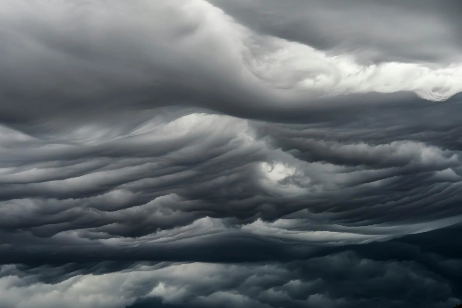
Asperitus
Formerly known as undulatus asperatus, when the supplemental feature Asperitus shows up, it's almost like looking at waves on the surface of water, but from a vantage point under the water.
(Pexels/Andrew Beatson)
The Atlas separates this from "undulatus" clouds, since undulatus are much more organized, often showing up as bands.
Although the exact way that these cloud form isn't understood yet, according to the Cloud Appreciation Society, there's some evidence that they are similar to mammatus clouds - from sinking, moisture-laden air, but with wind shear (its change in direction/speed over some distance) along the cloud base that causes the wind to flow in waves, carving the cloud base into these bizarre-looking shapes.
Cavum

(Ryan Borza/UGC)
Cavum is now the formal name of what's been called a "fallstreak cloud" or "hole punch cloud".
This supplemental feature is caused when ice crystals are introduced into a thin cloud comprised of super-cooled water droplets, usually due to an aircraft passing through the cloud on takeoff or landing. The water droplets remain liquid well below freezing, since there is nothing present for them to freeze onto. With the sudden appearance of the ice crystals, the water droplets in the vicinity all rush in — creating a clear spot in the cloud — where they freeze and grow the crystals into snowflakes, which then fall out of the sky. The wispy clouds in the middle of the cavum, in the image above, are virga produced by that falling snow.
Murus

(NOAA)
A Murus, or wall cloud, is a supplemental feature that takes the shape of a dark bank of cloud that lowers from the base of a supercell.
It is associated with strong updrafts inside the storm cloud, and can indicate the presence of a tornado, or the impending development of a tornado.
Cauda

(NOAA)
A Cauda, also known as a tail cloud, is another supplemental feature that can be seen off to the right of the wall cloud in the image above, looking like a dinosaur's tail trailing behind the storm.
Caudas are caused by air flowing into the storm, and their tube-like shape can sometimes be mistaken for a tornado.
Fluctus

(Sebast Poulin/UGC)
These supplemental features, now called Fluctus, are widely known as Kelvin-Helmholtz waves or Kelvin-Helmholtz instability.
They are caused by the winds above the cloud top blowing faster than the winds inside the cloud. This difference in speed (aka velocity shear) creates vortices, resulting in the top of the cloud being pulled upward into these wave forms.
Flumen
A flumen, aka a 'beaver's tail', is shown developing to the lower right in the timelapse video above, taken from the Rockwell City KCCI-TV webcam.
It is an accessory cloud caused by warm, humid air flowing into the base of the storm. These are often mistaken for tornadoes, but it only takes a moment to tell them apart, as a flumen will not be rotating.
Special clouds
Over the years, atmospheric scientists have collected evidence for enough odd cloud features that it prompted the WMO to add two new cloud name 'suffixes'. The first, genitus, indicates a cloud that formed or grew due to local conditions. The second, mutatus, is used for when local conditions cause one cloud type to morph into another type. Examples of these are shown below.
Cataractagenitus

(Billy Hathorn/Wikimedia Commons (CC BY-SA 3.0))
Cataractagenitus are clouds generated by the spray from large waterfalls, as seen above in the above photo taken at Niagara Falls.
Flammagenitus
Flammagenitus clouds form due to the heat from wildfires.

(Brocken Inaglory/Wikimedia Commons (CC BY-SA 3.0))
In the image above, a wildfire in Yellowstone National Park causes a flammagenitus cloud to form (the puffy white cumulus cloud above the smoke).
Homogenitus and Homomutatus
Homogenitus and homomutatus are clouds produced by human activities. Lumped under the same basic type, the two subtypes put the new suffixes to use to differentiate between clouds just after they form and those that have undergone some kind of change over time.
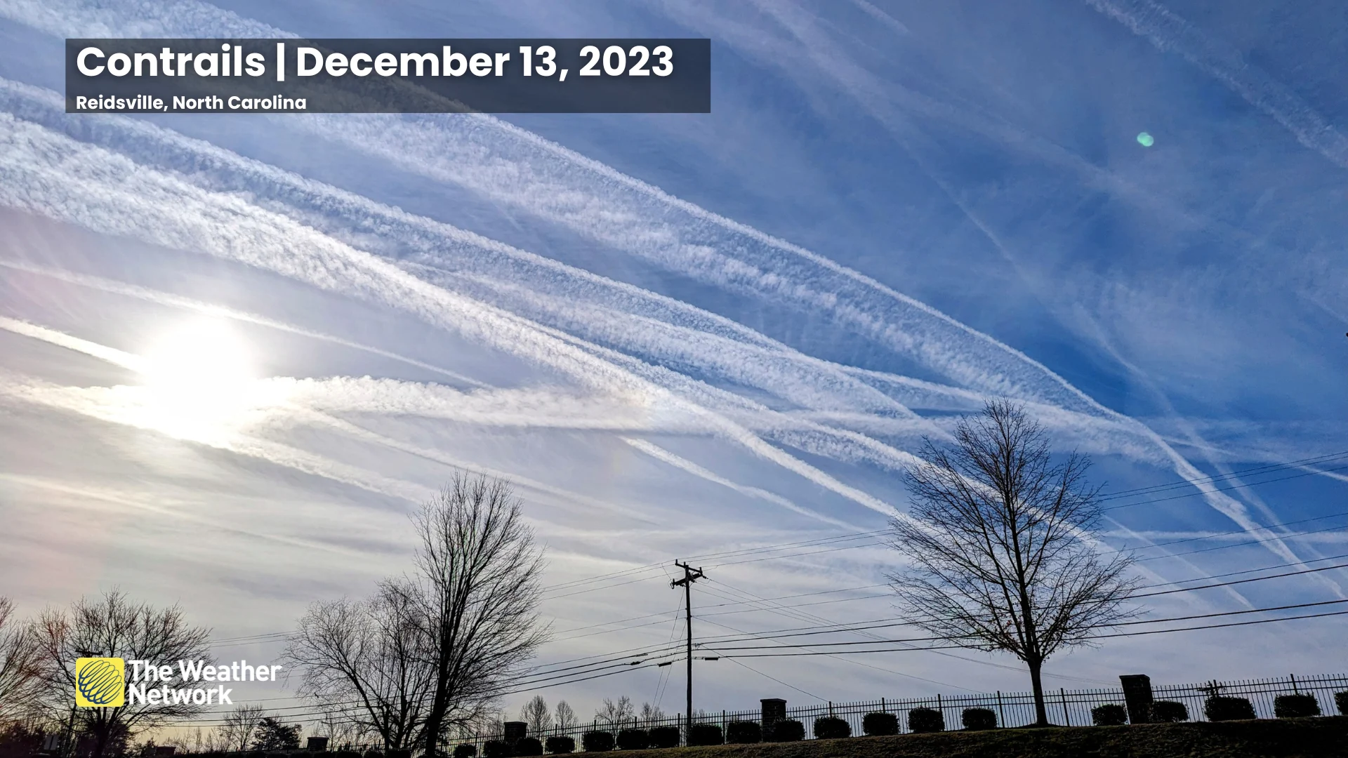
Aircraft contrails, clouds that form from industrial emissions, or that form overtop of power plant cooling towers, are three examples of homogenitus.

(UNSPLASH)
Persistent contrails are an example of homomutatus, which form when aircraft produce contrails in air that contains enough humidity for them to persist and grow, spreading out into cirrostratus or cirrocumulus clouds.
(Dennis Mersereau)
Silvagenitus
Silvagenitus is a type of cloud that forms as humidity is added to the air above the forest canopy from the soil and plants that make up the forest.

(Stanislav Doronenko/Wikimedia Commons (CC BY 3.0))
(Editor's note: This article was originally published on March 23, 2017, and has been republished and updated here.)