Rivers may fuel explosive strengthening of major hurricanes

Hurricane Idalia in 2023 may not have grown into a Category 4 storm without a plume of river water along its track
Rapid intensification of hurricanes is a pressing matter for communities along the Atlantic coasts. Every season for the past decade, we’ve seen at least one storm undergo a period of explosive strengthening—often right as it’s approaching landfall.
Experts are determined to understand the root causes of rapid intensification in order to improve forecasts before these deadly storms swirl ashore.
Researchers with the University of South Florida recently published a paper detailing how plumes of river water—of all things—can directly contribute to a storm quickly gathering strength.
DON'T MISS: How a mammoth hurricane rapidly intensifies in mere hours
Hurricane Idalia’s unlikely intensification
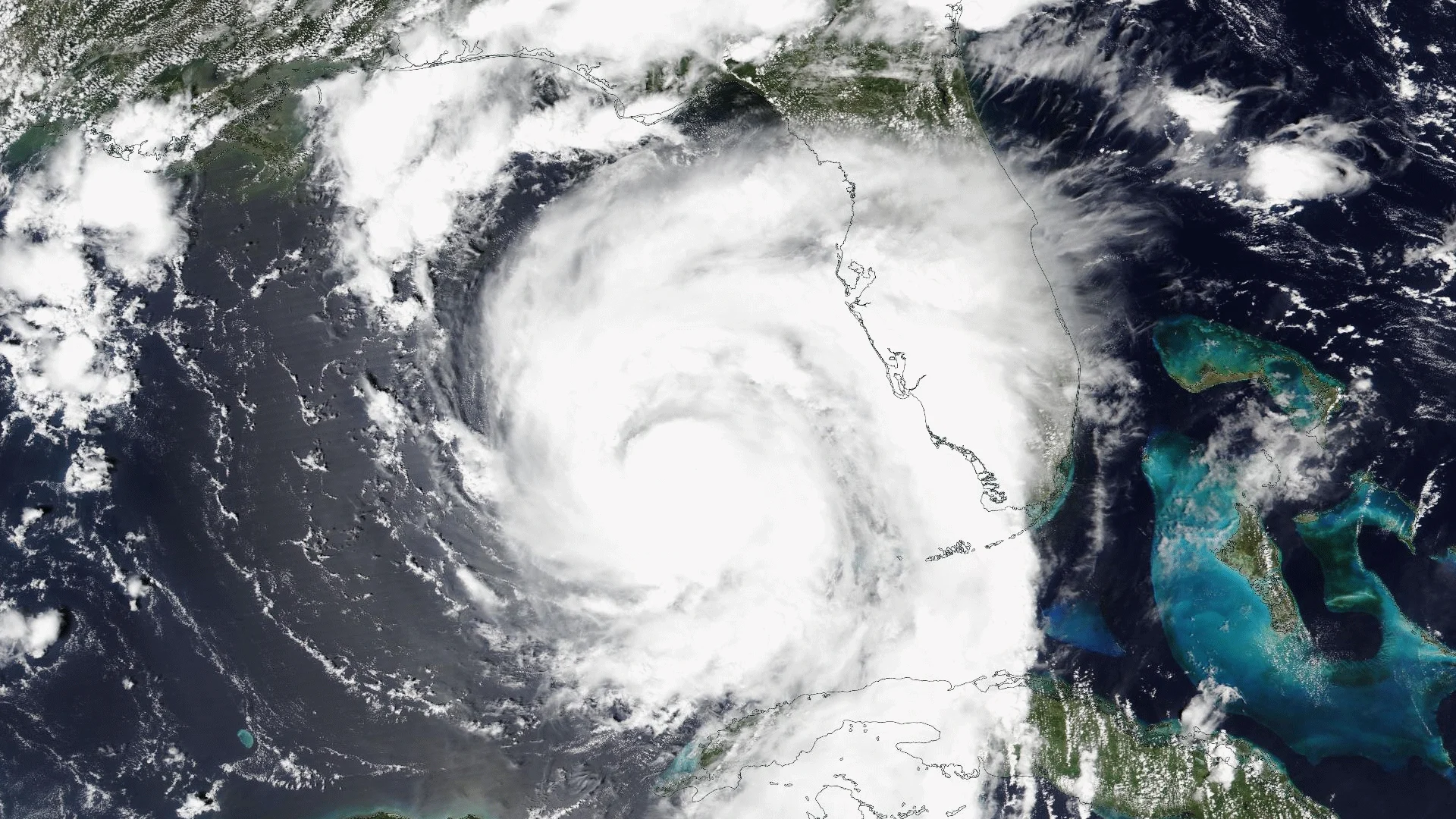
Idalia started life near the tip of Mexico’s Yucatan Peninsula on Aug. 26, 2023. The storm spent several days drifting into the Gulf of Mexico before it started accelerating toward the north.

Waters in the eastern Gulf of Mexico were several degrees warmer than usual for the end of August. This warmth helped strengthen Idalia into a hurricane—growing from a Category 1 with 150 km/h winds to a Category 4 with 215 km/h winds in just 18 hours before landfall on Aug. 30.
Rapid intensification a growing problem in the Atlantic
Rapid intensification is an increasingly common phenomenon in the Atlantic basin these days.
Hurricanes rely on ample moisture, low wind shear, and warm ocean waters to strengthen. Under favourable atmospheric conditions, very warm waters can fuel runaway intensification, sometimes allowing a hurricane’s winds to jump several categories in just a few hours.
But the atmosphere around Idalia wasn’t as perfect as you’d expect for swift strengthening. This means that another factor likely played a role in the hurricane’s intensification.
River water likely played a key role
Researchers believe that a plume of low-salinity river water drifting through the Gulf of Mexico unlocked the mystery behind Idalia’s sudden jump to Category 4 strength.

Hurricanes churn up the ocean something fierce as they pass overhead, forcing deep, cold water to rise toward the surface. This upwelling can cool sea surface temperatures and force a hurricane to weaken.
Plumes of river water remain concentrated within the top layer of the ocean because their lower salinity contrasts with the density of the salty seawater. This effectively creates a boundary layer between the hot water near the surface and the cooler water deep within the ocean.
As a result, Hurricane Idalia’s passage over a healthy plume of river water fed the storm a steady and stable reserve of hot sea surface temperatures as it traversed the region, likely fuelling its rapid intensification near landfall.
This wasn’t a one-off occurrence, either. The study points out that previous research has found compelling evidence that tropical cyclones in the southwestern Atlantic rapidly intensified when they passed over plumes of water discharged from South America’s Amazon-Orinoco River.
Hurricane forecasts are better today than at any point in human history. A deeper understanding of the factors that drive rapid intensification can help forecasters improve predictions even more—potentially saving lives in the future.
Header satellite image courtesy of NOAA.