The incredible history and tools of the Hurricane Hunters

Flying into the heart of a storm provides invaluable information to communities in harm’s way
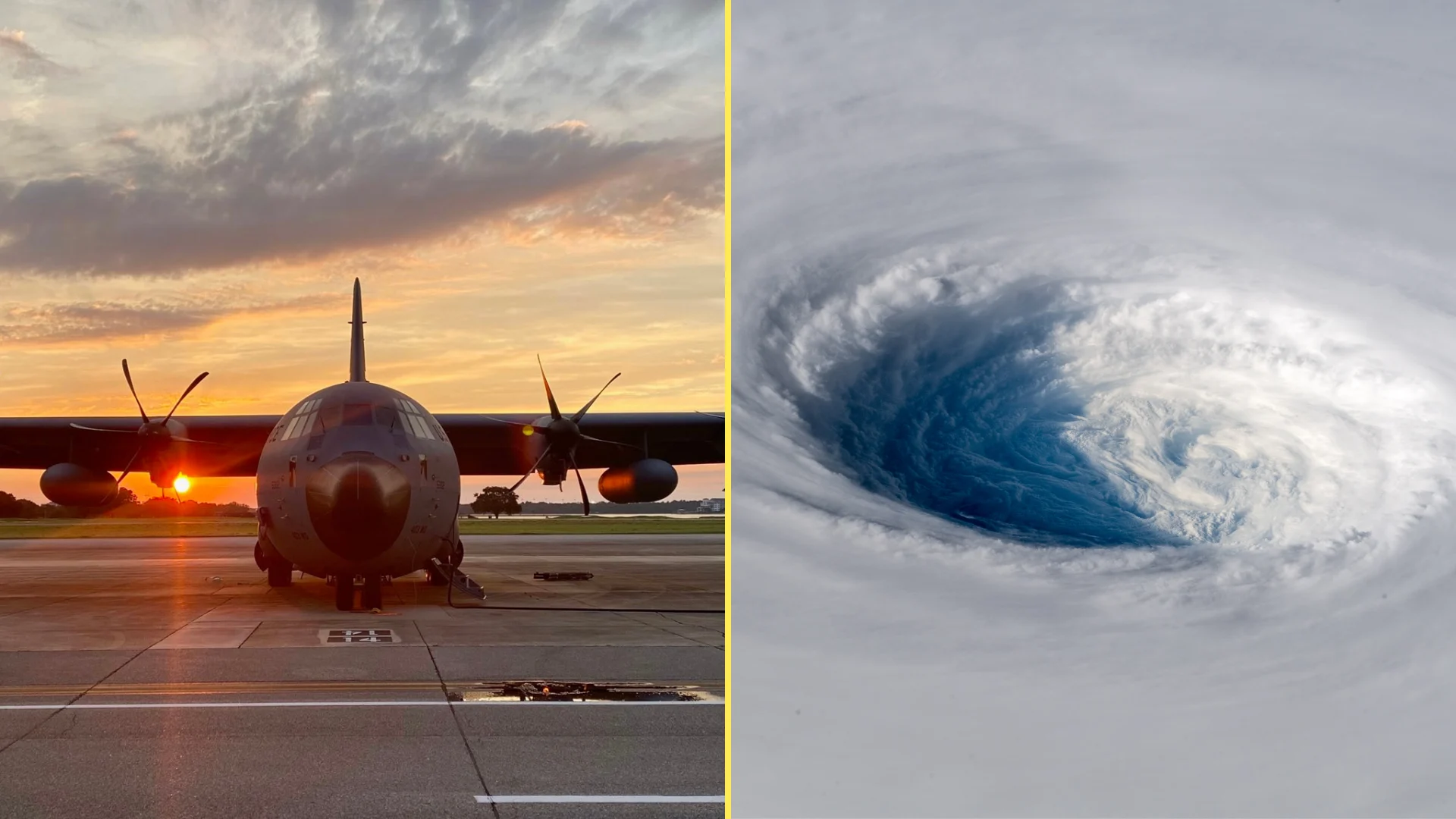
Hurricane Hunters are an indispensable part of forecasting during storm season. Crews endure some of nature’s fiercest conditions to relay critical observations back to shore straight from the heart of a hurricane.
The instruments aboard these aircraft use some ingenious methods to supply detailed information about a growing storm’s wind speeds and air pressure—an impressive effort that’s helped make today’s hurricane forecasts more accurate than ever before.
DON’T MISS: The high-stakes factors that decide where a hurricane tracks
Flying into storms began with a drink
The practice of flying into the eye of a hurricane reportedly began—as many wild ideas do—as a bet made over drinks.
Air Force Colonel Joe Duckworth hopped into his plane on July 27, 1943, and steered it toward the centre of a hurricane over the Gulf of Mexico. This impulsive act paved the way for future crews to safely take up scientific missions in the future.
The U.S. Air Force Reserve’s 53rd Weather Reconnaissance Squadron (WRS) has operated almost continuously since 1944, working alongside crews from NOAA to fly into countless tropical cyclones across the Atlantic and Pacific basins.
Gathering information on storms was especially useful for early hurricane forecasting efforts, as the first weather satellite wasn’t launched into orbit until April 1960.
The practice remains useful as ever today, with crews flying through the weakest tropical depressions to the strongest hurricanes on record.
Thirteen planes to tackle the world’s strongest storms
Today’s fleet includes ten aircraft operated by the 53rd WRS and three aircraft piloted by experts employed by NOAA.
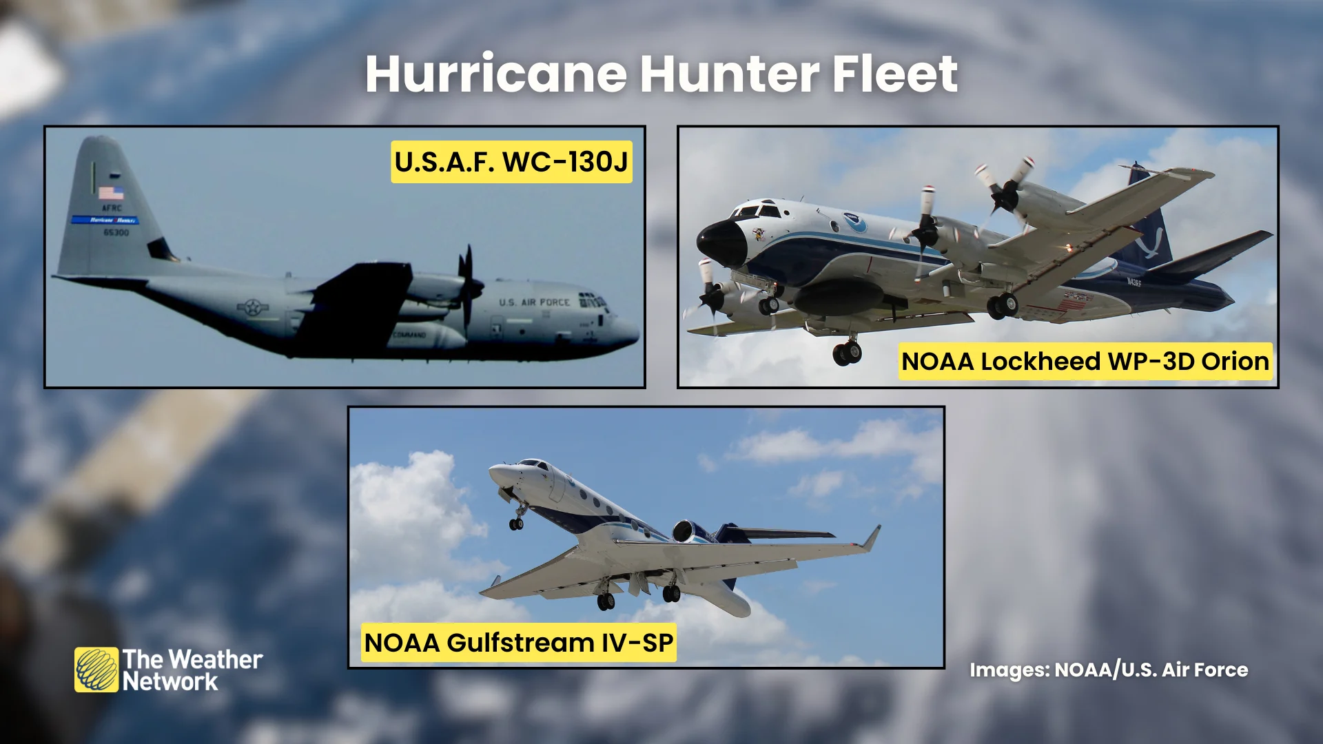
Twelve of the aircraft—ten Air Force WC-130Js and NOAA’s two Lockheed WP-3D Orions—are designed to penetrate the core of a storm, flying within hundreds of metres of the ocean’s surface to gather important information about the storm’s characteristics.
The remaining aircraft, NOAA’s Gulfstream IV-SP, is used to gather high-altitude data from the environment around a storm.
Instruments gather important data about a storm
Even in an age with advanced weather satellites, direct observations still play a vital role in keeping tabs on a hurricane. Multiple instruments aboard each Hurricane Hunter aircraft study every aspect of the storm.
Dropsondes are small devices deployed from the belly of the aircraft to measure air pressure, temperature, and humidity as they fall toward the ocean. They also utilize GPS technology to measure wind direction and wind speed.
Data collected by dropsondes reveal the inner-workings of a storm. Aside from measuring winds and pressure, for example, humidity can tell forecasters if dry air working into a storm’s core could prevent it from strengthening.
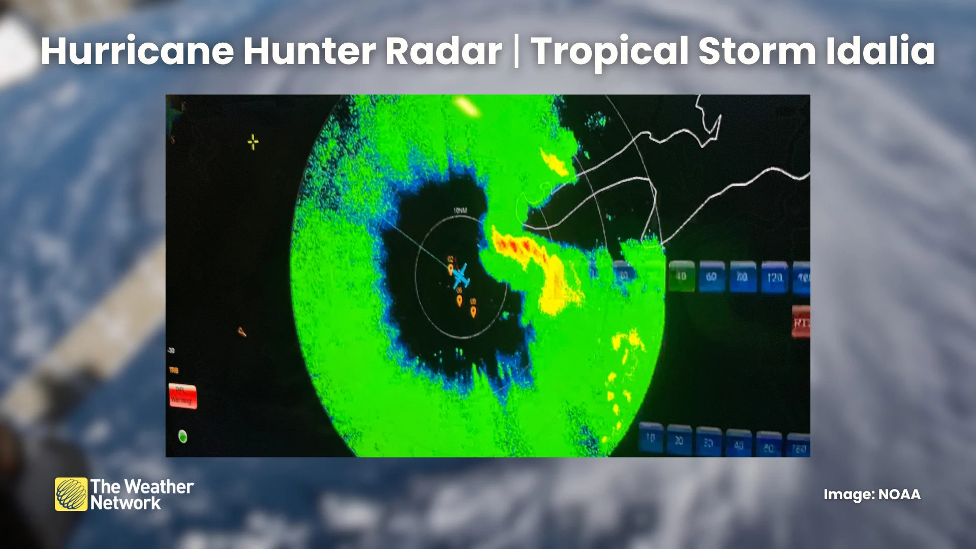
Radar is another crucial component aboard each aircraft. Weather radar paints a vivid picture of the internal structure of the storm, revealing the health of a hurricane’s eye and eyewall, as well as the rainbands swirling around the system.
But it’s SFMR that’s possibly the coolest tool at the Hurricane Hunters’ disposal. Short for Stepped Frequency Microwave Radiometer, this device observes microwave radiation reflected off the ocean surface.
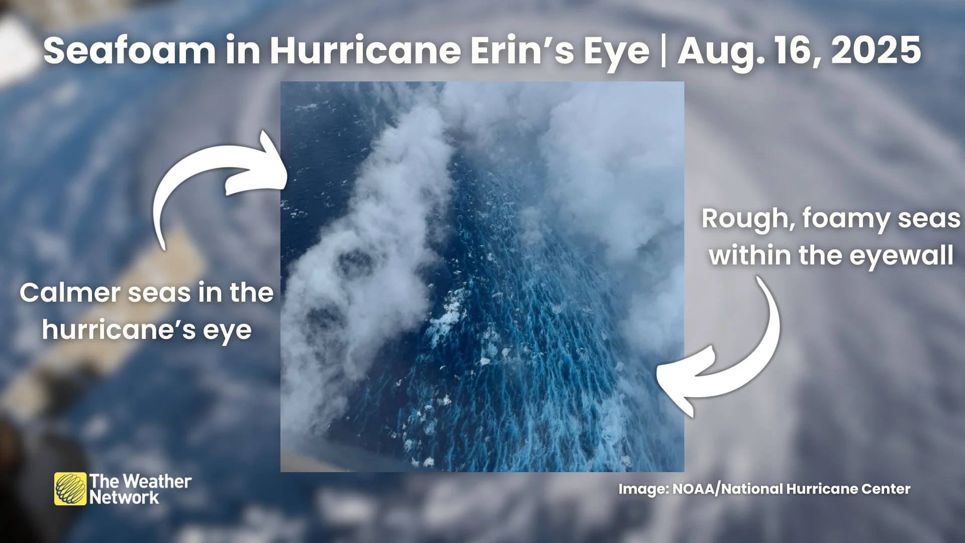
SFMR essentially measures the amount of seafoam on the ocean surface to accurately gauge how strong the wind is blowing. It’s a method that helps meteorologists observe the true intensity of a storm in the moment.
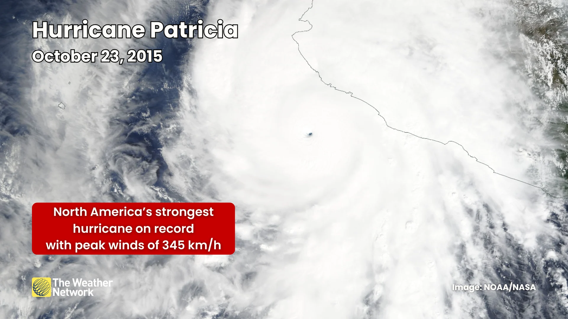
Data collected by the SFMR are so reliable that the U.S. National Hurricane Center (NHC) used this information to upgrade Hurricane Patricia's maximum winds to 345 km/h, making it the strongest hurricane ever observed around North America.
Header image created using graphics and imagery from NOAA and Canva.