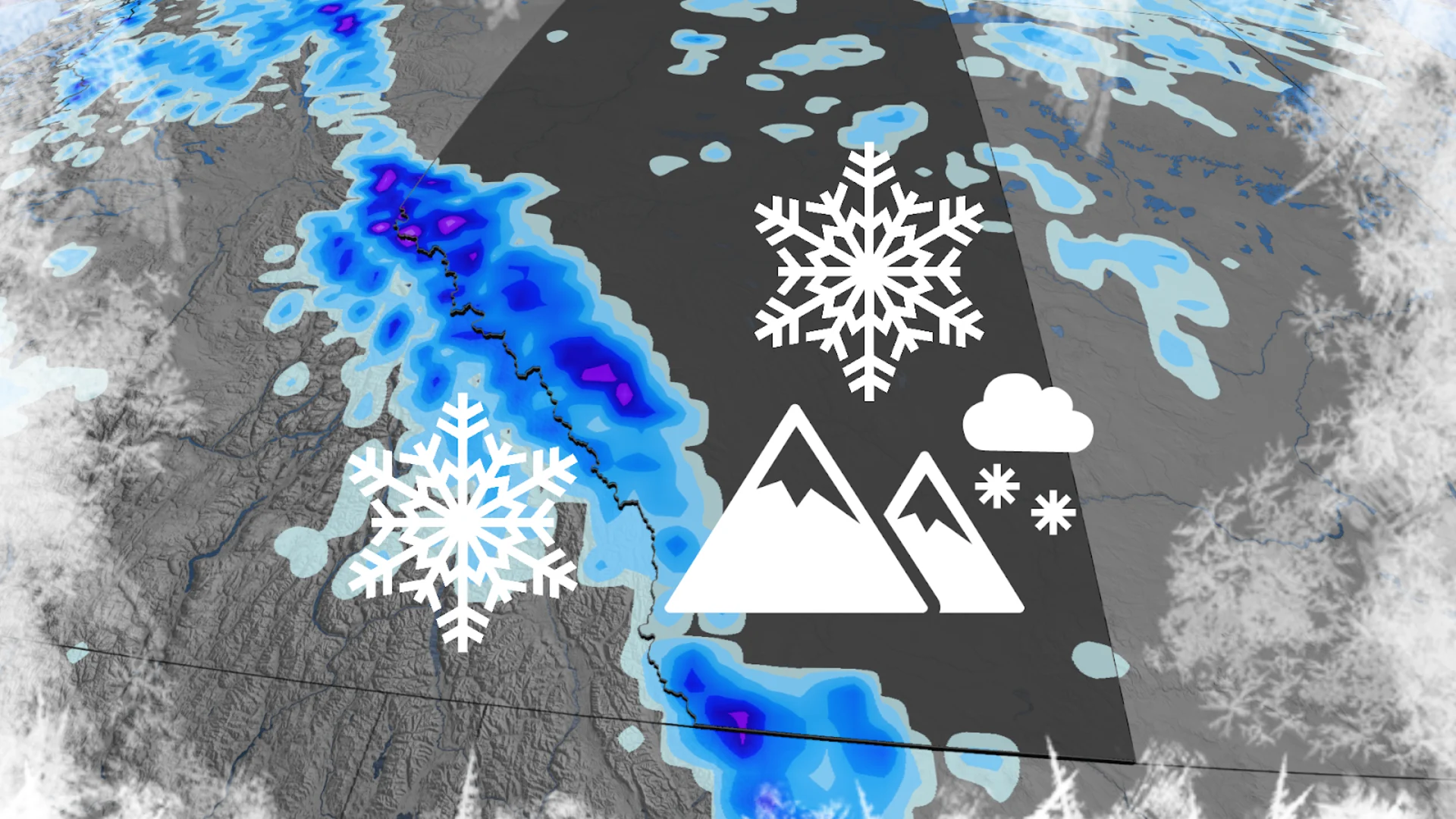
10-15 cm of weekend snow on the way to parts of Alberta
Welcome to October on the western Prairies!
It’s that time of year again, Alberta.
The arrival of lower temperatures this weekend will bring the opportunity for snow across portions of the Rockies. Folks in Calgary are on the lookout for the city’s first frost of the season.
DON’T MISS: Calgary’s first frost looms! Follow these tips for more time in the garden
Change is on the way for Alberta
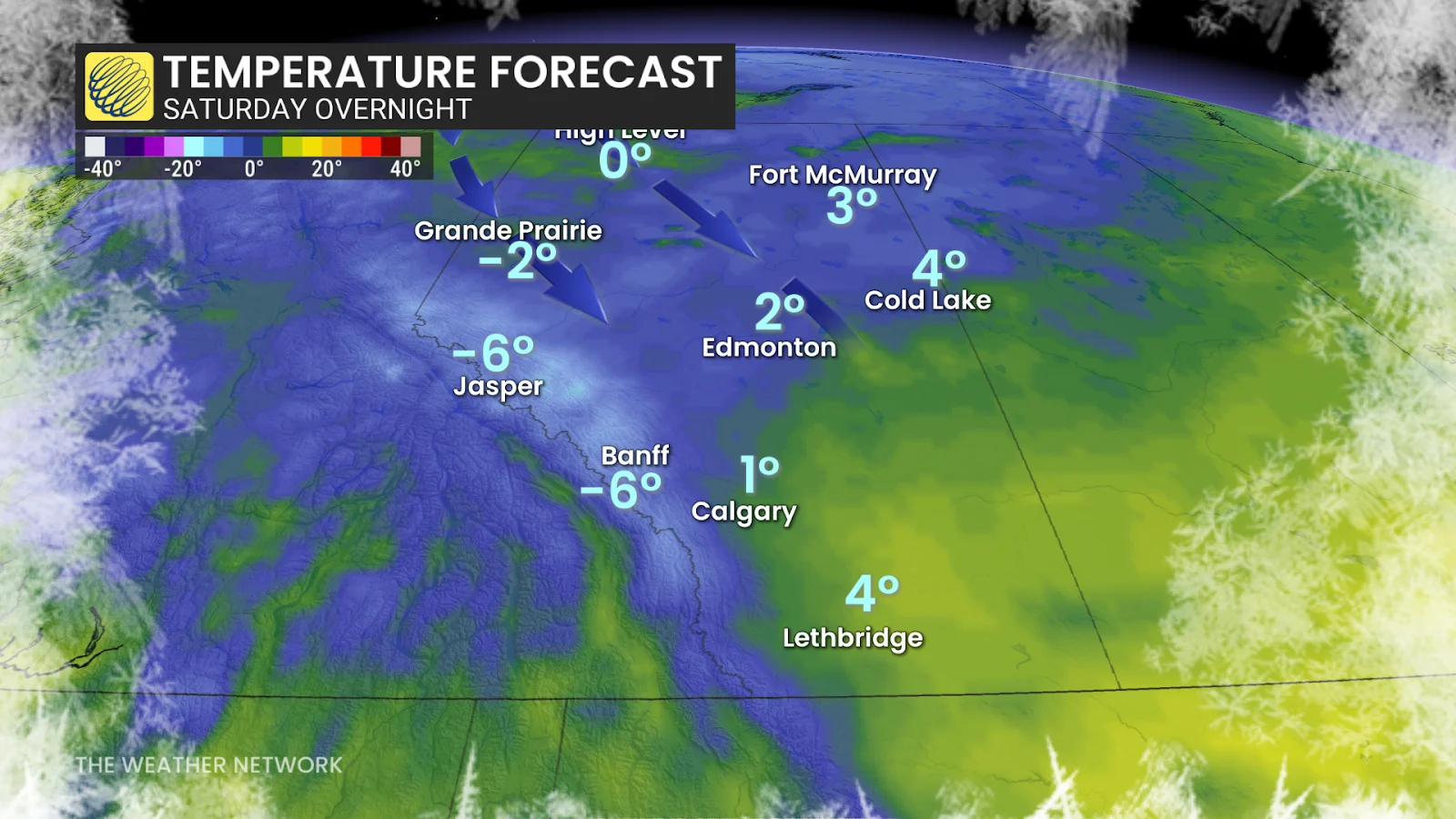
A sharp cold front expected to move through Alberta will send temperatures plummeting across the province. Overnight temperatures on Saturday will come in just above the freezing mark. Freezing levels may dip below 1500 m in the Rockies.
Precipitation will begin as a rain-snow mix across the Elbow Region on Saturday morning, spreading southward into the afternoon hours.
Calgary will see light rain on Saturday afternoon and evening, ending by Sunday morning. This precipitation, which may amount to 5-15 mm, will end the dry streak that the city endured through September.
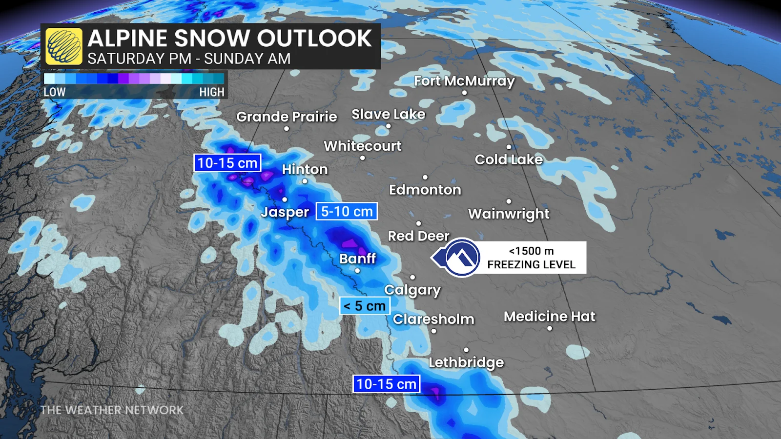
While precipitation will remain rain at lower elevations, snow is in the forecast for the alpines. Some of the higher elevations may see 10-15 cm of accumulation through Sunday morning. Banff and Jasper may see a rain/snow mix that’ll end overnight Saturday.
Temperatures are expected to remain near or below normal for the region heading into next week.
Stay with The Weather Network for the latest on conditions across Alberta.