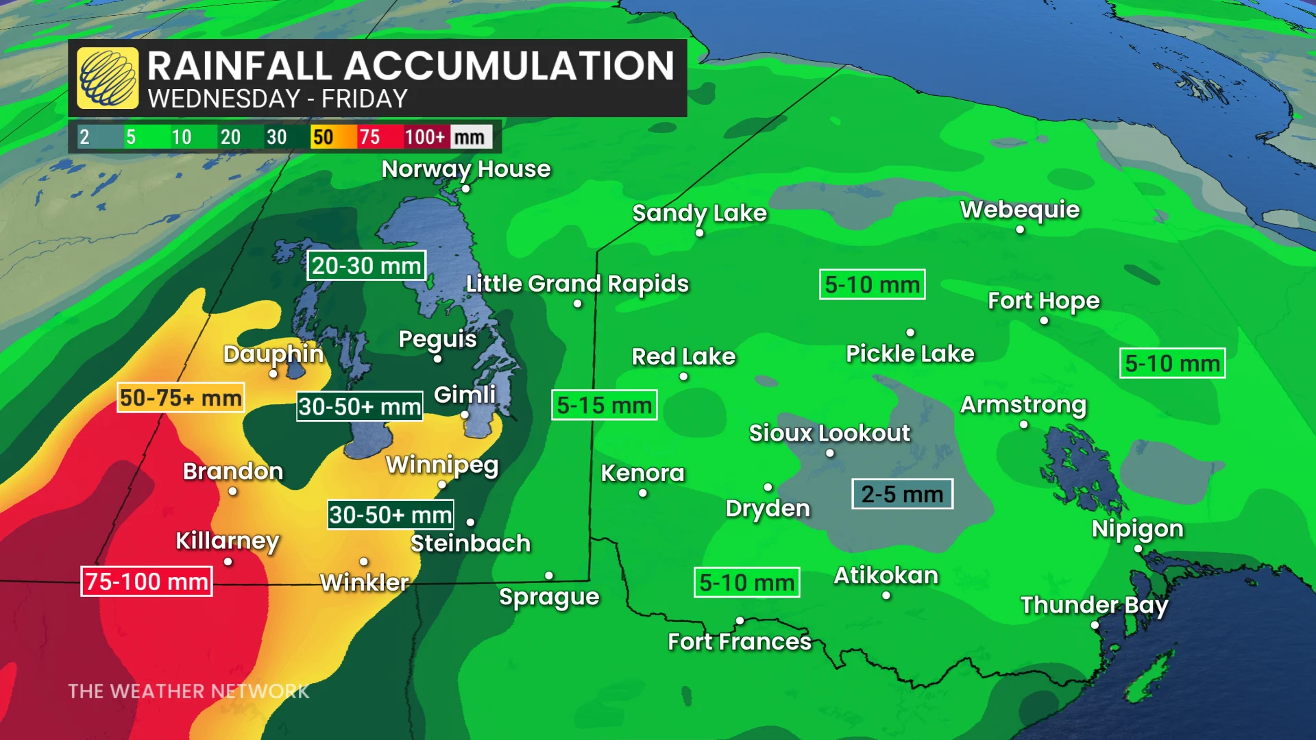
100 mm of rain to help with wildfire situation, but with heightened flood threat
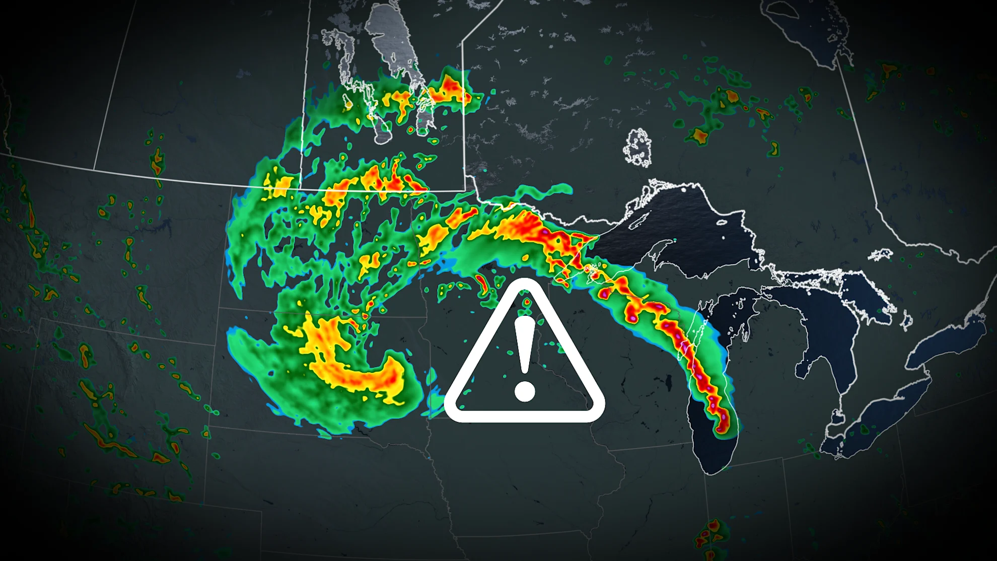
The extreme heat will finally break across Manitoba and northwestern Ontario, with heavy rainfall spanning the region over the next several days
As dangerous wildfires continue to prompt evacuation orders across sections of the eastern Prairies and northern Ontario, a change in the weather pattern will bring some much-needed rain and a significant drop in temperatures through the weekend.
Between 75-100 mm of rainfall is forecast as a major pattern breaks through the recent Prairie heat wave.
DON'T MISS: Evacuation orders, states of local emergency declared as Manitoba wildfires grow
Daytime highs will remain hot for much of Manitoba and northwestern Ontario on Wednesday, but expect a temperature freefall, dropping to the single digits by Saturday.

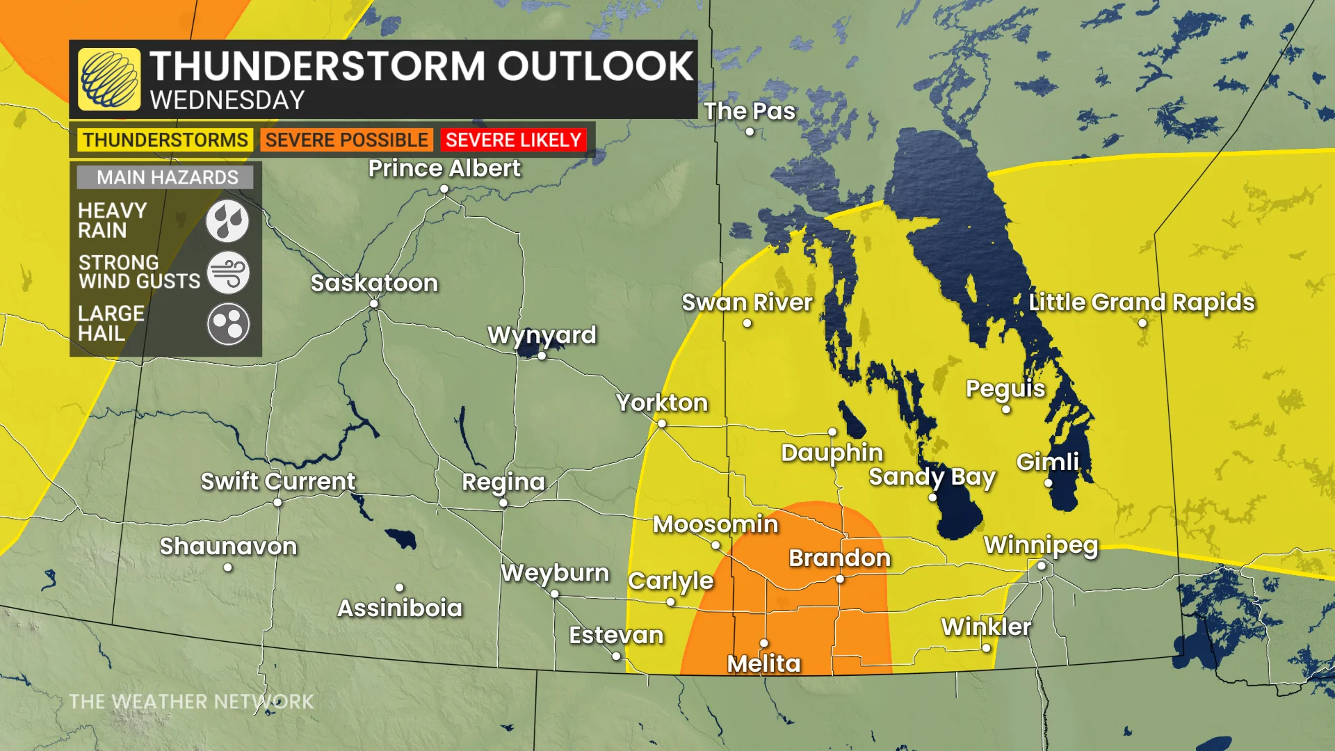
The slow moving and shifting heat will create a boundary, leading to significant rainfall and the potential for severe thunderstorms. Be sure to stay up-to-date on all of the weather alerts and warnings that may be issued in your area.
Heavy rain and thunderstorms stretch across Saskatchewan and Manitoba through Thursday
Multiple systems will lift into the region by Wednesday morning, continuing across Saskatchewan and Manitoba through Friday.
Expect rounds of heavy rainfall to last between 48-72 hours, with substantial totals forecast in some areas. Across the Saskatchewan and Manitoba border, between 50-100 mm of rain is forecast to fall.
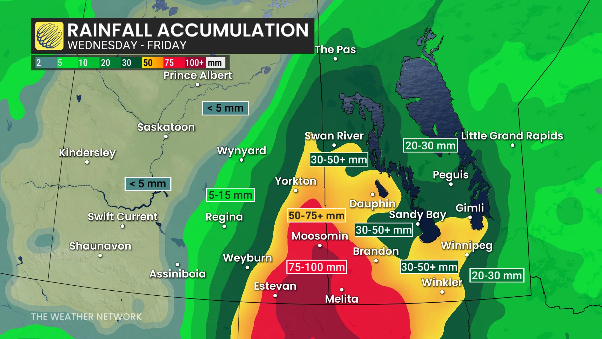
While this is good news for areas vulnerable to the wildfire conditions, this could also bring a heightened flood threat to parts of the region. The hot, and dry soil will have a limited ability to absorb this heavy rainfall.
A thunderstorm threat will span the region, as well, with the risk stretching across both Wednesday and Thursday.
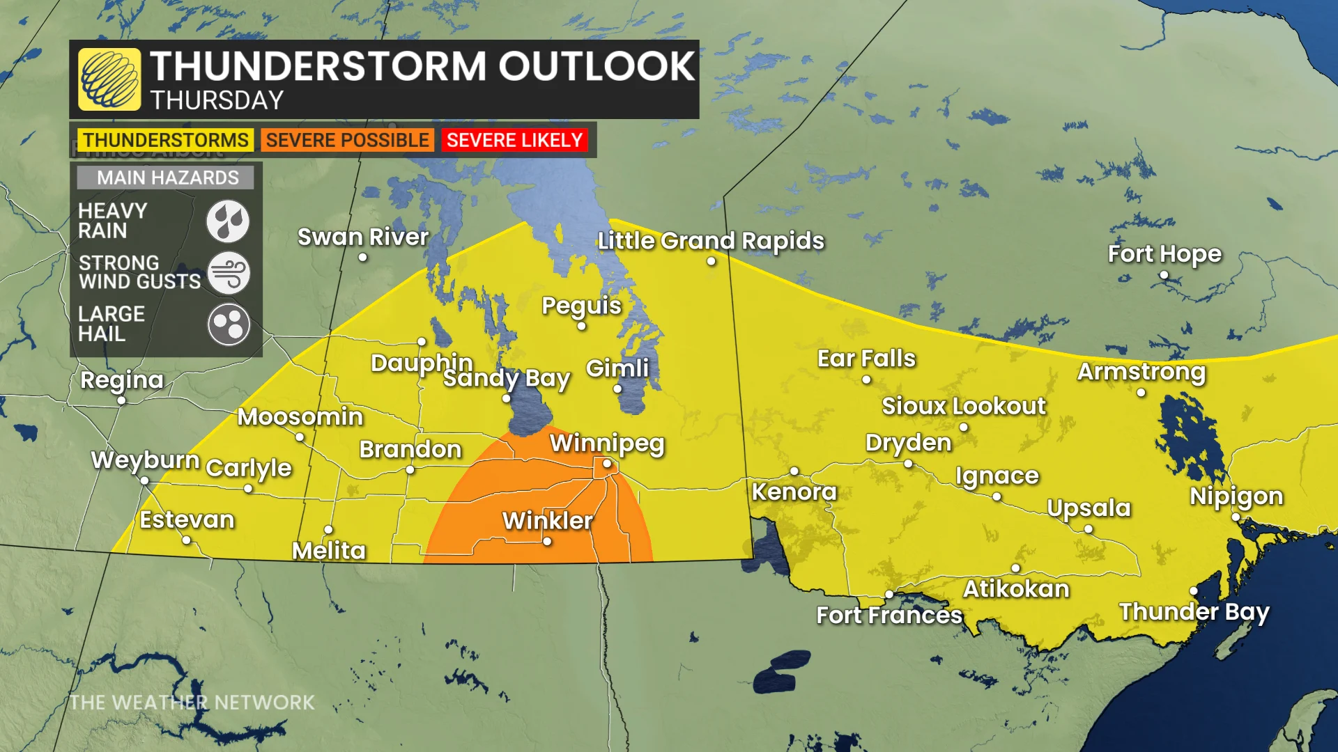
More widespread thunderstorm activity is expected on Thursday, with stronger impacts centred around the Winnipeg, Man. area.
Heavy rain, strong winds, and large hail are the main threats with any storms that develop.
Another large low pressure system is expected over the central U.S. early next week, and that could bring additional widespread rain to southern parts of the region .
Wildfire activity worsens across northern Ontario
With the ongoing heat and dry conditions, the fire activity worsened quickly across parts of northern Ontario, and prompted border communities to quickly evacuate.
RELATED: South Whiteshell Provincial Park cottagers flee, fire moves from Ontario border
Out of control wildfires persist near places like Kenora, Sioux Lookout, and Ingolf, Ont., with the fire danger rating reaching 'extreme' criteria. Wildfire smoke is greatly affecting air quality.
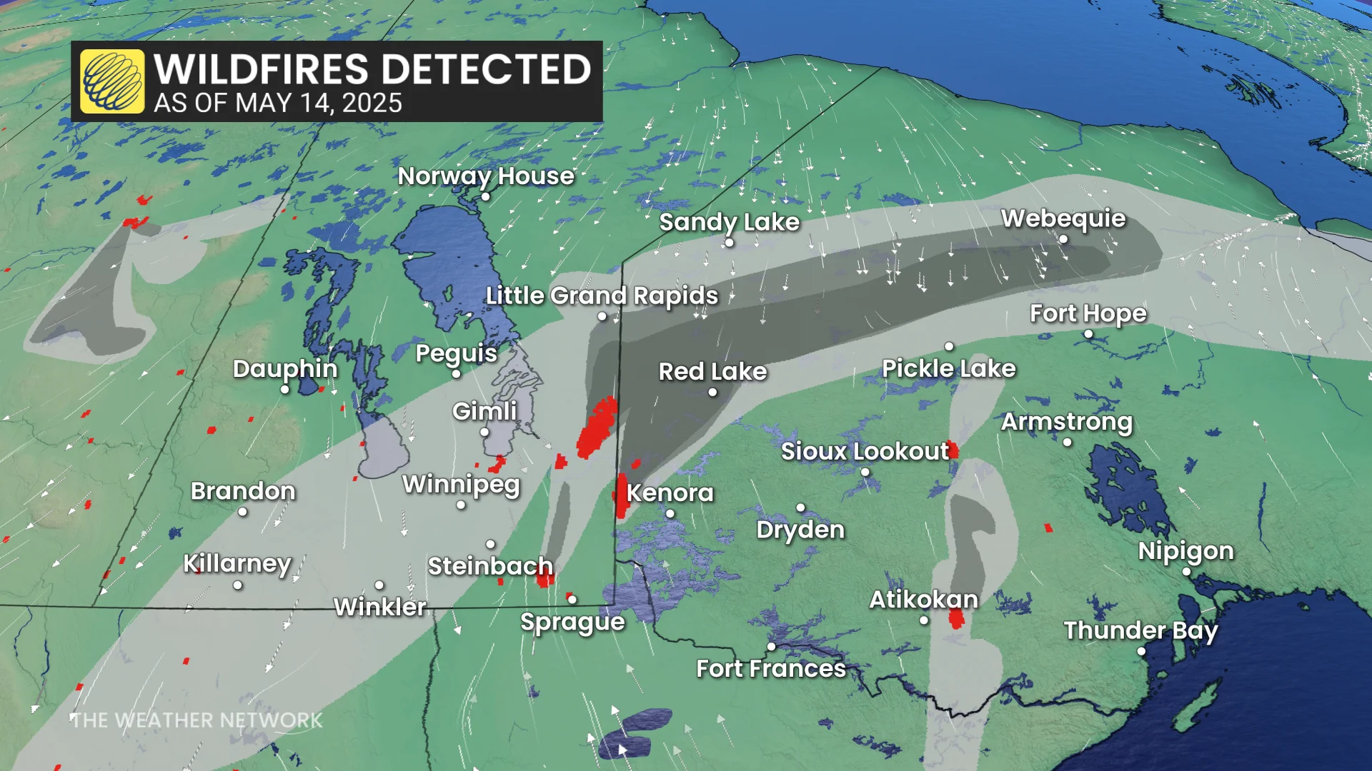
Incoming rainfall and cooler temperatures will help the situation by the weekend.
Single-digit high temperatures are likely for areas to the north and west of Lake Superior on Saturday, and these chilly temperatures will be even more widespread across the region for Sunday. Some areas will struggle to even reach the freezing mark.
SEE ALSO: Large northwestern Ontario forest fire prompts evacuation
Cooler-than-seasonal temperatures are expected to dominate next week, and continue into the final week of May, as well.