160+ million at risk for destructive ice, major snowstorm

A highly disruptive winter storm will create travel havoc from Dallas to Boston this weekend, with power outages possibly in the millions
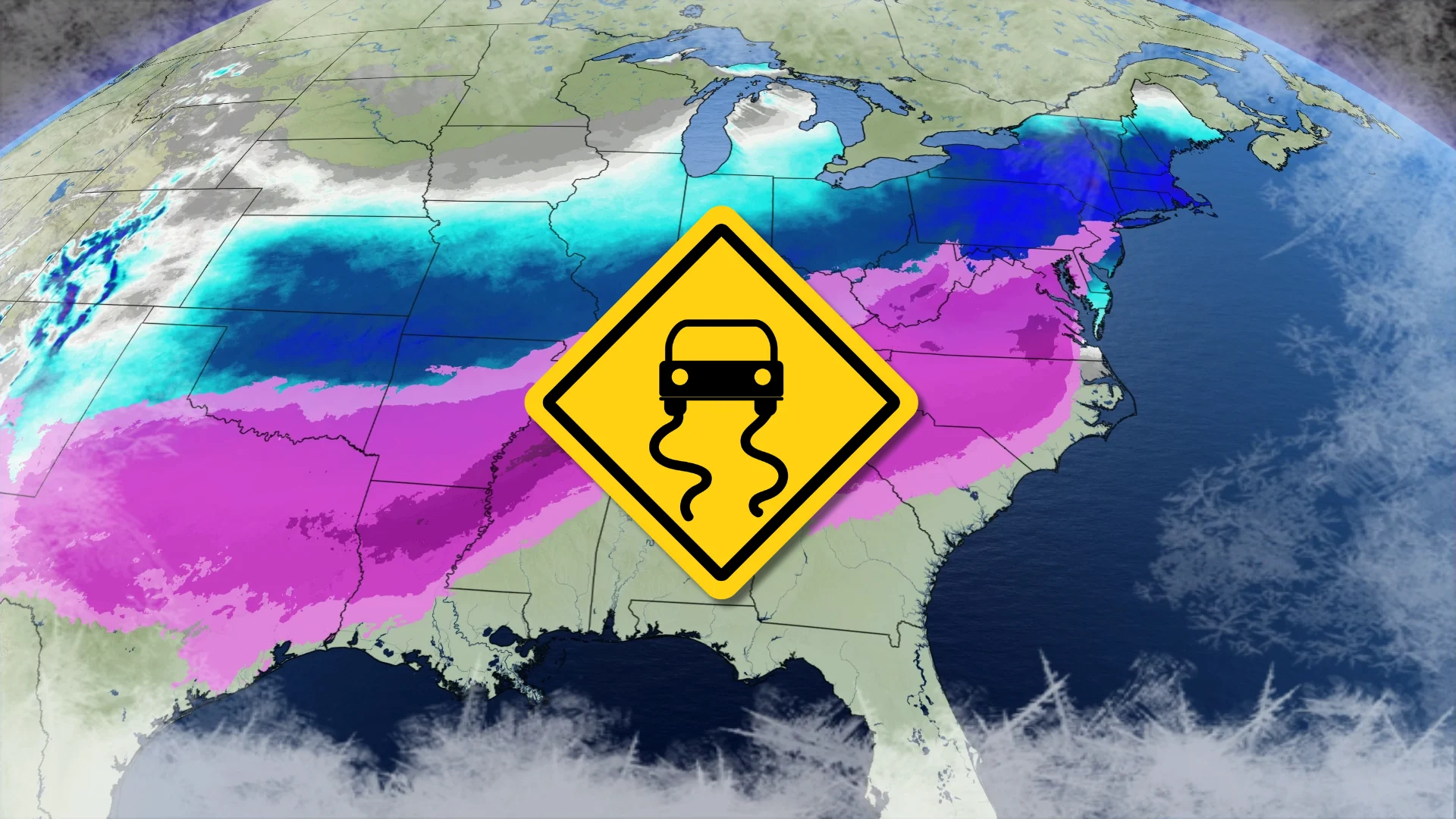
A high-impact winter storm expected to spread across the United States this weekend will produce destructive ice from freezing rain, as well as snowfall totals that could make travel impossible at times.
Millions of power outages are possible across areas hardest hit by the freezing rain. Some communities are in line for the highest snowfall totals they’ve seen in more than a decade.
DON'T MISS: Freezing rain and ice pellets are dangerous winter hazards
Arctic air meets tropical moisture
Frigid temperatures plunging south out of Canada this week will cover the southern and eastern U.S. over the next 24 to 48 hours.
Warm, moist winds blowing out of the south will collide with this Arctic cold front to kick off a widespread round of wintry precipitation beginning late Friday and continuing through late Sunday.

Heavy snow will fall on the colder side of the system, while a wedge of warm air aloft will create a significant ice storm across the southern states. All told, winter weather hazards will cover more than 160 million people across the United States this weekend, the U.S. National Weather Service said on Thursday.
This event will also bring significant snowfall totals to portions of Ontario, Quebec, and Atlantic Canada.
A devastating ice storm is likely
Significant ice accretion from freezing rain is likely from Texas through Virginia.

Widespread ice accretion totals of 10-15+ mm are expected across many major cities, including Dallas, Memphis, Atlanta, Charlotte, and Raleigh.
This may be a particularly damaging storm in portions of Mississippi and Louisiana, where accretions may approach 25-30 mm. Significant impacts are also expected across the Carolinas and northern Georgia.
Power outage numbers may approach the millions at the peak of the storm, with outages potentially lasting for days in some areas.

Impactful snows will fall on the colder side of the system. Accumulations of 20-30+ are likely along a swath from Oklahoma City to Massachusetts.
Drivers can expect near-impossible travel just about anywhere affected by this winter storm, with the hardest-hit areas essentially shutting down for several days. Significant flight cancellations are expected out of many major hubs across the eastern U.S.
WATCH: Large swath of U.S. prepares for destructive ice storm
Putting this storm in historical context
Few storms in recent memory compare to this weekend’s storm across the U.S., both in the severity of the conditions expected and the sheer size of the area impacted by the storm itself.
The scope of the anticipated ice storm is especially daunting, with damaging levels of ice accretion expected across a region measuring more than 700,000 square kilometres.
How does this storm stack up to previous events?

Much of the Mid-South, including the city of Memphis, saw a catastrophic ice storm in February 1994 that left up to 150 mm of ice accretion on exposed surfaces, with similar impacts to Eastern Canada’s infamous 1998 ice storm. The ice caused billions of dollars in damage and some homes were reportedly without power for a month after the storm.
North Carolina is no stranger to ice storms given the region’s geography. A benchmark ice storm in December 2002 left more than 1 million customers without power across the state, some of whom didn’t see electricity again for 10 days after the storm.
Meanwhile, the snowy side of the storm will produce totals that many communities haven’t seen in years.

Oklahoma City is in line for 30+ cm of snowfall, which would be its largest snowstorm since December 2009.
Louisville, Kentucky, which is the global hub of delivery giant UPS, is on track to see around 30 cm of accumulation, potentially making for the city’s largest snowstorm since February 1998.
Farther east, Washington, D.C., could witness its heftiest snowfall since a disruptive storm in January 2019.
Dangerous cold will follow the winter storm
The prospect of significant, long-lasting power outages is especially dangerous given frigid temperatures of -15°C or colder in the affected areas without significant warming during the day to provide relief.
A protracted cold snap combined with extensive power outages will heighten the risk for cold-related injuries among vulnerable people, as well as the risk for carbon monoxide poisoning due to improper use of tools like grills and generators.
Forecasters expect temperatures to remain well below seasonal across most of the eastern U.S. through the beginning of February.