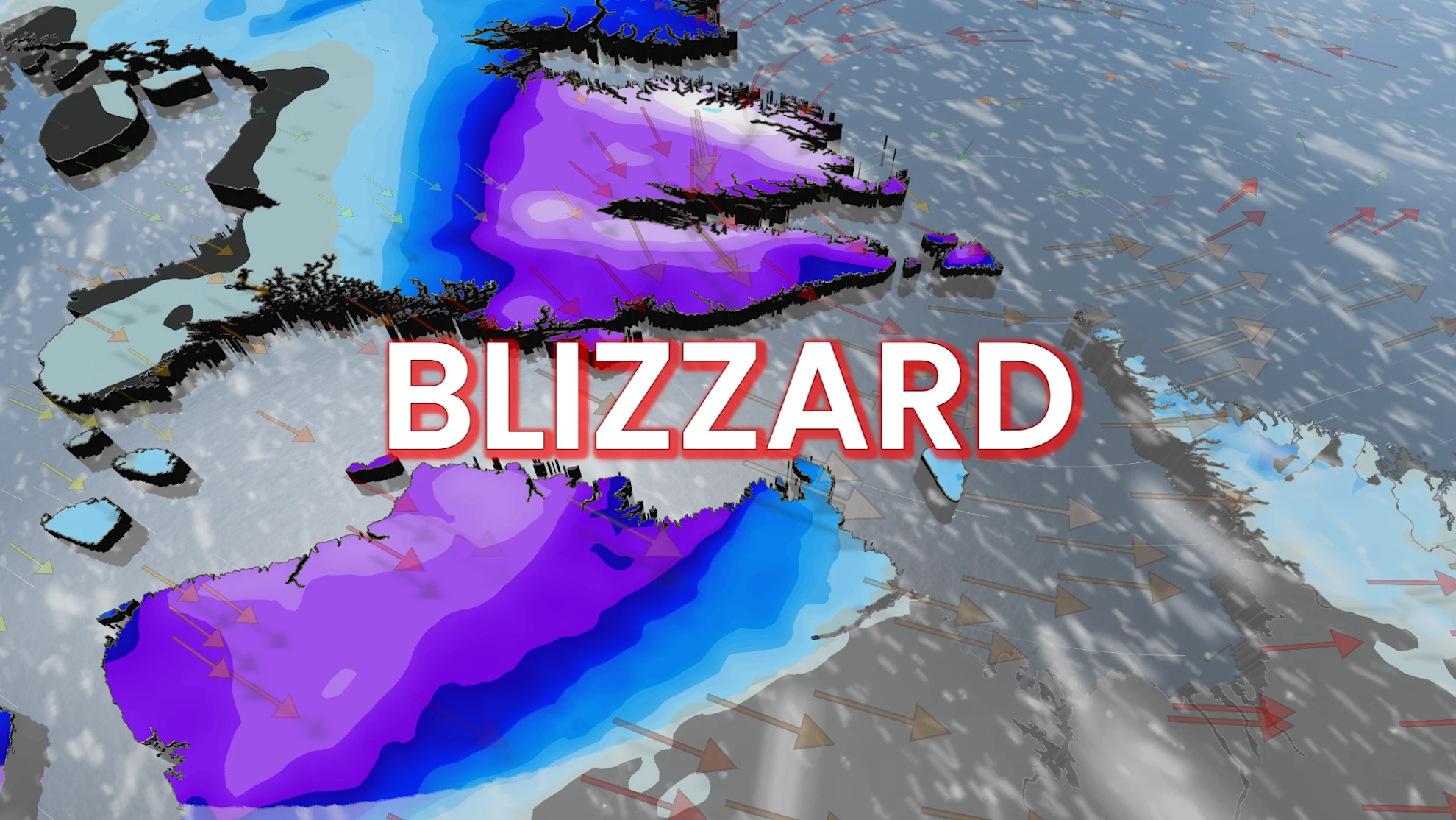
25 cm of snow: Third blizzard warning to hit this month

Spring snowstorm strikes again with third blizzard warning this month
Nothing screams the 'unofficial kick off to summer' quite like snowfall and blizzard warnings.
As we get ready to welcome the May long weekend, parts of northern Canada will be dealing with yet another round of hefty winter weather.
DON'T MISS: Canada's unofficial kickoff to summer won't feel like it for most
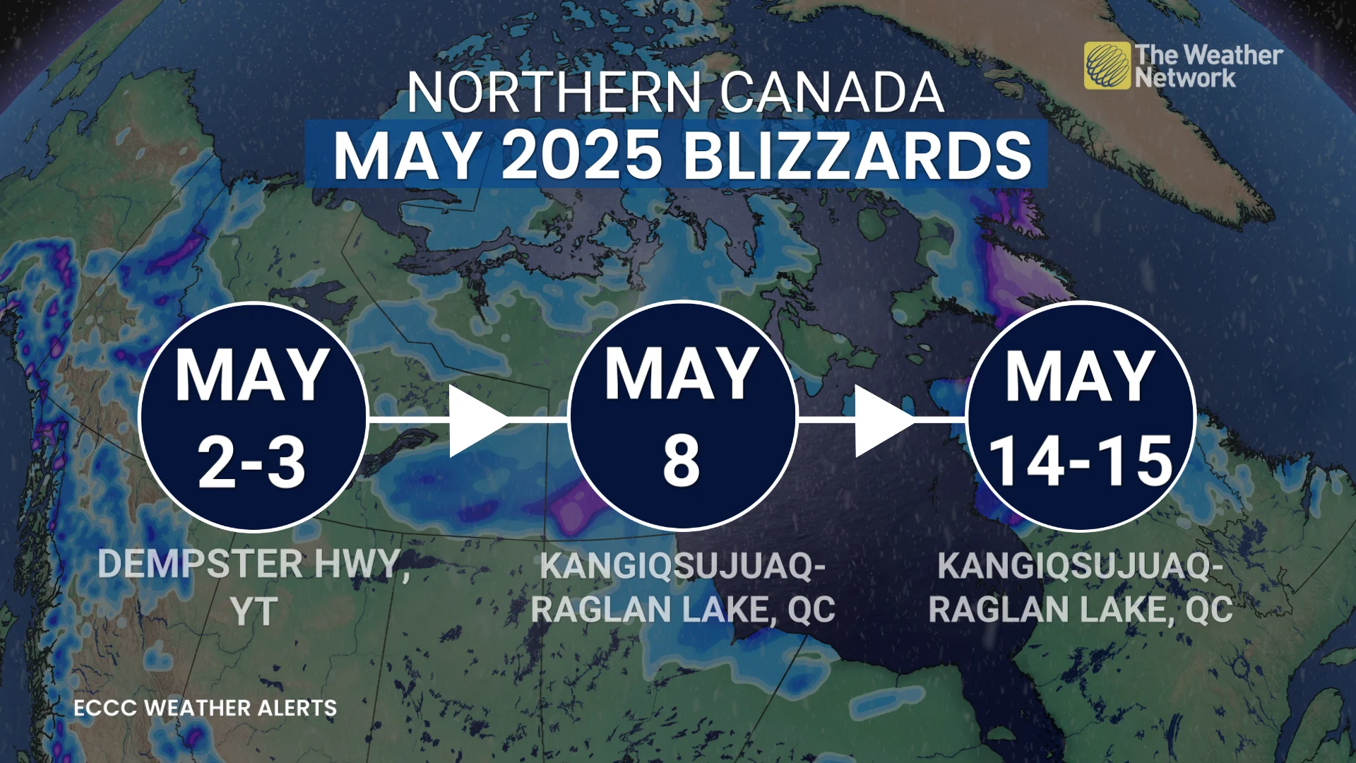
This is the third time just this month that blizzard warnings have been issued in Canada.
"We have a deepening low pressure system moving through the Hudson Strait. As the storm intensifies, strong winds are expected to impact northern Quebec and Baffin Island," says Rachel Modestino, a meteorologist at The Weather Network. "These regions are also on the cold, northside of the system where heavy snowfall is forecast."
Blizzard warnings are in affect for the Kangiqsujuaq-Raglan Lake regions in northern Quebec, urging to limit any time spent outdoors.
"Visibility will be suddenly reduced to near zero at times in heavy snow and blowing snow," says Environment and Climate Change Canada (ECCC) in the warning.
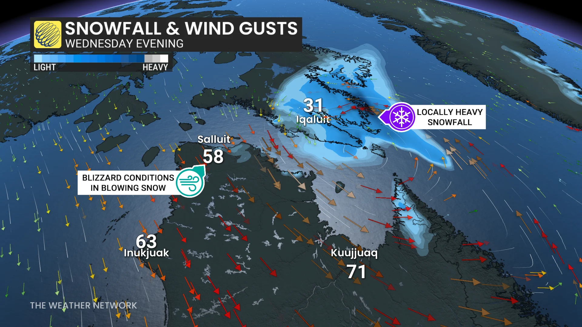
While the snow will lighten by Wednesday evening, persistent strong winds will continue to make for near-zero visibilities until Thursday evening.
A blizzard warning is issued when winds are expected to produce blowing snow, with widespread visibilities of 400 metres or less for at least 6 hours, according to ECCC.
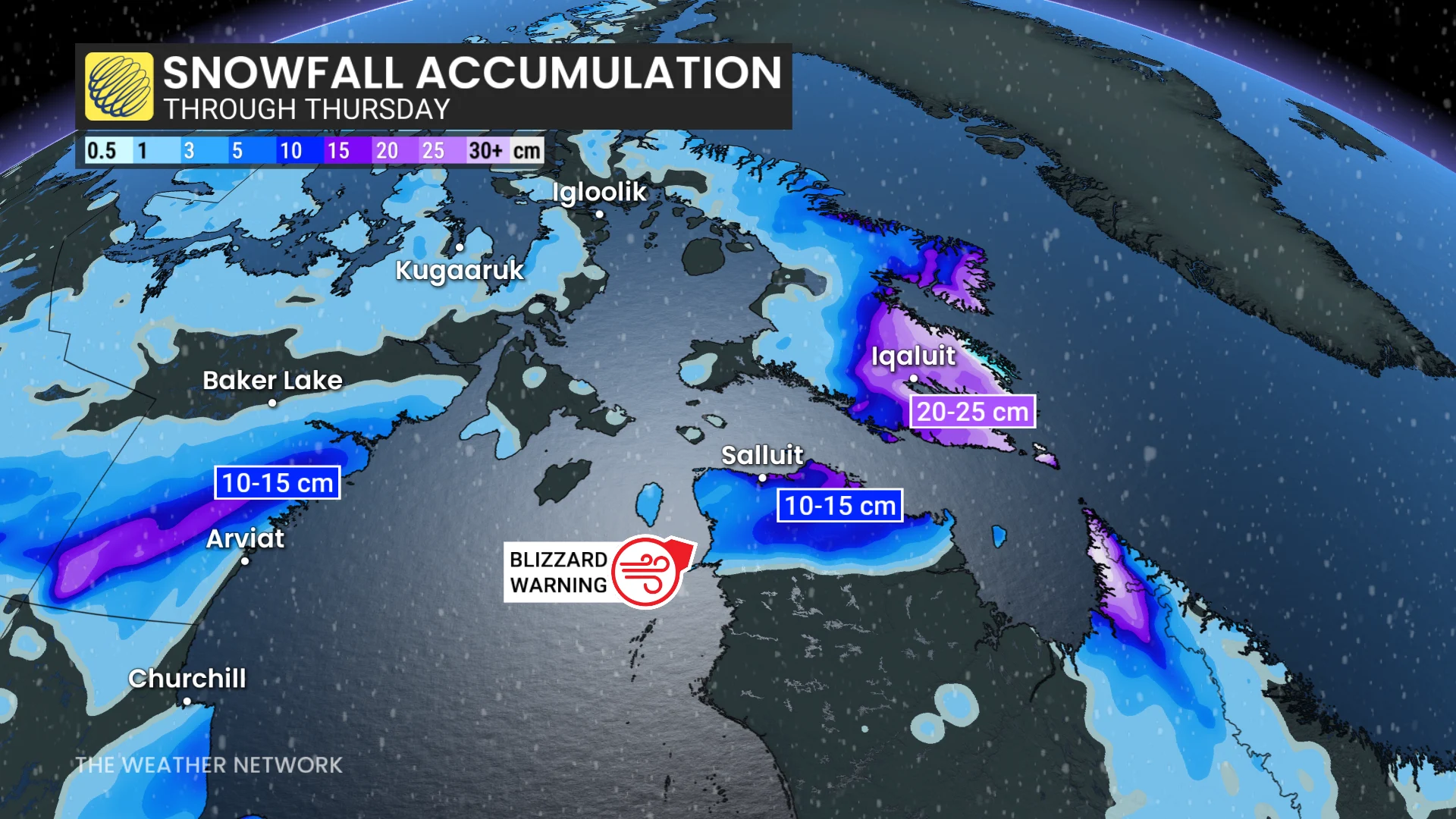
Snowfall warnings are also in affect for Iqaluit, Nunavut, where 15 to 25 cm is expected to fall through Thursday.
SEE ALSO: Where's spring? May kicked off with blizzard warning and up to 20 cm of snow
It is pretty rare for blizzard warnings this late in the season, but it is certainly not unheard of. In 2022, the Dempster Highway saw another blizzard warning issued on June 7-8.