30°C summer heat spans over 2,000 km from Ontario to Labrador

From Windsor to Labrador, warm summer temperatures will be feeling like the 30s and 40s for most of this week
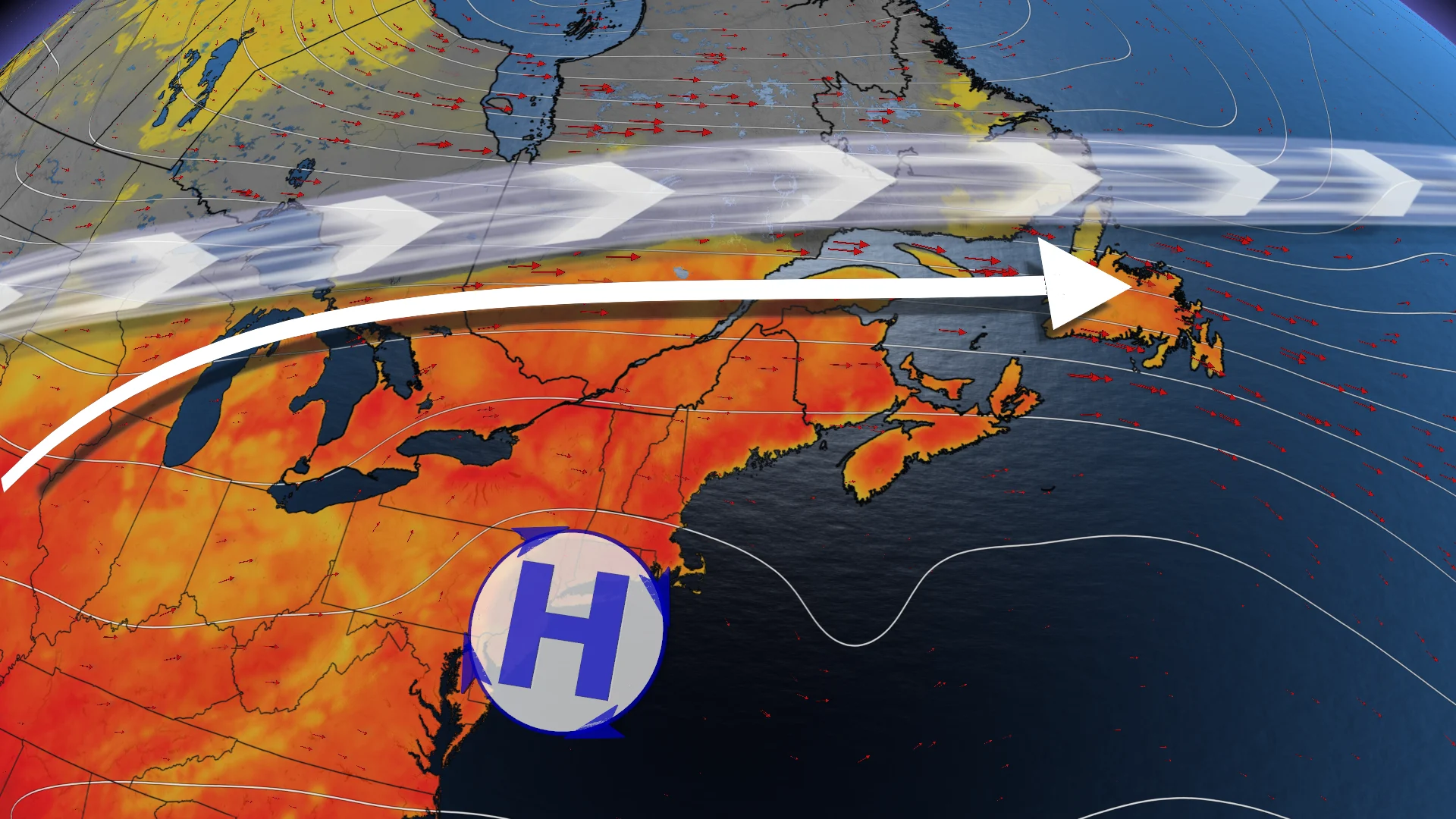
Much of Eastern Canada is under a prolonged stretch of mid-July heat, with a warm and humid air mass dominating from Windsor, Ont., right through to Labrador. Widespread heat warnings are in effect.
DON'T MISS: The Weather Network's exclusive summer 2025 forecast
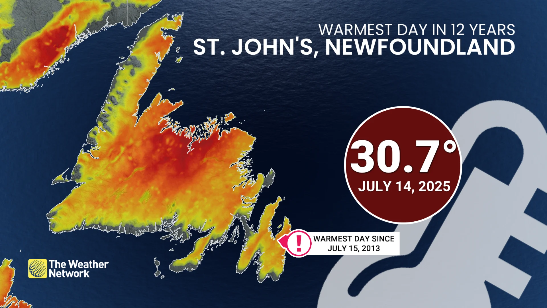
St. John’s, N.L., set a 12-year high on Monday, reaching 30.7°C, marking its hottest day since July 15, 2013.
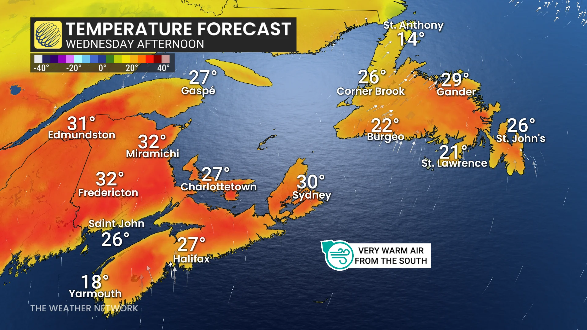
Southerly winds are keeping this pattern in place, driving several more 30°C days across inland parts of Newfoundland, the Maritimes, Quebec, and Ontario.
Along coastal regions, temperatures may feel marginally cooler due to onshore breezes.
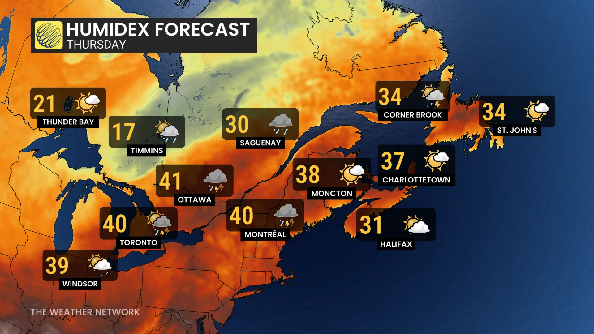
However, humidex values are forecast to rise into the high 30s to low 40s through Wednesday and Thursday, extending into Friday for Atlantic Canada.
DON'T MISS: 'Feel' miserable out? How our bodies react when humidex values soar
Relief will arrive with a strong cold front that will bring thunderstorms late this week. Ontario and Quebec should see improved conditions starting Friday, followed by a cooldown in Atlantic Canada by Saturday.
SEE ALSO: Lake Erie hits bathtub-water status, and it’s barely mid-July
Residents are encouraged to stay hydrated and limit outdoor activities during peak heat hours. The hot temperatures are a reminder of the importance of heat safety, especially during prolonged, high-humidex conditions. Check local weather advisories or alerts for updates.