
5-15 cm: Spring snow hits southern Alberta this week
Spring once again takes a back seat as a system moves into Alberta, ushering in cold air, moisture, and the possibility of snow
Southern Alberta is gearing up for a significant late-week snowfall, despite it being mid-April. Signals point to a developing storm impacting Calgary, the foothills, and areas south to Lethbridge starting Wednesday evening.
Weather Highlights:
Between 5-15 cm forecast for southern Alberta, starting Wednesday evening and lasting into Thursday morning
Temperatures near or below 0°C expected by Wednesday evening, creating conditions for a spring snowstorm
Snowy and messy conditions could disrupt Thursday morning commutes in Calgary and areas south to Lethbridge.
DON'T MISS: Spring reality check: April snowfall is normal in Canada

Southern Alberta braces for more spring snow this week
A weather system moving north of the Yellowhead Highway early this week will allow cold Arctic air to spill south, dropping temperatures near or below 0°C by Wednesday evening across southern Alberta. This, combined with moisture and instability, sets the stage for a classic spring snow event.

Snowfall is expected to begin Wednesday evening, spreading south and east into Thursday morning.
At this point, snowfall amounts are estimated between 5-15 cm, but exact totals and locations with the heaviest snow remain uncertain.
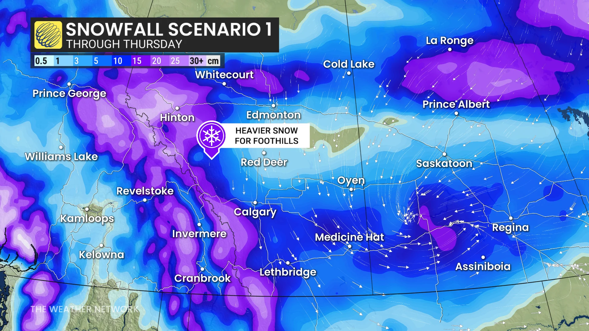
Southeastern areas could see rainfall mixing with snow due to mild air clashing with colder conditions.
RELATED: Canada’s snow season turns historic as multiple cities top 500 cm
Drivers in the region should prepare for potentially challenging travel conditions Thursday morning, especially in the southern foothills and Calgary areas.
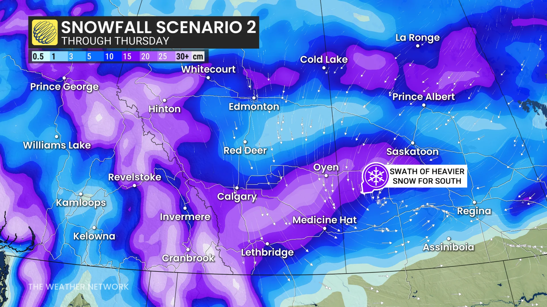
A mix of snow and rain may create messy driving across portions of the southern Prairies near the developing warm front.