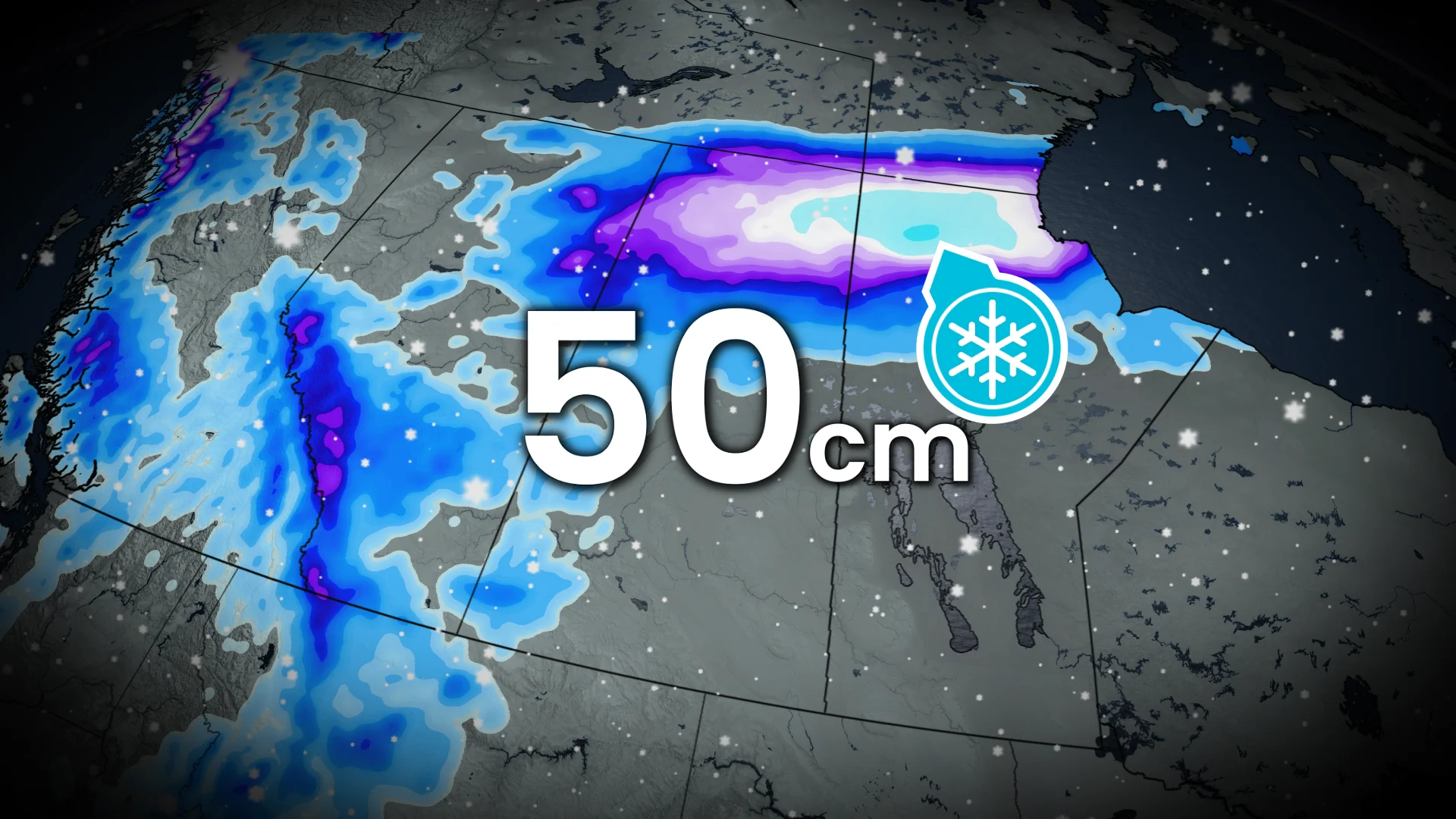
50 cm: Significant wintry weather for parts of the Prairies

Winter will be giving parts of the Prairies a sneak preview, with as much as 50 cm of snowfall possible in northern sections this weekend. Folks should prepare for significant travel disruptions
Folks across portions of the Prairies may need to dig their Halloween decorations out of the snow this week as a round of widespread snow moves into the provinces through Friday.
A strong low-pressure system developing across the American Rockies will push across the Prairies this week, bringing wind and widespread snow to all three provinces in the region. Some areas on the northern Prairies could see up to 50 cm of snow.
SEE ALSO: Canadian officials say high winds intensified tragic fire at CFB Wainwright
Significant impacts on morning commutes are likely as the roads become messy from snow and winds. People likely don't have winter tires on, yet, either, so use extra caution when driving in this weather. Consider postponing travel in the hardest-hit regions.
Widespread snow into this weekend
A potent, cold air mass from Northern Canada will envelope all of B.C., Alberta and parts of Saskatchewan on Friday and Saturday.
It will collide with abundant moisture lifting onto the Prairies from the Pacific Ocean and Gulf of Mexico. The result is a large fall storm with wind, rain and impactful snow across the Prairies.
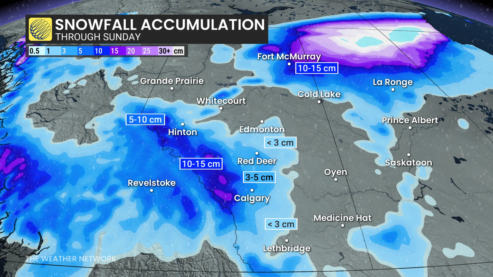
On the southern Prairies, there will be brief, but intense snowfall impacts, which will suddenly reduce visibility. In the northern sections, high snowfall accumulation and blowing snow threats are forecast.
Impacts will begin in Alberta. Early-Friday morning rainfall changes to wet snow from west to east.
Snowy impacts from Edmonton, the QE2, and then reaching to the international border, are expected through the morning.
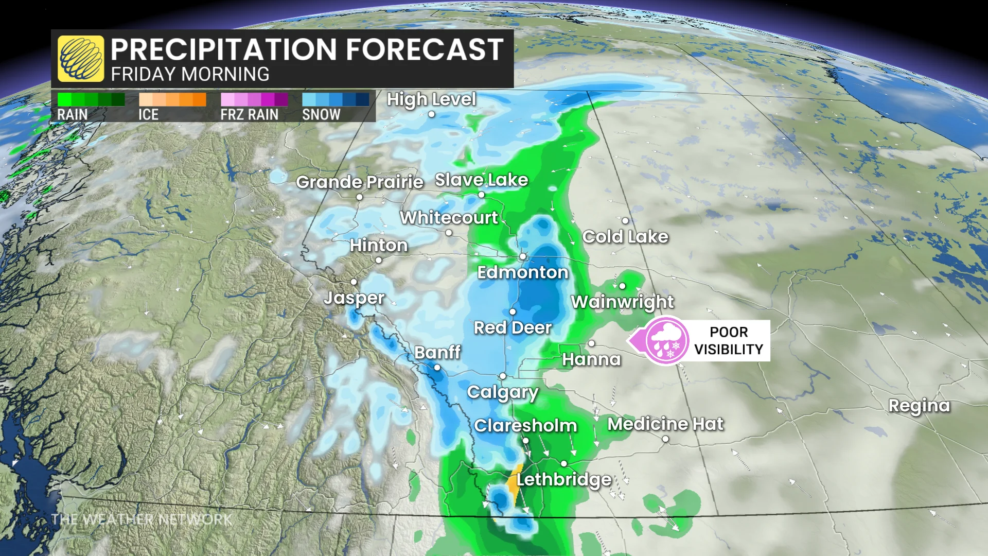
50-60 km/h wind gusts and brief, wet snow will result in sudden, reduced visibilities. Expect a slow drive to work on Friday morning along the QE2.
Snowfall continues to move east, up and down the Alberta-Saskatchewan border by Friday afternoon.
Impacts to the Yellowhead and Trans-Canada highways, as well as Fort McMurray, are expected. Winds will increase to 50-60 km/h.
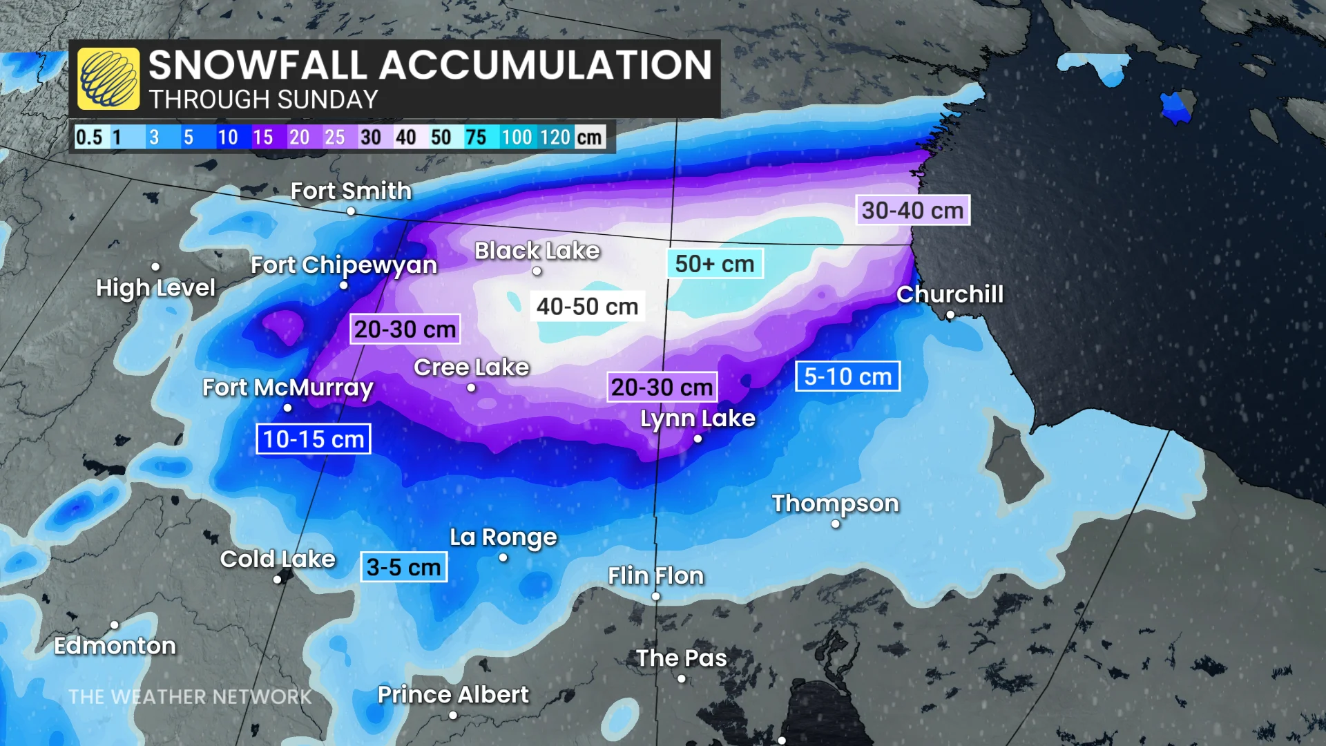
By Friday evening, the low lifts north. Significant snow is expected in northern Saskaatchewan and Manitoba. As much as 20-50+ cm is forecast.
Rain will change to brief, wet snow for regions west of Saskatoon, Sask. Winds will create a blowing snow threat.
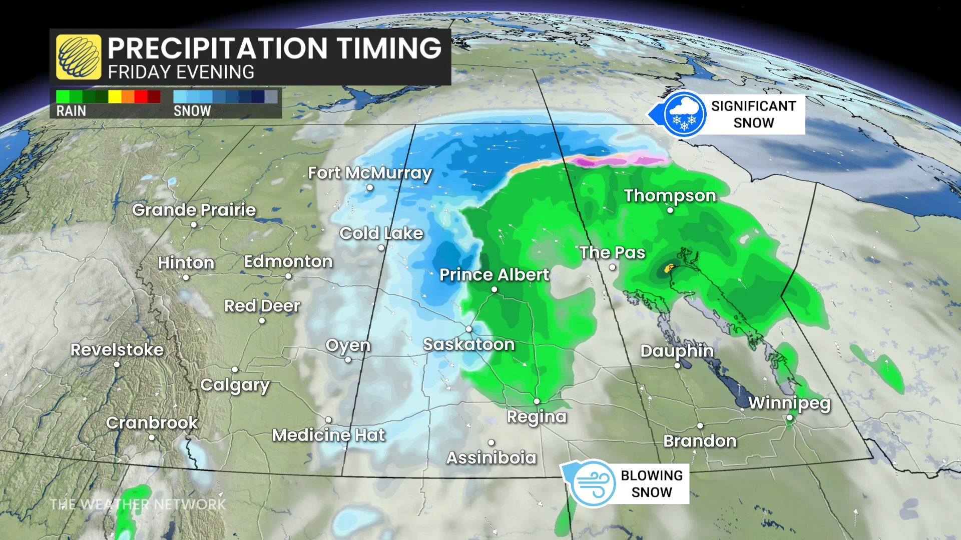
Another bout of snow is possible for Alberta Saturday, adding to the Rockies alpine totals, with light snowflurries expected on the foothills on Saturday evening.
Stay with The Weather Network for more information and updates on your weather across Alberta.