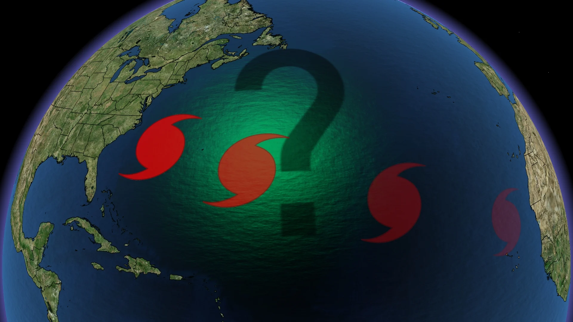
A later start to hurricane season may have you asking, where are the storms?
This year’s hurricane season has gotten off to a slow start, but that will change as we get later into the season
Around the same time last year, the talk of the town was Hurricane Beryl, a major hurricane for the Atlantic Ocean. It was the first hurricane of the season as well as the first major hurricane and the earliest Category 5 hurricane ever recorded in the Atlantic.
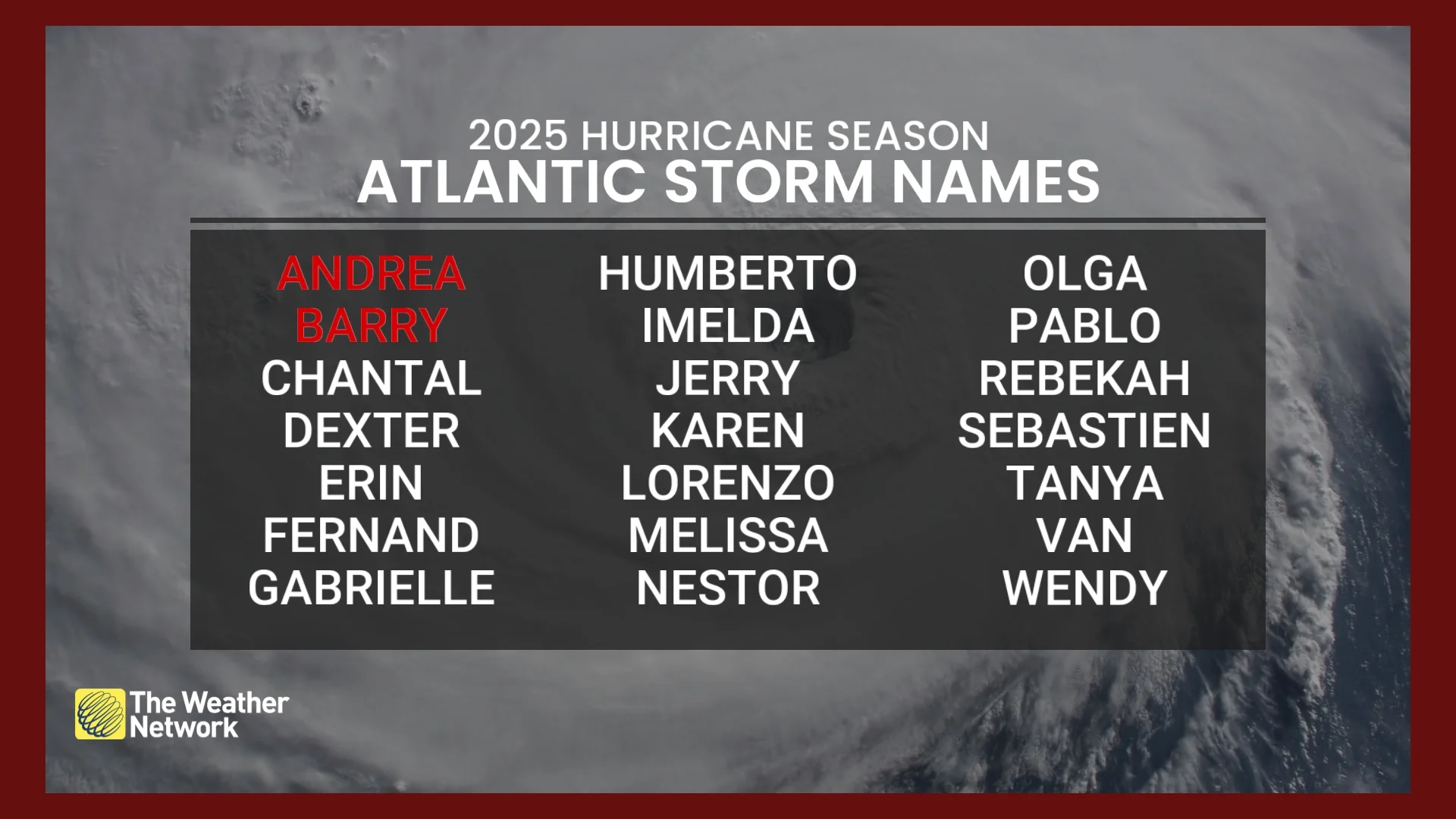
But so far, this year has been comparatively quiet, with only two named storms in the Atlantic Basin, Andrea and Barry. Both storms were outside the main development zone for systems inside the Atlantic.
RELATED: The Weather Network's hurricanes & tropical storms hub
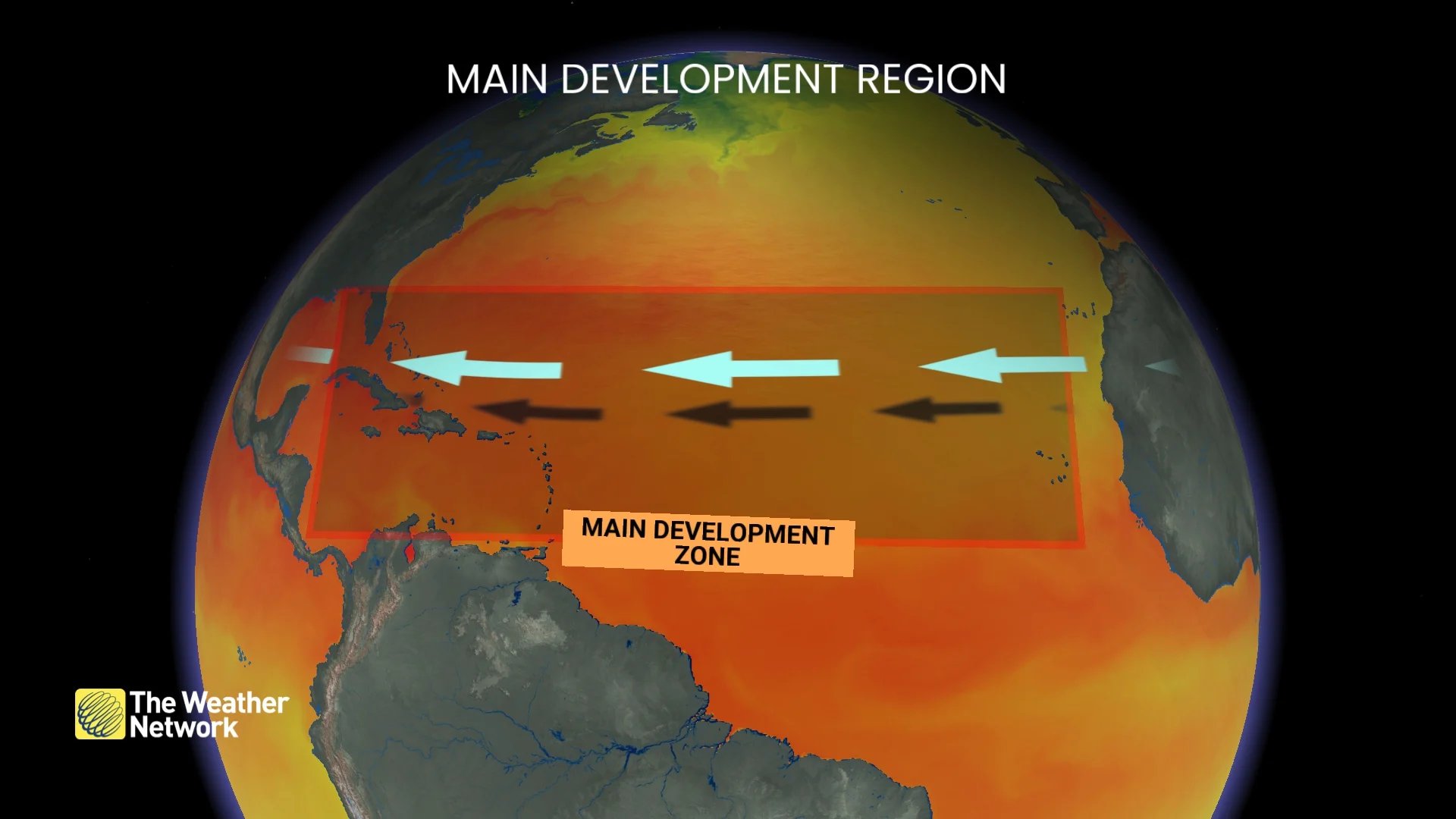
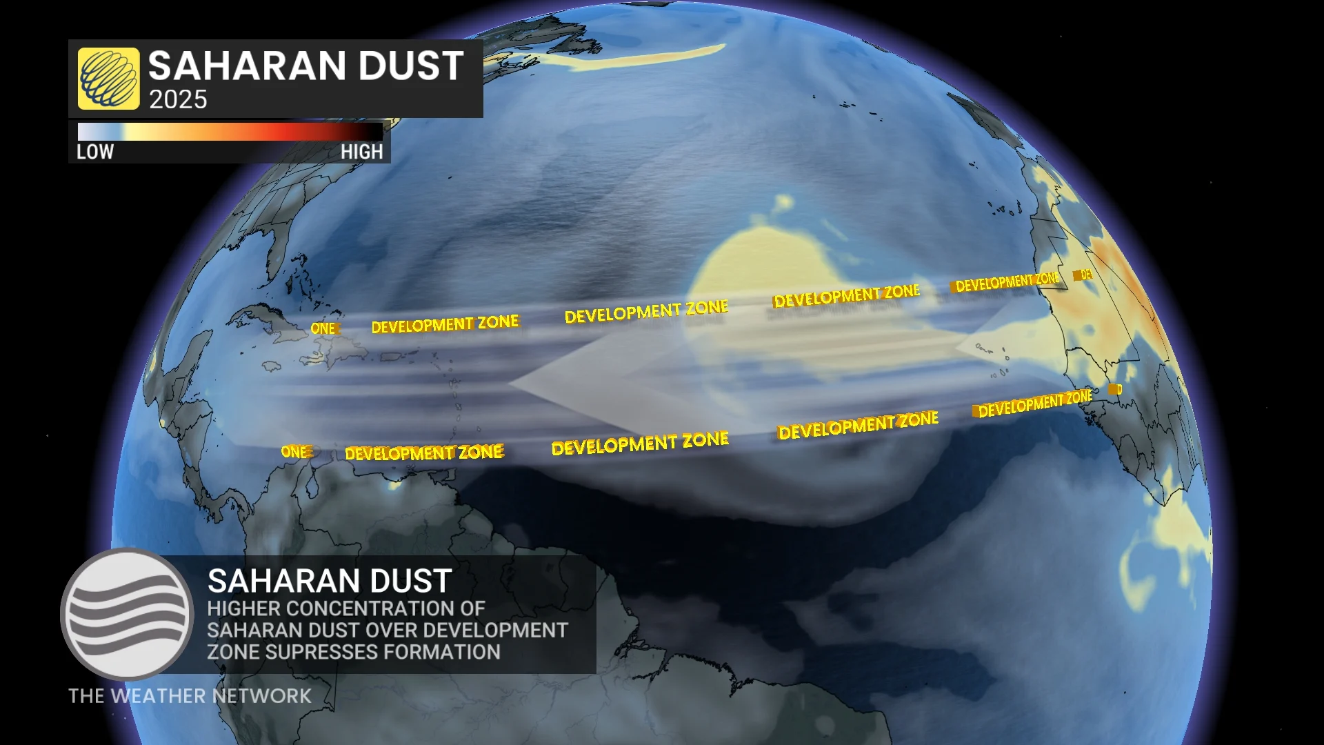
The main development region is an area of the Atlantic Ocean that stretches from the coast of northwestern Africa, past Cuba and Florida, into the Gulf of Mexico. This area is key to why this year's season has been slow to start.
The average date for the first named storm is June 20th, but Andrea, being the first Atlantic storm, was named on June 24th.
So why has it been so quiet compared to last year? Well, a good mix of factors has given this year’s hurricane season a slow start.
Lower temperatures and the Saharan Dust
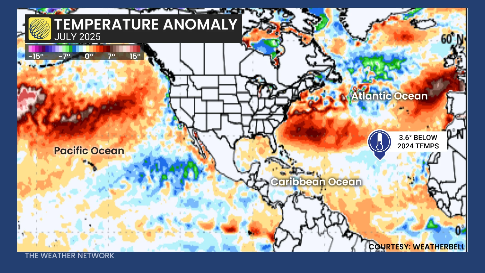
Why we’re seeing a claimer start to the hurricane season is more in part due to last year’s hurricane season having above-average sea surface temperatures, warming up the ocean temperatures in the main development zone, leading to a stronger season.
The higher ocean temperatures aided in strengthening smaller systems and boosted hurricanes to become stronger as they travelled across the Atlantic.
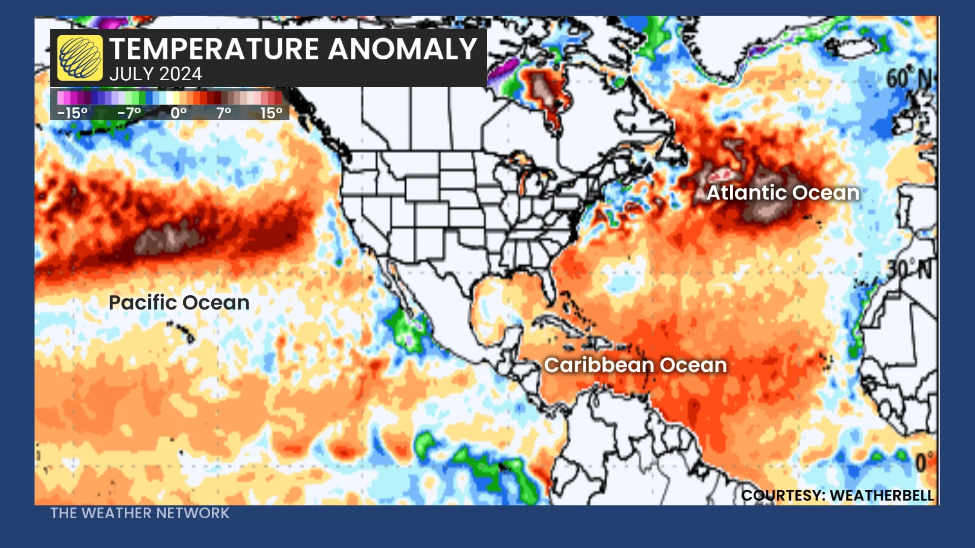
But this year, ocean temperatures have been near or below average, creating the opposite effect.
With some areas within the main development zone at 3.6°C lower than in 2024, the cooling has been inhibiting any ability for strengthening of systems across the region.
READ MORE: The heat is on! Where will Canada sizzle the most in July?
With temperatures below what they were in 2024, systems simply couldn’t form into storms the same way they did last June, but there have been other contributing factors.
Chief among them is the Saharan dust that has been blowing across the main development region; the high concentration of dust has helped to suppress hurricane development.
Sahara dust acts like a cap on a water bottle, not allowing thunderstorms to get out or, rather, strengthen as they would need to form stronger storms.
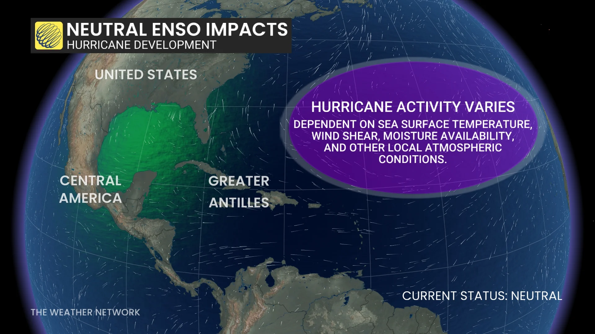
Another reason for a weak start is the different patterns we’re seeing this year. In the summer of 2024, we started to move towards a La Niña ENSO pattern, creating more hurricanes in part due to the weather trade winds, warmer water and less atmospheric stability.
DON'T MISS: Tornado confirmed in Alberta during Wednesday storms
While 2025 has seen a more neutral pattern this time around, leaving the hurricane activity to vary largely and be more dependent on local factors.
These factors include: sea surface temperatures, wind shear, moisture availability, and other local atmospheric conditions.
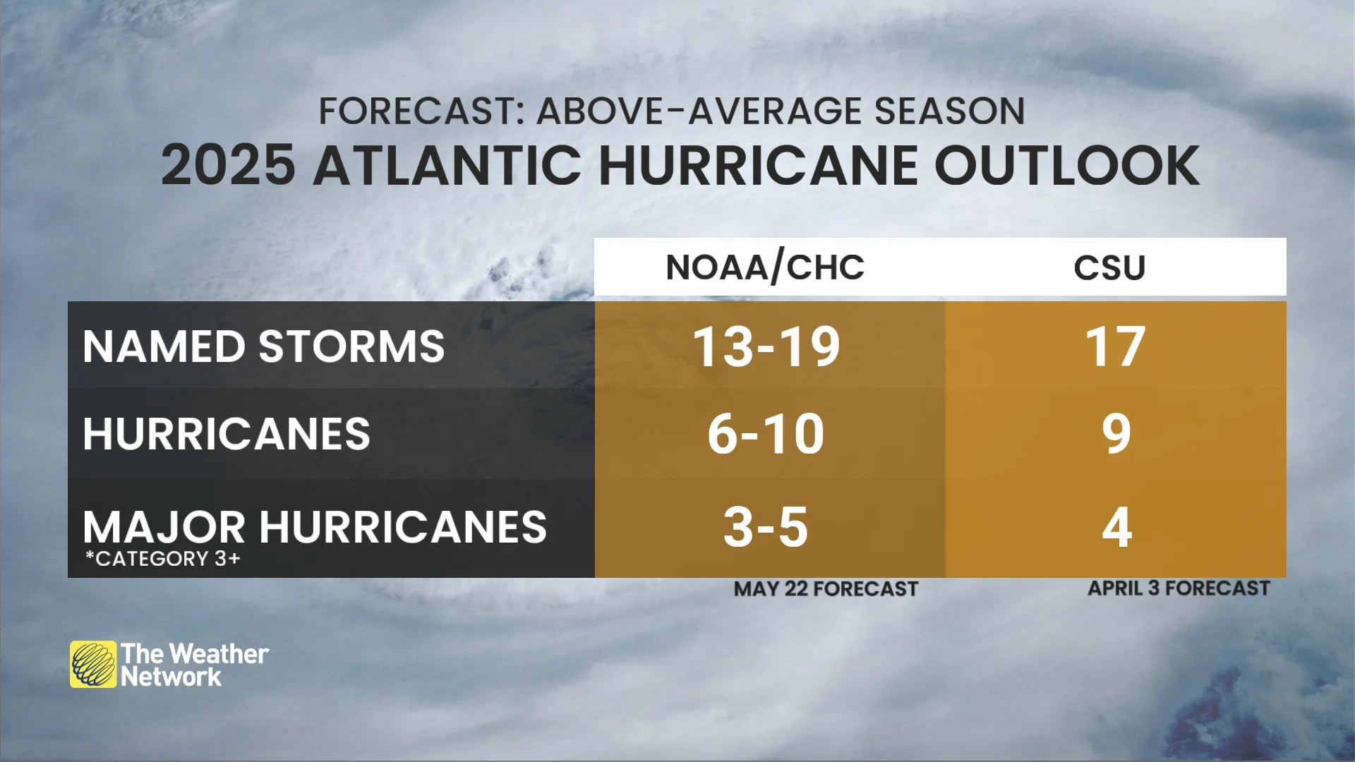
Season still expected to be above average
With all of that said, we’re still expecting to see a higher-than-average amount of hurricanes this season, with as many as 19 named storms possible forecasted for this year.
And the chances that we could see five Category 3+ hurricanes this year—it’s too early to write off the season just because it’s had a late start.
We may even have our next storm as soon as next week, as the chance of a tropical development is being tracked off the southeastern coast of the United States.
The low-pressure system in question could impact states from North Carolina to Florida; the system currently has a 60 per cent chance of developing into a storm.
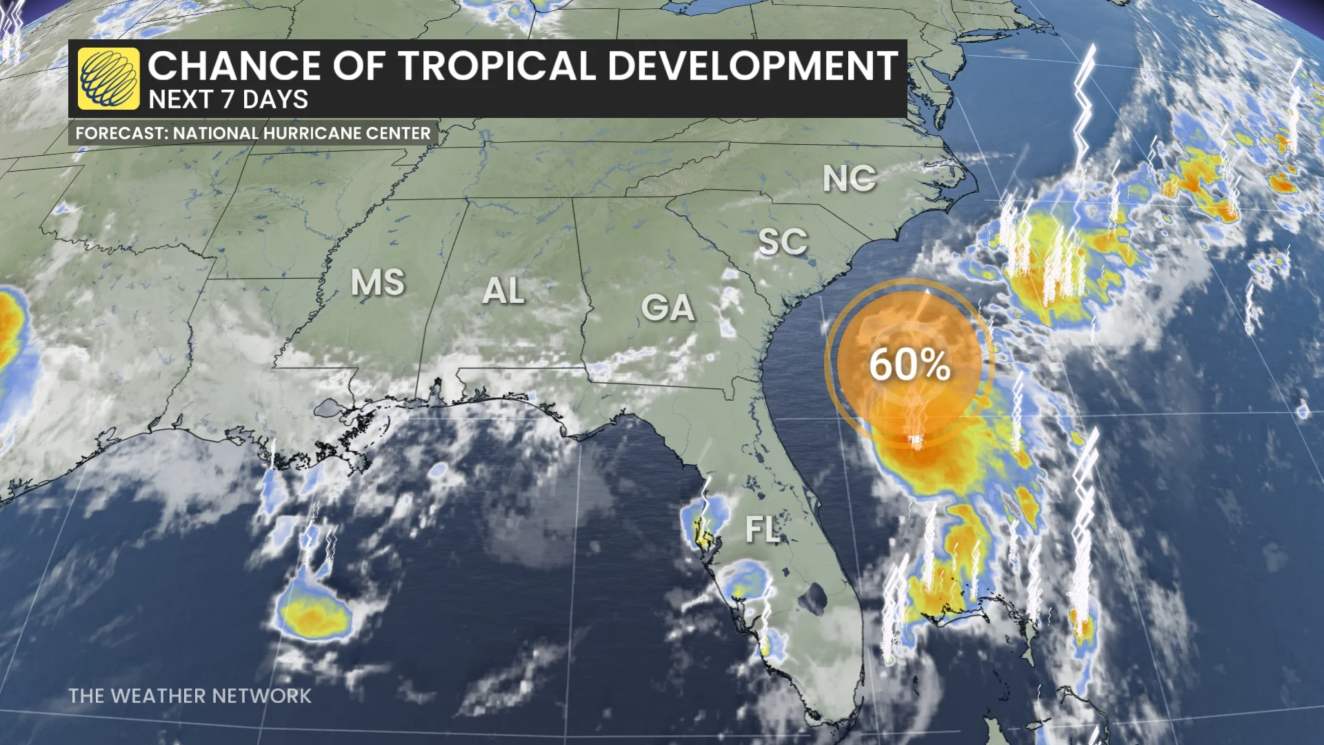
If it does manage to form, its name will be Chantal, from the list of 2025 storm names that change every single year.