
Wildfire smoke poised to return to B.C.’s South Coast, with Interior storm risk
After a brief reprieve, wildfire smoke is expected to drift back onto the B.C. South Coast this week as shifting winds aloft carry the haze from the Interior to coastal communities. Meanwhile, a risk of dry lightning from thunderstorms could spark new blazes on Tuesday
With special air quality statements still in place across a sizable portion of B.C., folks can expect a similar situation on Tuesday with wildfire smoke continuing to linger in the province.
High probability wildfire smoke returns to the South Coast of B.C. due to an abrupt wind shift.
RELATED: Vancouver broke an unexpected weather record this week
As well, there will again be a risk for severe thunderstorms in B.C. on Tuesday, with the potential for more lightning-ignited wildfires as a result. The setup will also see a severe-possible risk of storms in the southern Interior of B.C.
Folks across the region will have to stay alert for lightning strikes that could spark additional wildfires this week. As well, it is important to remain weather-aware and stay up-to-date on all of the latest watches and warnings as conditions change.
More wildfire smoke with wind change, and a thunderstorm risk, on Tuesday
Heavy smoke from ongoing fires has been a significant hazard for much of Western Canada in recent days, with many communities seeing air quality health indices reach 10 at times.
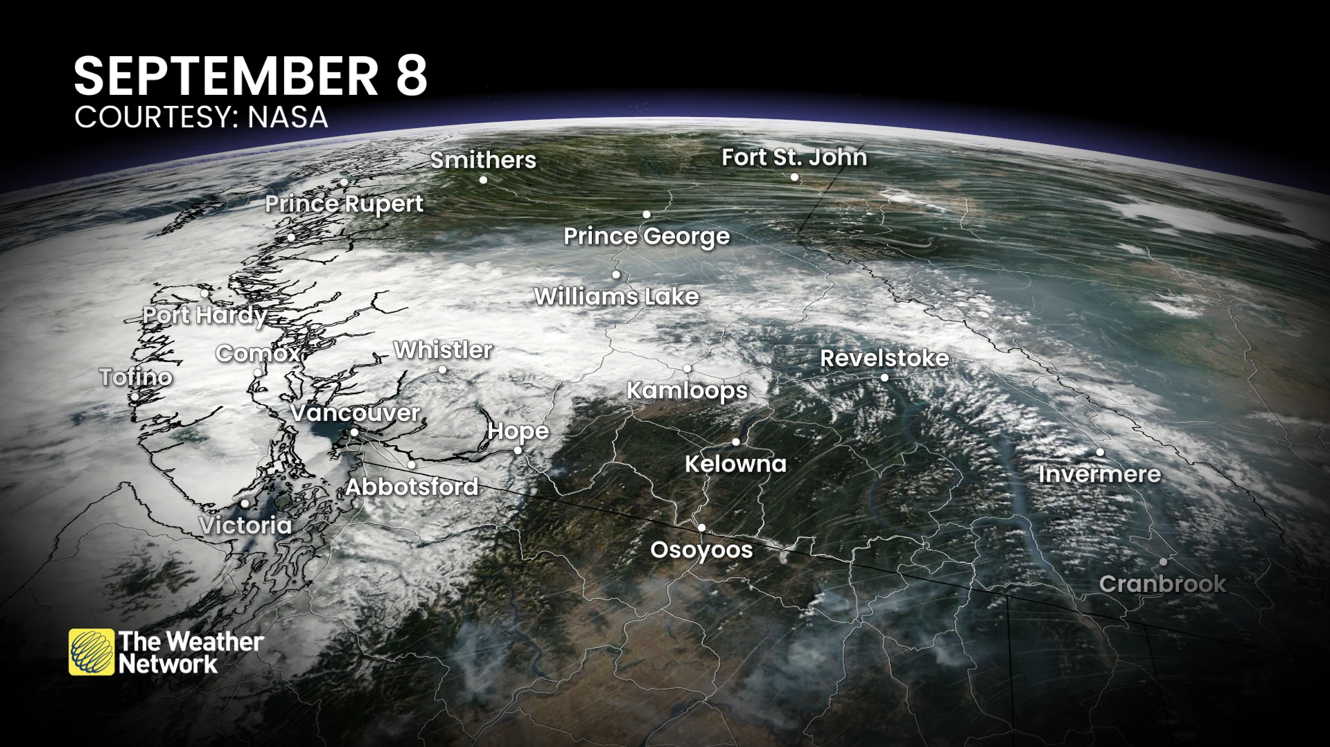
B.C. satellite imagery of wildfire smoke Sept. 8. (NASA))
The winds aloft during the past 48 hours have been lofting smoke to the northeast, crossing the Rocky Mountains and following the jet stream.
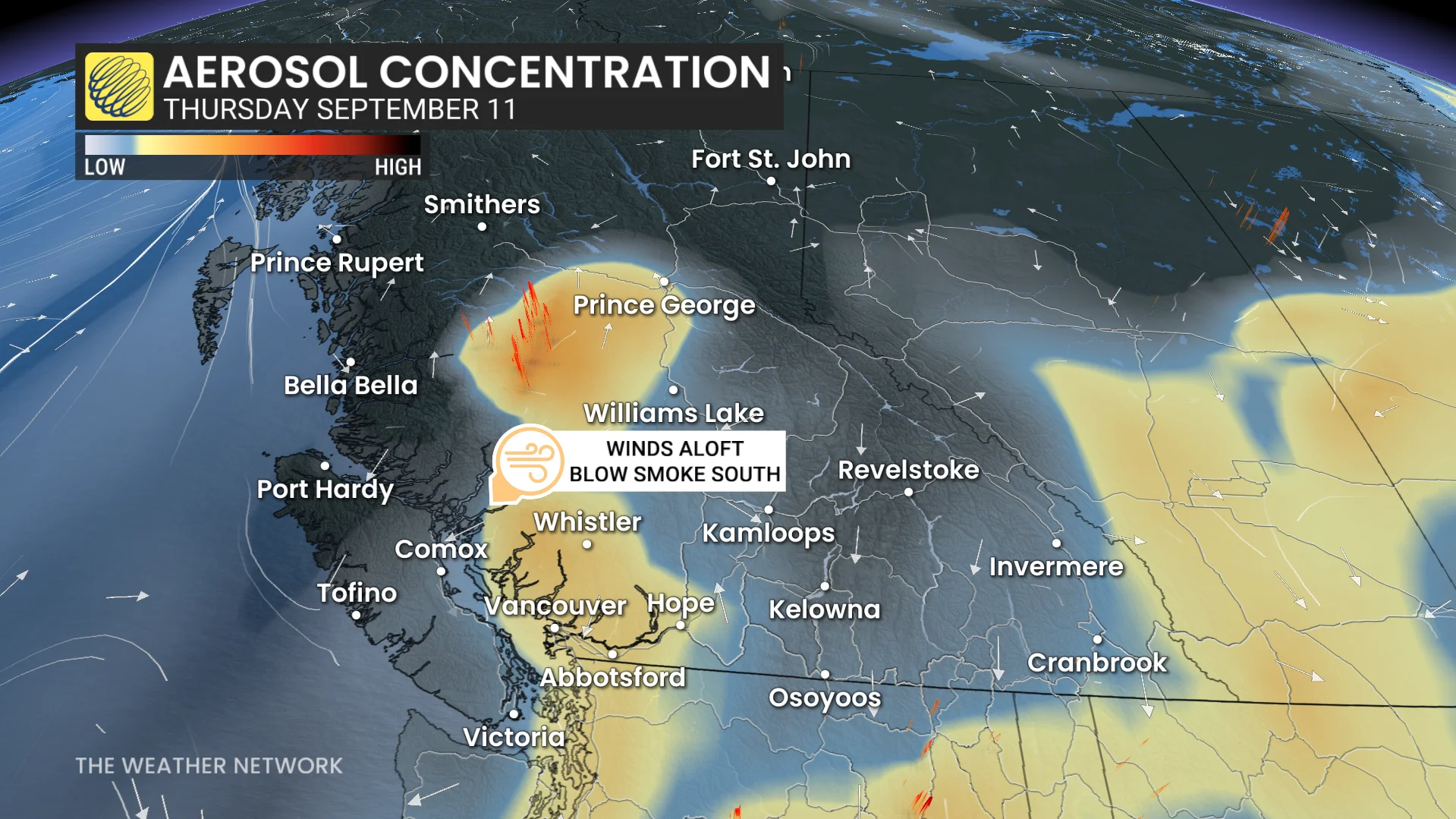
By Tuesday evening, similar weather patterns will persist with the wildfire smoke. An upper trough near Oregon reverses the wind direction aloft towards the coast, with the northerly flow steering smoke towards portions of Vancouver Island and the Fraser Valley.
DON'T MISS: Get the latest wildfire news and safety tips to help you stay safe

This northerly flow continues Wednesday and Thursday, bringing localized poor air quality downstream of the wildfire complexes west of Williams Lake.
During a wildfire, smoke conditions can change quickly over short distances and can vary considerably hour-by-hour.
And a similar, atmospheric pattern primed for thunderstorms will be present in the province. There will be a risk of stronger storms developing in the southern Interior, including for the Kamloops and Kelowna areas. Dry lightning will be a threat for setting off new wildfires.

Other potential hazards with severe storms include large hail and strong winds.
However, wildfire smoke in the area may limit thunderstorm coverage and intensity by stabilizing the atmosphere.
Air quality advisories may spread to coastal communities throughout the week.
Over the next one to two weeks, significant precipitation deficits will continue across the South Coast and central Interior, with little in the way of meaningful precipitation.
Stay updated on air quality alerts and lightning risks as conditions evolve.
WATCH: Wildfire smoke wafts across Western Canada, impacting air quality
Stay with The Weather Network for all the latest on conditions across Western Canada.