
Above-average Atlantic hurricane season likely in 2025, NOAA says

Experts are quickly coming into agreement that we’re likely on the cusp of another active Atlantic hurricane season this year
Forecasters with NOAA announced Thursday that they expect another above-average Atlantic hurricane season this year.
Experts cited favourable conditions across the Atlantic Ocean—plus the absence of El Niño in the Pacific—as factors that may drive the formation of more named storms than we’d see during a normal season.
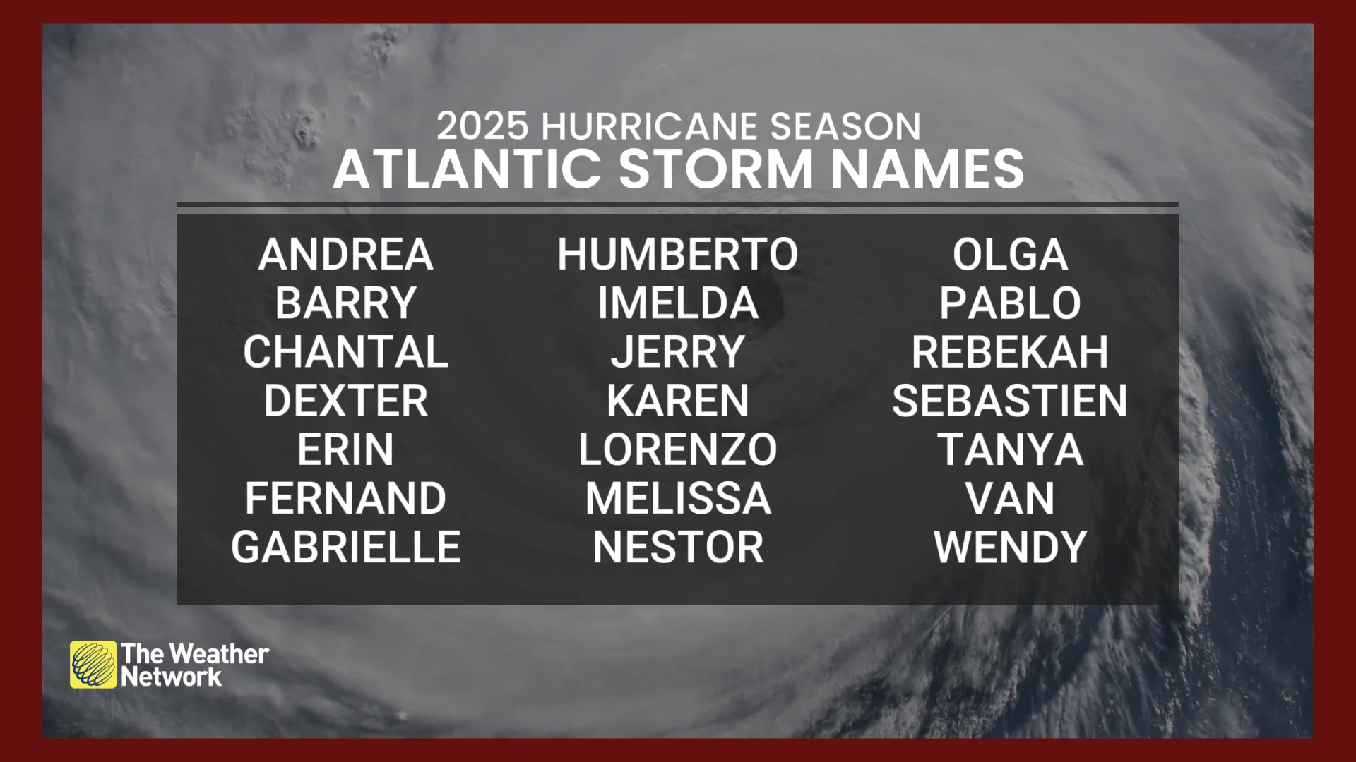
Atlantic hurricane season begins on June 1 and runs through November 30, though storms can and sometimes do form outside of that date range.
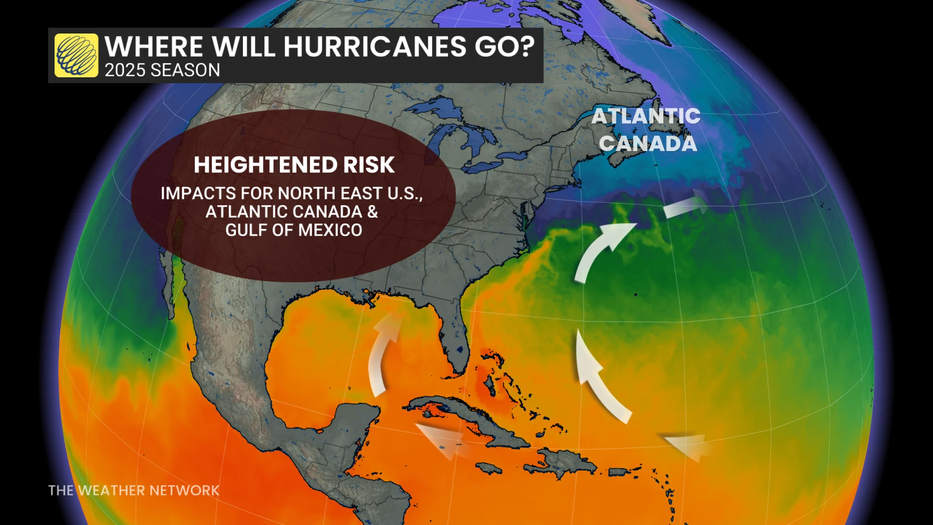
Folks who live along or near the coast throughout Atlantic Canada are reminded to prepare for hurricane season well before any storms have a chance to form. No matter how many storms form in a season, it only takes one storm making landfall to threaten life and property.
DON’T MISS: Deep U.S. cuts may affect Canadian hurricane forecasts this summer
NOAA expects an active hurricane season ahead
The latest forecast issued by NOAA calls for 13 to 19 named storms this year, with 6 to 10 of those storms growing into hurricanes. Several major hurricanes with Category 3 winds or stronger are possible.
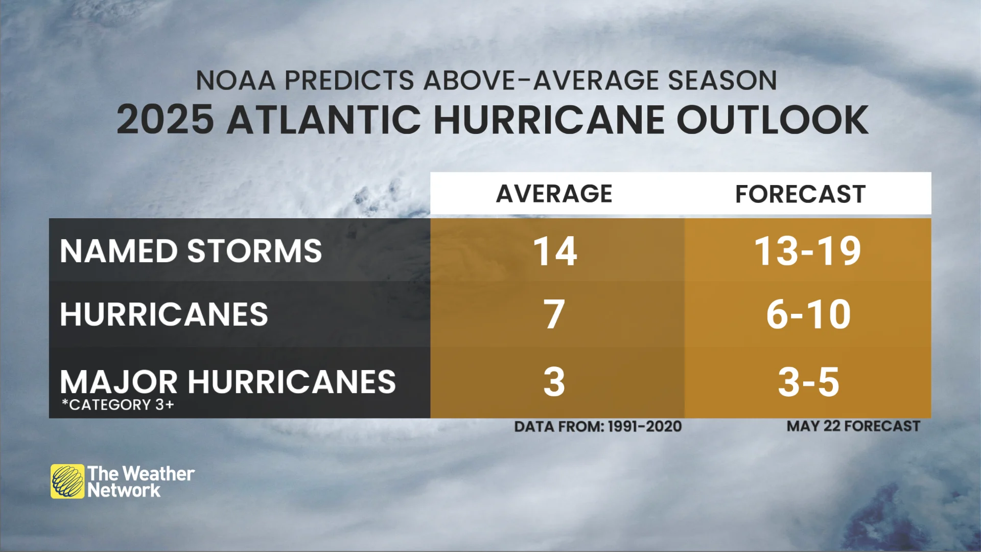
An average Atlantic hurricane season produces around 14 named tropical storms, seven of which become hurricanes and three of those hurricanes growing to Category 3 intensity or stronger.
NOAA’s prediction of an above-average Atlantic hurricane season is in line with a similar forecast published by Colorado State University (CSU) in April.
Favourable ingredients likely through the months ahead
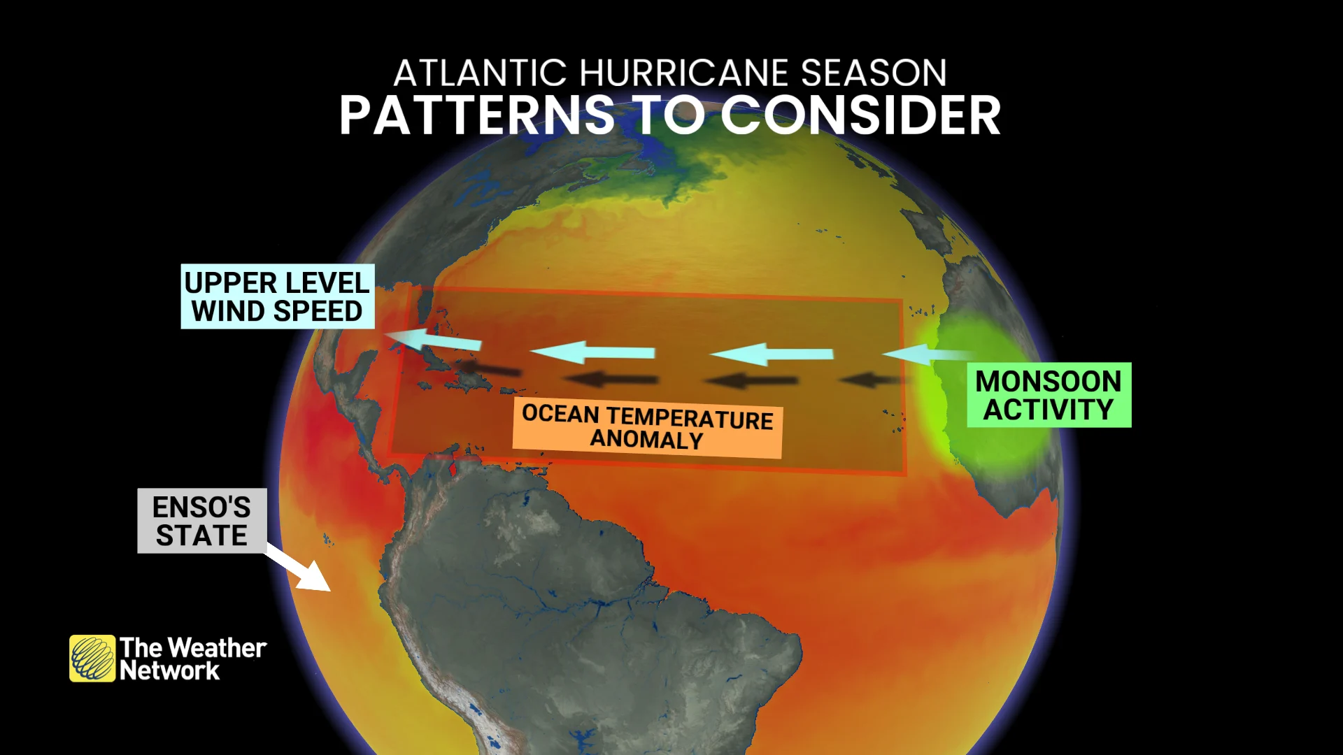
Meteorologists study long-range trends in factors like ocean temperatures, wind shear, and western Africa’s monsoon season for clues about potential tropical cyclone formation through the upcoming summer and autumn months.
Waters remain very warm throughout the Atlantic basin—continuing a trend we’ve seen for the past couple of years.
RELATED: How hot water fuels the world’s most powerful hurricanes
Temperatures in a key region of the ocean between the Caribbean and Africa, known as the Main Development Region (MDR), are a bit cooler than we saw last year. This may encourage activity to form a little closer to land in the western half of the basin.
Next door in the Pacific Ocean, the presence of ENSO-Neutral conditions—the lack of either El Niño or La Niña—will serve to lessen the amount of wind shear blowing over the Atlantic Ocean.
Wind shear can spell doom for a budding tropical cyclone as it can destroy thunderstorms at the heart of the system before they can take root.
“This hurricane season also features the potential for a northward shift of the West African monsoon, producing tropical waves that seed some of the strongest and most long-lived Atlantic storms,” NOAA added in its press release.
The Canadian Hurricane Centre (CHC) will release its own outlook for the upcoming Atlantic hurricane season on Friday.
Stay with The Weather Network throughout hurricane season for all the latest forecasts and information.