
Amid the deep freeze, 20-30 cm of snow en route to B.C. South Coast

Bitterly cold Arctic air has gripped much of B.C. this week, and the weekend features very heavy snow on the normally balmy Vancouver Island.
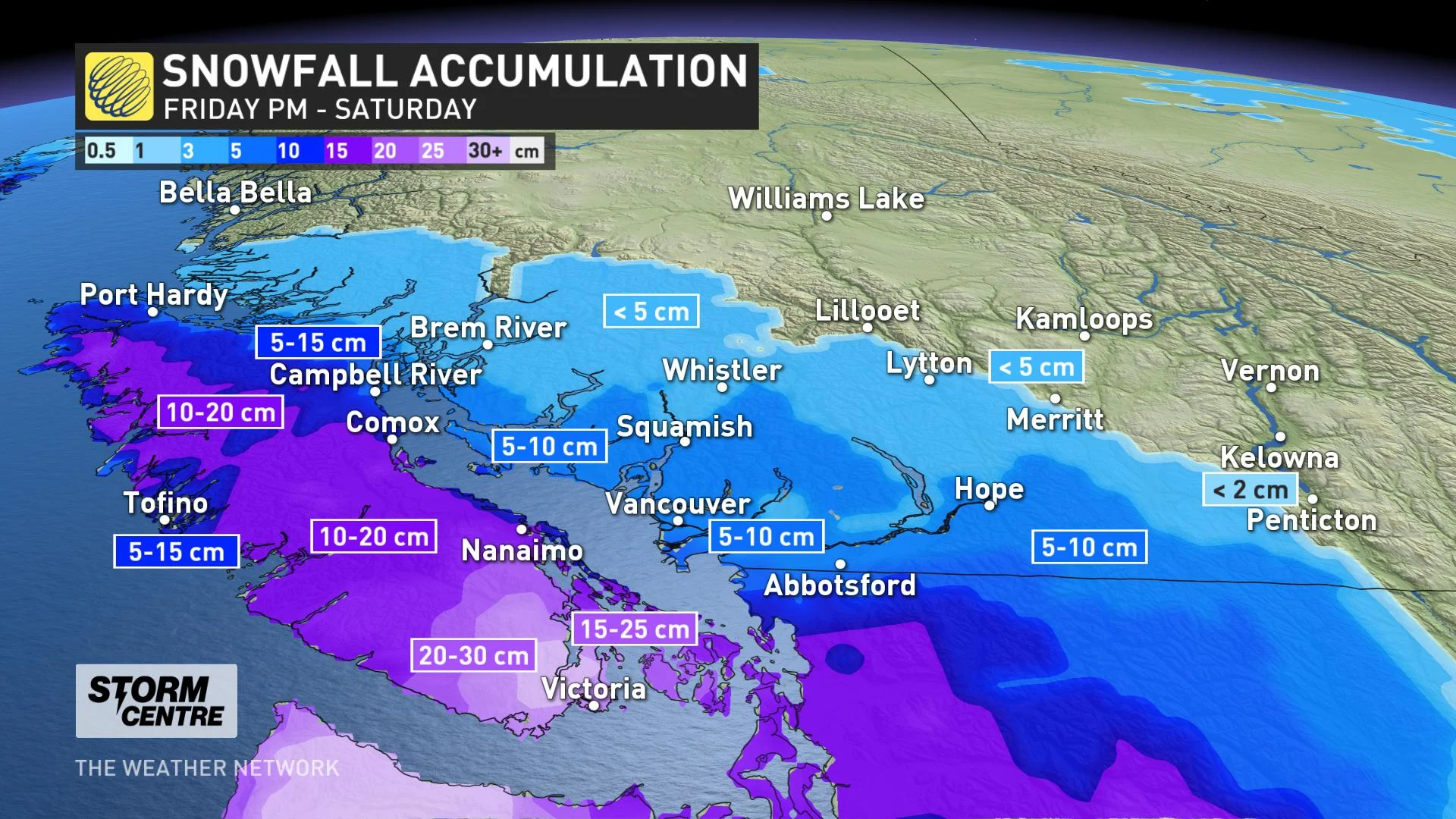
The weekend starts off with a very potent winter storm for Vancouver Island, with up to 30 cm expected for some parts of the island through Saturday, including Victoria, which could see as much as 25 cm. On the Lower Mainland, much more modest amounts are expected. Light snow showers continue Sunday here and there, but a more potent system may be shaping up for next week. Take a closer look, below.
WEATHER HIGHLIGHTS:
System continues Saturday after moving in overnight
Potential for impressive snow totals for Vancouver Island including Tofino and Victoria, more modest on the Lower Mainland
Potential for another system next week
INTO SATURDAY: WINTER STORM AND SNOWFALL WARNINGS ISSUED ACROSS VANCOUVER ISLAND
By the time people on Vancouver Island wake up, a fair bit of snow will already be on the ground, after the effects of this system move in overnight.
There will be a very sharp contrast between totals on the Lower Mainland, with very dry Arctic air, and on Vancouver Island, which is less cold, as this moisture-laden system sweeps in.
As such, Vancouver Island, where winter storm warnings are in effect, is set for some 15-30 cm for some areas, with Victoria in line for up to 25 cm. The Lower Mainland, by contrast, is in for more modest amounts of some 5-10 cm.
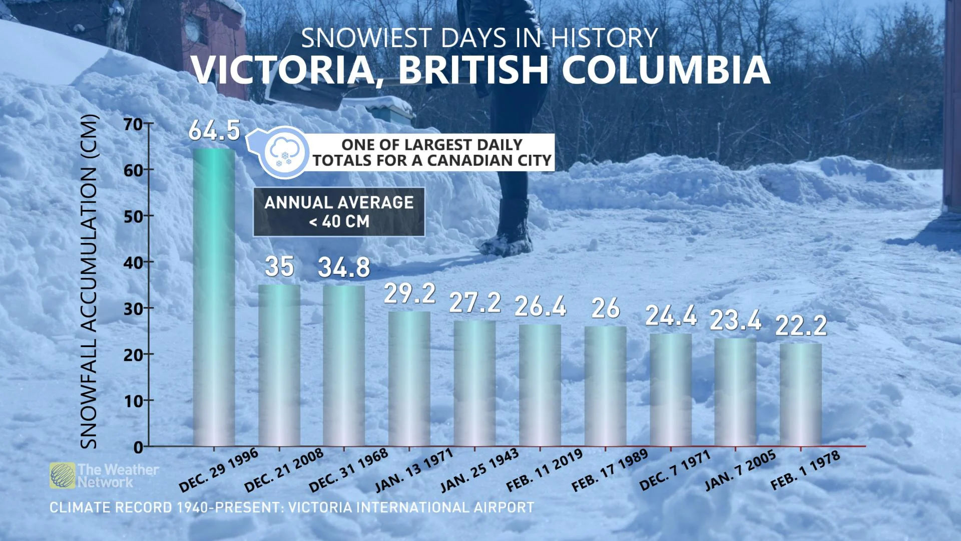
Though uncommonly high amounts are expected, it’s likely no ‘blizzard of 1996,’ the infamous storm that dumped 65 cm of snowfall on Victoria; nevertheless, it could become a top 10 heaviest snowfall event over the past several decades for the capital region.
BEYOND: EYES ON ANOTHER POTENTIAL SYSTEM NEXT WEEK
Beyond Saturday's system, some snow showers will linger on Sunday, but it's the early part of next week that forecasters are watching, with the chance of another high-impact system.
"This will be a much tricker forecast for precipitation type for coastal areas, with the potential for a rain/snow mix near sea level, but models are likely struggling with the impact of so much fresh snow on the ground so we could see snow at times into the metro areas," Weather Network meteorologist Dr. Doug Gillham says.
Later in the week, another system is expected around Thursday. Temperatures by then will be milder, but still low enough to allow for some potential rain/snow mixing for some areas near the coast, and all-snow for ski areas.
Check back as we continue to monitor the forecast for B.C.