Storm surge looms for Alberta, large hail and damaging winds likely
Severe storms may bring large hail, strong winds and a low tornado threat to Alberta mid-week.
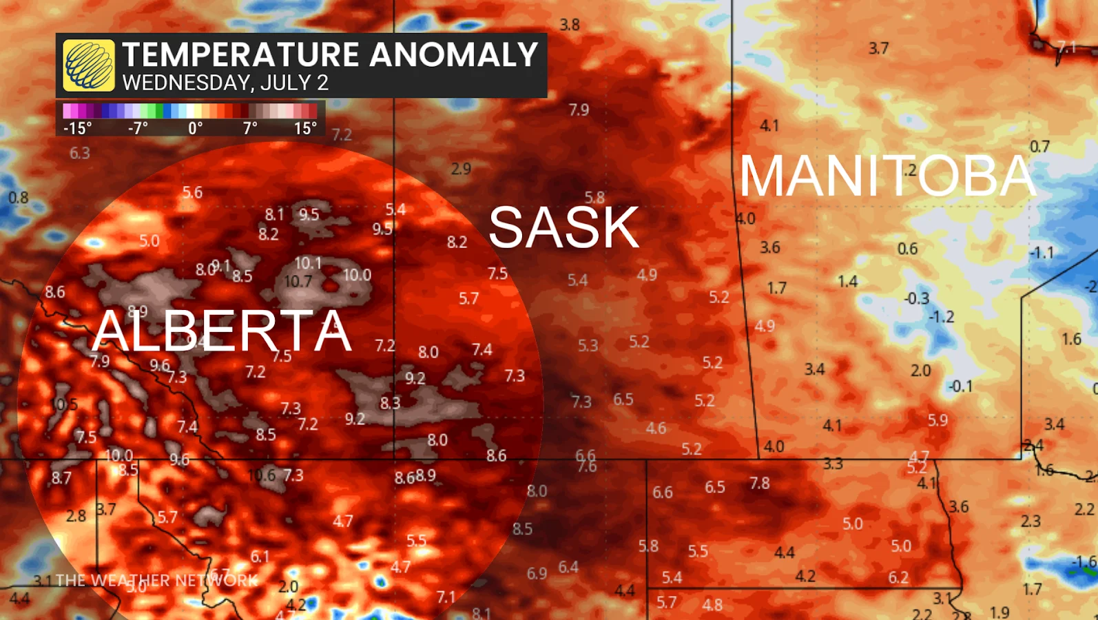
Alberta's heat wave is peaking, bringing with it another round of potentially severe thunderstorms.
Wednesday is shaping up to be the most volatile day of the week, with temperatures in the south reaching up to 10ºC above seasonal levels and conditions ripe for more widespread and severe storms.
Storm energy builds with hail and wind in the mix
The heat and humidity are fuelling instability in the atmosphere, giving storms plently of energy to work with.
MUST SEE: Lightning contributing factor in recent northwestern Ontario wildfires
Central Alberta, particularly the areas around Grande Prairie, Hinton and Whitecourt, faces a risk of damaging hail, some of which could be larger than 4 cm in diameter.
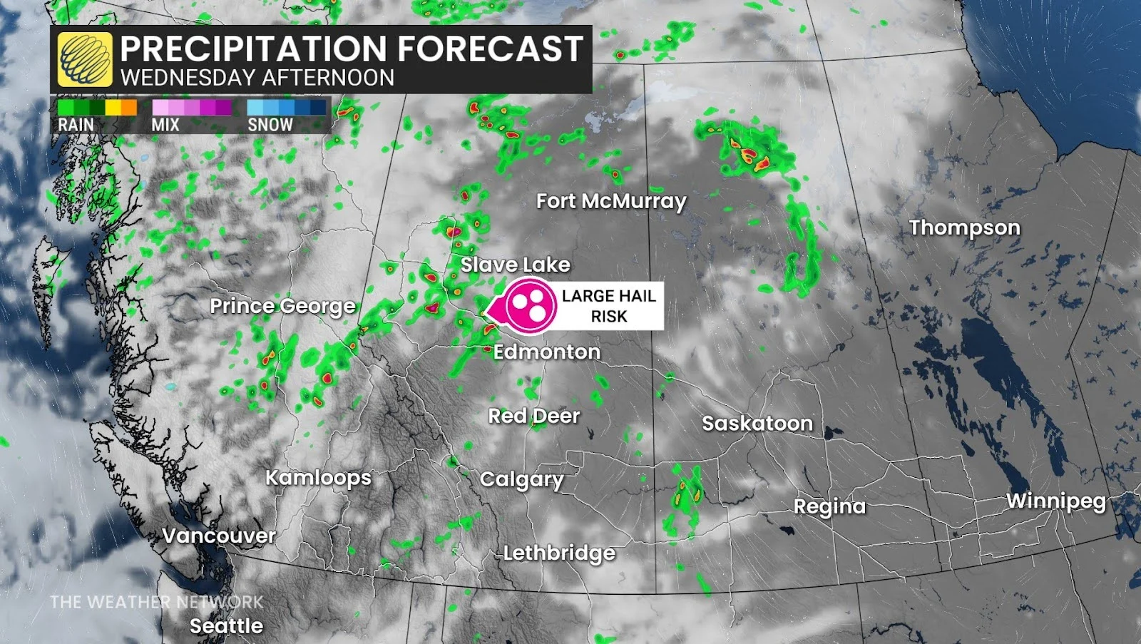
Calgary is also expecting afternoon and evening storms, with forecasters growing more confident as the day progresses.
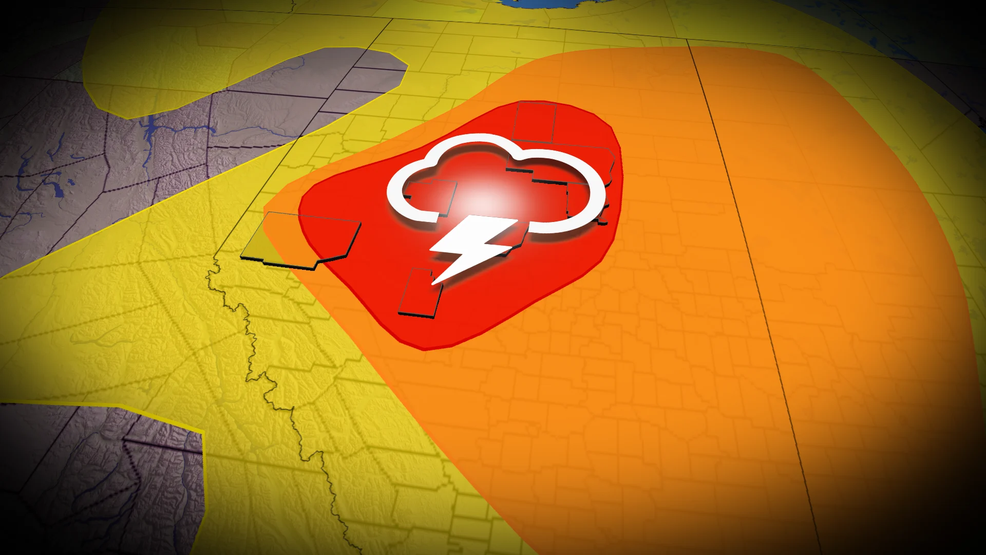
The key threats this time:
Very large hail (over 4 cm)
Damaging winds (90-110 km/h)
A low to moderate tornado threat, with brief spin-ups possible
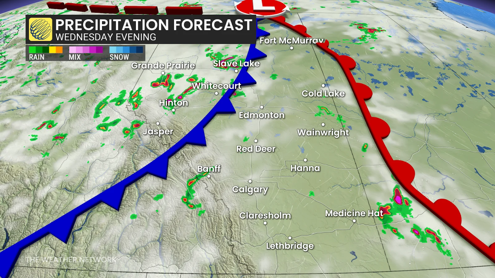
Fast-moving storms limit flood concerns — but not the impact
Unlike slower systems that stay and cause flooding, Wednesday's storms are projected to move quickly east-northeast at speeds ranging from 60 to 80 km/h.
SEE ALSO: Flies won't leave you alone? This Canadian invention could help!
This speed reduces the risk of flash flooding —however it does not eliminate the threat of damaging winds or hail.
As the week wraps up, Alberta is anticipated to get some relief from both the heat and the storms, with cooler air coming in by Friday.
In the meantime, residents are urged to remain weather-aware. Those in high-risk areas should pay attention to alerts, particularly in the late afternoon and evening.
Stay with The Weather Network for more information and updates on your weather across the Prairies.