Peaking Prairie heat prolongs severe storm threat, damaging impacts
Alberta's heat wave is peaking, bringing with it another round of potentially severe thunderstorms.
Fireworks weren't the only thing booming in Alberta on Canada Day as severe storms bubbled up, bringing large hail and even a tornado warning to parts of the province.
Wednesday is now shaping up to be the most volatile day of the week, with temperatures in the south reaching up to 10ºC above seasonal levels and conditions ripe for more widespread and severe storms.
MUST SEE: Don't make this deadly mistake when waiting out a storm
We'll also see the severe storm threat carry over to the eastern Prairies on Thursday, targeting eastern Saskatchewan and western Manitoba, before the heat finally begins to break.
Be sure to monitor local weather alerts and incoming conditions throughout the day.
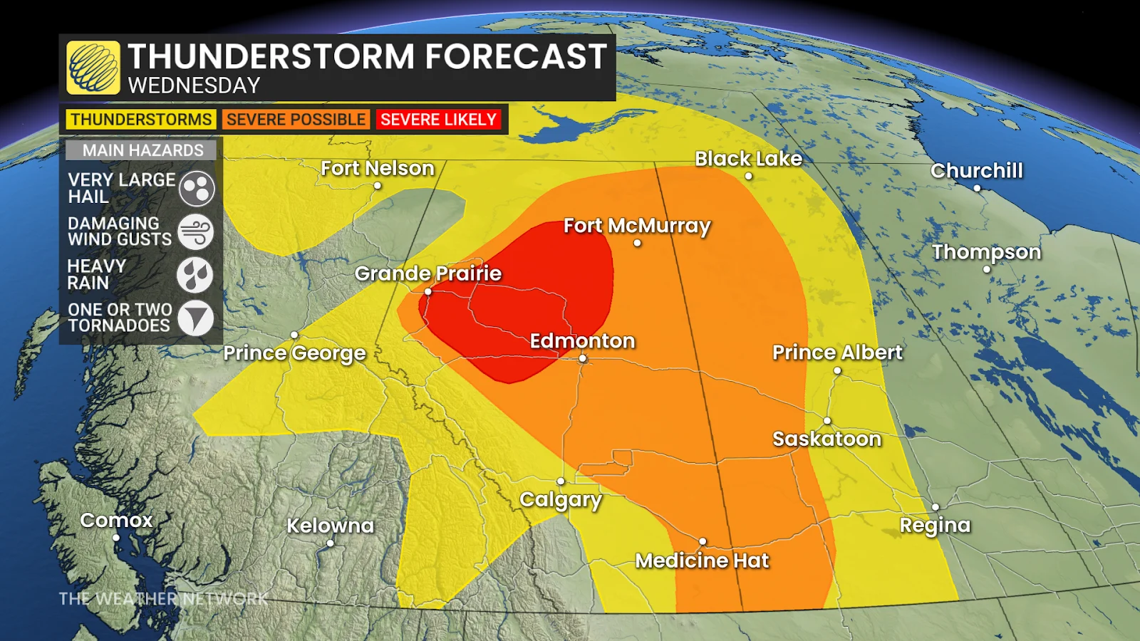
Severe weather spins up again in Alberta on Wednesday
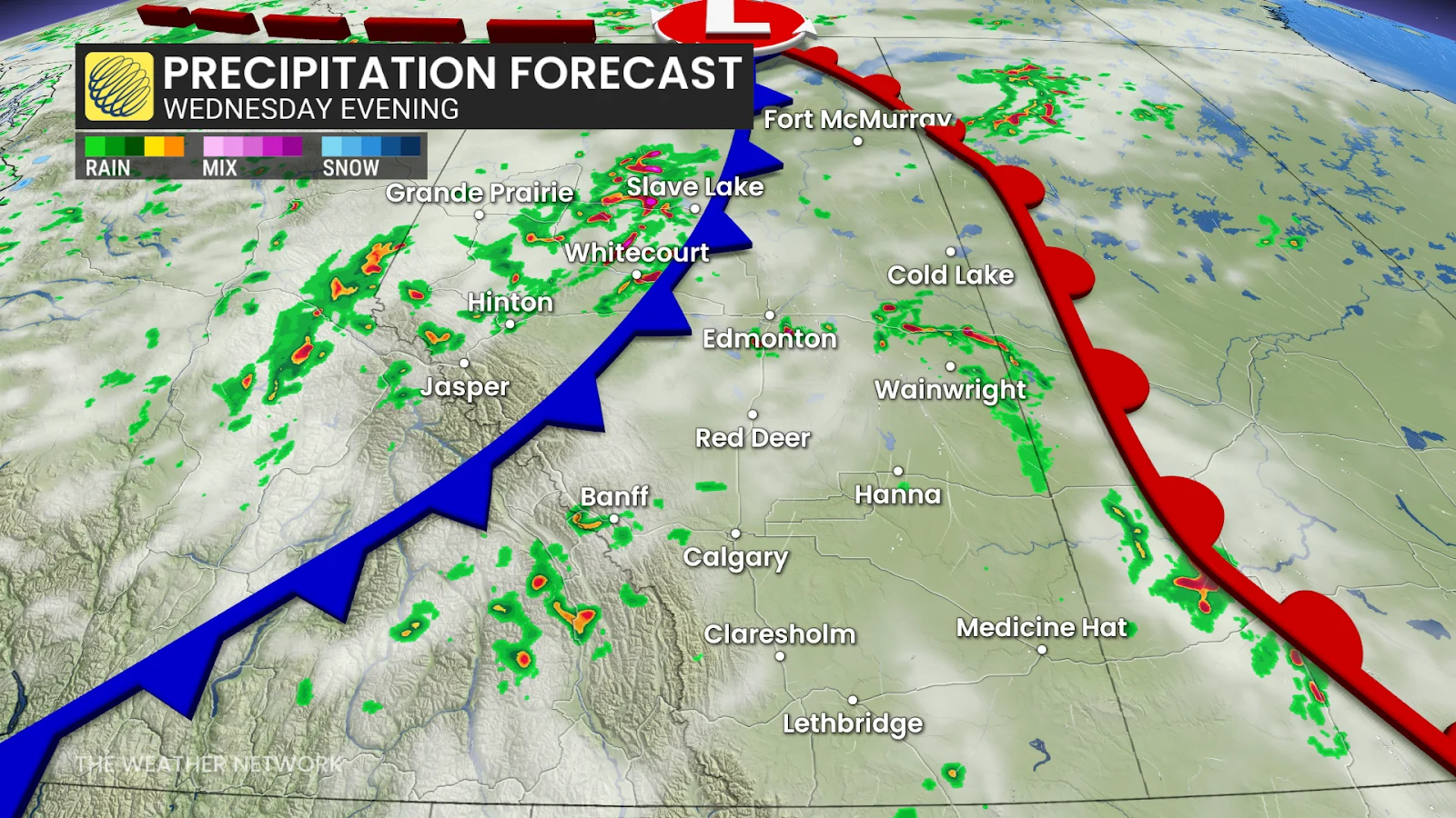
A cold front sweeping across Alberta will clash with the heat that has been looming over Alberta, triggering more storm development on Wednesday afternoon and evening. The severe threat will also spill into Saskatchewan, along the provincial border.
Once again, central Alberta, particularly the areas around Grande Prairie, Hinton and Whitecourt, faces a risk of damaging hail, some of which could be larger than 4 cm in diameter.
The heat and humidity are fuelling instability in the atmosphere, giving storms plenty of energy to work with.
The key threats this time:
Very large hail (over 4 cm)
Damaging winds (90-110 km/h)
A low-to-moderate tornado threat, with brief spin-ups possible
Unlike slower systems that stay and cause flooding, Wednesday's storms are projected to move quickly east-northeast at speeds ranging from 60-80 km/h.
SEE ALSO: Scud clouds are scary tornado lookalikes - how to tell them apart
This speed reduces the risk of flash flooding—however it does not eliminate the threat of damaging winds or hail.
Storm threat shifts into Saskatchewan, Manitoba on Thursday
The same cold front to trigger Wednesday's storms will makes its way east into Saskatchewan and Manitoba on Thursday, triggering another risk of thunderstorms; although there is still some uncertainty as to how strong the storms will be.
Thunderstorm energy over the Prairies will still be high, though, so we will see a risk of severe storms developing along the Saskatchewan-Manitoba border in the late afternoon to evening hours.
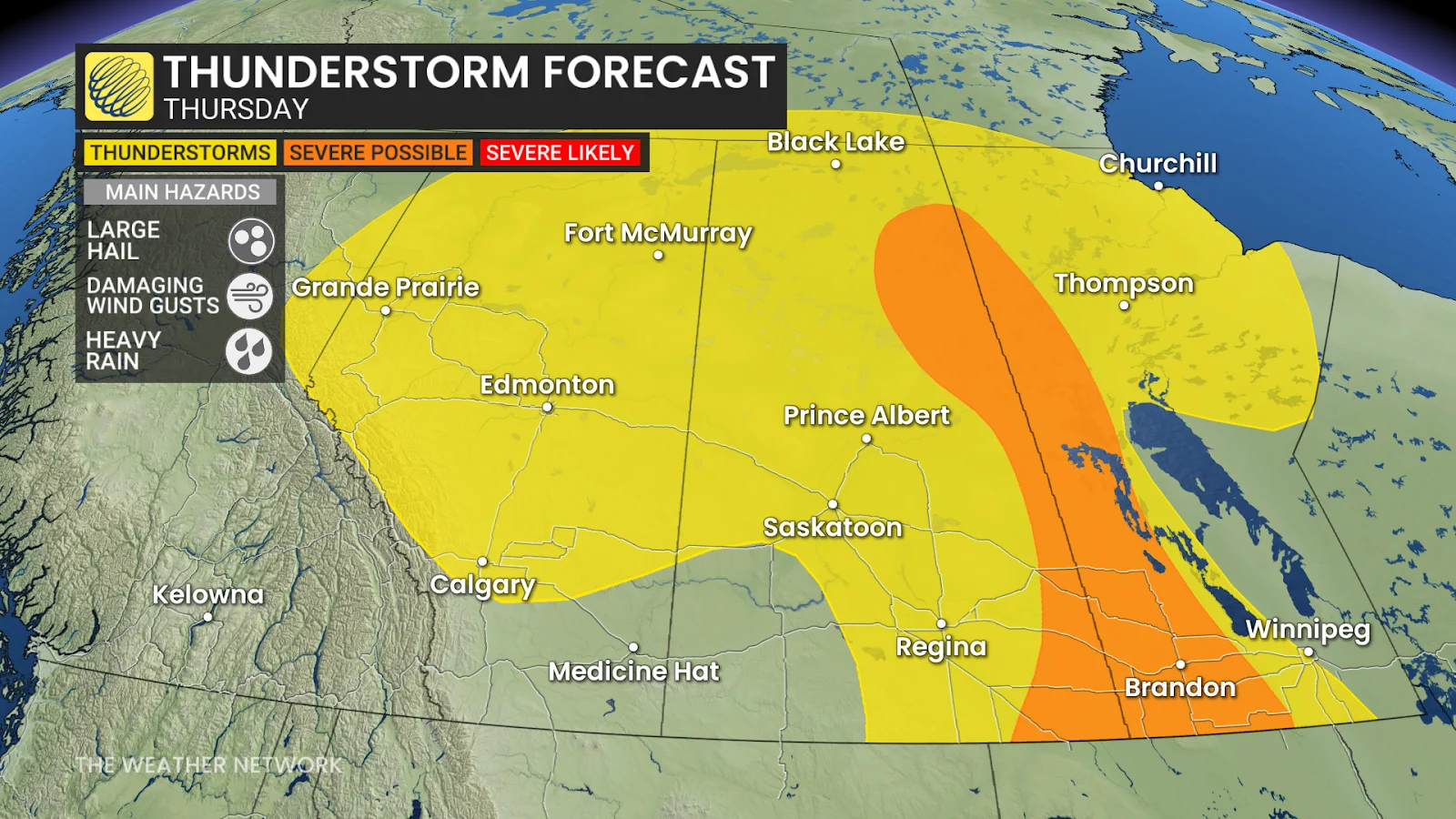
We could once again see some large hail, between 3-5 cm in diameter, and damaging winds between 90-110 km/h with any severe storms that pop up.
As the week wraps up, the Prairie provinces are anticipated to get some relief from both the heat and the storms, with cooler air coming in by Friday.
In the meantime, residents are urged to remain weather-aware. Those in high-risk areas should pay attention to alerts, particularly in the late afternoon and evening.
Stay with The Weather Network for more information and updates on your weather across the Prairies.