Alberta storm threat: Beneficial rain, but risk of very large hail
Thunderstorms are likely to impact Alberta for the next few days, with the threat for some to turn severe. Be sure to stay alert and weather-aware
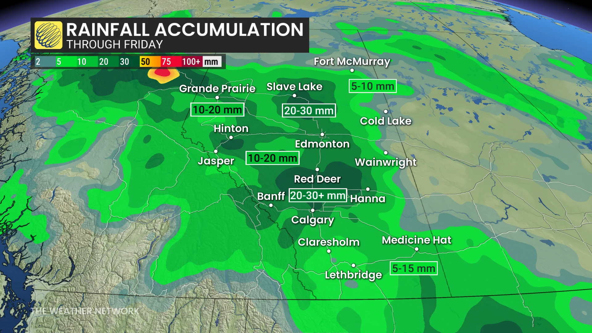
Southern and central Alberta are set to experience widespread rain and thunderstorms over the next few days, as a developing low-pressure system moves through the region.
Additional weather systems are anticipated to bring more rounds of rain and thunderstorms into next week as well, with 40-80 mm of rain expected for a significant portion of the region by the time all is said and done.
DON'T MISS: Get the latest wildfire news and safety tips to help you stay safe
Mid-June is an important period for rainfall across the region, providing much-needed moisture. While some wildfire-affected areas are unlikely to receive the volume of rain required to fully address ongoing challenges, days of significant rainfall will help in the efforts to control the fires, and reduce the risk for new fires to begin.
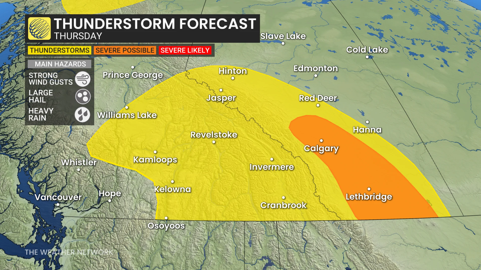
With the storms, however, comes the threat for large hail in populated areas, with the severe risk especially hitting on both Thursday and Friday.
Residents are encouraged to stay updated on weather alerts and potential impacts related to heavy rainfall and thunderstorms in the coming days. Here's a closer look at the day-to-day weather breakdown.
Thursday:
A stronger weather boundary will form over the Rockies on Thursday, sparking severe thunderstorms. These storms could bring large hail, heavy rain, and strong outflow winds.
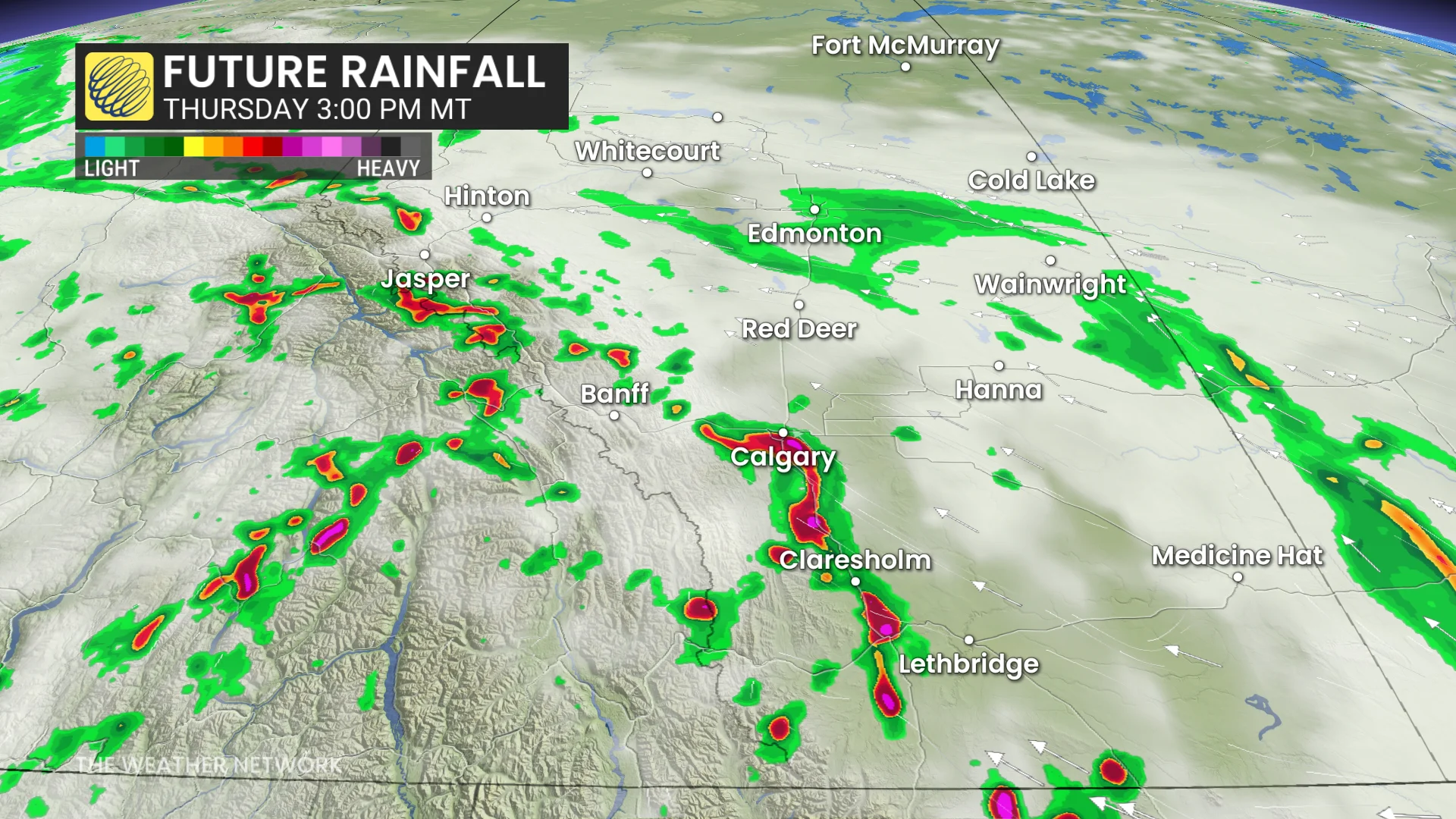
By late afternoon, the storm activity is expected to track eastward, potentially affecting a wider area, including Red Deer, Calgary, and regions farther south.
Thursday’s storm activity is expected to be more intense and widespread compared to Wednesday.
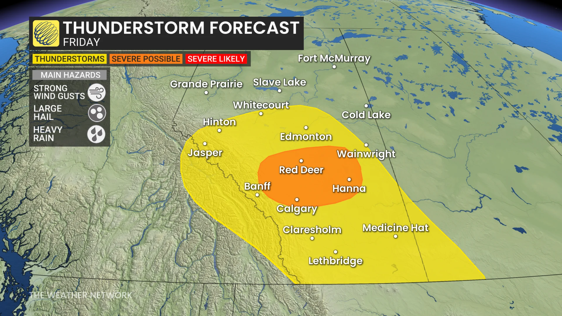
Friday:
On Friday, another low pressure system will develop and move north, delivering steady rain to Edmonton and areas further north.
RELATED: How does hail get so big?
Meanwhile, thunderstorm activity is expected to span across southern and central Alberta.
Large hail-producing thunderstorms may develop in areas including Calgary, Red Deer, and regions to the east.
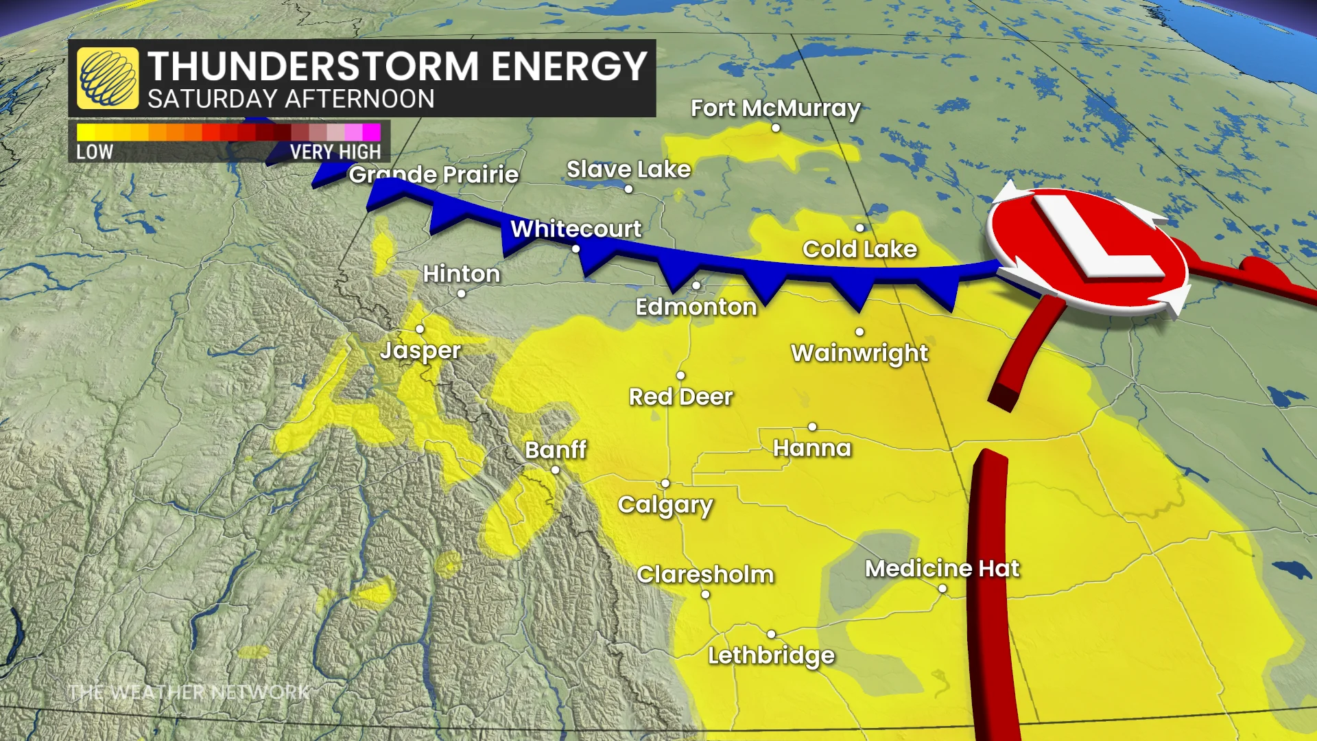
Saturday:
The low pressure system in northern Alberta will track east into Saskatchewan on Saturday. Despite this movement, its associated frontal boundaries will continue to spark thunderstorms across parts of Alberta.
The highest forecast uncertainty with exact locations and strength of thunderstorms will be on Friday and Saturday.
Residents should remain alert to potential storm development over these next several days, and monitor local weather updates across impacted areas.
DON'T MISS: The Weather Network's exclusive summer 2025 forecast
The expected rainfall will not only aid wildfire suppression efforts, but will also cover much of the agricultural regions in the southern Prairies, offering essential moisture.
Looking ahead, a shift to a hotter weather pattern is anticipated by the end of June once again.