Flash flood threat grows in Florida, Mexico as tropics heat up
Popular vacation destinations in both Florida and Mexico will need to stand on guard against potential flooding over the next week
Flooding will pose a serious risk to portions of Mexico and Florida over the next couple of days as two tropical systems percolate in the Gulf of Mexico.
The Atlantic hurricane season is turning it up a notch as the region welcomes its second named storm of the year, Barry.
Meanwhile, folks along the southeastern U.S. coast, especially in Florida, will need to pay close attention to the development of a disturbance over the next week. A flash flood risk will develop as this system drenches the region with soaking rains in the days ahead.
DON'T MISS: Tropical systems don’t need a name to trigger devastating floods
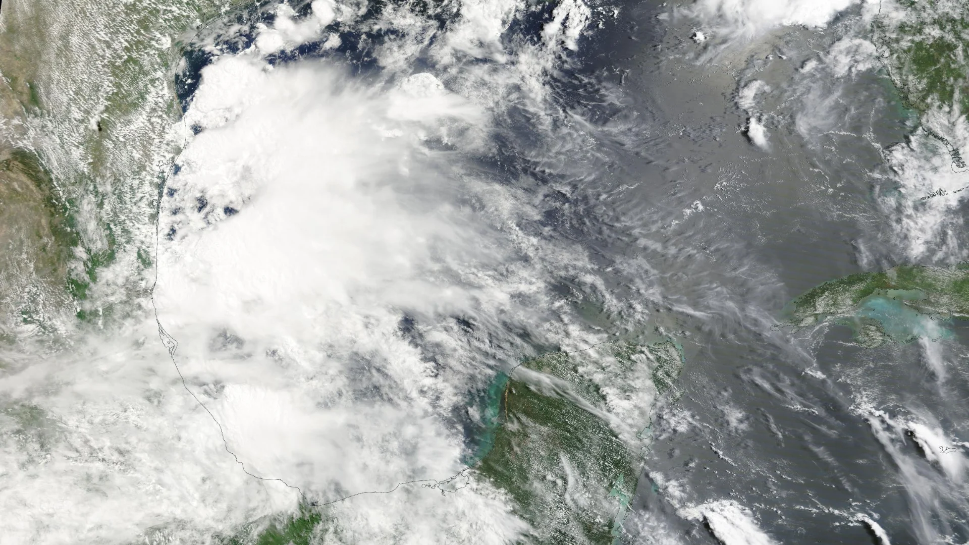
Barry intensifies before Mexico landfall, threatens floods, potent wind gusts
A tropical storm warning is currently in effect for the eastern coast of Mexico from Boca de Catan southward to Tecolutla. This includes the city of Tampico.
Hurricane Hunters flying through the system found it had organized enough to classify an upgrade to tropical storm status on Sunday. Barry currently boasts sustained winds of 65 km/h, according to the U.S. National Hurricane Center (NHC).
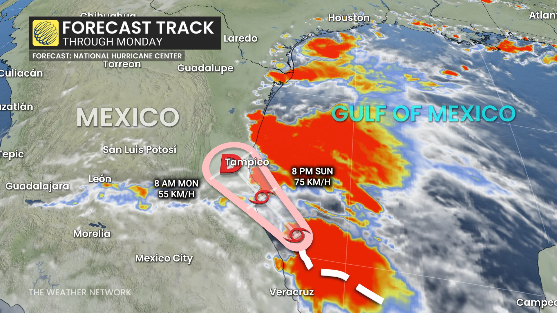
Wind shear will hamper the system’s intensification, though its slow movement and warm waters may allow a slight increase in strength before the system makes landfall Sunday night.
Rapid weakening is then forecast after landfall, mainly due to the mountainous terrain.
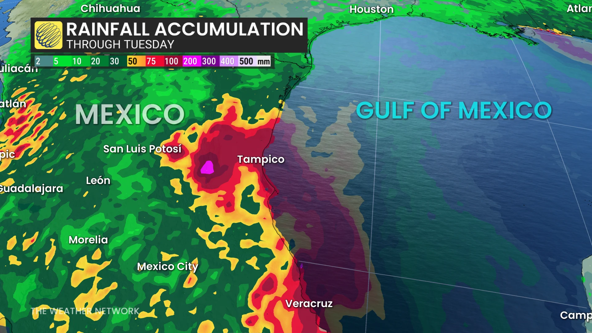
Communities across the region can expect 75-150 mm of rainfall, with isolated totals up to 250 mm across the Mexican states of Veracruz, San Luis Potosi and Tamaulipas through Monday.
Threats include flash flooding and mudslides, especially with the steep terrain in northeastern Mexico. Blustery wind gusts are likely to yield power outages as tropical storm conditions are forecast through Sunday evening.
Another system could develop near U.S. Southeast
Meanwhile, the NHC is monitoring the potential development of another disturbance near the southeastern U.S. coast, which has a 20 per cent chance of developing into a tropical system over the next seven days.
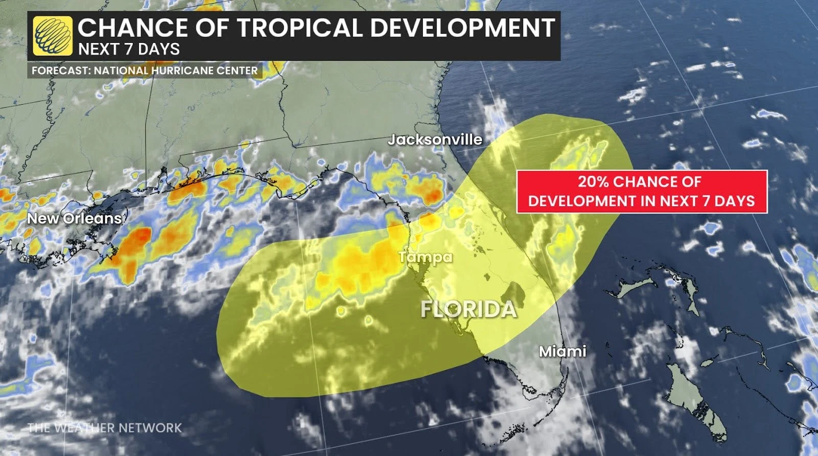
Regardless of development, though, drenching tropical downpours are likely across from southeastern Louisiana through southern Florida. Some portions of western Florida, including Tampa, could see 150-200 mm of rain through the end of the week.
Flash flooding is a serious issue with tropical disturbances whether or not they develop into named storms. Flooding from heavy rain is the number one cause of death in a landfalling storm. Never try to drive across a flooded roadway. It’s impossible to tell how deep the water is until it’s too late.
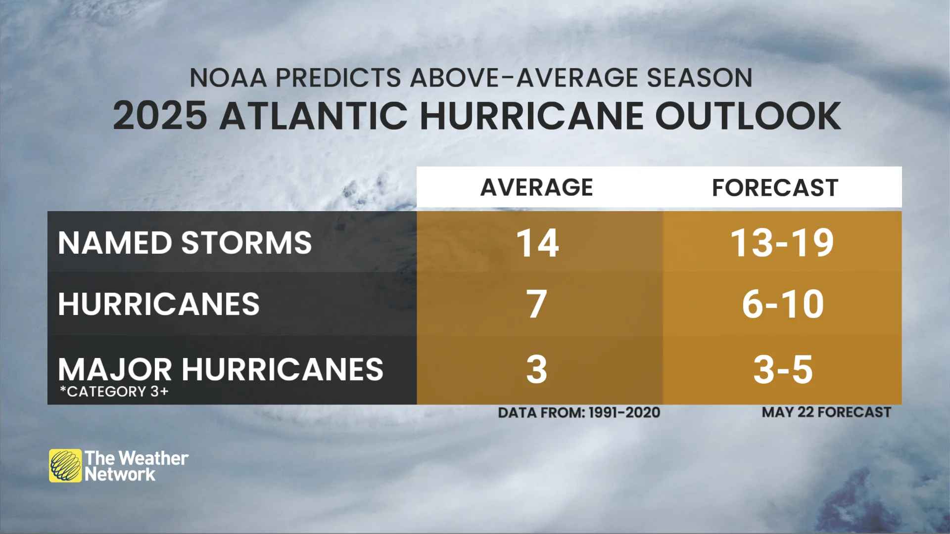
2025 Atlantic hurricane season expected to be above average
Forecasters with NOAA announced last month that they expect another above-average Atlantic hurricane season this year.
Experts cited favourable conditions across the Atlantic Ocean—plus the absence of El Niño in the Pacific—as factors that may drive the formation of more named storms than we’d see during a normal season.
Header image courtesy of NASA Earth Observatory/MODIS.