
B.C. gets help from atmospheric river to fight wildfires, temperatures cool down
A Gulf of Alaska low-pressure system has ushered in significant rainfall and a cooldown for B.C.'s South Coast, bringing fall-like conditions to the region.
An atmospheric river has been impacting the B.C. coast with significant rainfall, delivering much-needed relief to areas experiencing dry conditions and an elevated wildfire risk.
It has been a highly beneficial rainfall since it is spread out over a more extended period of time. The recent dry conditions across the B.C. coastline have been a huge contributor for the wildfires in the area. However, we will also see some hazards pop up from the heavy rains.
SEE ALSO: 'Megathrust' earthquake fault line confirmed off Haida Gwaii, capable of generating large tsunamis
The significant rain will be some of the greatest totals this year, and helpful to the building drought conditions across the province.
Atmospheric river brings relief and hazards this weekend
The event has been classified as an atmospheric river. An atmospheric river is exactly what it sounds like – it’s a long, narrow river of water vapour in the lower atmosphere.

These rivers in the sky transport moisture from the subtropics to the mid-latitudes and are ranked in intensity on a scale of 1-5.
An AR3 event is forecast for the Central Coast and expected to last through much of Saturday and Sunday.
More rain to come after hefty totals recorded
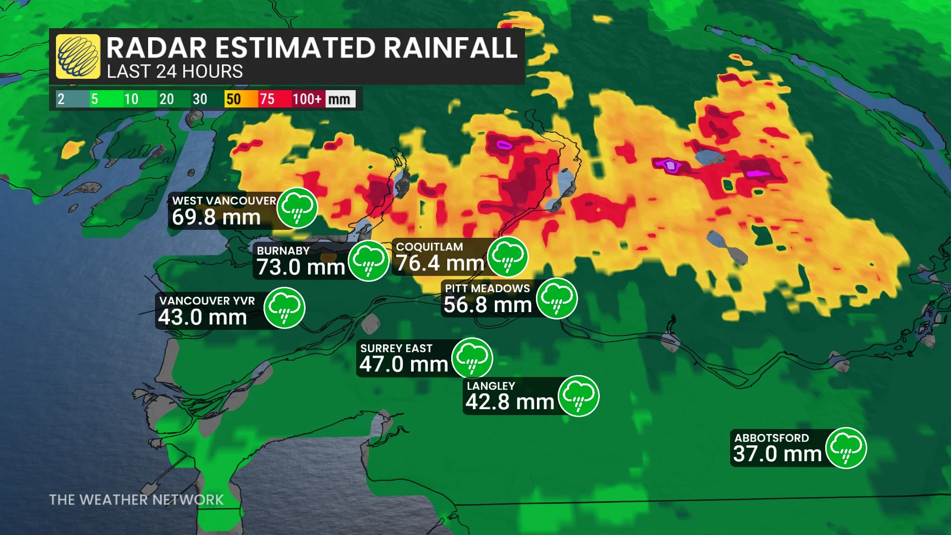
The atmospheric river brought impressive rainfall totals to B.C.’s South Coast on Friday. Vancouver International Airport picked up 43 mm of rain, making it the rainiest day of 2025 for it and the fifth-rainiest August day on record.
Rain continues on Saturday, mainly for the Sunshine and Central coasts while the precipitation moderates and eases for the Lower Mainland.
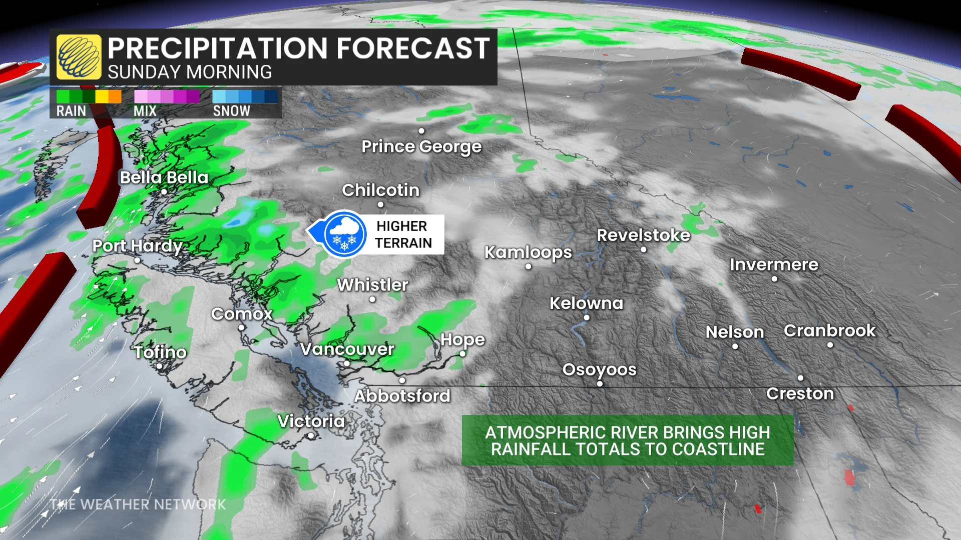
Light showers remain for Vancouver and the South Coast areas while it continues to be widespread for western Vancouver Island, north end of Sunshine Coast, and northward towards Prince Rupert. Coastal communities can expect heavy rain to persist through to late Sunday, and even possibly through early Monday.
Mountainous regions could see see 75-100+ mm of rain over the weekend with this event.
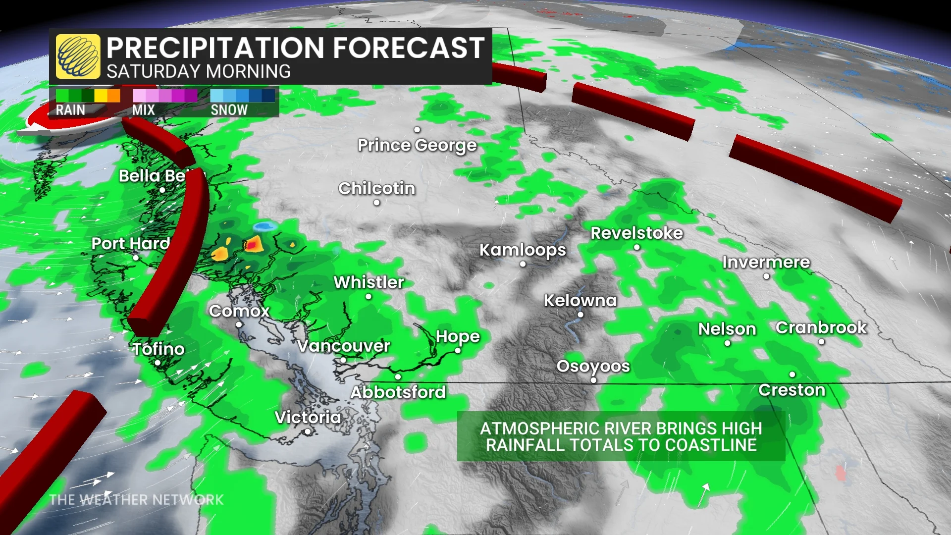
Populated regions of the South Coast, including the Lower Mainland, can expect 30-50 mm of rain through Sunday, with the bulk of the rainfall having already fallen. The Central Coast could see 75-100 mm through Sunday while 30-50 mm is on the table for western Vancouver Island.
RELATED: Canada introduces an impact scale for atmospheric rivers

Localized flooding will be a hazard to look out for if the ground is unable to soak up the rains fast enough. Roadways will also become slick and visibility may be reduced during particularly heavy periods of rain.
This rainfall will, however, provide much-needed relief for ongoing wildfires and Level 3 drought conditions on Vancouver Island and parts of the B.C. coastline.
Cooling temperatures and summer snow
High-terrain snowfall is also quite possible as the cold front dips southward, pulling temperatures down with it.Freezing levels will drop below 3000 m on Saturday and to around 2500 m Sunday, with some high-elevation snow possible on mountain peaks near Tsʼilʔos Provincial Park.
A shift to drier conditions with a warming trend is anticipated by the middle of or towards late next week. Temperatures are forecast to remain cooler than seasonal into the weekend, and early next week. However, a return to seasonal temperatures—and potentially warmer-than-seasonal conditions—is expected later in the week.
Stay with The Weather Network for more information and updates on your weather across B.C.