
B.C. sees rainfall totals add up as potent atmospheric river continues
Rivers will be running high along the B.C. coast this weekend as an atmospheric river continues to bring drenching rains
A strong atmospheric river continues to fuel a bout of heavy precipitation across coastal communities in B.C.
This weekend's rainfall is the latest wave of moisture in a series to affect the West Coast, representing a sharp pattern change from the stretch of dry weather that plagued the province in recent weeks.
DON’T MISS: What’s the wettest month in your corner of Canada?
The soggy impacts from the atmospheric river will spill into early next before it finally subsides.
Rain continues this weekend
Plentiful rain is on tap across British Columbia as back-to-back systems roll into the West Coast.

Rain began for the northern and central sections of the coast during the day Friday, sliding south toward the western shores of Vancouver Island and the South Coast through the day.
We can expect that precipitation to continue for the South Coast and southern half of Vancouver Island into the day Saturday, gradually tapering off as the day progresses.
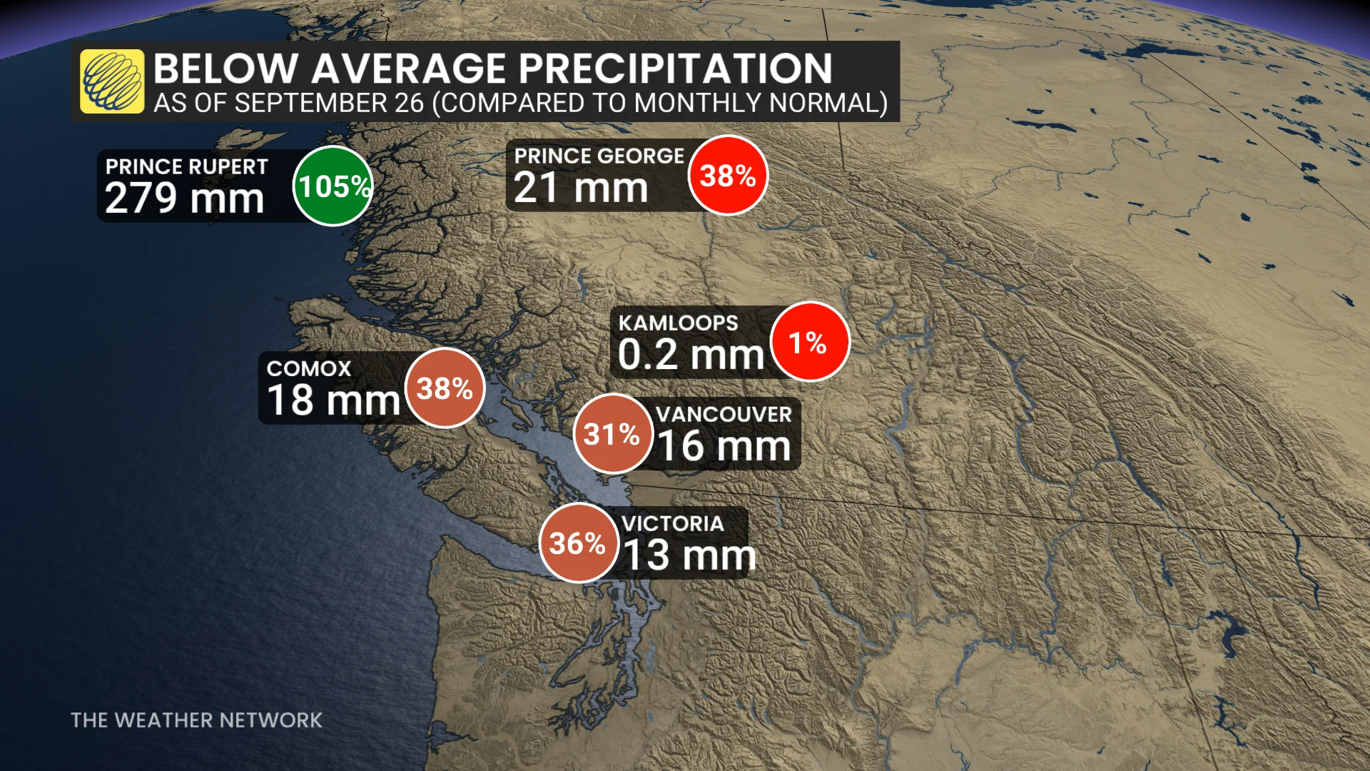
So far, the Lower Mainland has avoided the brunt of the recent rainfall, soaking in only 16.1 mm this month before Friday. This event is no exception—while the heaviest rainfall will miss Vancouver, expect decent totals heading into Sunday and Monday.
Next round of rain arrives Sunday into Monday
A southerly moisture feed arriving Sunday will bring a renewed batch of precipitation expected to push into Vancouver Island and the South Coast early in the day.
Folks across the region can expect this rainfall to persist into the overnight hours and through the day Monday.

More than 100 mm of rain is forecast for western Vancouver Island and the Coast Mountains. Totals on the order of 30-50 mm are on tap for the Lower Mainland, with totals rising to 50-75 mm along the Sea to Sky.
Stay with The Weather Network for all the latest on conditions across B.C.