Hurricanes Humberto and Imelda will bring double the trouble to Bermuda
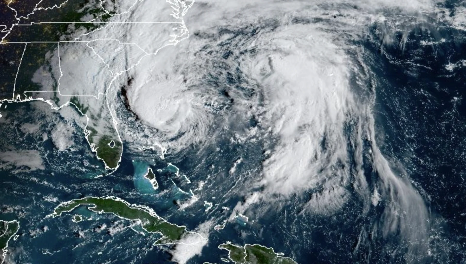
With Humberto producing dangerous surf and rip currents for Bermuda and most of the U.S. East Coast, Imelda has also grown into a hurricane and will ultimately take a similar path behind Humberto
Where Hurricane Humberto goes this week, Hurricane Imelda will similarly follow.
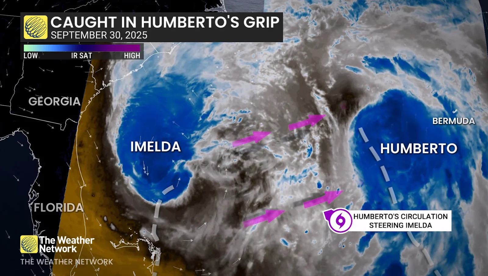
It might sound like a puzzle but it's a consequence if two tropical systems get too close to each other, a case that has happened with the aforementioned storms. Dubbed the Fujiwhara effect, the phenomenon occurs when two storms get close enough together that they begin to interact with one another.
DON'T MISS: The incredible history and tools of the Hurricane Hunters
Humberto is currently producing dangerous surf and rip currents for Bermuda, and most of the U.S. East Coast, while Imelda is forecast to became hurricane Tuesday morning and will ultimately take the same path in behind Humberto, also set to bring impacts to Bermuda on Wednesday and Thursday.
Humberto weakens to a Category 2 hurricane
Humberto lost its strength early Tuesday as it entered an area of high wind shear, weakening the storm to Category 2 strength.

Forecasters with the U.S. National Hurricane Center (NHC) expect the storm to recurve out to sea through this week, steered along by a strong ridge of high pressure parked over the central Atlantic.
The hurricane is forecast to turn and accelerate east-northeastward on Wednesday. On the forecast track, the centre of Humberto will pass west, and then north of Bermuda on Tuesday and Wednesday, bringing up to 50 mm of rainfall to the island. It will then transition into a large, extratropical storm in the North Atlantic later Wednesday.

Dangerous rip currents are expected across the northern Caribbean, Bahamas, Bermuda and the U.S. East Coast this week as Humberto continues to churn through the region.
WATCH:How the Fujiwhara effect can send hurricanes spinning off course
Imelda becomes a hurricane on Tuesday
Imelda’s structure has been improving, with more symmetric banding around the centre, despite fighting against dry air. NOAA Hurricane Hunter aircraft data confirmed intensification, with the system officially reaching hurricane status early Tuesday.
The storm has turned away from the Bahamas and is now accelerating toward Bermuda. It is expected to continue strengthening and pass close to the island late Wednesday and early Thursday, giving folks zero break from Humberto's passing.
A hurricane watch has been issued in Bermuda ahead of the expected impacts from Imelda, while a tropical storm warning continues. The watch is expected to become a hurricane warning later Tuesday, however.
As Imelda passes near Bermuda, 50 mm to 100 mm of rainfall is expected from Wednesday into Thursday, the NHC says.

Interests on the island should pay close attention to forecast updates in the days ahead.
RELATED: Hurricane terms everyone should know as the season heats up
The system’s slow development, and slow forward movement, will likely prove beneficial for the southeastern U.S. coast. Hurricane Humberto will cause a weakness in that ridge of high pressure over the Atlantic, providing Imelda an off-ramp of sorts to make a hard turn toward the northeast.
This sharp deviation will significantly reduce the amount of wind and rain expected along the U.S. coast. Folks will still see locally heavy rainfall, however, with minor flash flooding and coastal flooding. Dangerous swells and rip currents will also stick around for the next several days.