
B.C.’s snowpack falls below-average ahead of wildfire season
A dry winter season has left B.C. running behind ahead of wildfire season––but there’s some hope on the horizon
Folks across British Columbia hope to bank as much alpine snow as possible during the winter before temperatures soar and wildfire season arrives with summer.
This past winter was underwhelming in the snowfall department, leaving much of the province with below-average snowpack heading into May.
Keep up with the latest wildfire news and information at The Weather Network’s wildfires hub.
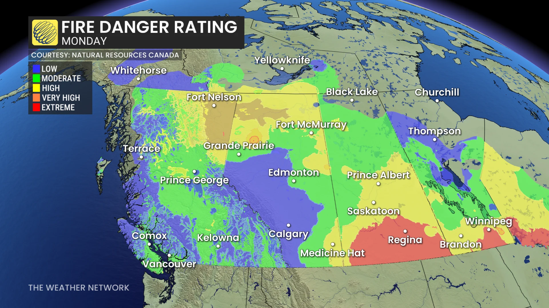
Although the fire risk is currently low to moderate for many of the typical fire zones like the southern Interior, the fire risk is high for portions of northern B.C.
It’s still very early in the season, and May can be a crucial month to aid in building moisture ahead of the main portion of the summer fire season. The drought risk is rising due to low snowpack, an early melt, and warm, seasonal forecasts.
How far behind is the snowpack at this point in the year?
The entire province is at just 71 per cent of normal—a 29 per cent deficit heading into the late spring.
DON’T MISS: Canada’s biggest 2025 wildfires roar to life. Here's where they are
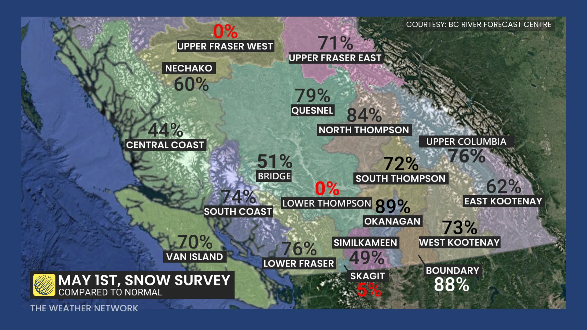
This will affect factors like water levels from the spring runoff. The Fraser River snow index at Hope is down to 70 per cent, raising concerns for water levels. Snowmelt also set in early, with 15 per cent of the peak snowpack having melted already by May 1.
If you’re looking for a bit of good news, there’s some hope on the horizon.
Forecasters are watching unsettled conditions with rain and mountain snow for the majority of the upcoming work week. There’s not an abundance of moisture with any of these incoming systems––but the arrival of moisture will certainly help the situation.
Stay with The Weather Network for all the latest heading into wildfire season.