
Brutal wind chills return Friday, but could this be Toronto's last polar dip?
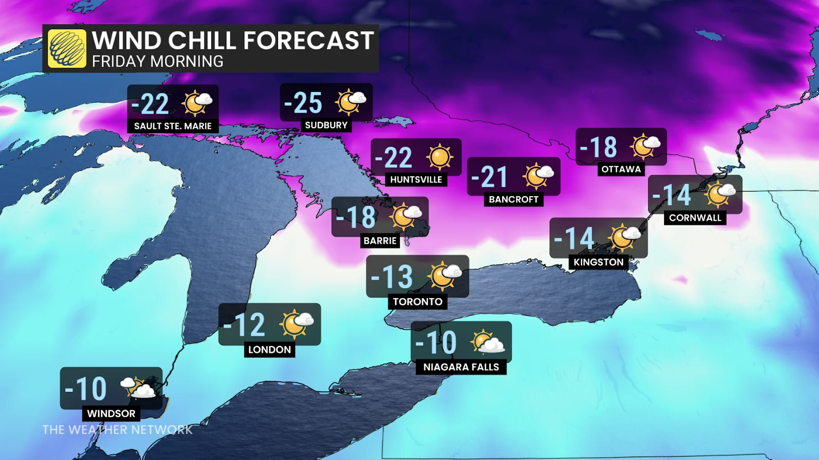
Southern Ontario set to return right back into the freezer on Friday. Expect some nasty morning and evening wind chills
Keep all of that winter gear on standby. After Thursday's mild spring temperatures and severe thunderstorm risk, the Greater Toronto Area (GTA) and much of southern Ontario will see a return to bitterly cold windchills by Friday.
But could this be the last major polar dip of the season?
Cold and windy Friday for Toronto
Toronto's morning and evening wind chill values on Friday could fall to the minus teens, extending into Ottawa, as well.
DON'T MISS: Will Canada’s volatile March go out like a lion or a lamb?
Despite the chill, Friday will feature sunny skies.
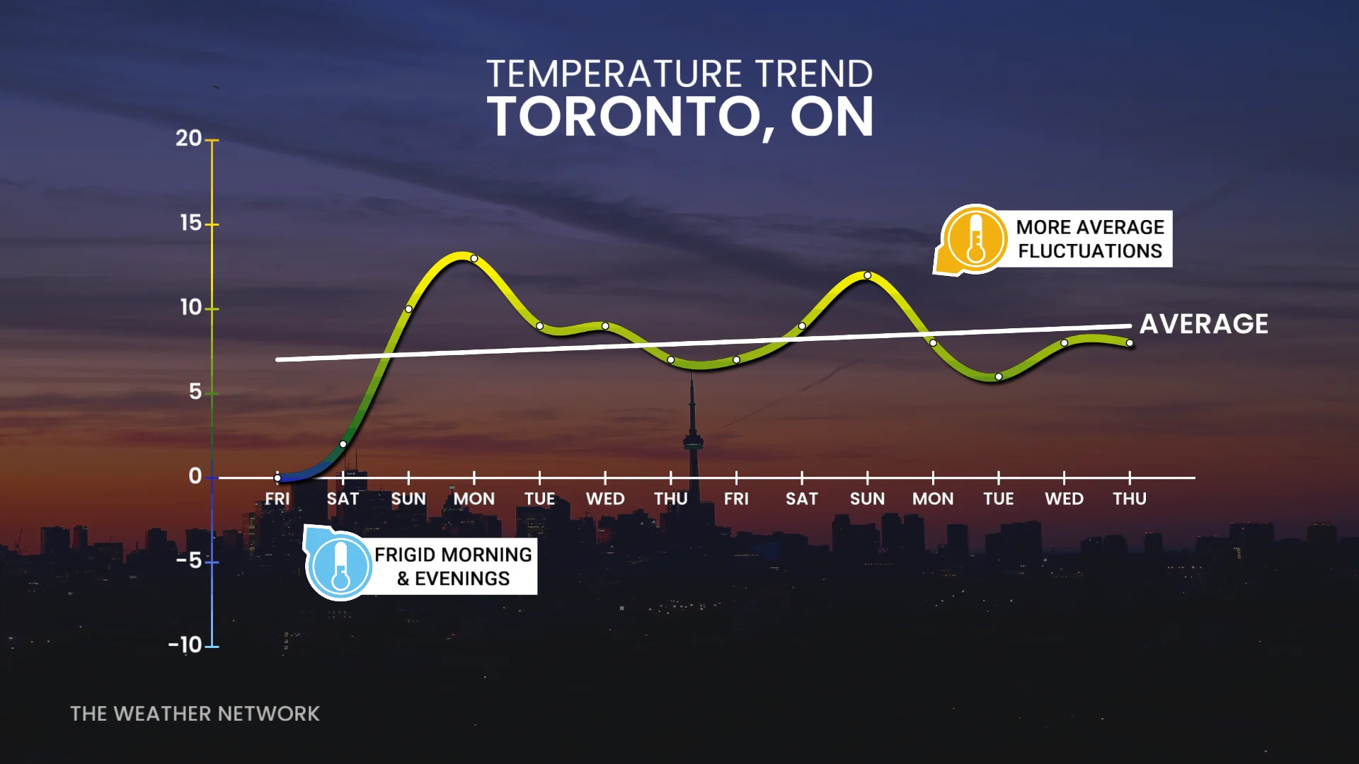
Saturday stays cold, with temperatures struggling to climb above freezing and a chance of flurries. However, by Sunday, a noticeable warm-up begins, and even milder conditions are forecast for Monday.
Is there hope for more consistent warmth in April? Not so fast
As we head into April, the temperature pattern will remain variable, but trends indicate fewer frigid days. While periods of April snow and cold air are normal—Toronto averages 4 cm of snow during the month—the sharp cold snaps with -15 windchills will become less frequent.
Expect a temperature rollercoaster in early April, with occasional mild days and above-normal highs mixed in.
DON'T MISS: A typical April’s weather across Canada is one wild ride
U.S.-based systems will likely track into the Great Lakes, creating milder, rainier conditions.
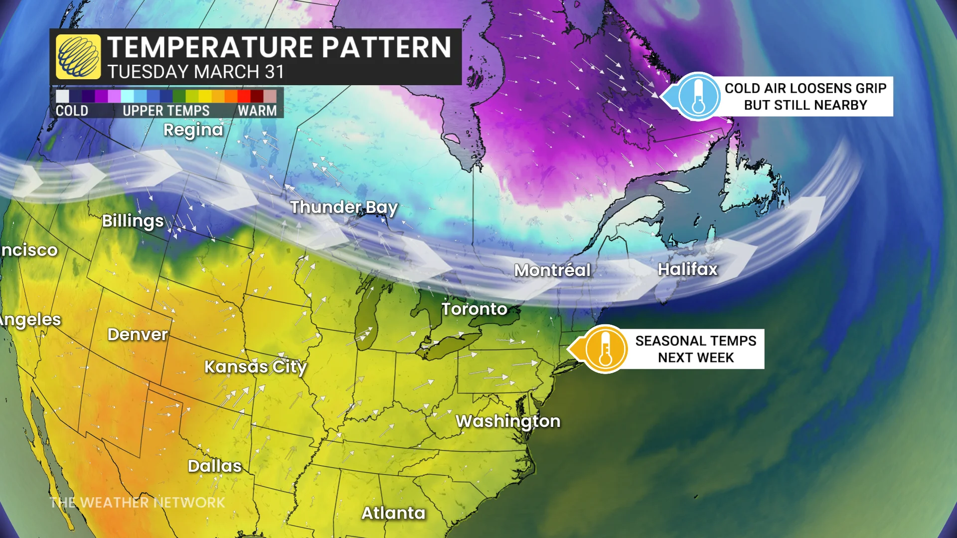
That said, colder air will lurk nearby and could still bring periodic cool downs, though less intense than what has been seen recently. Consistent warmth typically arrives later in the season.