
Buffet of fall, wintry impacts on the table in Ontario this weekend
Fall and winter will clash over southern Ontario during the next few days, bringing folks a few stormy days of weather whiplash. Be prepared for rain, thunder and snow, depending on where you are
From thunderstorms to lake-effect snow squalls, southern Ontario will be seeing a triple threat of stormy weather over the next few days.
With freezing rain and heavy snow forecast to impact the Ottawa region and southern Quebec this weekend, what does that leave the rest of southern Ontario?
DON’T MISS: Beware the dangers of fall snowstorms across Canada
Well, the region is forecast to get a taste of both fall and winter stormy weather as a clipper system moving through northern Ontario brings in strong airflow across the province.
Folks will want to pay special attention to Sunday and Monday's forecasts, as they may impact travel conditions and commutes.
Thunderstorms build on Saturday
Our clipper system moving into northern Ontario to start the weekend will help to promote a strong, southerly flow across southern Ontario. That will drive temperatures into mid-teens in southwestern Ontario and into the double digits for the Greater Toronto Area (GTA).
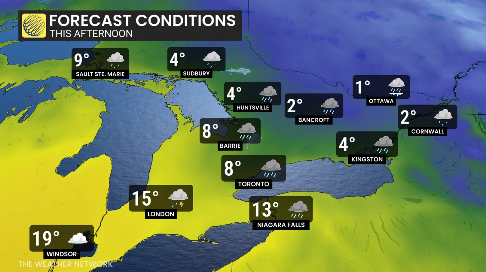
A mild, unstable warm sector will bring a chance of isolated thunderstorms on Saturday afternoon, primarily from London to Niagara, with modest instability in place.
Bursts of shower activity forecast across the GTA Saturday afternoon, with heavier rainfall across cottage county and east towards Peterborough (10+ mm possible).
The warm front will be slower to push into the GTA, arriving in the early evening hours––meaning a large temperature difference will develop across the escarpment.

Behind the front, winds will shift and blow from the northwest, strengthening through the overnight hours. That will spark the lake-effect initiation.
Winds pick up Sunday
Sunday will be a blustery day throughout the region. 60-80 km/h gusts are possible during the day, especially atop the escarpment and the shores of Lake Huron.
These gusty, northwesterly winds will help lake-effect squalls become organized throughout Sunday.

Squalls off Lake Huron will be the main focus, putting London to Woodstock as the main target area. A secondary focus will develop off Georgian Bay, with Collingwood to Highway 400 south of Barrie in line for foul weather.
Lake-effect snow squalls Monday
Gusts will ease slightly heading into the beginning of next week, but the winds will remain supportive of lake-effect squalls throughout the region.
We may see a triple-lake band develop during the day, with a squall starting over Lake Superior, snaking across Lake Huron, and continuing over Lake Erie—a total distance of 1,000 km.

Through Monday, total snowfall accumulation will widely vary.
Georgian Bay band: 5-15 cm, with light accumulation pressing towards the northern GTA (Newmarket, King City, etc.)
Lake Huron band: 15-30+ cm for portions of Huron, Middlesex, Elgin, Perth, and Oxford counties.

As is the nature of snow squalls, accumulations will vary greatly over short distances. Localized snowfall totals may approach or exceed 20 cm in areas where snow squalls remain stationary for an extended period of time. This potential looks greatest in southwestern Ontario.
Stay with The Weather Network for all the latest on conditions across southern Ontario.