Building severe storm, supercell risk threatens the Prairies Friday
Stay alert for rapidly changing conditions in your area as storms build across parts of the Prairies to end the week
Ample instability will fuel a renewed risk for severe thunderstorms across portions of the Prairies on Friday.
The greatest risk for potent storms will build in Saskatchewan and Manitoba. All types of severe weather are possible here, including the risk for one or two tornadoes.
Stay safe by keeping up with the latest severe weather watches and warnings in your area. Know what to do and where to go if a tornado warning is issued for your location.
DON’T MISS: Don’t fall victim to these seven dangerous tornado myths
Friday severe weather potential grows
Friday will feature the highest instability we’ve seen all week across the Prairies.
This enhanced thunderstorm fuel will feed the risk for severe weather heading into the afternoon and evening hours.
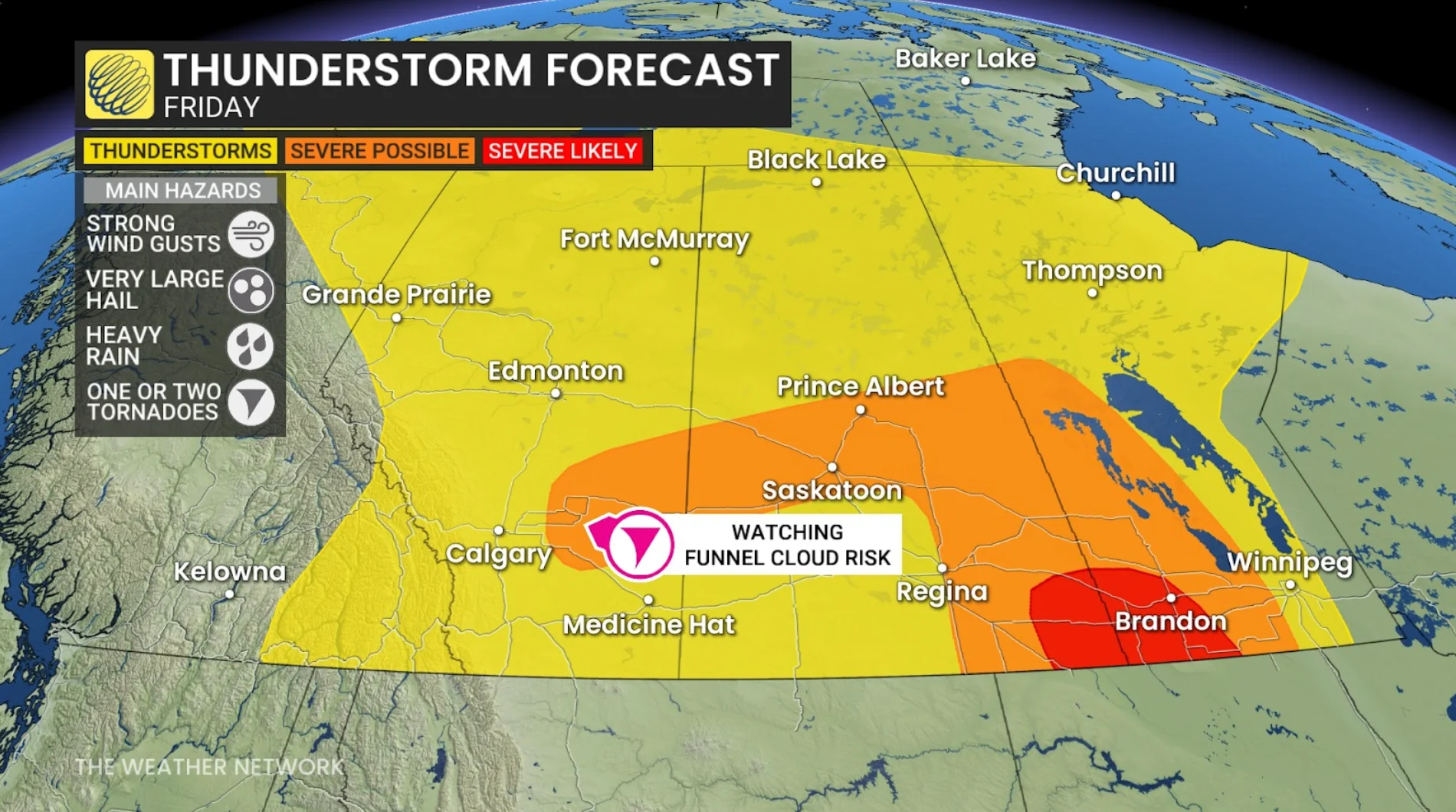
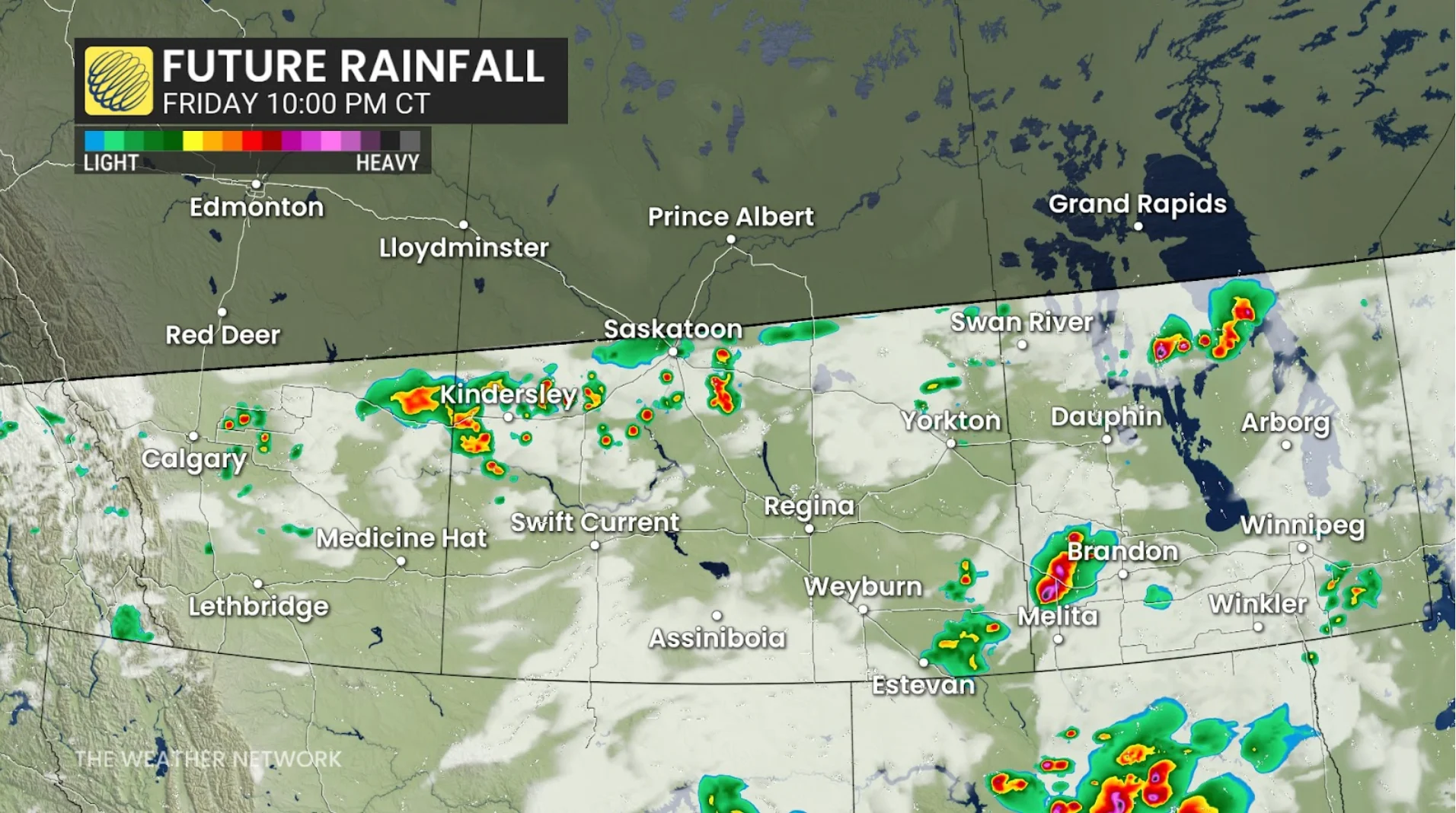
A widespread risk for isolated thunderstorms will cover the region from northern Alberta to southern Manitoba and just about everywhere in between. This includes a risk for hail in the Alberta foothills.
The potential for organized severe weather will unfold across portions of Saskatchewan and Manitoba, including Saskatoon and Regina. The greatest threat is likely around Brandon and Estevan.
RELATED: Tornado season is underway in Canada. Here’s what you need to know
Folks here can expect strong wind gusts, large hail, heavy rainfall, and possibly one or two tornadoes. Supercells and rotating storms are possible along and near the international border, which could also carry the risk for tornadoes.
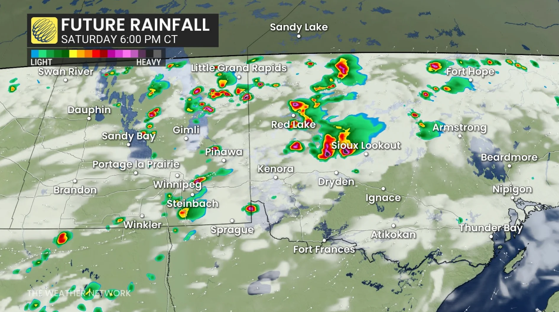
Saturday looks to be another stormy day as high instability and favourable dynamics spread over the region once again.
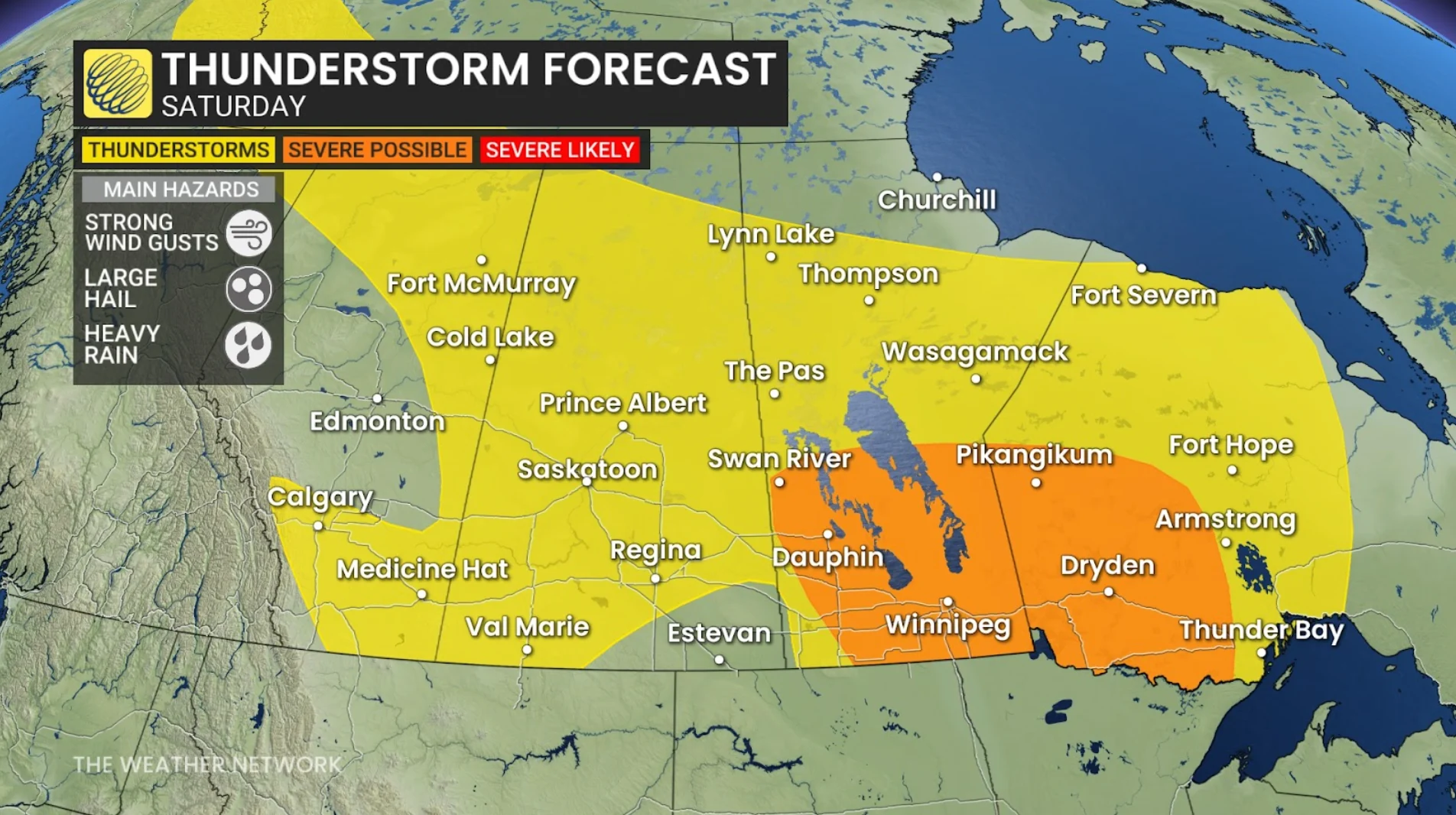
The risk for severe thunderstorms will push into Manitoba on Saturday, covering communities including Brandon, Winnipeg, and the Interlakes region.
Stay with The Weather Network for the latest on conditions across the Prairies.