Bundle up: First frost potential looms for parts of the GTA
The GTA is set to experience some of the coldest temperatures so far this season over the next couple of nights, with the potential for the first frost in some areas
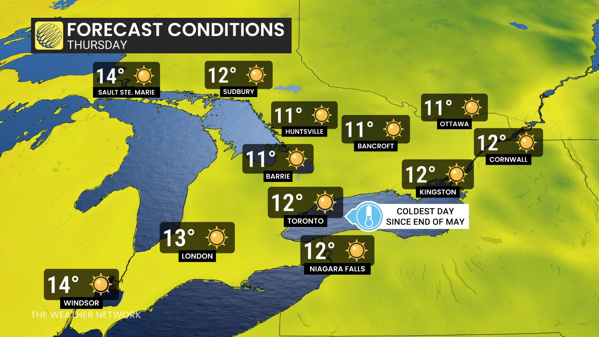
After a stretch of unseasonably warm, summer-like conditions, Ontario is now transitioning into more typical autumn weather as the Thanksgiving long weekend approaches. Daytime highs through Thursday will hover a few degrees below seasonal, struggling to reach the low teens.
DON'T MISS: Abrupt transition to winter: Canada’s 2025-26 winter sneak peek
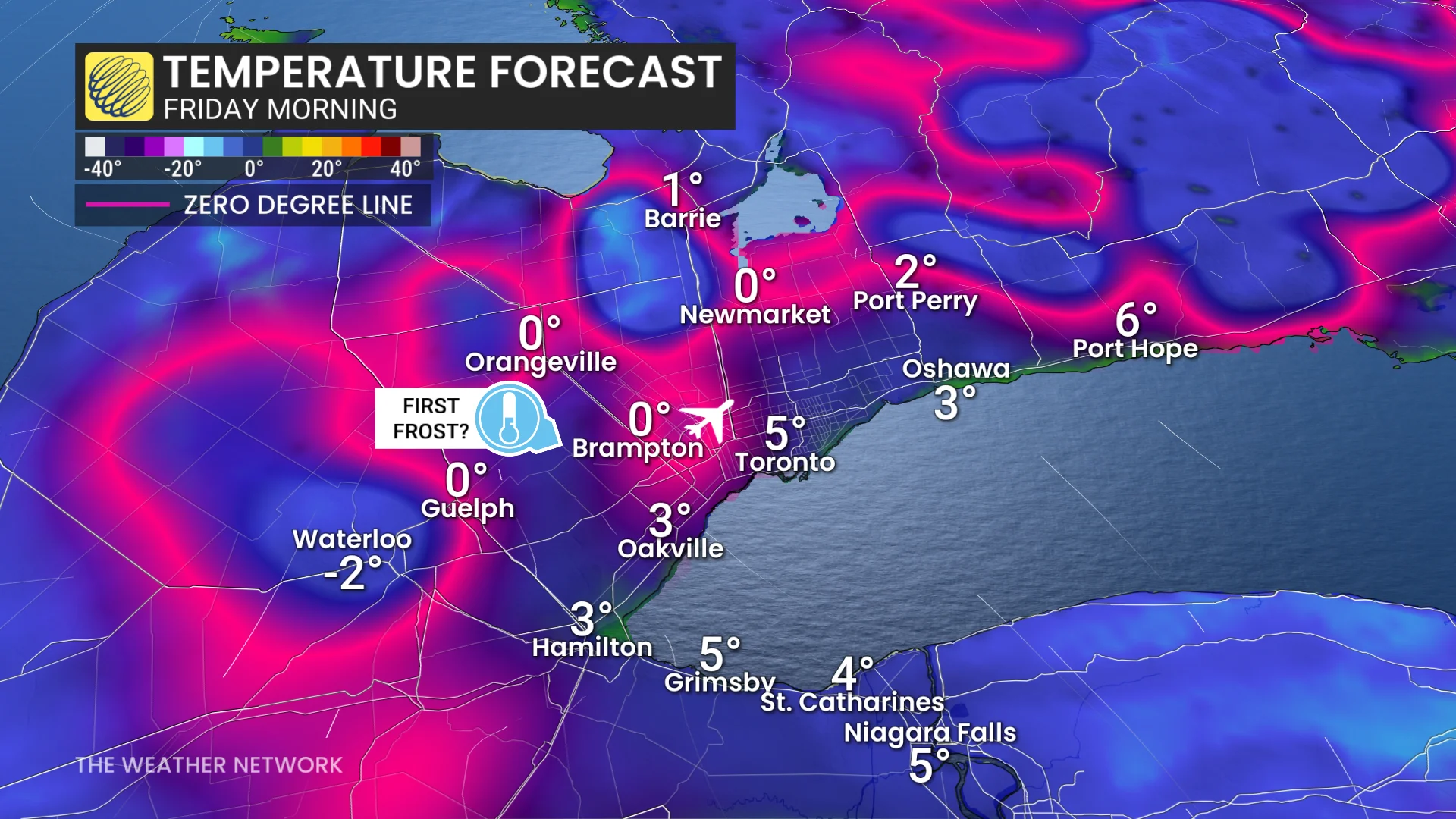
Widespread frost is expected early Thursday and Friday mornings, particularly in rural areas where temperatures could dip a few degrees below freezing. Urban centres, however, are likely to remain just above the freezing mark.
Keep an eye on frost advisories for outdoor plants as conditions remain chilly over the next couple of nights.
Cold front brings cooler weather to southern Ontario, first frost possible
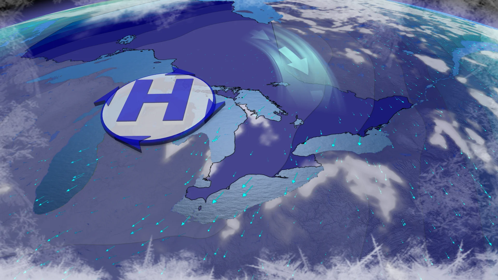
Following Tuesday's rain and storms, a cold front has swept into southern Ontario, ushering in a much cooler northerly airmass. The cooldown will be noticeable starting Wednesday, with even chillier conditions expected Thursday.
High pressure building over the Great Lakes will clear skies, leading to overnight lows that may drop parts of the GTA near 0°C Thursday night into Friday morning.
RELATED: The '3Cs' you need to know to protect your plants from frost
The first frost of the season is possible, especially in areas near the 401, Pearson International Airport, and north Toronto. Areas along the QEW and downtown Toronto will likely avoid frost, thanks to the moderating effect of Lake Ontario.
Thursday’s forecast high of 12°C in Toronto will be the city’s coldest since May 22.
Beautiful Thanksgiving weekend shaping up
Looking ahead, the weekend is trending sunny, dry, and near seasonal with daytime highs in the upper teens—ideal conditions for those embracing the fresher fall weather.