Busy hurricane season still expected in updated Atlantic outlook

The atmosphere continues to look favourable for an above-average Atlantic hurricane season over the coming months
Experts with Colorado State University (CSU) continue to expect an above-average Atlantic hurricane season in the weeks and months ahead.
While we’ve had a relatively slow start to the season, ingredients still appear favourable for the development of plenty of tropical storms and hurricanes as we head toward the peak of the season later this summer.
Coastal residents are advised to prepare for hazards like flooding and power outages well before a storm ever forms.
DON’T MISS: A later start to hurricane season may have you asking, where are the storms?
Forecast calls for above-average season
Tropical cyclone experts at Colorado State University issue highly anticipated seasonal outlooks every year, adjusting their expectations as the season unfolds.
CSU’s initial forecast this year called for 17 named storms, with 9 of those storms growing into hurricanes, and 4 of those becoming major hurricanes with winds of Category 3 status or stronger.
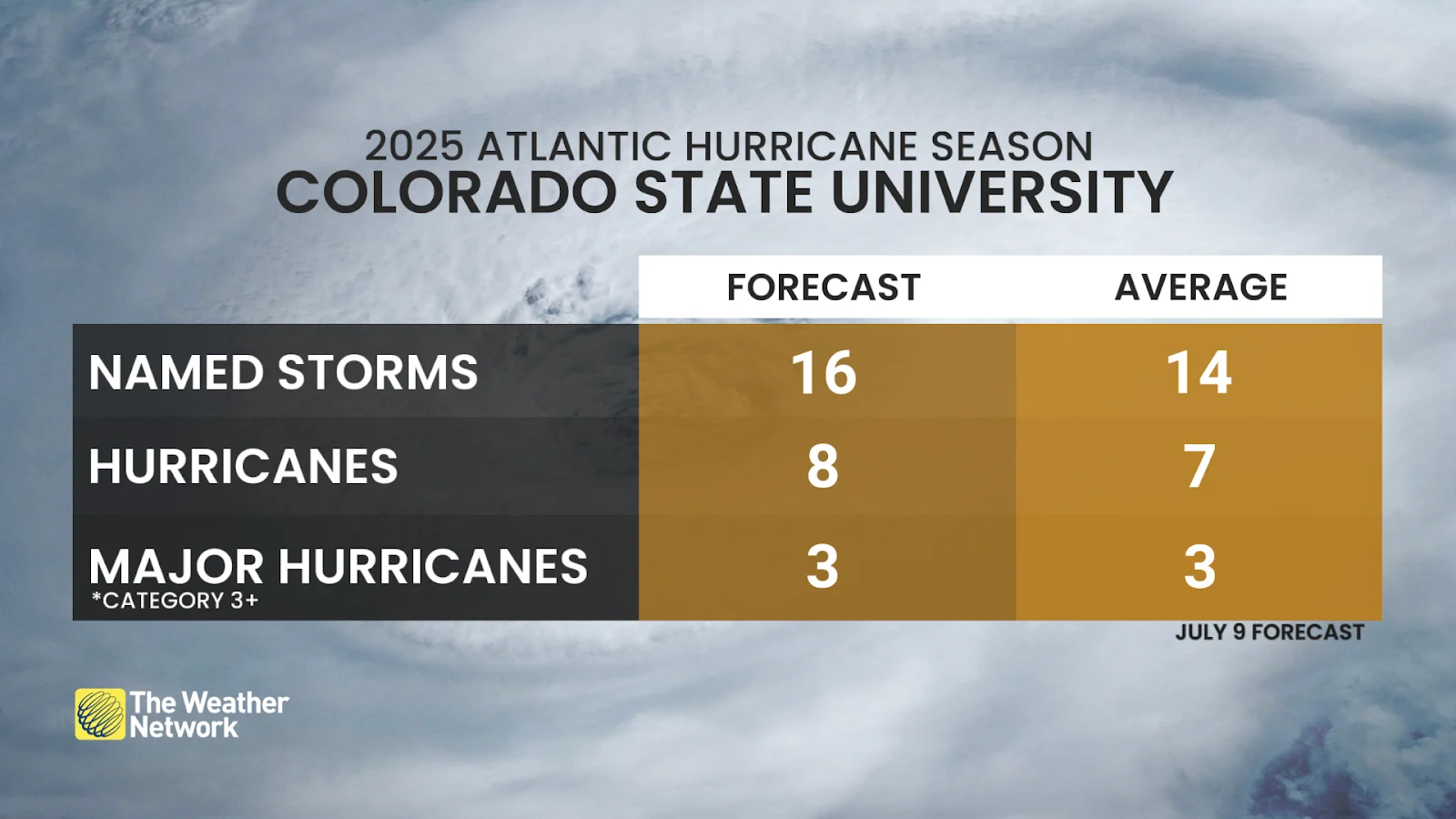
The team announced on July 9 that they’ve pulled back the forecast just a hair—but they still expect an above-average season to progress over the coming weeks and months. CSU’s latest forecast now calls for 16 named storms, 8 hurricanes, and 3 major hurricanes.
An average Atlantic hurricane season produces 14 named storms, 7 hurricanes, and 3 major hurricanes.
Check out The Weather Network’s hurricane hub for all the latest on storms near Canada and around the world
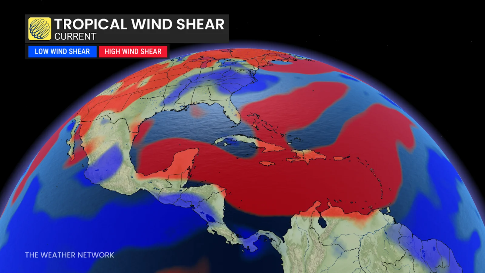
“The primary reason for the slight decrease in the outlook is both observed and predicted high levels of Caribbean shear,” the experts said in their July forecast update.
The team added: “A warmer-than-normal tropical Atlantic combined with likely ENSO neutral conditions typically provides a more conducive dynamic and thermodynamic environment for hurricane formation and intensification.”
Slow start so far, but peak season yet to come
So far this year, we’ve seen 3 named storms—Andrea, Barry, and Chantal—and none of them have reached hurricane strength. Andrea’s formation on June 24 marked the latest start to an Atlantic hurricane season since 2014.
MUST SEE: Texas storms triggered a ‘large and deadly flood wave’
Barry struck Mexico as a tropical storm and its remnants helped fuel the tragic Texas floods on July 4. Tropical Storm Chantal struck the Carolinas as a major rainmaker a few days later, bringing deadly flooding to central North Carolina.
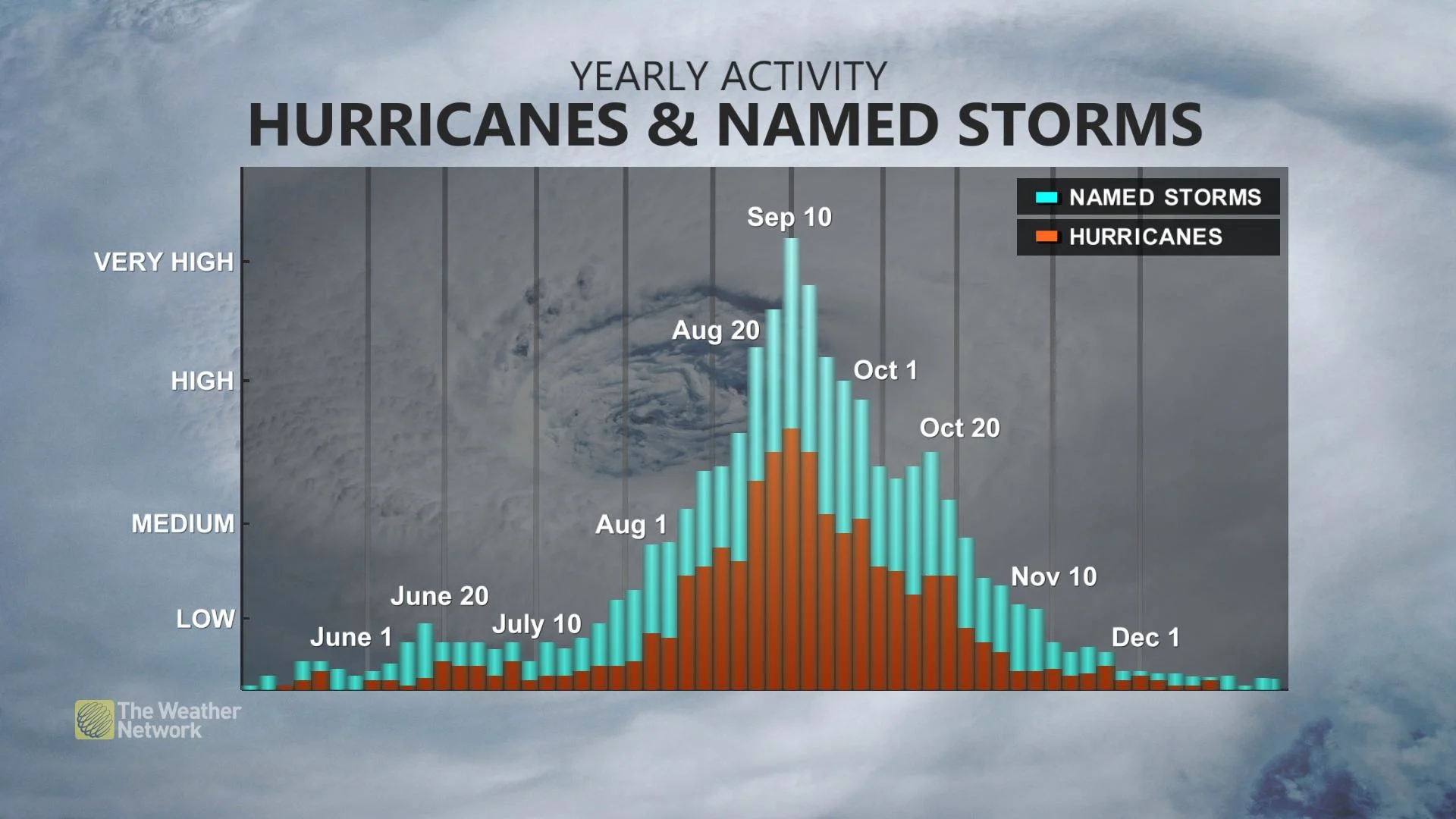
Atlantic hurricane activity slowly picks up from the start of the season on June 1. Tropical cyclone formation ramps up in a hurry once we reach August and continuing through the climatological peak of the season during the second week of September. Tropical storms and hurricanes are possible well into the autumn months.
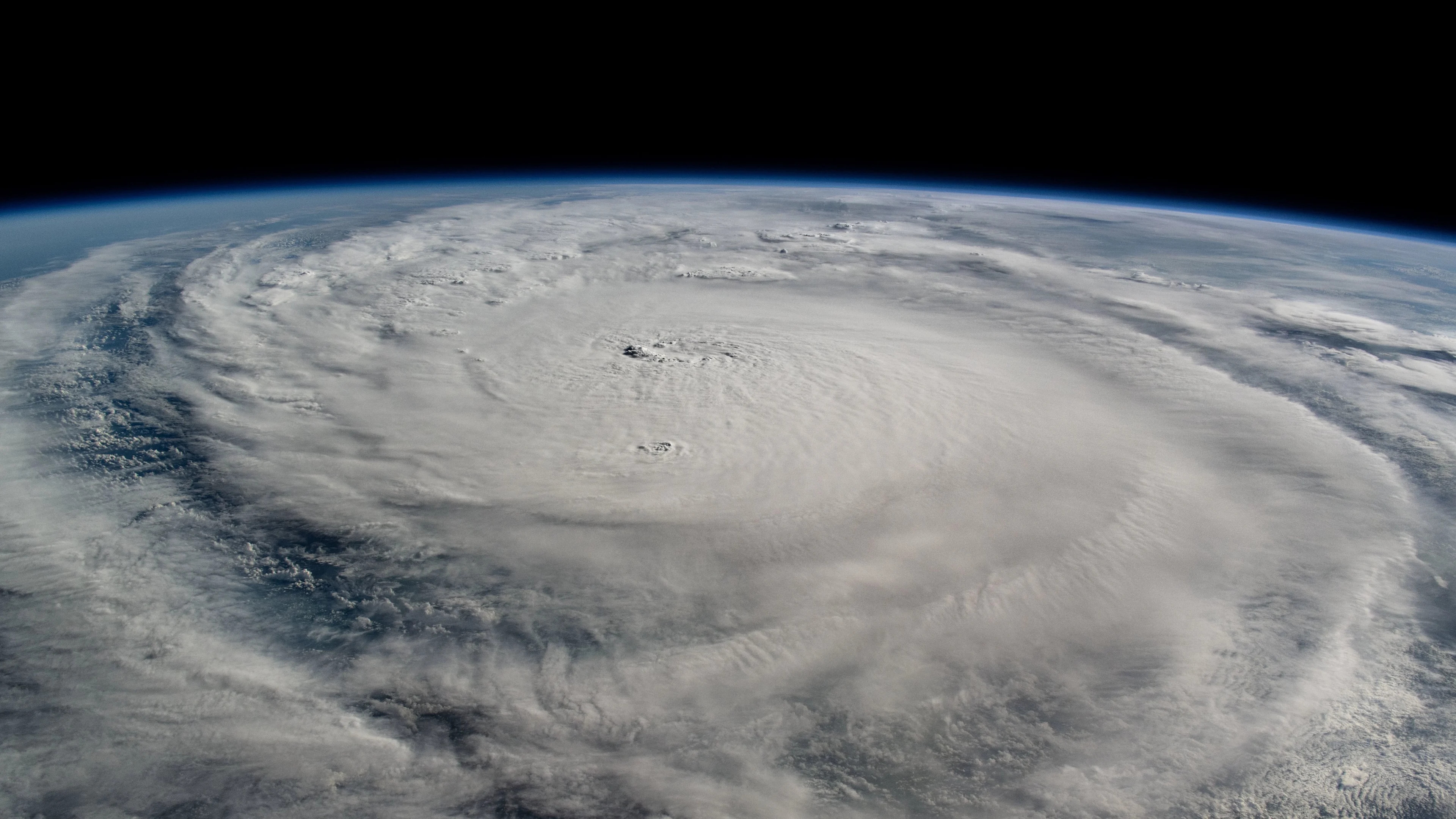
Header image of Hurricane Milton from the International Space Station courtesy of NASA.