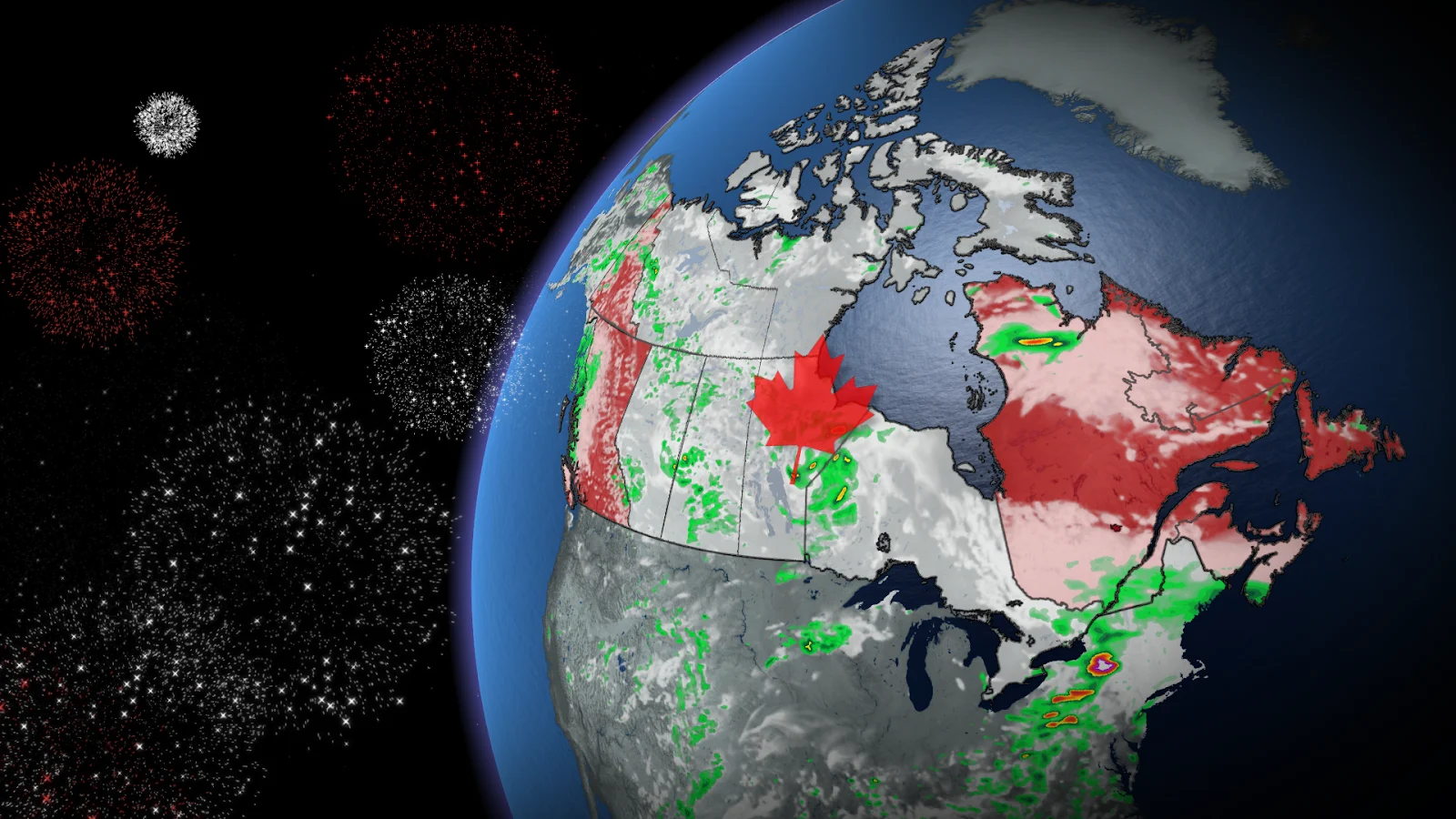
Canada Day weekend brings changeable summer weather across the country

Will the Canada Day long weekend deliver ideal summer weather for outdoor activities? Please read on for details on what we expect across Canada for the upcoming weekend and beyond.
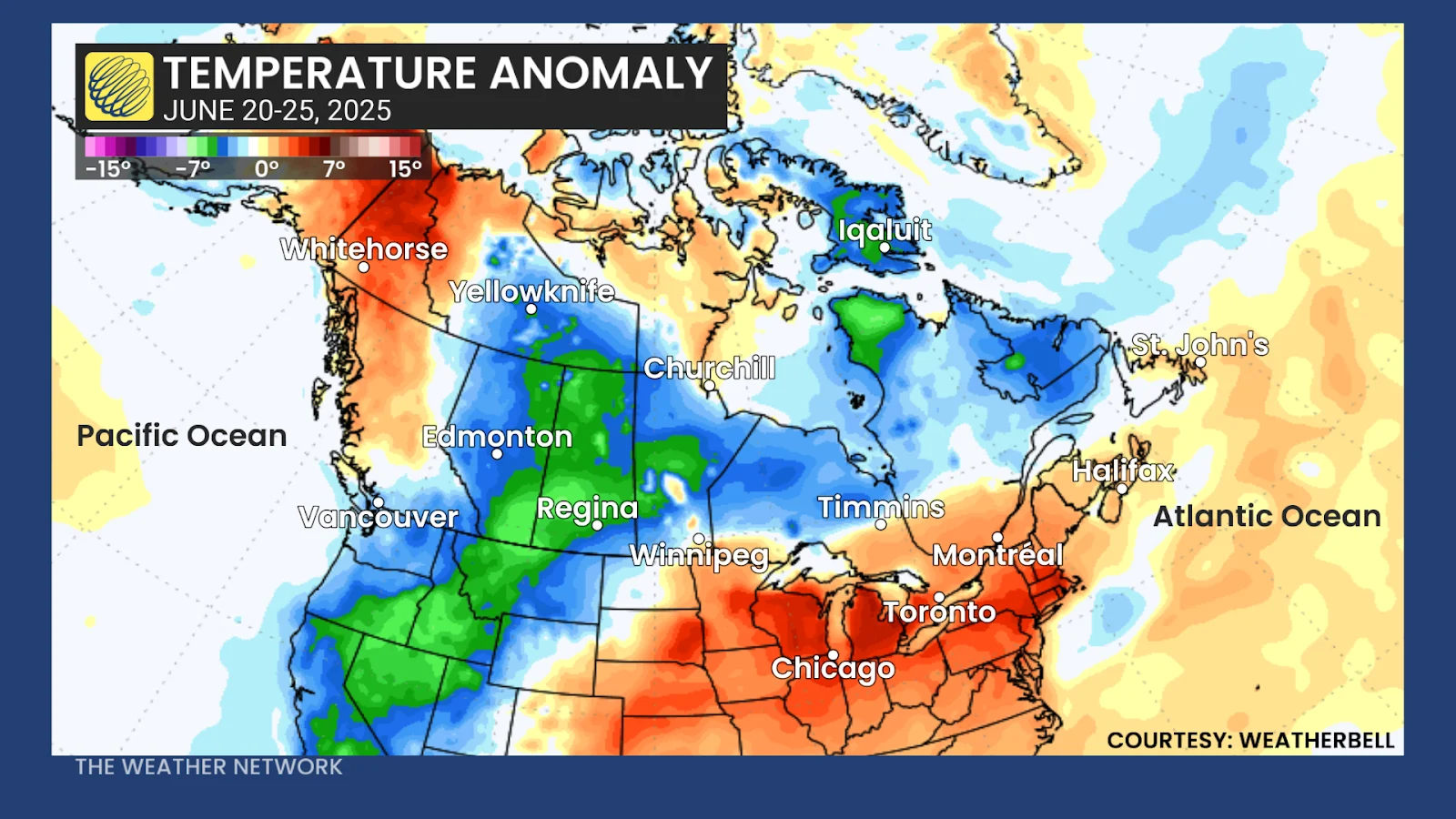
The first official week of summer has featured a tale of two seasons across Canada, with neither extreme providing ideal conditions for outdoor activities. Across southern Ontario, southern Quebec (and briefly into the Maritimes), the story has been recording-shattering heat and humidity.
Meanwhile, much cooler (spring-like) weather has dominated from southern B.C. to Labrador. This has included severe storms and localized flooding for parts of the Prairie provinces and even some heavy snow in the Rockies.
Here is the temperature anomaly map for the first five days of summer (June 20-25).
As we head through the long weekend, we will see a change in the national pattern. That is both good and bad news.
DON'T MISS: Made in Canada: The UV and AQHI indexes that protect our health
The good news is we will no longer be dealing with extreme temperatures—either hot or cold. However, pattern changes usually come with active weather. So, most of the country will see some weather interruptions during the weekend.
But with weather systems on the move, we will all see periods of pleasant weather during the long weekend as well.
Friday
As we kick off the weekend on Friday afternoon, most of Canada will be near seasonal or on the cool side of seasonal. The coolest weather will be found across B.C., southern Alberta, and from northeastern Ontario to Atlantic Canada. These regions will feel more like late May.
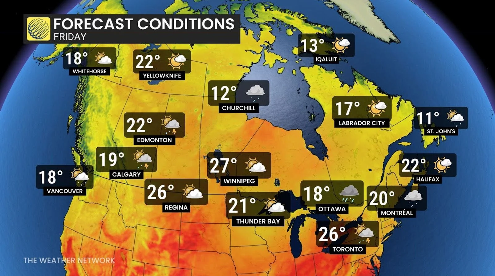
Warmer weather will be found across parts of the eastern Prairies, including Winnipeg, and across southwestern Ontario. The humidex will be near 40 for London and Sarnia and in the lower 40s for Windsor.
However, rain and thunderstorms to the east of Lake Superior will spread east across the Nickel Belt, northeastern and central Ontario, and into southern and eastern Ontario, as well as southern Quebec, during Friday afternoon and evening with localized torrential rain.
Scattered showers and thunderstorms are also likely across the Prairies, including Calgary and Edmonton, and across much of B.C.
Saturday
The threat of showers and thunderstorms will continue through Saturday across the Prairies, and showers will linger into Saturday across eastern Ontario and southern Quebec, including Ottawa and Montreal. Rain will also spread into southwestern parts of the Maritimes.
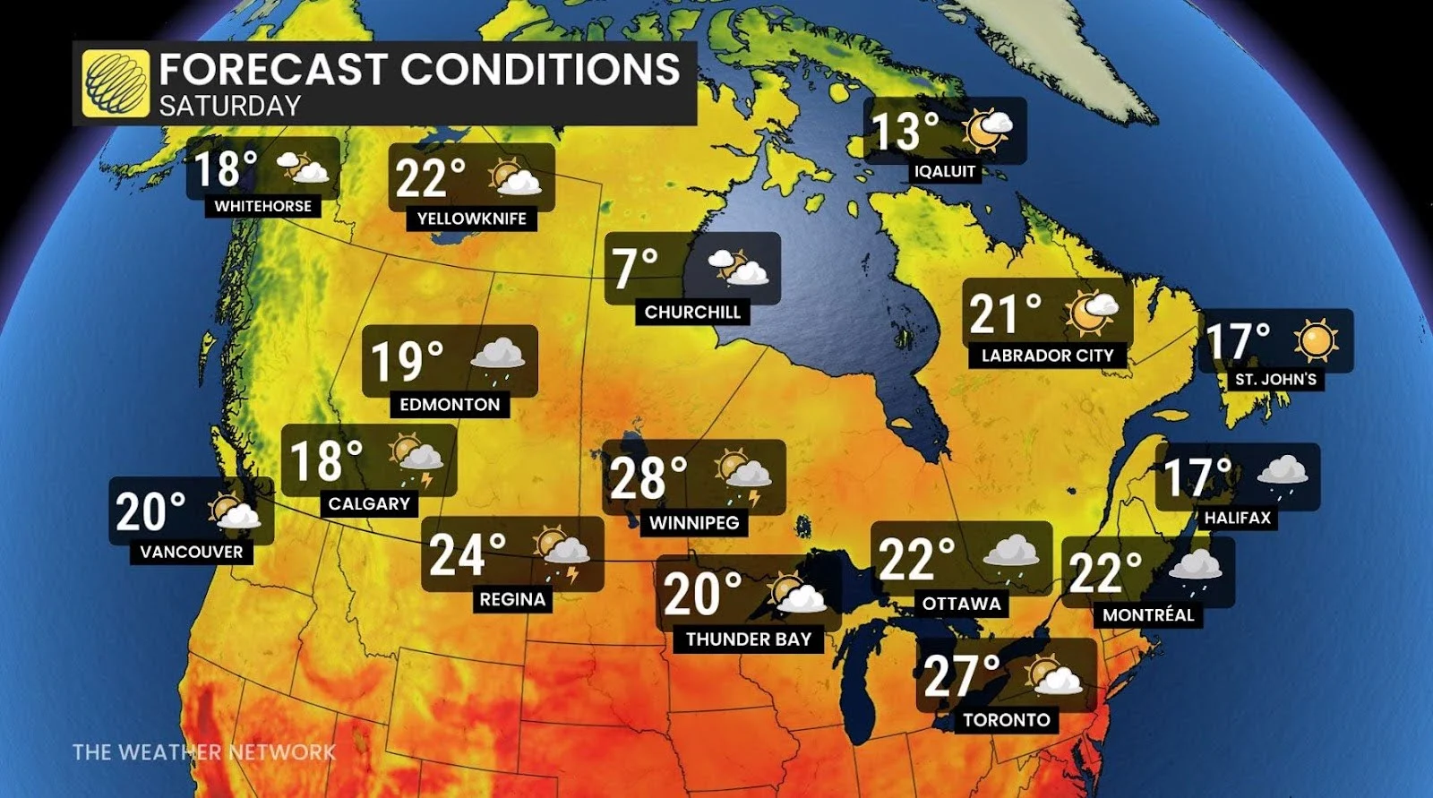
However, pleasant weather is expected across the rest of Atlantic Canada, southern Ontario and the south coast of B.C. with near-seasonal temperatures.
SEE ALSO: Behind the Stitch: Explore the intricate process of creating Canada flags
Sunday
Sunday will be a pleasant summer day across most of Canada. Sunshine and pleasant temperatures are expected from the Great Lakes to Atlantic Canada, across most of B.C. and the western Prairies.
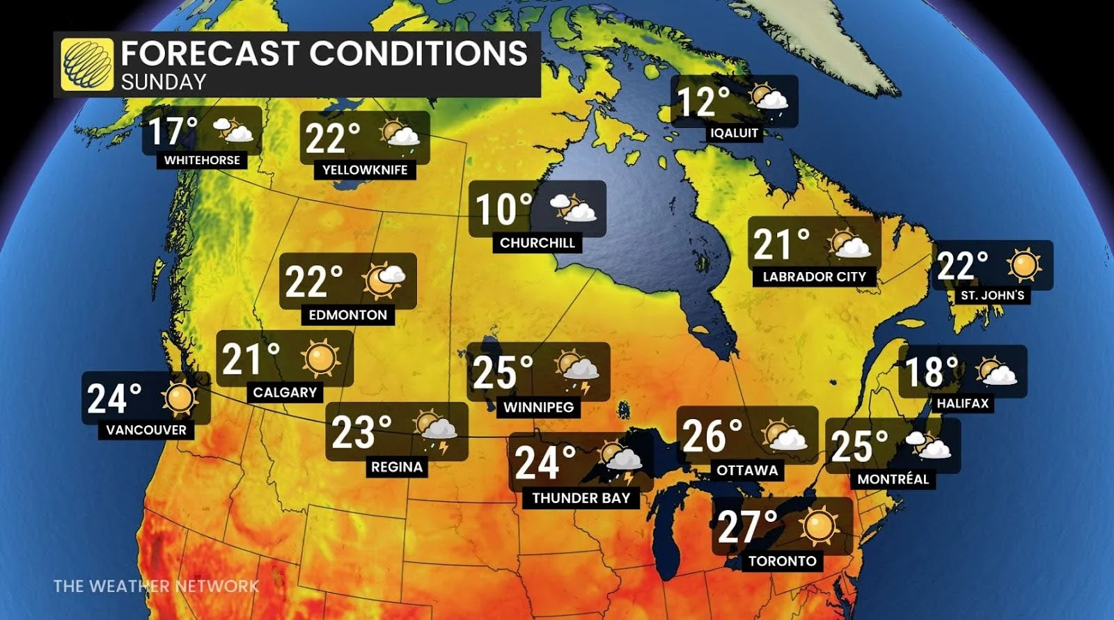
However, scattered showers and thunderstorms are likely across the central and eastern Prairies, including Regina and Winnipeg, and extending north to Yellowknife in the Northwest Territories.
Monday
Monday will be a very warm day across most of Canada, with brilliant sunshine across most of Western Canada. Temperatures will approach 30°C for the south coast region of B.C. (away from the immediate coastline) and reach the low to mid 30s across the southern interior of B.C.
Hot and humid conditions are also expected across southern and eastern Ontario, as well as southern Quebec, including Toronto, Ottawa, and Montreal, with the humidex in the upper 30s.
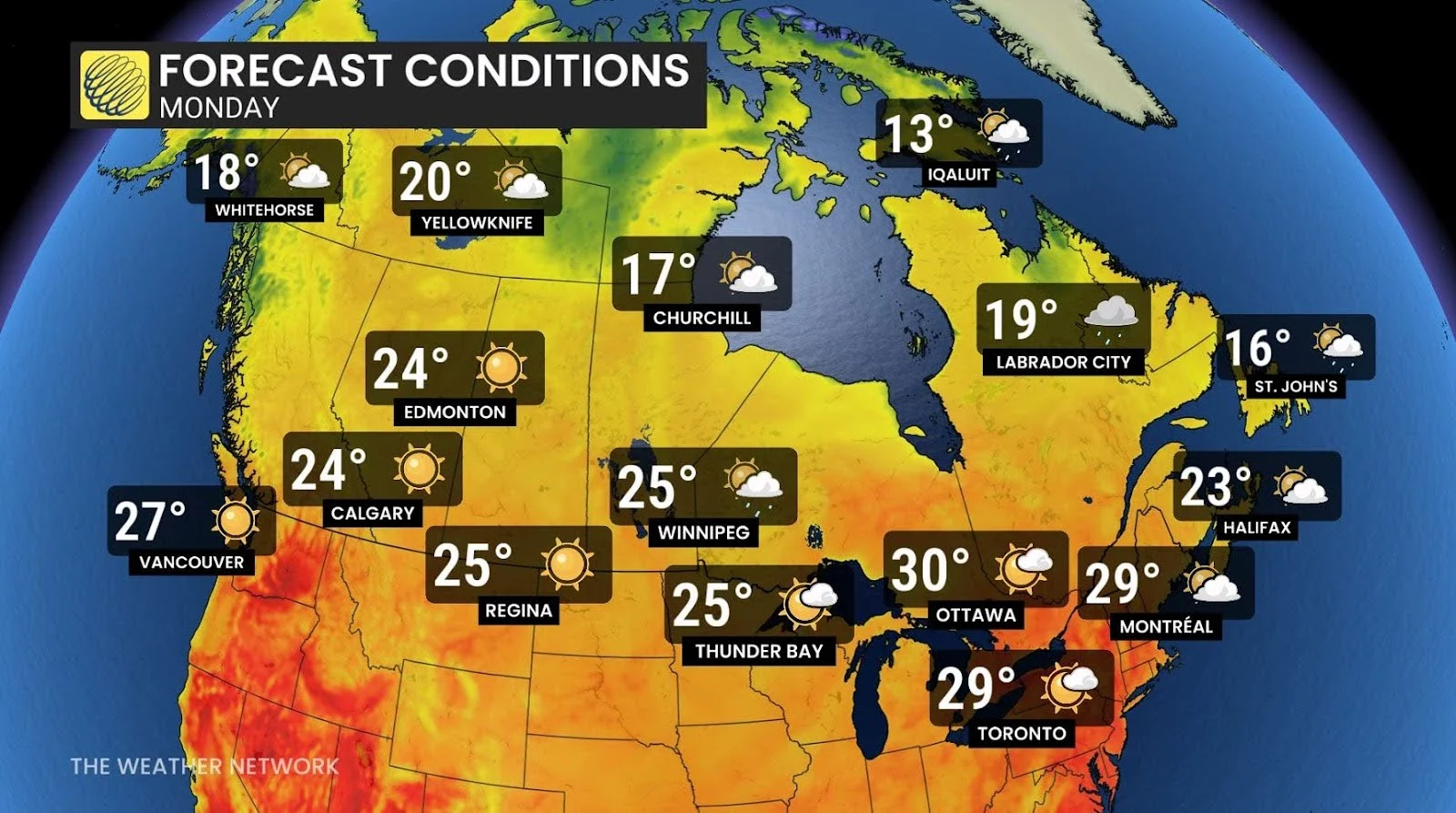
Showers and thunderstorms are likely across central and northern Manitoba, northern Ontario, and into western Quebec.
Tuesday
During Monday night and into Tuesday, showers and thunderstorms will spread across southern and eastern Ontario and southern Quebec as a cold front tracks into the region.
RELATED: How weather can impact Canada Day firework displays
The threat of showers and thunderstorms will continue into Canada Day across Ontario and Quebec. It is too early to have confidence in the exact timing and whether this will impact fireworks during the evening, but at this point it looks like the threat for rain will be over before evening for Toronto, Ottawa, and possibly Montreal. However, there will be an increasing risk for showers and thunderstorms in the Maritimes during Tuesday evening and Tuesday night.
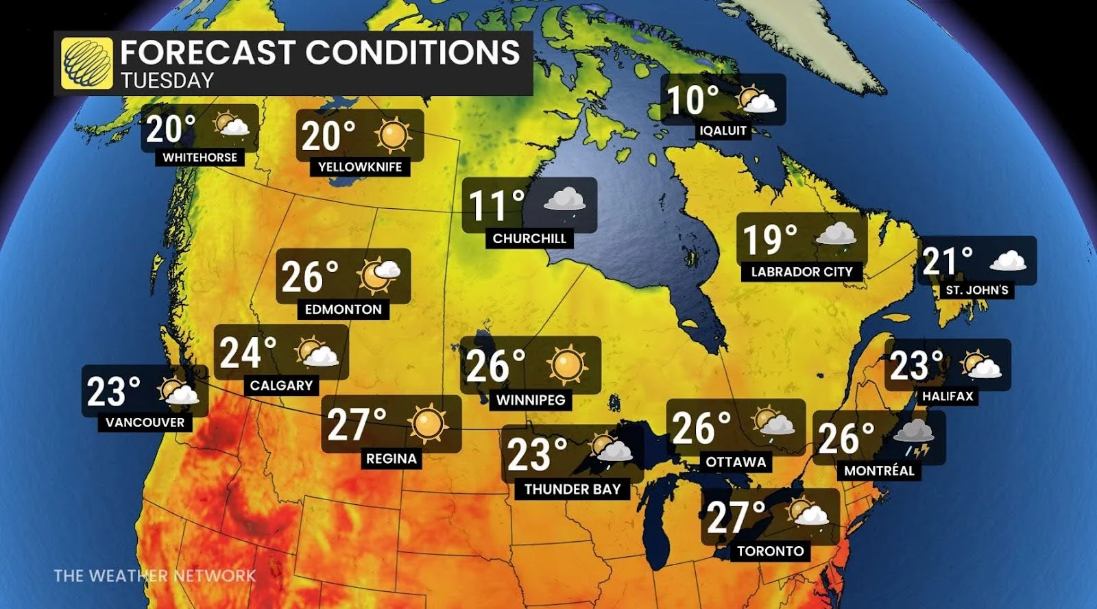
Meanwhile, sunshine is expected across most of Western Canada for Canada Day, but scattered thunderstorms are expected to develop late in the day across western Alberta.
Warmer than normal temperatures are expected to dominate across most of Canada during the first week of July, with the hottest weather expected across Western Canada. A few days of cooler (more seasonal) weather is expected across Ontario and Quebec, and even when warmer weather returns, it will not be as oppressively hot and humid as what we saw earlier this week.