Canada's unofficial kickoff to summer won't feel like it for most
For much of Canada, the unofficial start to summer--the upcoming Victoria Day long weekend--will signal a transition from a taste of summer back to our spring reality.
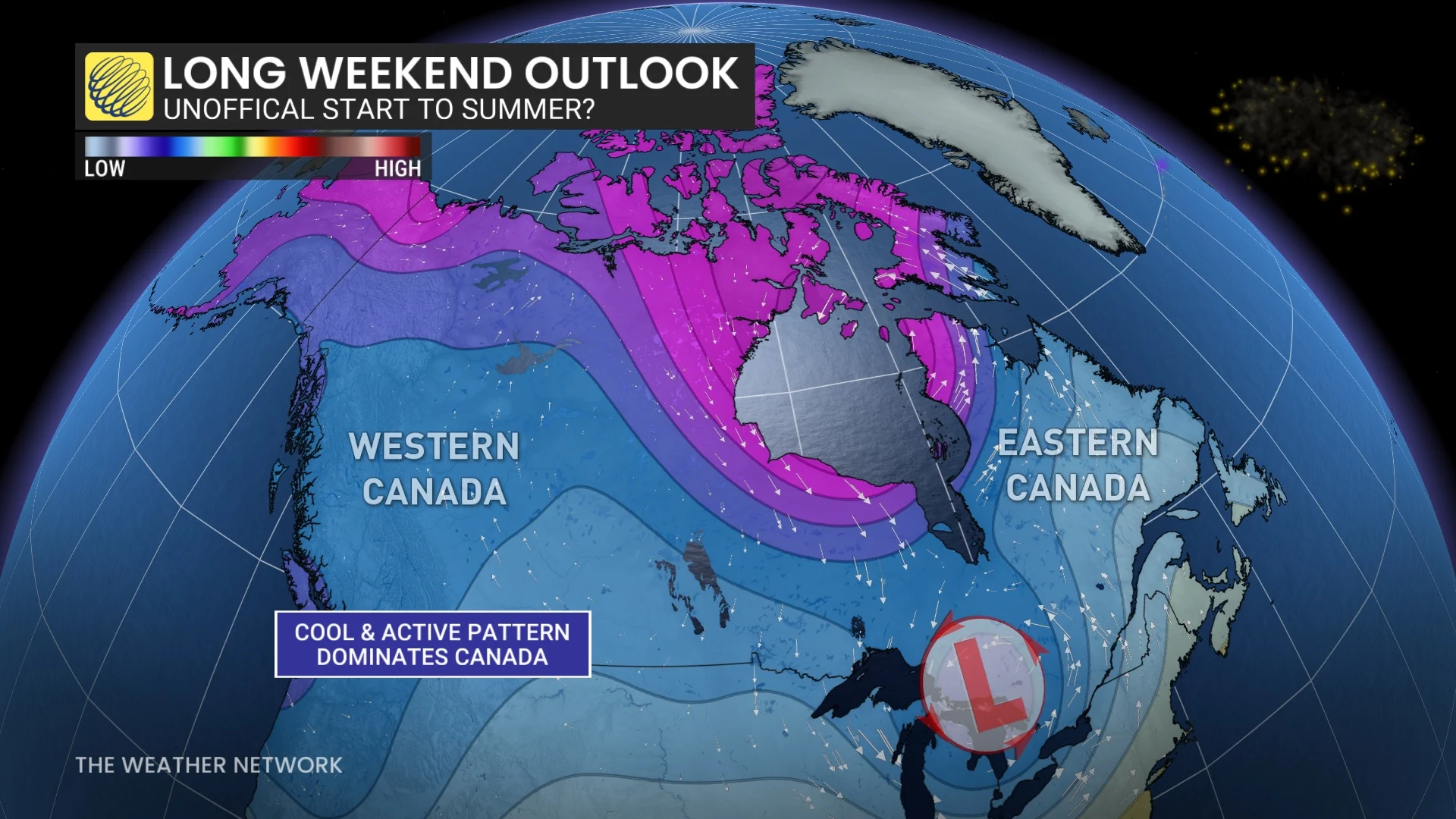
While we typically look to the Victoria Day long weekend as the "unofficial" start to summer since it's approximately a month before it begins, it may not feel like it is this year.
For starters, many parts of Canada have already had a taste of summer--including several locales hitting the 30-degree mark. The other reason? The recent summer-like warmth the country has seen will be a thing of the past for most Canadians.
SEE ALSO: The science behind fireworks: What goes into amazing Victoria Day displays?
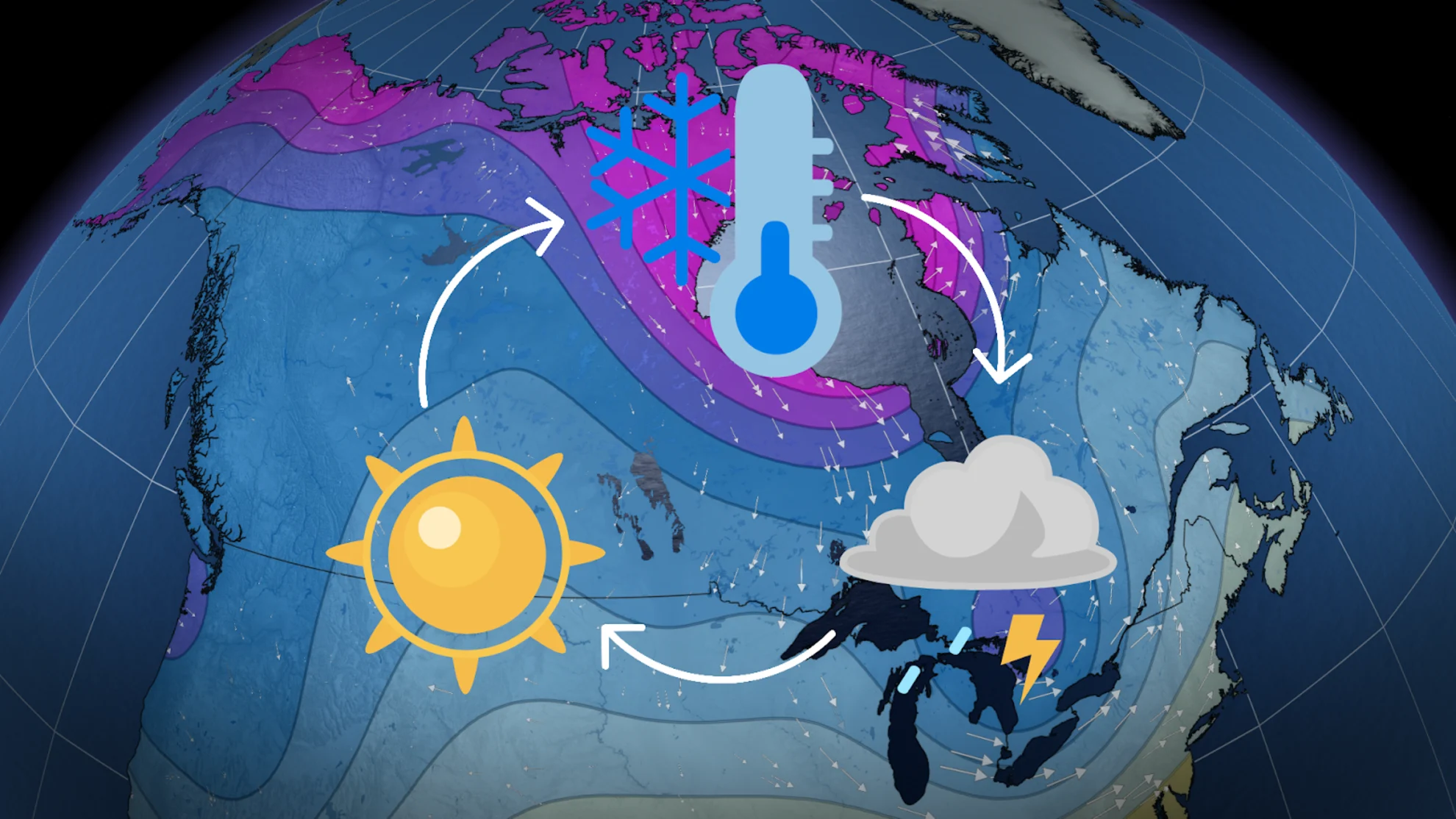
In fact, the next week will bring a transition back to spring, rather abruptly for some, with colder-than-normal temperatures spreading across much of the country during the long weekend. The cool weather will dominate across much of Canada by the end of the long weekend.
Expect interruptions in weather, so have backup plans
This year's Victoria Day weekend will fall during a change in Canada's pattern, which is expected to ramp up in terms of unsettled weather.
At times, the pattern will be rather active––and on the colder side--so have backup, indoor plans in case of disruptive weather.
Most Canadians will need some layers if they are heading out doors, with more spring-like temperatures making a return to the scenery after summer's brief fling.
Large parts of Canada will still be at risk to see frost again after the long weekend with the return of the cooler pattern. Southern urban and suburban areas should be safe, but the rural area could be at risk again, especially north of the more densely populated areas.
Western Canada
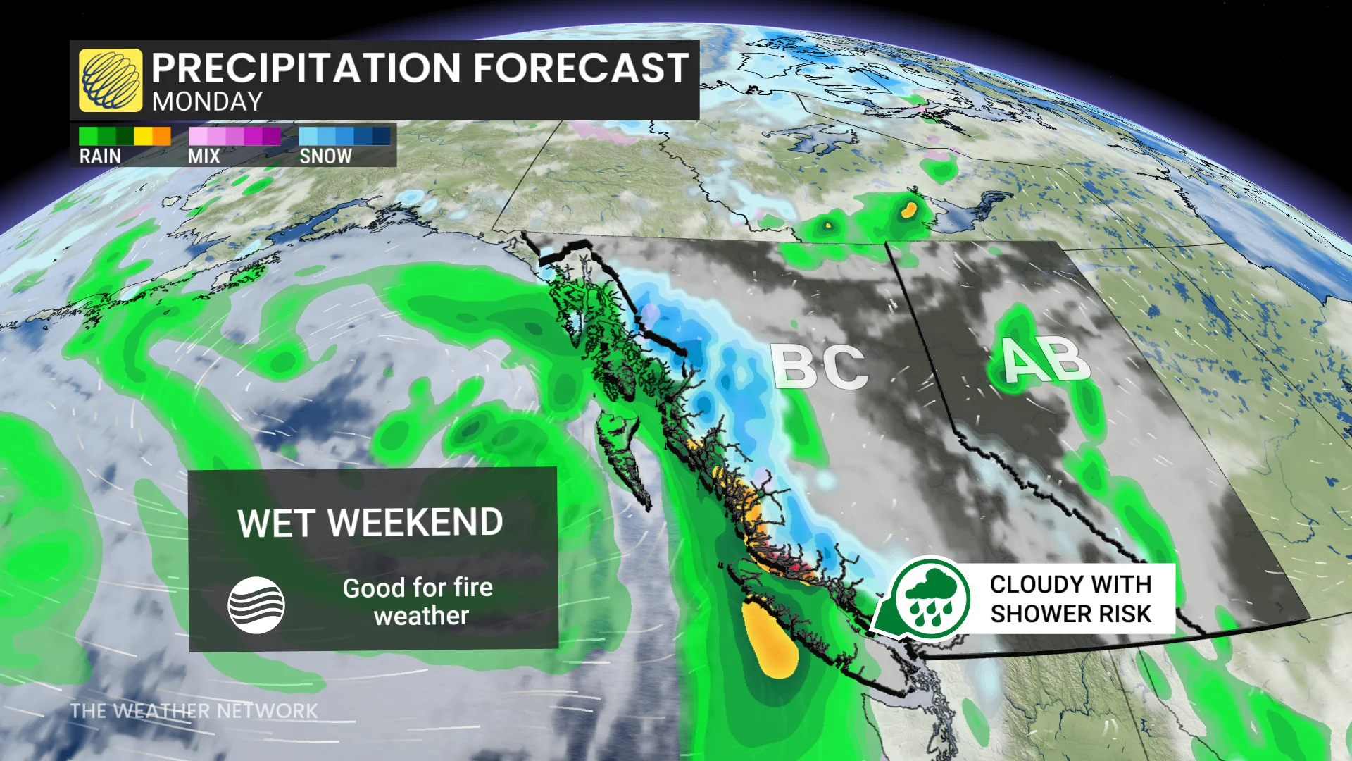
B.C. will see cooler-than-seasonal temperatures, sticking around for the next two weeks. The coastal region will see a wet beginning to the long weekend, but some breaks are expected Sunday and Monday.
Changeable, but overall, cooler-than-seasonal temperatures will linger on the Prairies through the long weekend, and continue into next week--bringing a threat for frost.
Alberta, as alluded to above, will remain cool but areas in the north will trend warmer. Conditions will be mostly dry to start with shower chances building as the weekend goes on.
Saskatchewan and Manitoba will be mostly dry after a soaking work week system, which also generated tornado warnings in the former on Monday night.
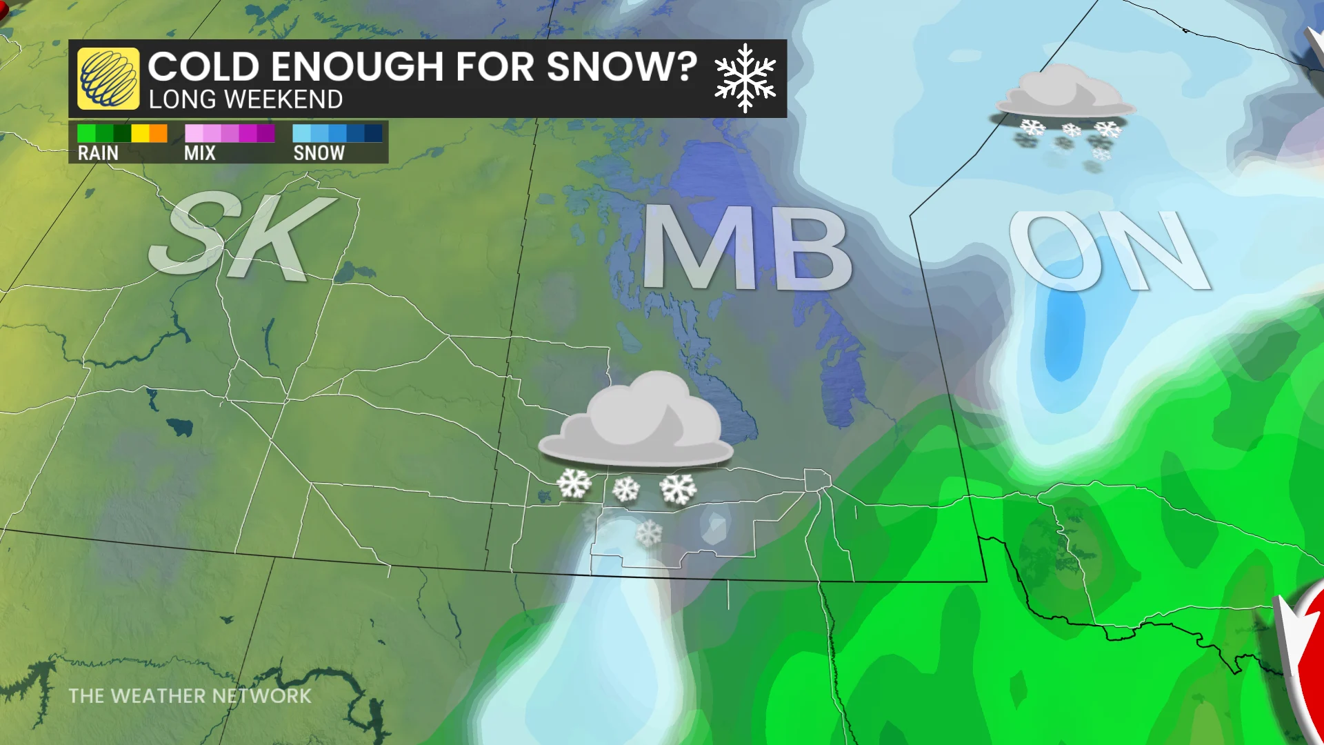
We will be watching the potential for wet snow along the Saskatchewan-Manitoba border from Saturday to Sunday, depending on the temperature drop, but only one computer model is currently showing the risk.
Ontario
In northern Ontario, the start to the long weekend could be quite nice. Temperatures in the mid-20s will continue through Friday and possibly Saturday for parts of the region, including around the south shore of James Bay. But a blast of much colder weather will arrive on the weekend, sending temperatures back into the single digits.
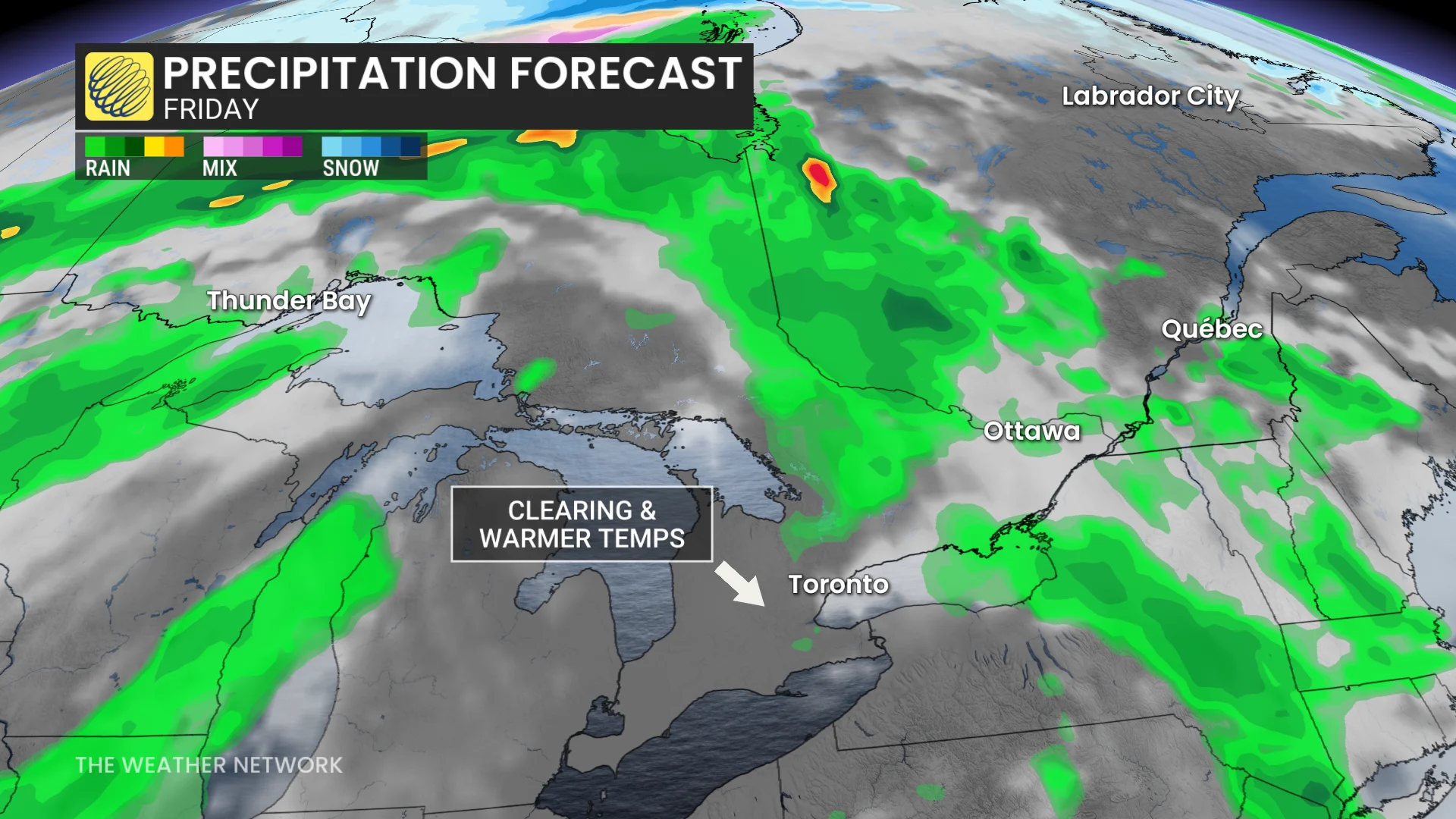
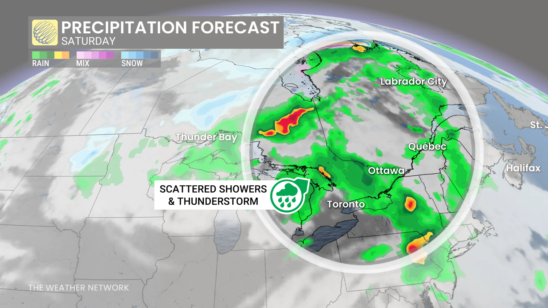
The system from the Prairies will impact the Great Lakes region, including cottage country and areas east, on Friday with thunderstorms and rain.
However, timing of the system could favour a good start to the long weekend for southern Ontario.
SEE ALSO: Large northwestern Ontario forest fire prompts evacuation
A period of rain and thunderstorms is likely on Friday morning, followed by some sunshine, a gusty, southwesterly wind and warm temperatures--reaching the mid-20s across much of southern Ontario. But some places, including the Greater Toronto and Hamilton Area (GTHA), have the potential to reach the upper 20s.
Saturday will bring a mix of sun and cloudy periods with a threat for scattered showers and thunderstorms, and near-seasonal temperatures in the upper teens to lower 20s, along with a gusty wind. Sunday will feature similar conditions, but Monday will be more of a pleasant day, with cooler-than-normal temperatures dominating.
Quebec
Friday will be a mixed start to the long weekend with temperatures jumping into the mid-20s, possibly going into the upper 20s, but they will occur before the arrival of showers and thunderstorms.
A few rounds of showers and thunderstorms are likely this weekend, but there will be rain-free periods, as well. Saturday will still be a warm day with temperatures reaching the low to mid-20s--possibly upper 20s if we get some bonus sunshine. Sunday will turn cooler with steady or slowly falling temperatures, and significant rain for southeastern areas.
Occasional showers could hold on even into Monday as temperatures continue to trend in the cooler direction.
Atlantic Canada
Cooler weather will spread back into Atlantic Canada late week. During the long weekend, temperatures will be within a few degrees of seasonal.
Conditions will be unsettled to start the weekend, with scattered showers on Friday. They will improve on Saturday as skies will be mostly clear.
DON'T MISS: Planning to barbecue this long weekend? Watch this first
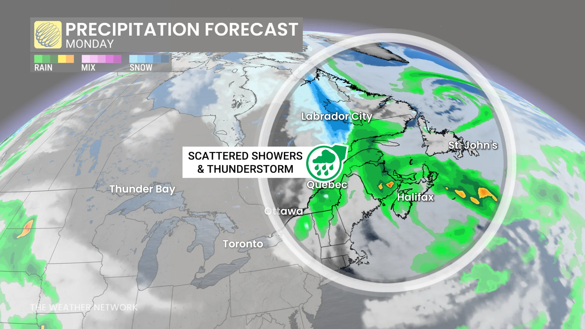
But, more widespread rain arrives on Sunday and Monday in the Maritimes with a low-pressure system, while conditions remain mostly dry for Newfoundland. However, the risk for showers for the Avalon Peninsula increases on Monday.
For Newfoundland and Labrador, this weekend is a more of positive change back to spring after a relapse into winter over the Mother's Day weekend.
Check for local fire bans before setting off fireworks
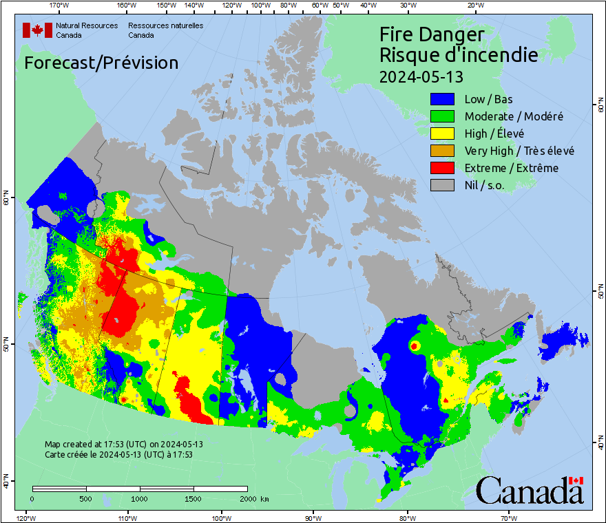
Canada’s wildfire season is already off to an active start, with dozens of blazes being reported across the country.
Canada sees an uptick in wildfires during warmer months, many of which are caused by human activity. This long weekend, it’s important to check for local fire bans, as they may prohibit or restrict the use of fireworks.
With files from Rachel Modestino and Dr. Doug Gillham, meteorologists at The Weather Network, and Nathan Howes, a digital reporter at The Weather Network,
Stay tuned to The Weather Network for the latest Victoria Day weekend forecast details.