Chantal takes aim at the Carolinas as Atlantic's third named storm
Chantal came to life Saturday off the southeastern U.S. coast, expected to bring potent wind gusts, soaking rains, flash flooding and life-threatening surf as it prepares to make landfall in South Carolina on Sunday morning
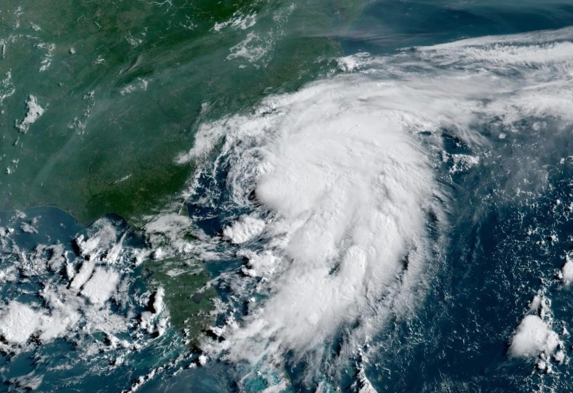
The Atlantic Ocean has its third named storm of the 2025 hurricane season--Chantal, which is churning off the southeastern U.S. coast.
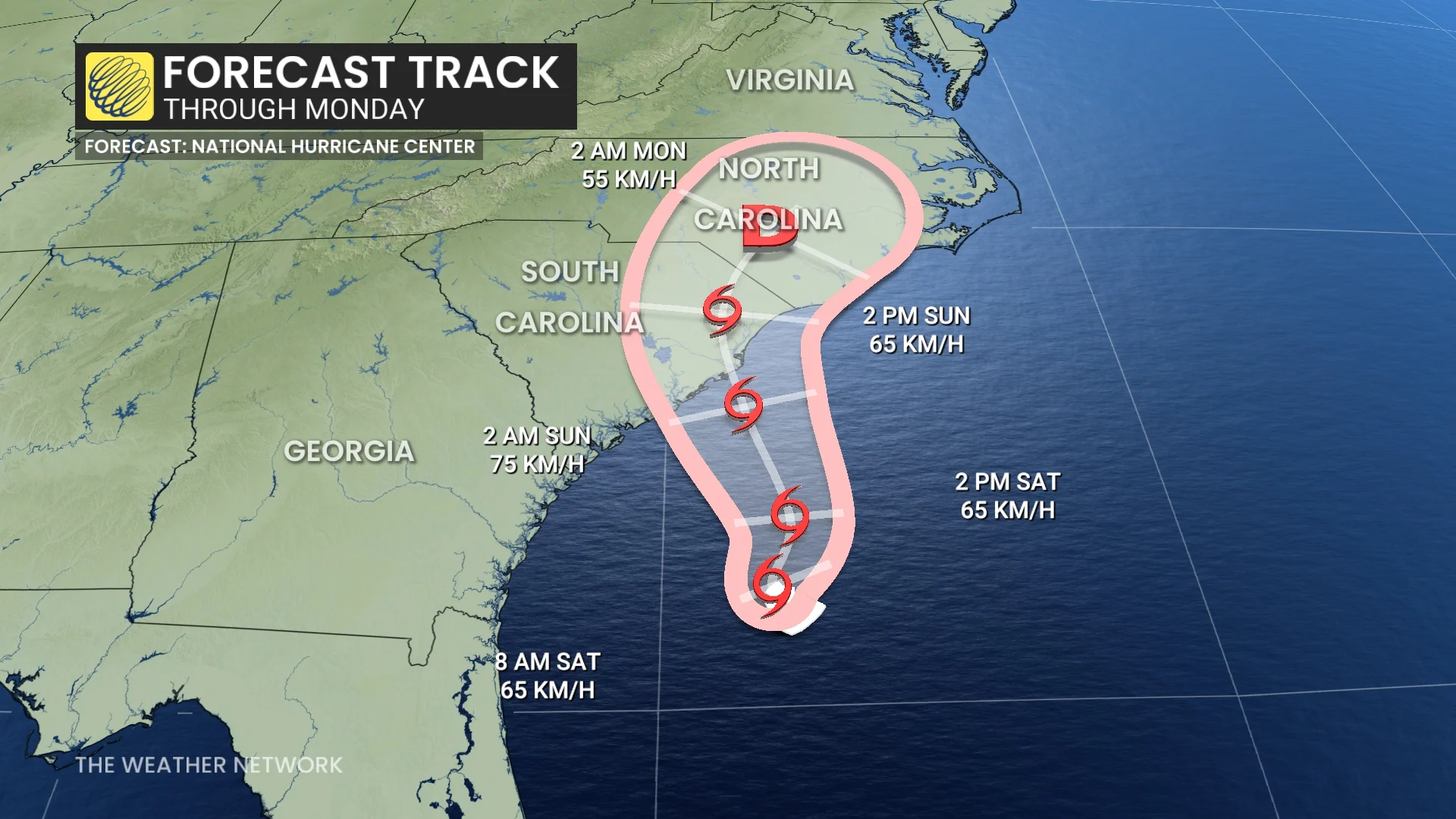
The storm is targeting South Carolina for a Sunday landfall, with tropical storm watches and warnings now in effect for some popular coastal destinations--many of which are busy for the holiday weekend.
Visit The Weather Network's hurricane hub to keep up with the latest on tropical developments in Canada and around the world
As Chantal nears the coastline, impacts across parts of the southeastern U.S. will be widespread, with strong winds, heavy rain, flash flooding and life-threatening surf following the system inland over the Carolinas through the end of the holiday weekend.
Chantal comes to fruition ahead of Sunday landfall
A disturbance off the Georgia coast formed into Tropical Depression Three on Friday afternoon and has now reached tropical storm status as Chantal.
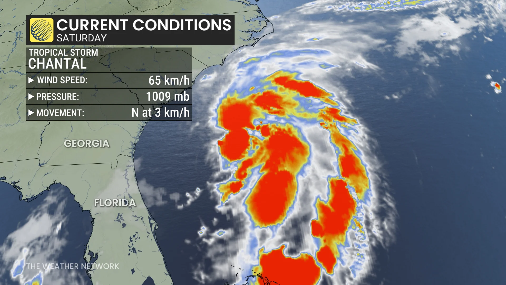
As of Saturday morning, Chantal boasts maximum, sustained winds have increased to near 65 km/h with higher gusts. Some additional strengthening is expected before Chantal reaches the coast.
The U.S. National Hurricane Center (NHC) expects the centre of Chantal to move across the coast of South Carolina Sunday morning.
MUST SEE: Above-average Atlantic hurricane season likely in 2025, NOAA says
A tropical storm warning is in place from South Santee River, S.C., to Cape Fear, N.C. A tropical storm watch is in effect from Edisto Beach, S.C., to South Santee River, S.C. Those are popular destinations for both Canadian and American travellers heading south to enjoy the warm weather.
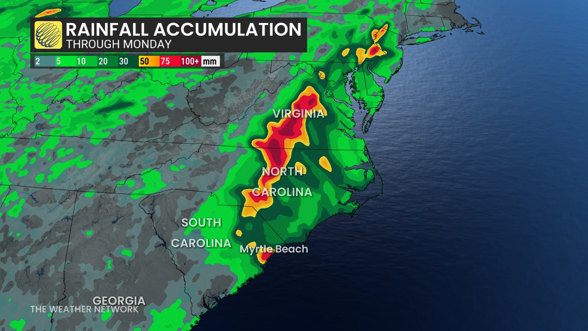
Chantal is expected to produce heavy rainfall across portions of the coastal plain of the Carolinas through Monday. Rainfall totals of 50 mm to 100 mm, with local amounts to 150 mm are expected. The anticipated rainfall brings elevated risk for flash flooding.
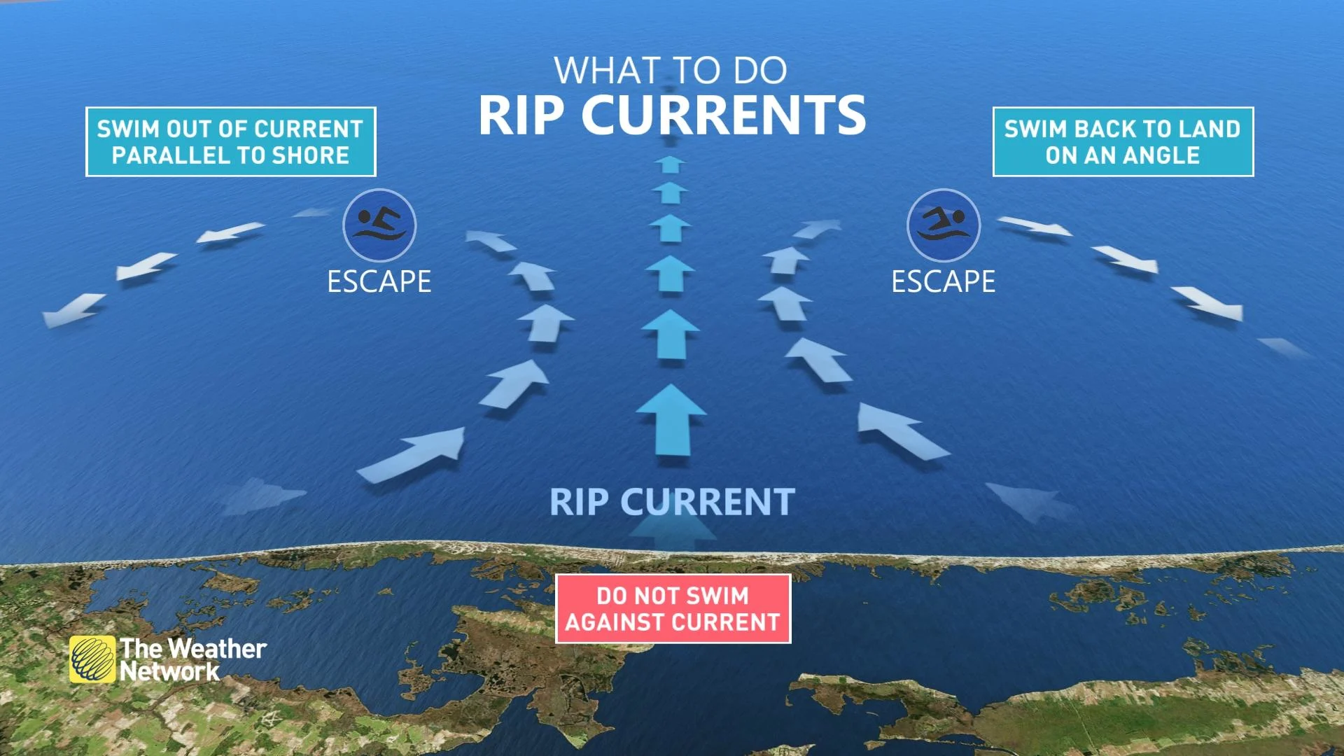
Rip currents will pose the greatest hazard to beachgoers this weekend. Stay out of the water if told to by local officials, and know how to escape a rip current if you’re caught in one.
Despite the relatively sluggish start to the season, experts expect an above-average season in the months ahead. We don’t arrive at the peak of hurricane season until late August and early September.
Coastal residents anywhere along the Atlantic basin are reminded to prepare for hurricanes well in advance of a storm’s formation and arrival. Storms and their remnants can bring gusty winds, tornadoes, and flooding rains hundreds of kilometres inland from the point of landfall.
Thumnbnail courtesy of NOAA.