Cold front brings storms, sharp temperature drop to the Prairies
A cold front is sweeping across the Prairies Monday and could trigger severe thunderstorms for parts of the region and northwestern Ontario
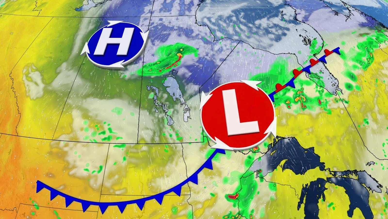
A blast of autumn weather is about to change up the start of the week on the Prairies, bringing a mix of severe thunderstorms and a dramatic drop in temperature.
The clash of warm, late-summer air with an approaching cold front is anticipated to fuel stormy skies Monday, with conditions heading east into Tuesday.
CHECK OUT: Why do leaves change colour in the fall?
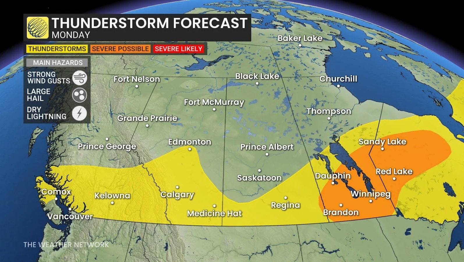
Storm risk spreads east
Southern Manitoba, including Winnipeg, is in a severe weather hot spot, with gusty winds, hail and frequent lightning all possible.
Northern Ontario, in particular around Red Lake, may also experience stronger storms by Monday night.
Farther west, isolated thunderstorms remain possible in Alberta and B.C., particularly around the foothills and interior regions. While Calgary is less likely to be affected, forecasters say storm chances are improving to the west.
From summer heat to sweater weather
DON'T MISS: Five pro tips to help you prep the garden for fall
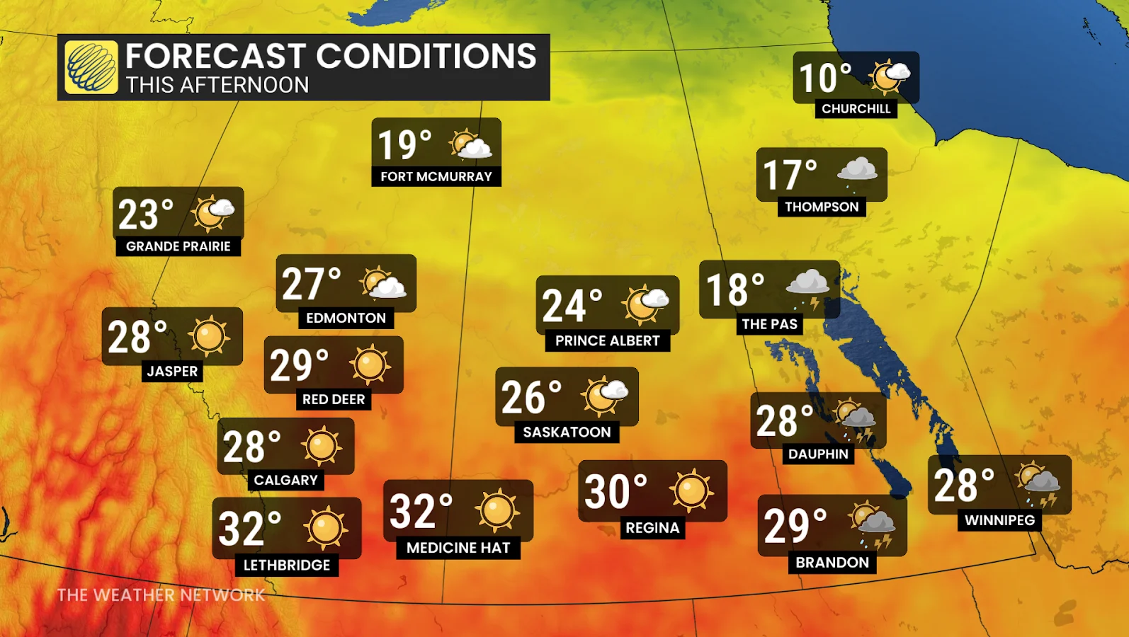
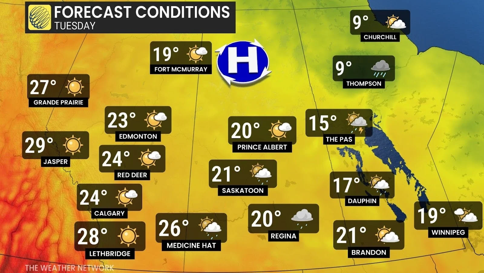
As the storms pass, cooler air will settle in behind them. Winnipeg will drop from 28ºC on Monday to 19ºC on Tuesday, while Regina will fall from 30ºC to 20ºC.
By Tuesday, the storm threat shifts to northern Ontario, where the greatest risk of severe weather exists, while eastern Ontario and parts of Quebec face a smaller, isolated chance.
The sudden drop in temperature is a sure sign that summer is giving way to fall, whether Canadians are prepared for it or not.
Stay with The Weather Network on the latest across the Prairies and Ontario.