Severe storm setup in Alberta could bring huge hail and devastating winds
A severe storm setup is taking shape in Alberta for Monday, with large hail emerging as a key threat––alongside the risk of damaging winds and heavy downpours.
Summer-like conditions have arrived in Western Canada, but they're also preparing the ground for active weather, with an ideal setup for severe storms to develop in areas of Alberta by Monday.
RELATED: Scientists uncover a driving force behind deadly humid heat waves
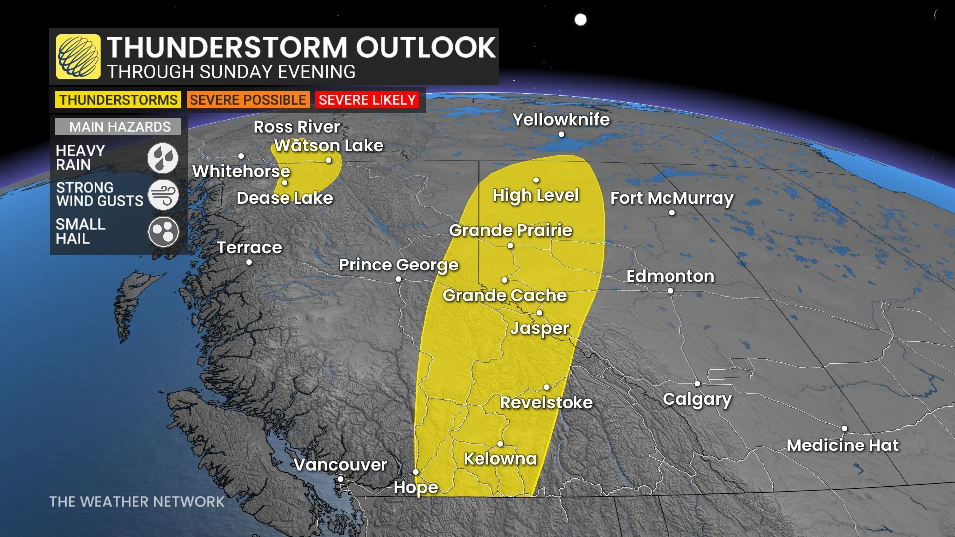
But first, irregular thunderstorms are expected to form Sunday evening throughout areas of British Columbia and Alberta. While some storms are not forecast to be severe, they may still produce tiny hail, gusty winds and heavy rain.
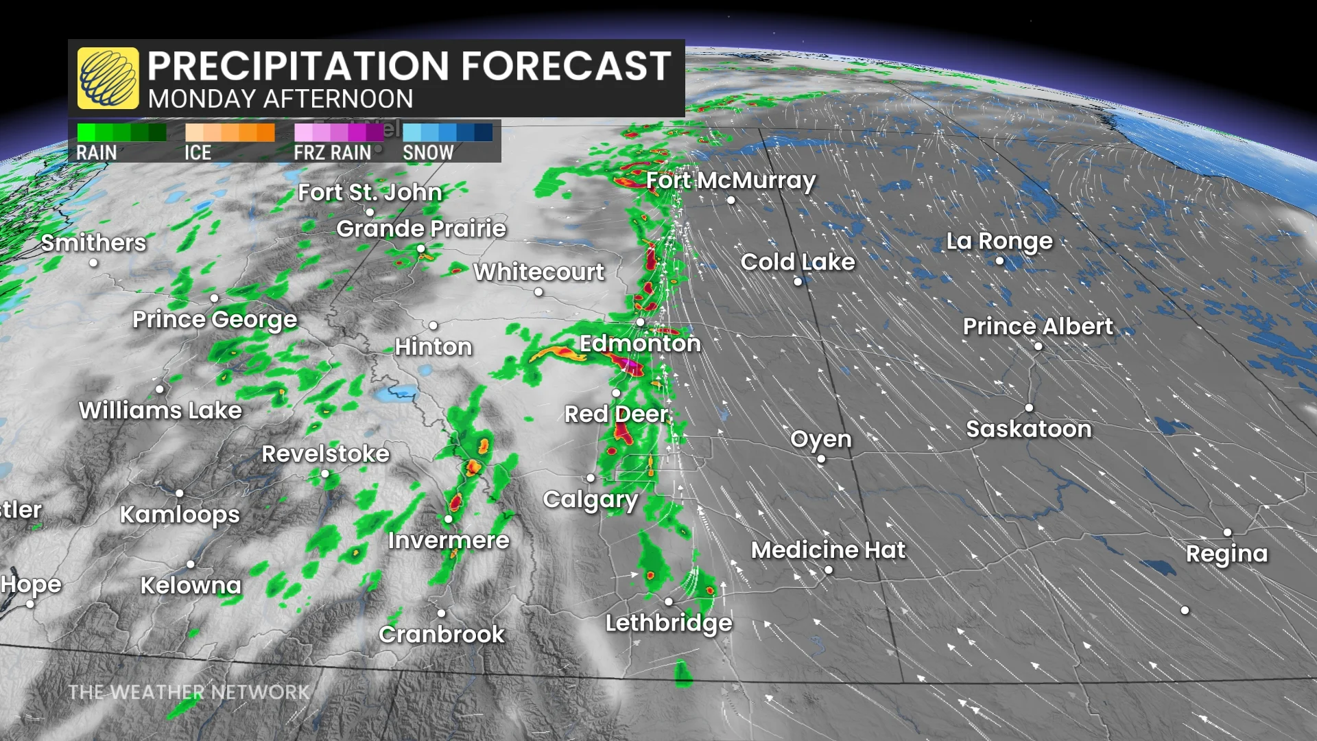
Sunday will be a prelude to Monday's risk
Starting in the evening, on the western coast and eastern provincial border, B.C. will get most of the rain in the buildup. With small pockets of snow at higher altitudes, the West Coast, especially, will see a lot of rain going into the overnight period.
Northern Alberta will also be getting in on the action with rain around Grande Prairie and north of Whitecourt.
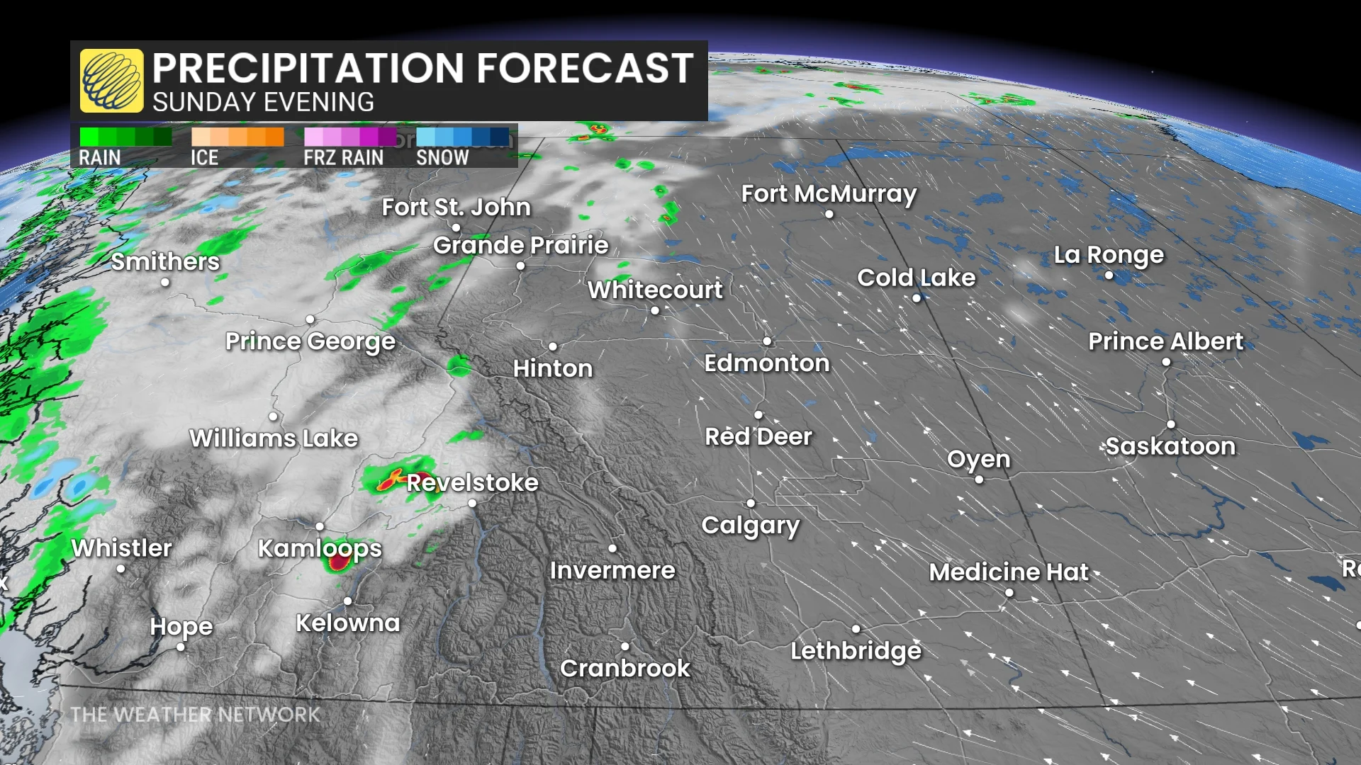
But that’s not all. Along the provincial border, eastern British Columbians and northeastern Albertans will be under a stalled upper trough. It carries the risk of triggering thunderstorms for the region from Sunday afternoon into the evening.
Thankfully, the thunderstorms are expected not to be severe, but may bring strong winds and small hail across the area.
Monday storm threat picks up in Alberta
Monday's severe weather potential is heightened with the development of a trough across the province. A cold front draped across Alberta (north to south) will be the catalyst for the severe weather late in the afternoon into the evening.
READ MORE: False start to the summer? Cool May clings on, but change is coming
Both a stronger upper level of support and the warm temperatures setting in will enhance the instability, allowing the cold front to be the trigger for the storms.
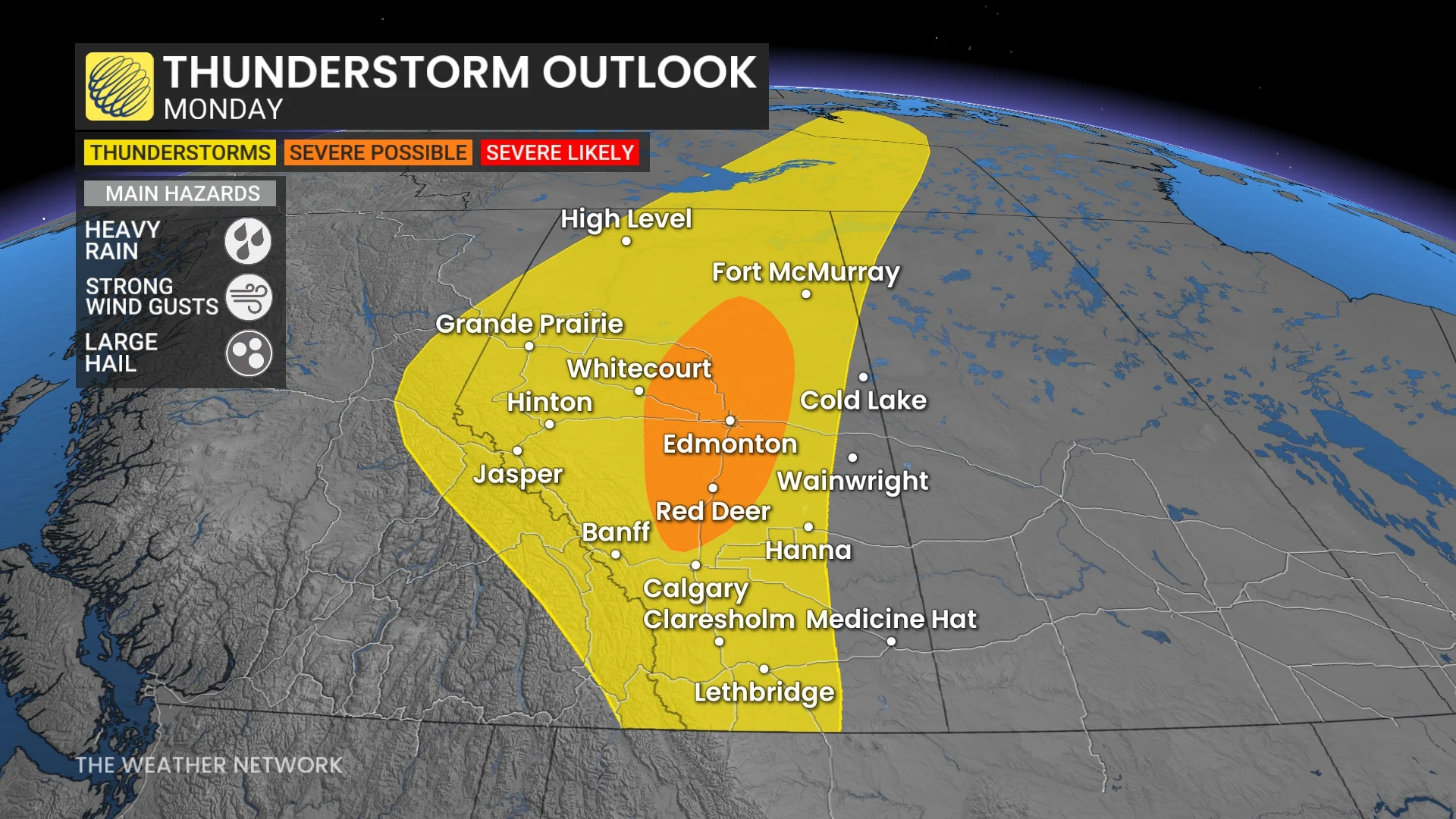
A strong line of storms is expected to sweep over the province, with central Alberta between Edmonton and Calgary serving as its main development area.
Severe storms are likely to produce strong gusts (up to 90 km/h), heavy rain and huge hail (nickel-sized or larger) in the most developed storms.
The severity of the storms has low confidence, including some that have the potential of becoming supercells. The setup is being closely monitored, so stay tuned to The Weather Network for the latest updates.
Expect rain to follow the storms across the province, forming around central and middle Alberta, with some of the rain across eastern British Columbia.
Stay tuned to The Weather Network for the latest forecast updates for Alberta.