Severe weather risk will shift into Manitoba, NW Ont. after nocturnal threat
A nocturnal threat for severe storms will continue for parts of Saskatchewan, extending into Manitoba. The potential will reappear in Manitoba and northwestern Ontario on Thursday, with a tornado chance present alongside damaging wind gusts and large hail
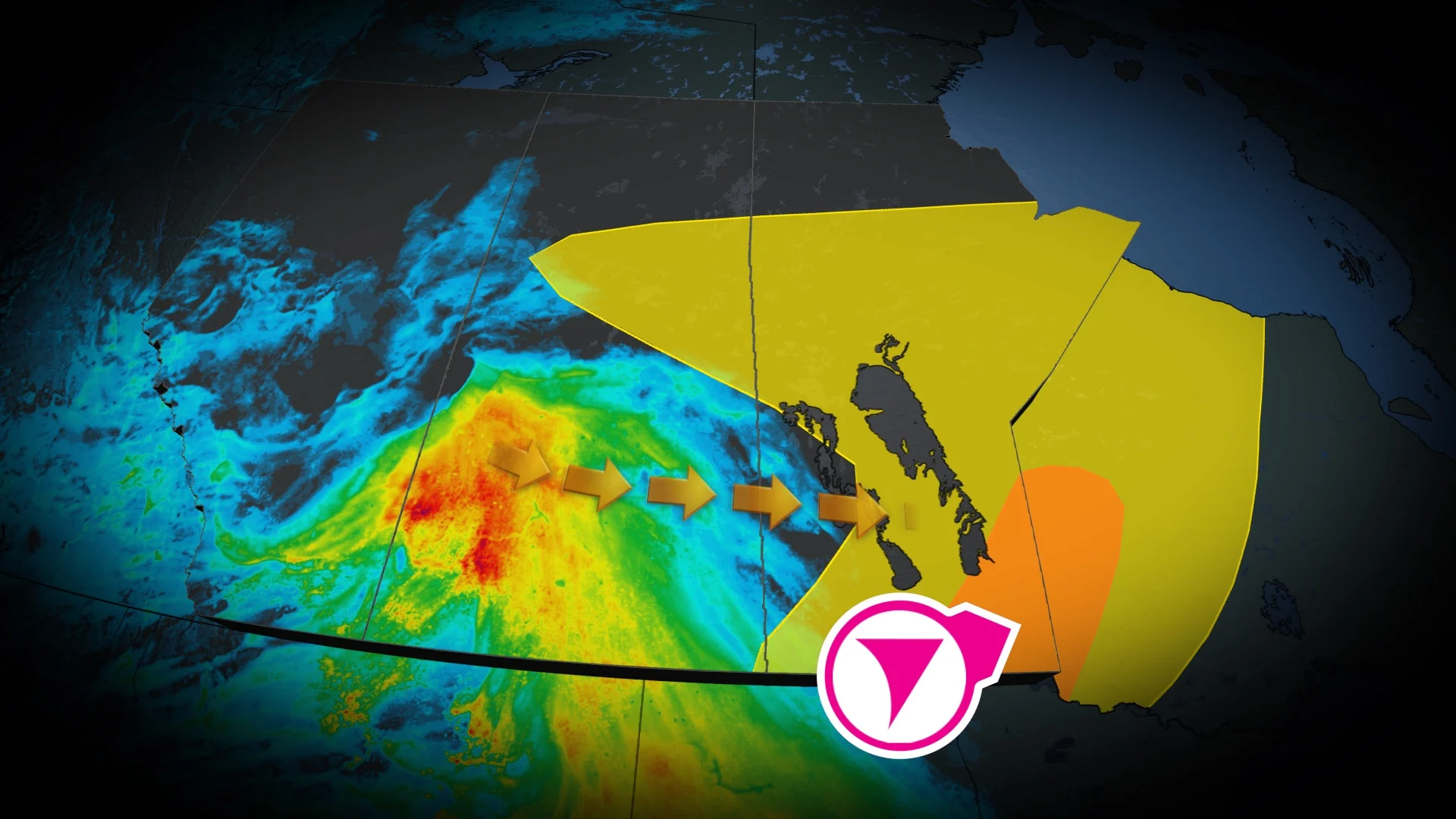
After a stormy Wednesday in southern Alberta and Saskatchewan, which saw tornado watches and warnings, respectively, the threat for severe weather will shift east into Manitoba and northwestern Ontario on Thursday.
However, parts of Saskatchewan and Manitoba will see the risk of severe weather through Wednesday overnight. On Thursday, the focus of the severe storm potential will shift east into southern Manitoba and northwestern Ontario, where ample amounts of thunderstorm energy will build through the afternoon.
DON'T MISS: Get the latest wildfire news and safety tips to help you stay safe
Along with large hail of 2-4 cm in size, there is a potential for one or two tornadoes. However, there is uncertainty in the risk because of a cap in the environment that may inhibit that.
It'll be important to remain weather-aware, and stay up-to-date on all of the latest watches and warnings as conditions change.
Wednesday night: Severe storm threat continues
Overnight, this system is expected to bring persistent rain into wildfire-affected areas of Saskatchewan and Manitoba, offering much-needed relief through late-Thursday into Friday, when as much as 30-80 mm could fall.
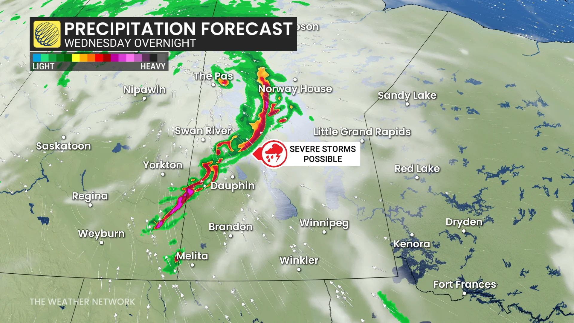
In south-central Saskatchewan, there is isolated potential for some large hail and severe thunderstorms to continue east through the overnight. That can also bring with it strong wind gusts.
DON'T MISS: 2025 is Canada's second-worst wildfire season on record for area burned

Thursday: Storm risk shifts east, Alberta significantly cools
By Thursday, the storm system will shift eastward, bringing a significant cooldown to Alberta, with daytime highs falling shy of 20°C.
SEE ALSO: Canada’s rain gauge runs dry, cities top weeks without rain

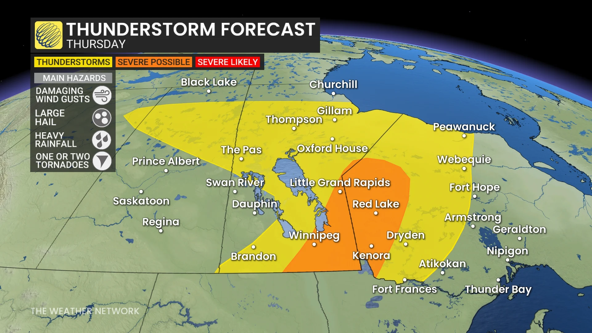
In southern Manitoba and northwestern Ontario, high thunderstorm energy will build through the afternoon. The system’s advancing cold front will strengthen through the day and possibly trigger severe storms by the late afternoon and evening.
There is some uncertainty where thunderstorms will trigger, but a potent environment is present for large hail and damaging winds storms near the Winnipeg area and east.
The hail size is expected to be 2-4 cm (loonie- to golf ball-sized). There is a potential for one or two tornadoes, as well, with the cluster of storms line out in front of the cold front, but there is a cap in the environment that may inhibit that.
Beyond, temperatures will be changeable through the weekend. Northern areas will be cooler than normal, but the southern Prairies will end up warmer than normal with a couple rounds of warmer weather surging north of the U.S. border. Warmer-than-normal temperatures will dominate next week.
Be sure to check back for the latest updates across the Prairies