
Dangerous heat, storm risk build across Ontario this weekend
Use caution in the days ahead as extreme heat is a deadly threat to vulnerable people
Extreme heat will begin building into Ontario this weekend as a powerful ridge of high pressure develops over the region.
Several rounds of strong to severe thunderstorms are possible along the edge of this high pressure beginning Friday overnight and continuing into Sunday.
High heat and humidity are a dangerous combination—even for relatively healthy individuals. Use extreme caution this weekend and next week as temperatures soar.
DON’T MISS: Why extreme heat is one of the world’s deadliest weather disasters
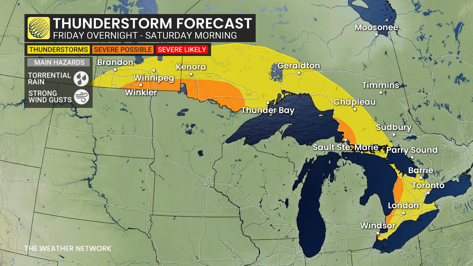
Severe storms Friday night through Sunday
The ridge of high pressure responsible for the building heat will nudge toward Ontario to start the weekend. This “ring of fire,” as meteorologists call it, can serve as the focus for development of strong to severe thunderstorms.
These clusters of storms can be quite difficult to forecast—but also quite intense with strong winds, torrential rain, and vivid lightning.
RELATED: Why nocturnal thunderstorms can be particularly dangerous
Forecasters expect the first round of strong to severe storms to develop through the overnight hours Friday into Saturday morning, targeting portions of northwestern Ontario, as well as the eastern shores of Lake Superior and Lake Huron. These storms could pack torrential rainfall and strong wind gusts.
Renewed rounds of storms are expected Saturday afternoon and into the overnight hours.
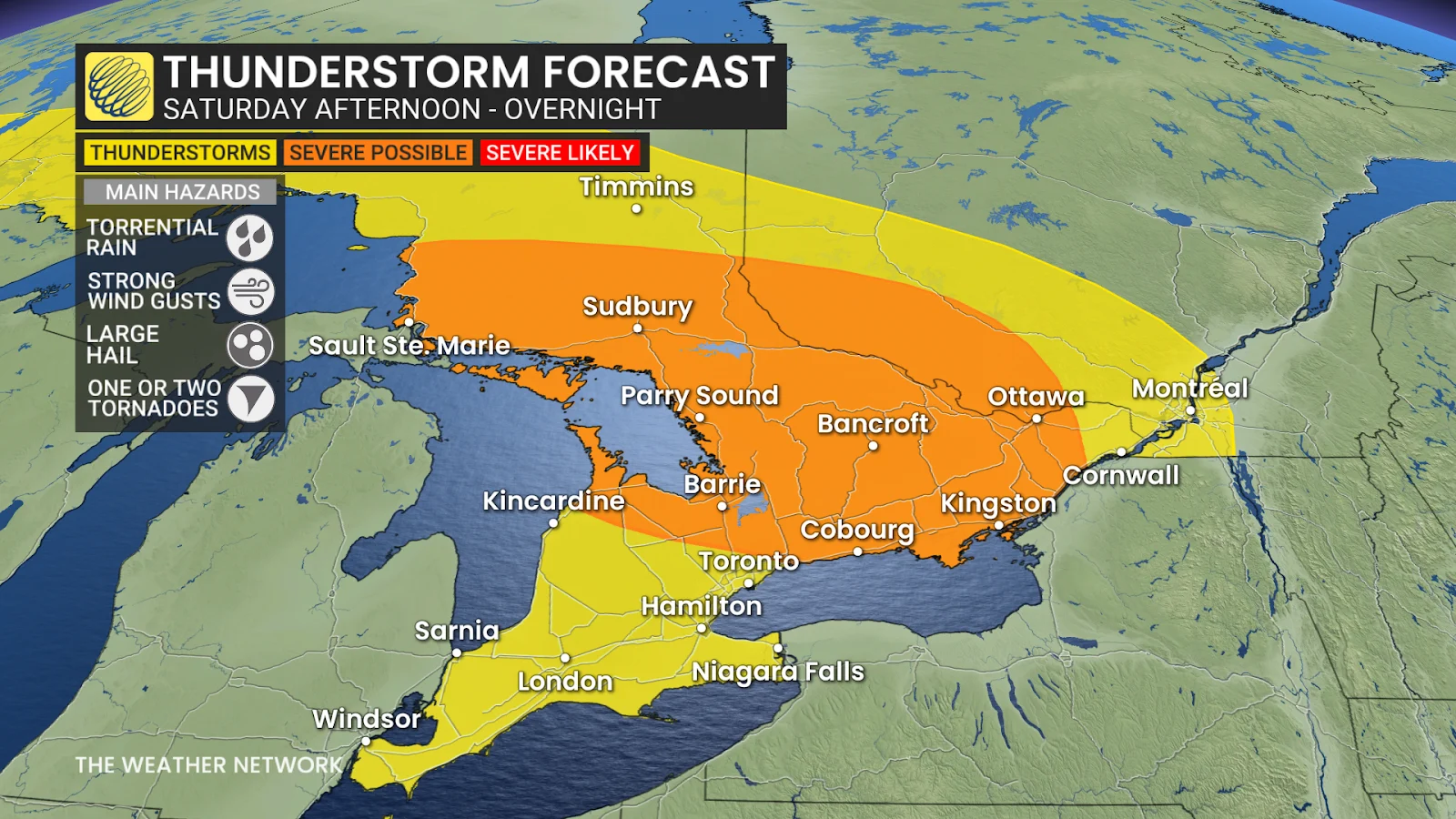
The first batch of storms could build through the late afternoon and evening for northeastern, central, and eastern Ontario. The second round could arrive late Saturday night and continue into the overnight hours.
There is still lots of uncertainty on how these storms will develop, but all modes of severe weather will be possible—including torrential rains, strong wind gusts, large hail, and even one or two tornadoes.
Make sure you have a way to receive severe weather warnings the moment they’re issued.
Early-summer heat wave envelops Ontario
We’ll see temperatures and humidity increase to dangerous levels as the ridge of high pressure intensifies through the weekend and into next week.
Southern Ontario will endure a multi-day stretch of extreme heat and humidity beginning Sunday, with temperatures climbing into the low- to mid-30s and humidex values rising toward the mid 40s.
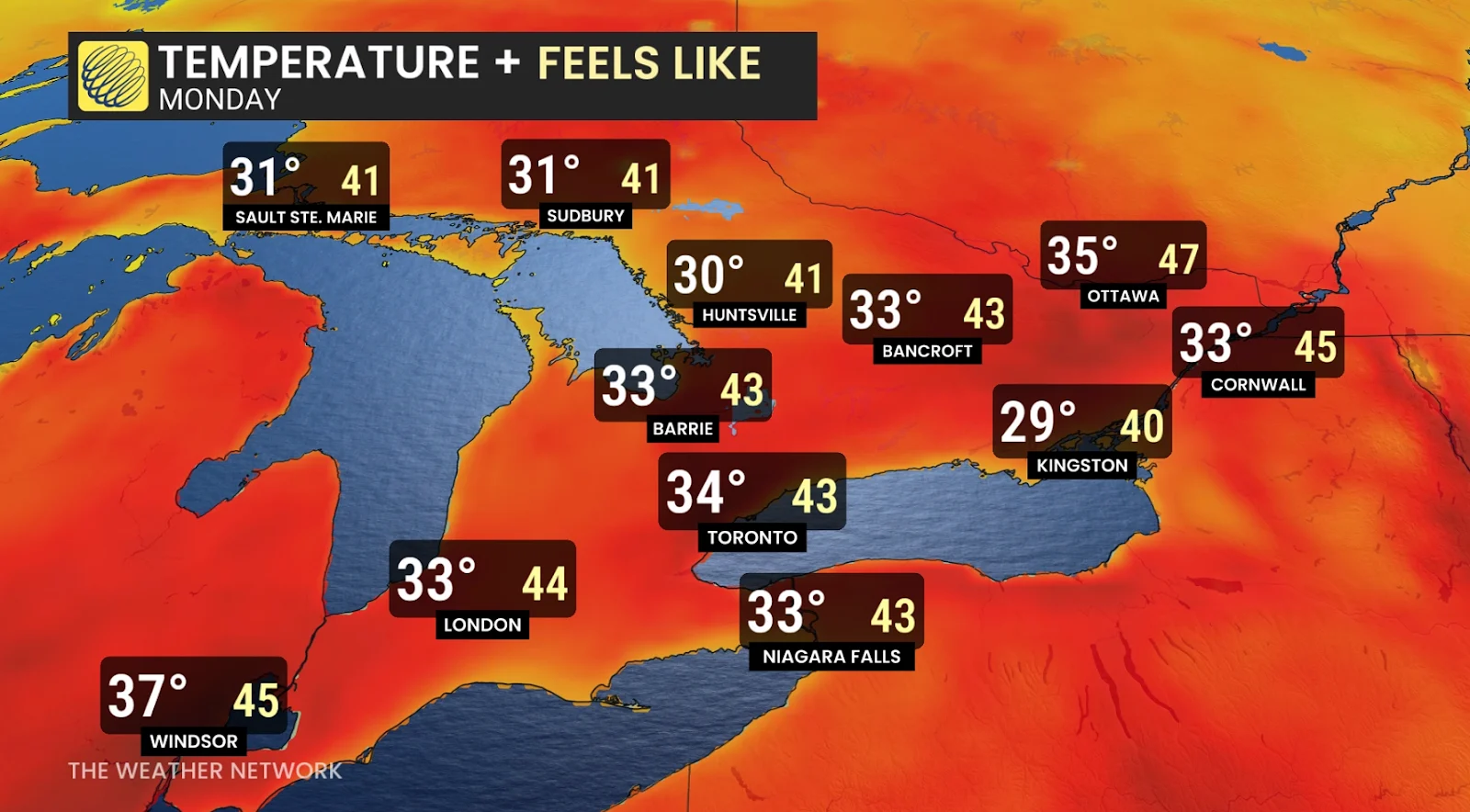
Sunday through Tuesday will serve as the focus of the extreme heat and humidity. We’re expecting at least three days of temperatures of 33°C or higher across most of the Greater Toronto Area and southwest—with daytime humidex values into the mid 40s.
Overnight lows will remain in the mid 20s, providing little relief for those living without reliable access to air conditioning.
Hot weather safety tips
Drink plenty of water. Avoid caffeine and alcohol, which can be dehydrating.
Avoid direct sunlight, especially during peak hours and when the UV rating is high.
Wear lightweight, loose-fitting clothing.
Use air conditioning when possible. If you do not have access to air conditioning, consider visiting a cooling centre, a shopping centre, or a public library.
Check on elderly relatives and other vulnerable neighbors.
Avoid strenuous activities during the hottest parts of the day.
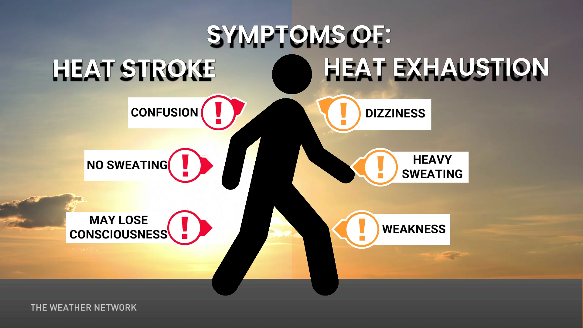
If you experience symptoms of heat-related illnesses like dizziness, nausea, or confusion, seek medical attention.
Header image created using graphics and imagery from Canva.
Stay with The Weather Network for all the latest on conditions across Ontario.