Dangerous weather factors could fuel further wildfire growth on the Prairies
Wildfire risk grows across the prairies with weather playing a critical role
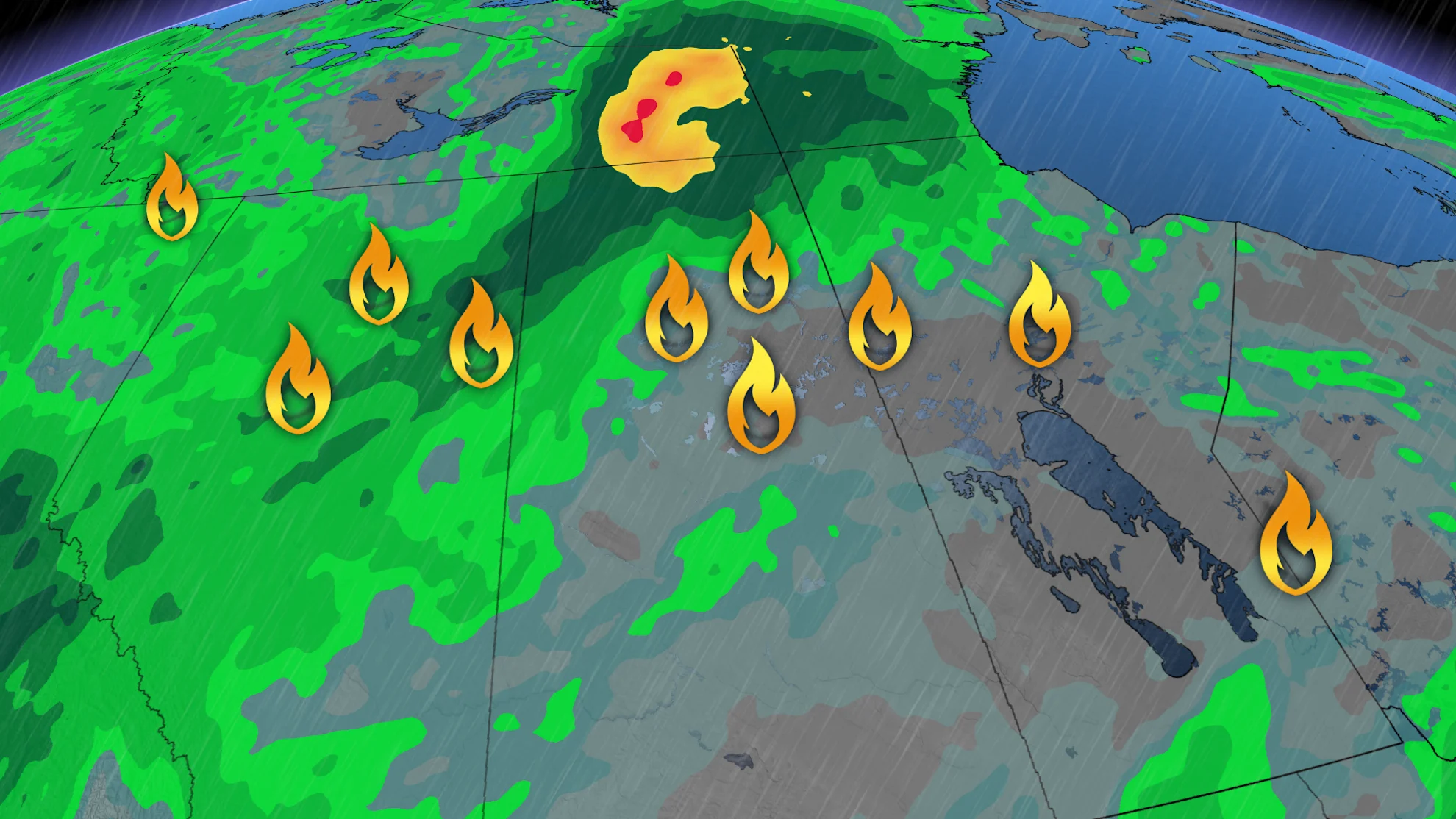
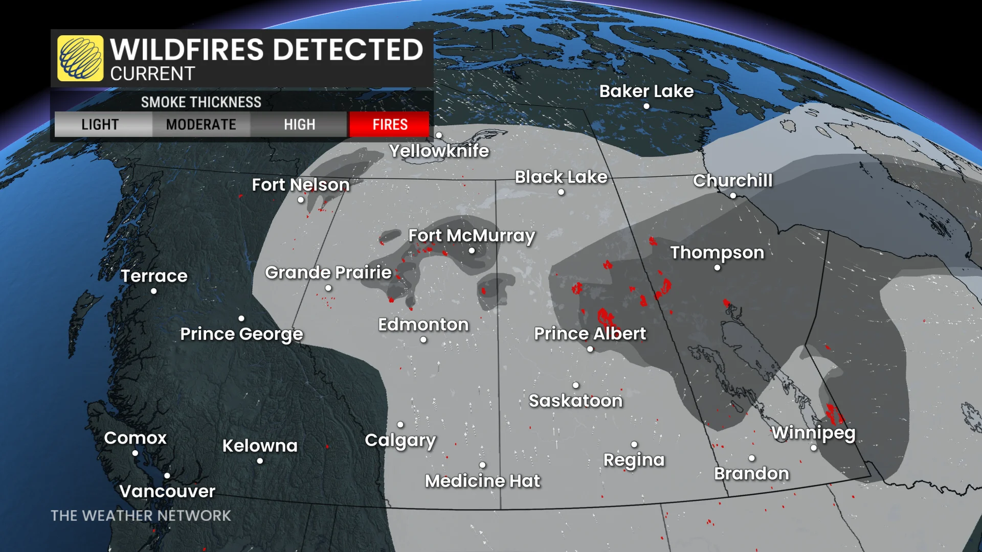
Much of the Prairies continue to grapple with dangerous, significant wildfires, and upcoming weather conditions are likely to play a critical role in fire management over the coming days.
DON'T MISS: Get the latest wildfire news and safety tips to help you stay safe
Manitoba has declared a provincewide state of emergency as wildfires intensify. Roughly 17,000 residents will evacuate from northern and eastern regions.
In Saskatchewan, the Lac La Ronge Indian Band, Peter Ballantyne Cree Nation and Montreal Lake Cree Nation declared a joint state of emergency on Wednesday, with additional support sought as the early wildfire season intensifies rapidly.
RELATED: First Nations plead for help as wildfires devastate northern Sask.
Extreme heat, low humidity, and strong winds have fueled a wildfire threat in northern Alberta, forcing hundreds of residents to leave their homes earlier this week. A mandatory evacuation order was issued for Chipewyan Lake.
Weather forecast not helping
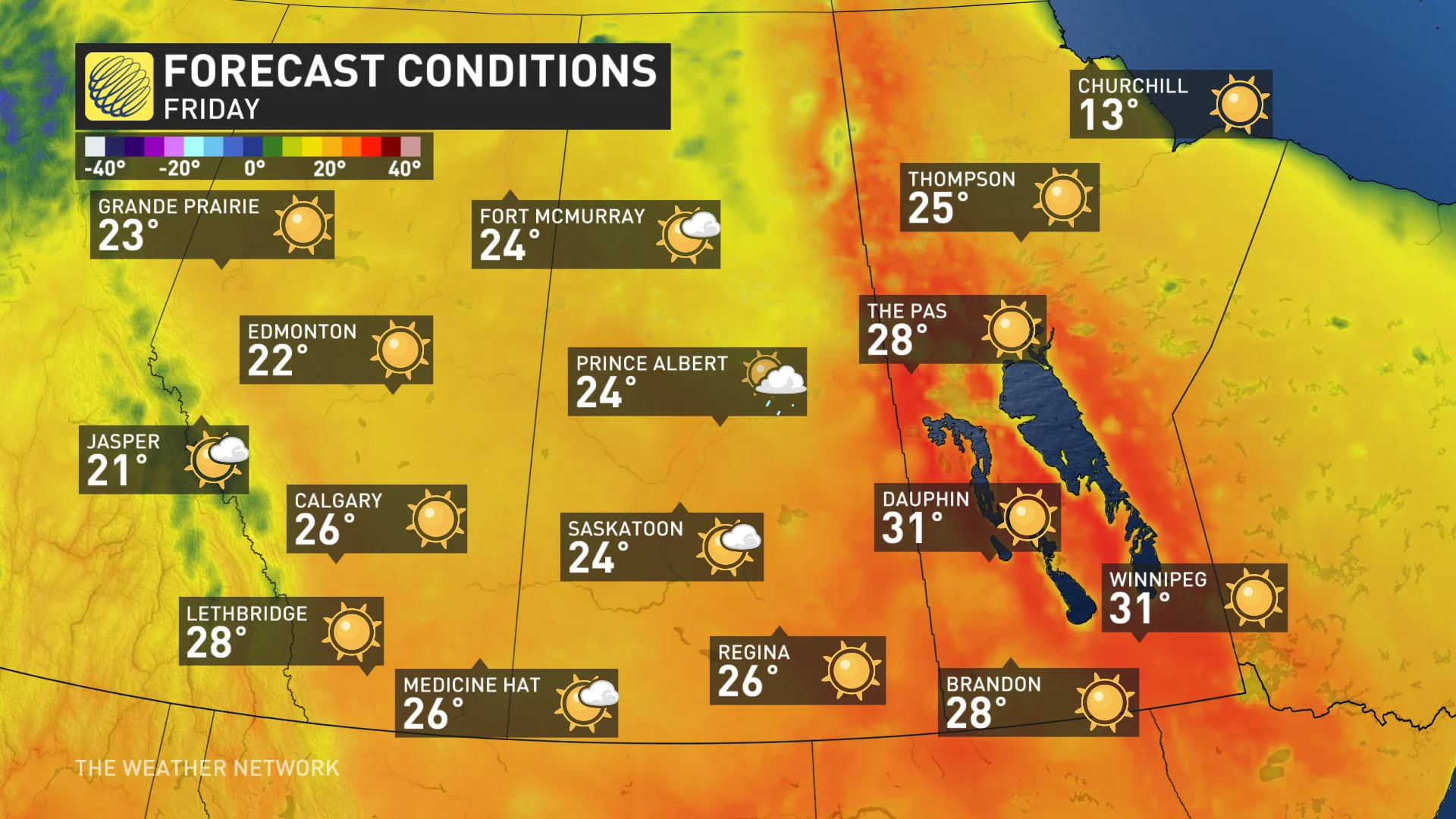
Hot temperatures are expected to persist in Alberta and Saskatchewan on Thursday, expanding into Manitoba by Friday. Heat warnings were issued as temperatures soar into the 30s for some.
A thunderstorm threat in Alberta on Thursday could spark new fires, as well, as widespread rainfall is not anticipated with the storms that develop.
DON'T MISS: The Weather Network's wildfire hub
Winds and lightning could fuel the wildfire growth
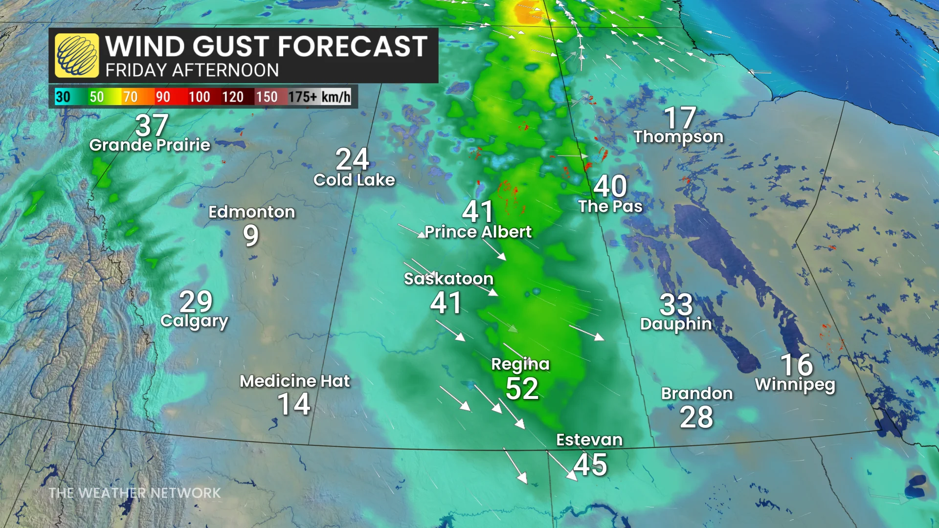
By Friday, as the trough shifts east, isolated thunderstorms are forecast for eastern Saskatchewan. While rainfall will once again be minimal, lightning strikes remain a risk, albeit fewer in number.
Wind gusts are expected to strengthen along the trough, potentially fueling wildfire growth in the coming days.
Cooler temperatures will begin arriving in Alberta on Friday, with a more noticeable cooldown for the eastern Prairies expected late in the weekend and into Monday.
However, the combination of limited rainfall, elevated temperatures, and increasing winds means the fire danger rating will stay high to extreme throughout the weekend.
SEE ALSO: Satellites capture thick smoke pouring out of Canadian blazes
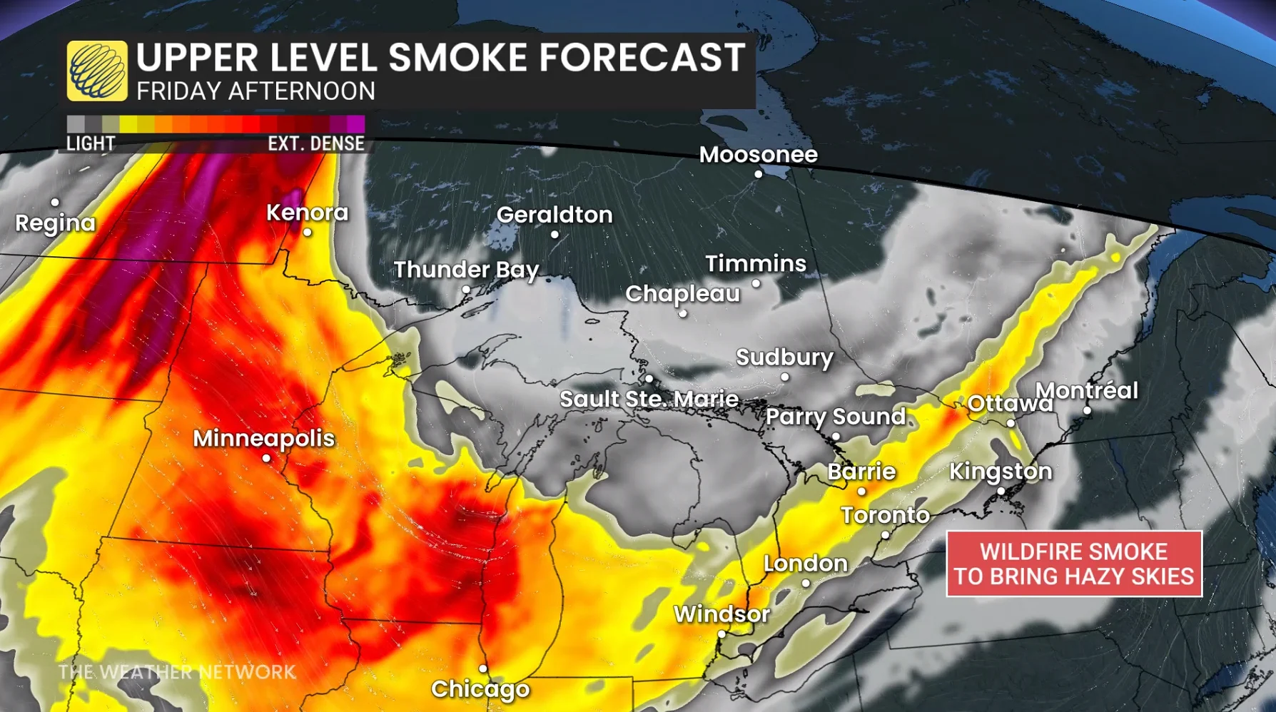
Widespread wildfire smoke is also likely to increase, affecting the Prairies and other areas of Canada as upper-level winds distribute the smoke. Residents are advised to monitor air quality conditions closely, and take necessary precautions as needed.
Start of June offers more help with wildfire concerns
The weather for the first week of June features less heat and more rain than we initially expected.
This will include some much needed rain from the central Rockies, across central and northern Alberta, northern Saskatchewan and Manitoba, and into adjacent parts of the Northwest Territories. A wetter pattern is also expected across parts of southern Manitoba as we turn the page on the new month.
WATCH BELOW: Poor drought outlook in southern Alberta has some taking action
Stay with The Weather Network for more information and updates on your weather across the Prairies.