
Driver's alert: Freezing rain may briefly impact travel in Ottawa area Friday
Icy risk developing for parts of eastern Ontario Friday morning, Ottawa included
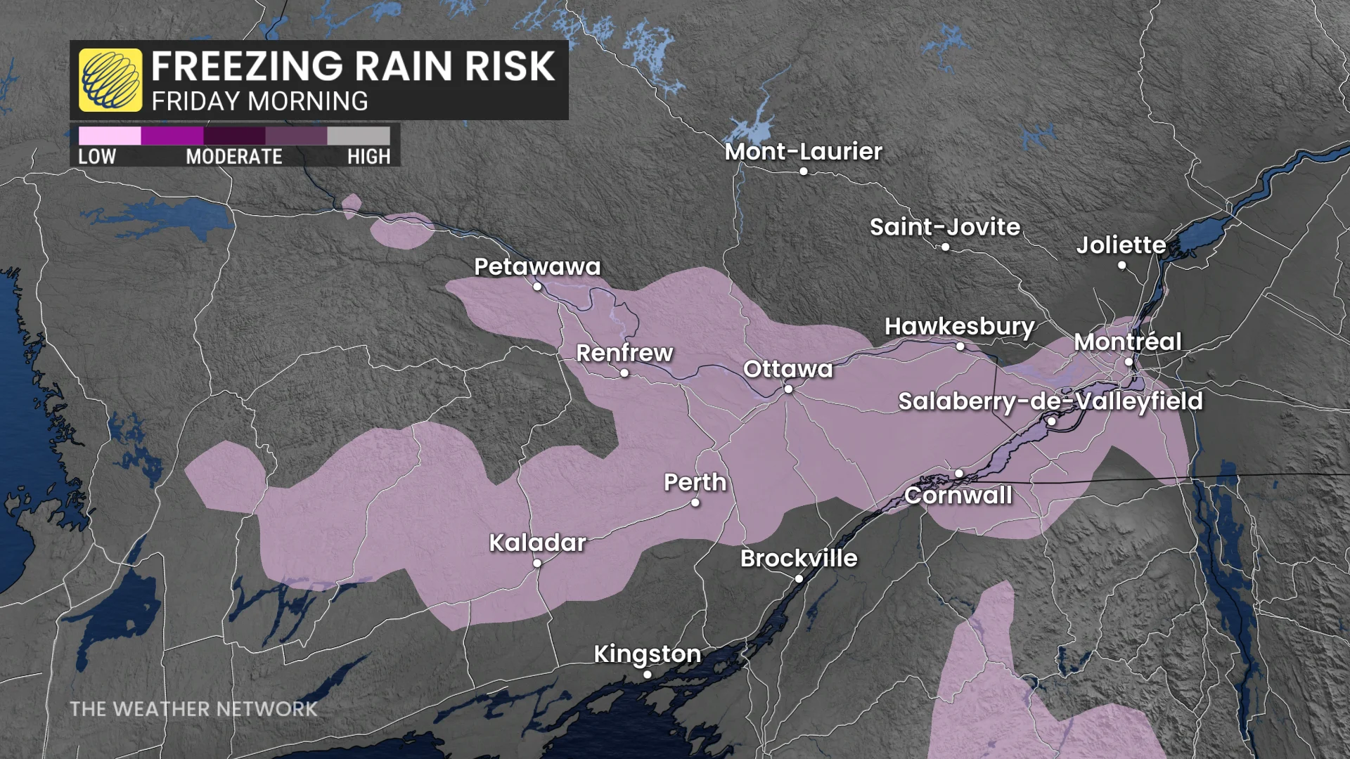
Drivers beware: A freezing rain risk moves into Ottawa area early Friday morning, with slick roads possible ahead of the commute.
DON'T MISS: Polar vortex disrupted: Rare, atmospheric shift could enhance winter’s path
A cold front will slide southward overnight Thursday, creating a brief risk of freezing rain in the Ottawa area early Friday. Light moisture tracking down the Ottawa Valley could lead to icy conditions during the morning commute.

This week, temperatures across Ontario have been slightly below seasonal, with overnight lows dipping a few degrees below freezing. As cold air settles in the valleys overnight, it increases the chance of freezing rain as moisture arrives.
RELATED: Freezing rain is the 'worst' type of precipitation. Here's why
The areas most likely to see impacts include eastern Ontario from Arnprior to Cornwall, the Richelieu Valley in Quebec, and Highway 7 near Perth, Ont.

Drivers traveling overnight Thursday into Friday morning are urged to exercise caution due to the potential for slick roads.
Slippery sidewalks pose a risk of falls or injuries for pedestrians, as well. Plan commutes accordingly and take extra care on roads and walkways.
By mid- to late morning Friday, rising temperatures above freezing should reduce the risk of icy conditions.
WATCH: Why freezing rain is the WORST type of precipitation
Be sure to check back for the latest weather updates across Ontario.