Drop in air quality returns to Ontario with wildfire smoke, storm risk
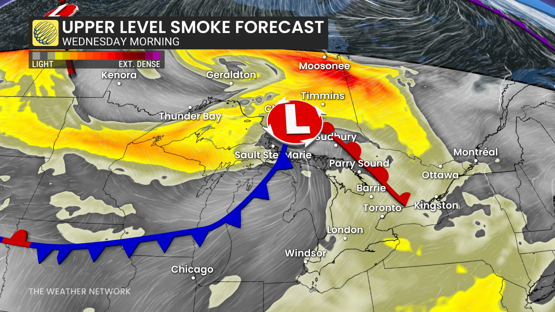
Another wind shift arriving Wednesday morning will place southern Ontario directly downwind from the wildfires, resulting in another bout of upper-level smoke in the air
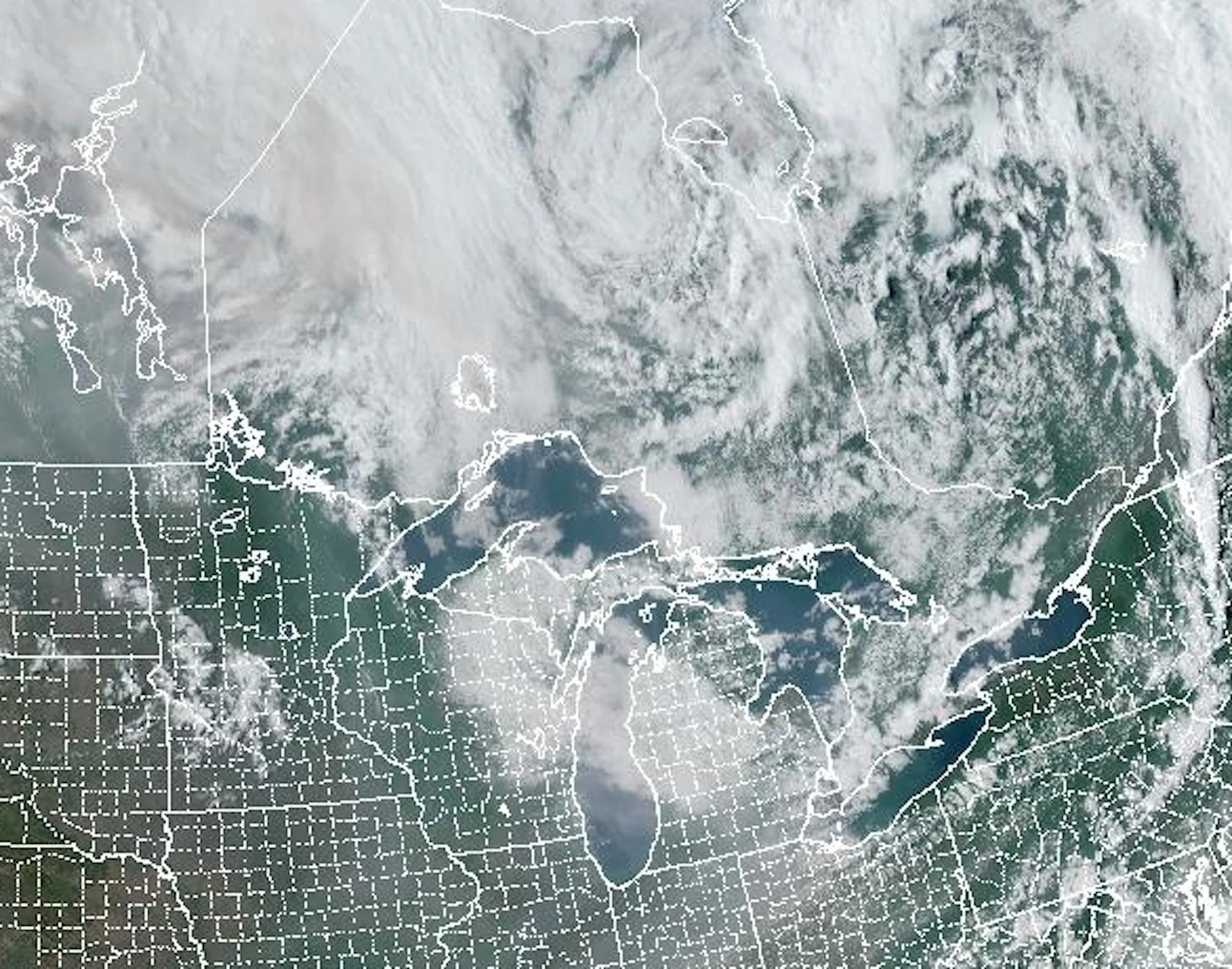
Ontario will welcome back wildfire smoke and the threat of thunderstorms on Wednesday.
With more wildfire smoke returning, that means we're on track for reduced air quality in southern Ontario on Wednesday, but it won't be as poor as what the province experienced last week and weekend.
DON’T MISS: The current wildfire season could match Canada's most destructive year
While air quality won't be as degraded, the return of reduced air quality could prove irritating to vulnerable people, such as those living with chronic respiratory problems. Take precautions to protect yourself from the smoky skies.
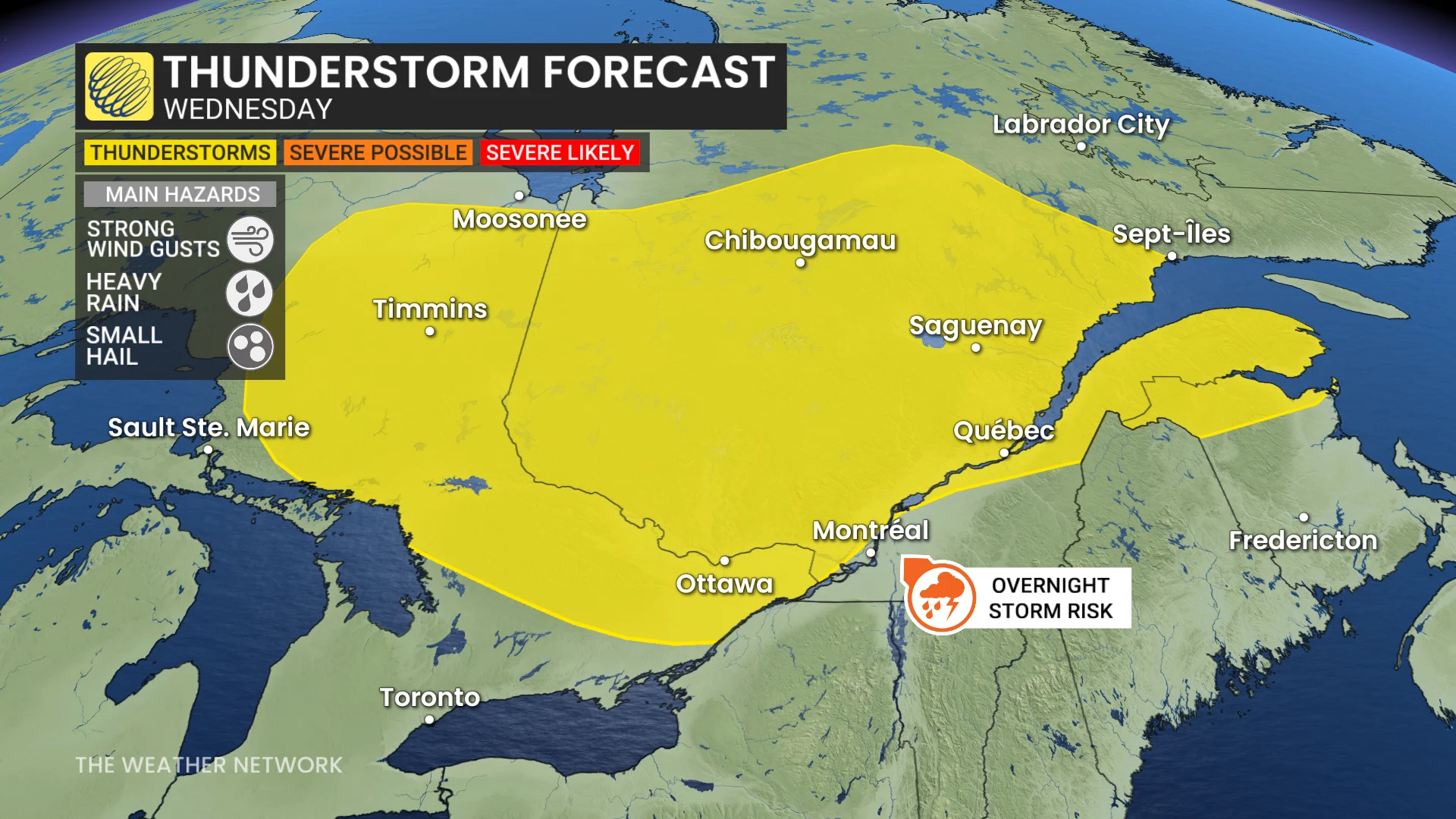
With a risk of thunderstorms for parts of southern Ontario, be sure to keep an eye on local weather alerts for your area before heading out, and be prepared to adjust any outdoor plans as conditions change.
Wednesday and Thursday: Poor air quality comes with wildfire smoke, accompanied by storm threat
Smoke from the wildfires in the West is on track to move into southern Ontario on Wednesday morning.
The smoke won't be as prevalent as it was last Thursday, when the air quality reached the high-risk category, with Wednesday seeing more of a moderate risk to air quality.
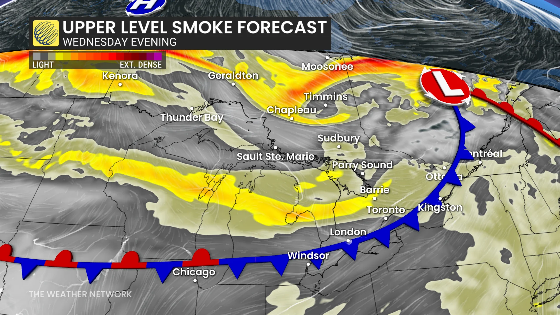
A secondary bout of wildfire smoke is expected to move in the evening and overnight.
As well, showers and thunderstorms are expected to move into central and eastern Ontario on Wednesday, there could even be some stronger storms.
But wildfire smoke and a dry atmosphere will limit the severity of the storms. There is a smaller chance of storms in the Greater Toronto Area (GTA), but they would just be of the garden variety type.
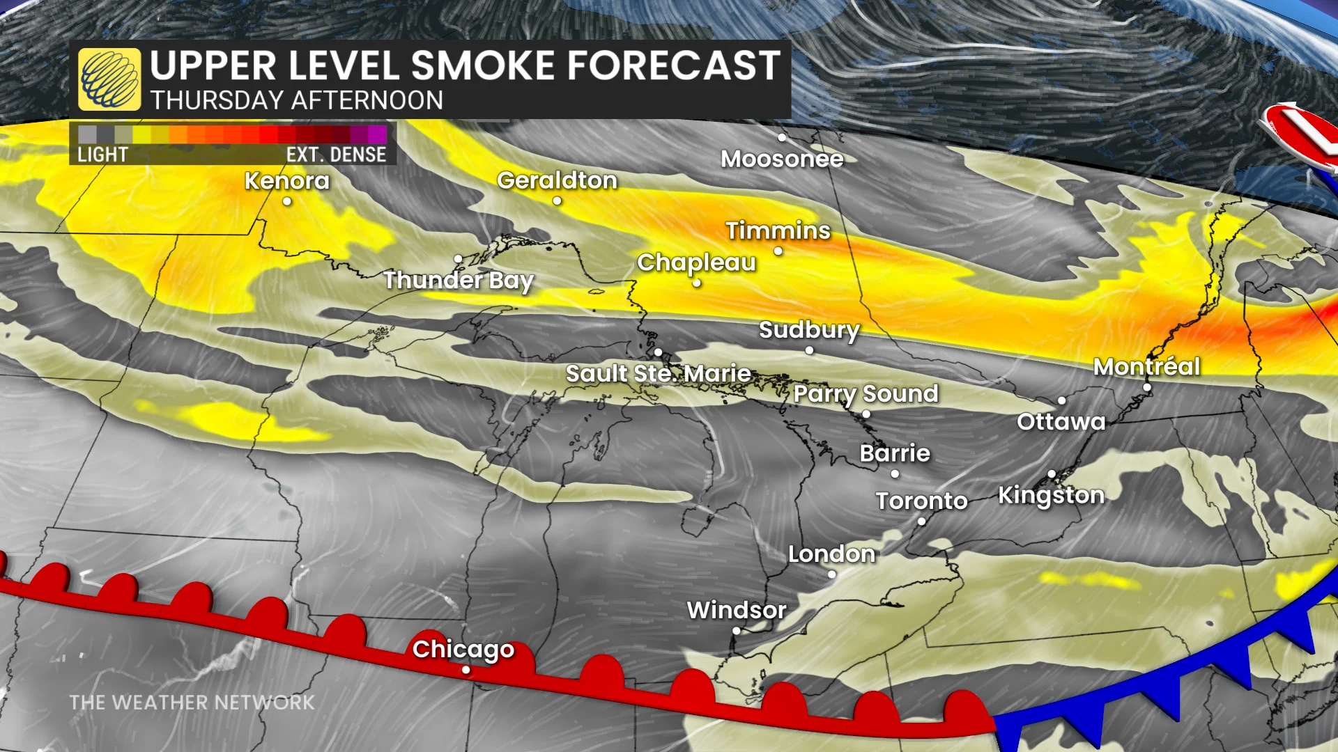
For Thursday and beyond, a northwesterly flow is expected to continue through the rest of the week, potentially bringing multiple periods of lower air quality.
Much cooler conditions will push back into the region for Thursday and Friday--except for across southwestern Ontario--with a threat for showers, but both days should be mostly rain-free.
Friday will be rather chilly in the Greater Toronto and Hamilton Area (GTHA), thanks to the east wind off Lake Ontario holding temperatures to the mid-to-upper teens.
For the weekend, Saturday appears to have the highest risk for rain. Sunday looks like the better day of the weekend--cooler than seasonal, but mostly dry.
Stay tuned to The Weather Network on Wednesday for more information on Ontario's long-range forecast in The Weekender!
Header satellite image courtesy of NOAA.