
See what may jeopardize your weekend weather in southern Ontario

Dry conditions and abundant sunshine. Some pleasant weekend weather finally graces southern Ontario
Last weekend felt like April across much of southern Ontario. Will this weekend bring warmer weather with the arrival of meteorological summer?
Please read on to find out what you can expect from the first full weekend of June.
DON'T MISS: The Weather Network's exclusive summer 2025 forecast
While this weekend won’t be as warm as what we saw on Tuesday and Wednesday, it will be much warmer than last weekend.
This weekend will also include a return to dry weather with some sunshine. Conditions for most of the weekend will be ideal for getting outside to enjoy a wide variety of activities.
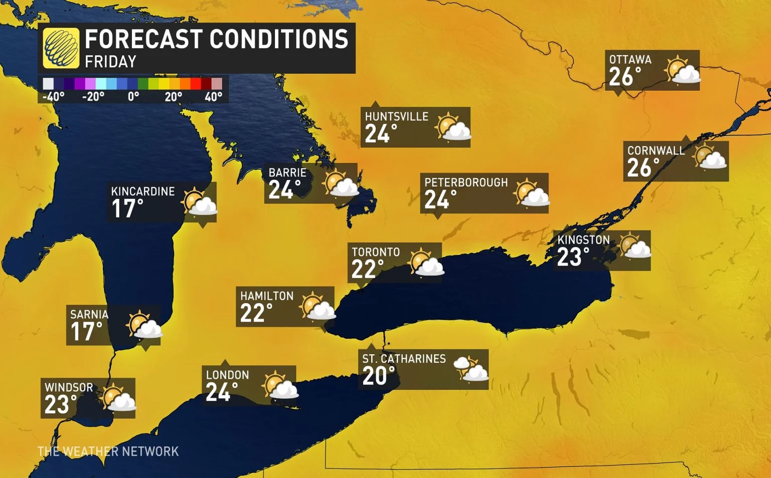
Sunshine and seasonal: Ideal start to the weekend on Friday
We will kick off the weather with pleasant early summer weather Friday with a mix of clouds and hazy sunshine and near seasonal temperatures.
Temperatures will actually be a couple degrees warmer across cottage country than across most of the Greater Toronto area as northern areas will see more sunshine during the afternoon.
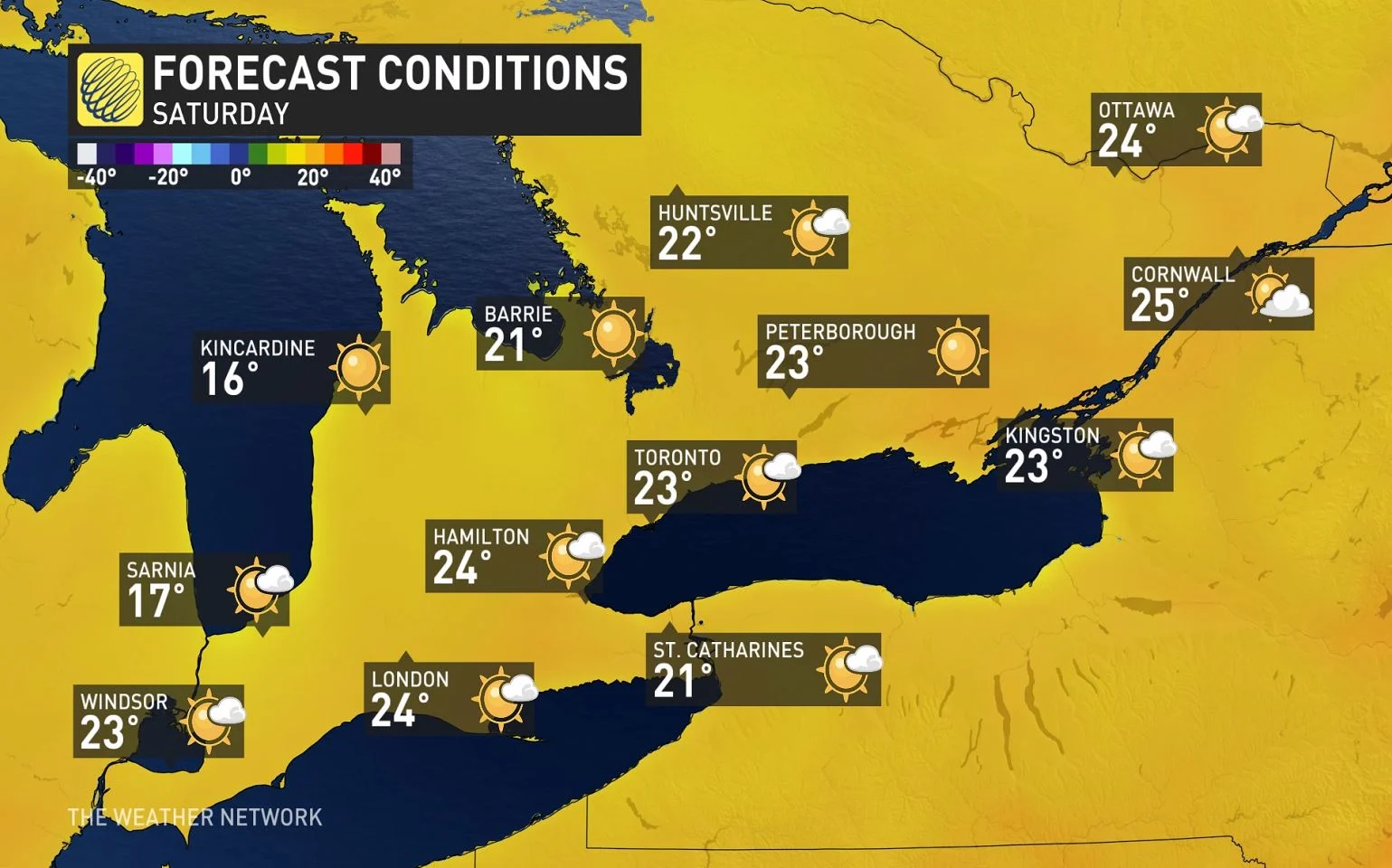
Wildfire smoke may impact Saturday skies
Saturday will be a pleasant day with abundant sunshine and near seasonal temperatures for early June. However, the sky will be hazy due to the smoke from western Canada wildfires. It will also be noticeably cooler near Lake Huron and Georgian Bay with a northwest wind blowing in off of the chilly waters of the lake.
MUST SEE: Your allergies could flare up in the coming weeks. Here's why
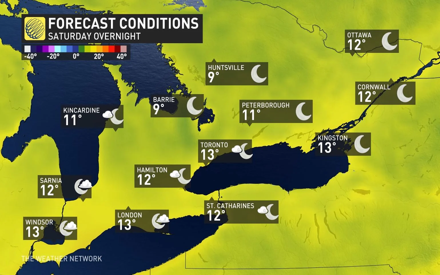
Saturday night will be partly cloudy and cool with single digits across cottage country.
East wind cools temperatures for Sunday
Sunday will start off with some hazy sunshine, especially to the north of Toronto. However, we will see increasing clouds during the day with a threat for showers during the afternoon, especially across southwestern Ontario and the Niagara region.
During Sunday will also have a brisk east wind and that will keep temperatures several degrees cooler near the west end of Lake Ontario, including much of the Greater Toronto Area (GTA).

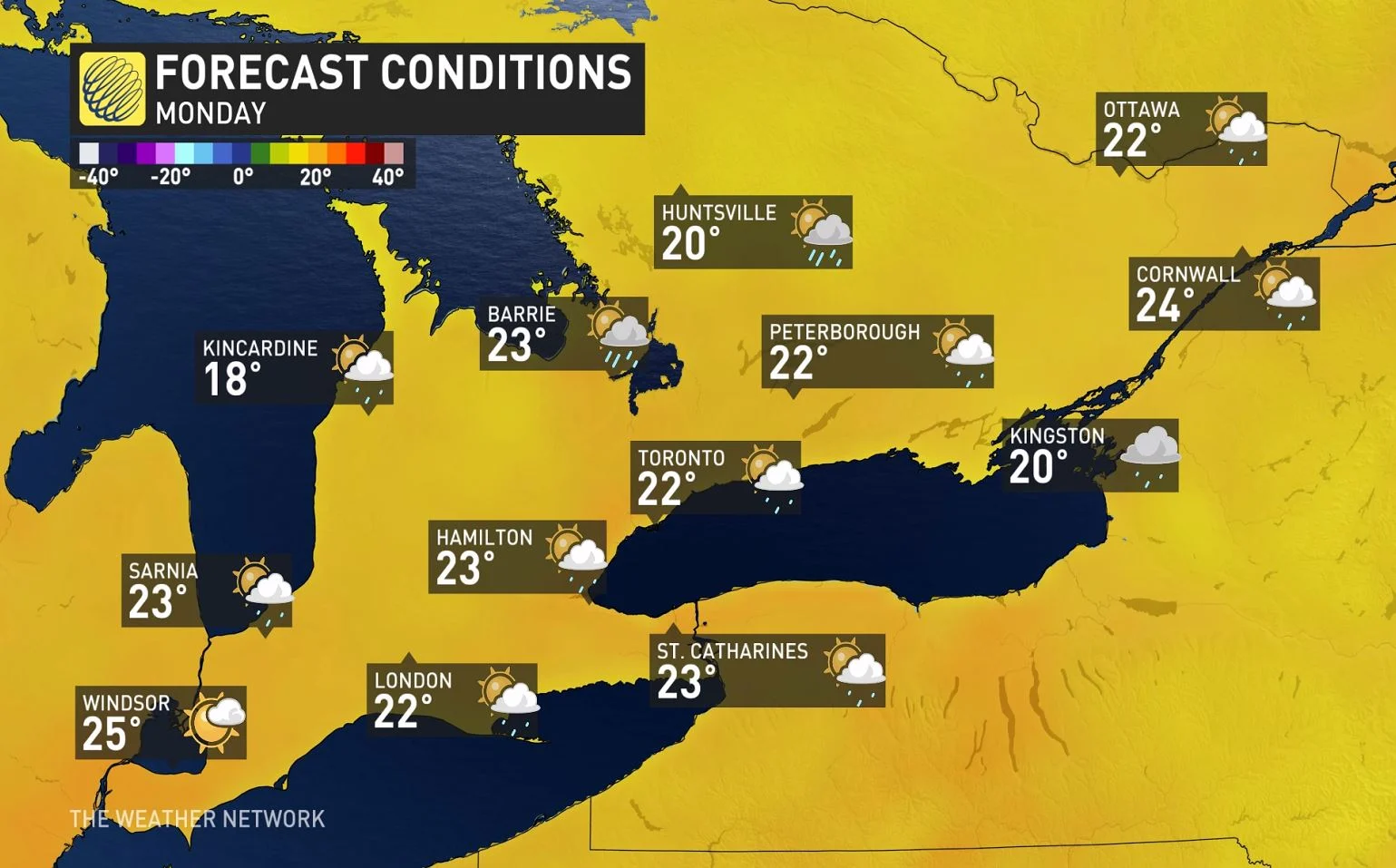
Early next week, a slow moving system will bring occasional showers and possibly a thunderstorm across southern Ontario, but we will also have some sunny breaks.
Some unsettled weather gives way to more summer-like weather next week
The threat for passing showers will continue through Tuesday and temperatures will be on the cool side of seasonal.
SEE ALSO: Odd weather terms you may hear in the spring and summer
However, drier weather is expected for the second half of next week with a gradual warming trend. At this point we expect near seasonal temperatures late next week with high temperatures returning to the mid 20s by the end of the week.