Warnings issued as Hurricane Erin remains a powerful Category 3
Erin packed maximum winds of 205 km/h during the day Sunday
Erin remains a powerful major hurricane on Sunday as it churns through the southwestern Atlantic Ocean.
While its winds are down from Saturday’s peak as a scale-topping Category 5, Hurricane Erin continues to grow in size and could restrengthen soon.
Anyone visiting The Bahamas, Bermuda, the U.S. East Coast, and residents across Atlantic Canada should closely monitor the track of this system heading into the upcoming week. Rough seas and rip currents will extend far away from Erin’s path.
DON’T MISS: An inside look at Hurricane Erin’s astounding rise to Category 5
Erin still a major hurricane
Saturday’s astonishing bout of rapid intensification made Hurricane Erin the fifth Category 5 storm we’ve seen in the Atlantic since 2022.
The storm spent about nine hours with peak intensity of 260 km/h winds before winds slackened a bit as an eyewall replacement cycle began.
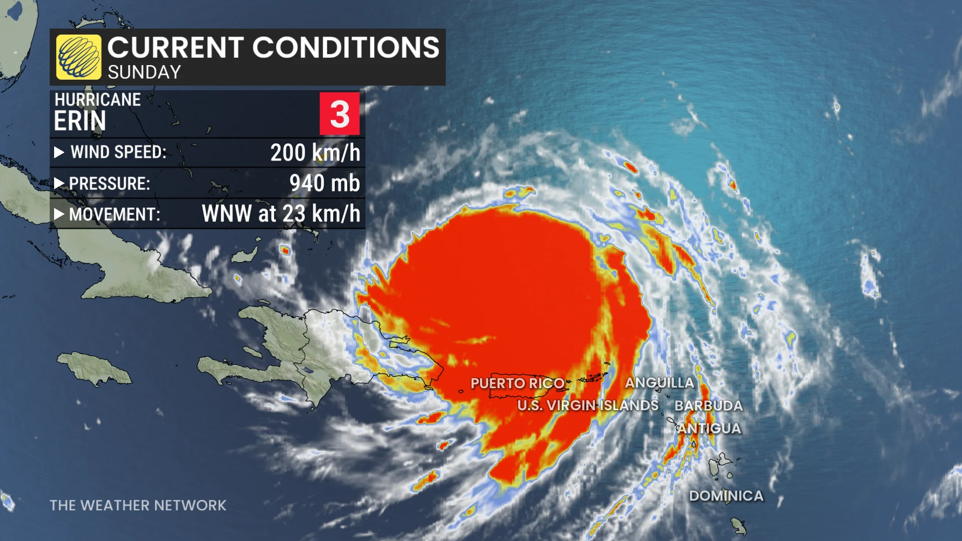
Forecasters with the U.S. National Hurricane Center (NHC) found that Erin remained a powerful Category 3 major hurricane on Sunday, with maximum sustained winds of 205 km/h at 2:00 p.m. EDT.
Hurricane Erin is expanding in size. Hurricane-force winds extend outward up to 35 km from the centre, and tropical-storm-force winds extend outward up to 335 kilometres. The NHC expects Erin to double or triple its current size over the coming days.
A ridge of high pressure over the central Atlantic will force Erin to slowly recurve as it heads north through the upcoming workweek, avoiding a direct landfall in the U.S. or Bermuda.

SEE ALSO: La Niña watch issued for this winter as key factors signal change
The hurricane’s outer bands are affecting islands in the southwestern Atlantic, prompting tropical storm warnings for the Turks and Caicos Islands, as well as the southeast Bahamas.
Additionally, flooding rains and gusty winds are occurring over Puerto Rico and the Virgin Islands. Localized flooding, along with landslides or mudslides, are possible.
Any hurricane recurving close to North America warrants close monitoring in Atlantic Canada. It’s possible that the system may make a close approach to southeastern Newfoundland, especially the Avalon Peninsula, late next week.
Rip currents a major hazard
Regardless of Erin's track, rough surf and rip currents will pose a significant hazard to beaches throughout Puerto Rico on Sunday, and then the Bahamas, Bermuda, eastern U.S. and Atlantic Canada during the early and middle part of this week.
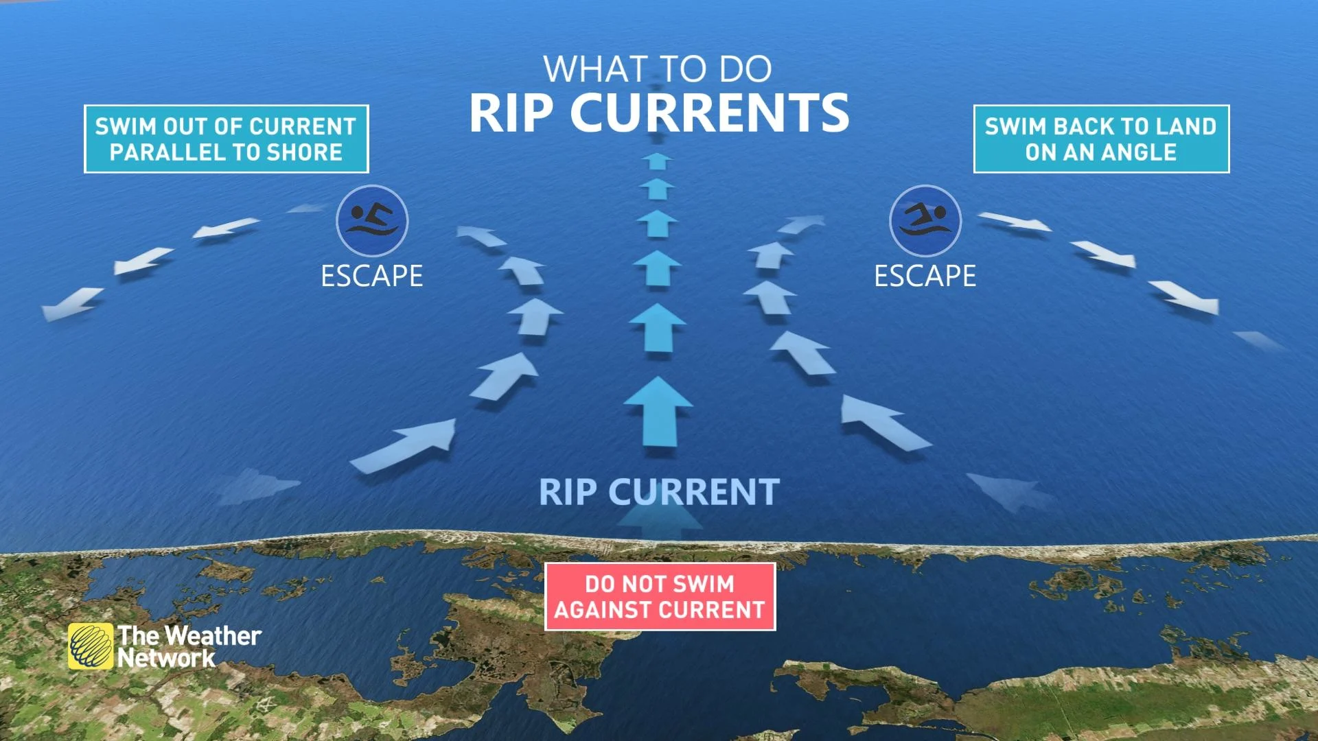
Rip currents form when waves hit the beach head-on, creating narrow currents of water that rush back out to sea.
STAY SAFE: Rip currents are a natural hazard along coasts – here’s how to spot them
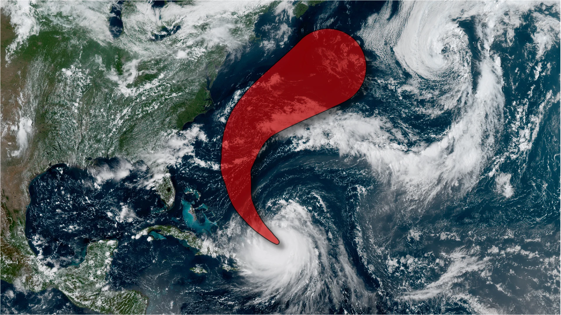
It is highly uncertain at this time if or what impacts to the U.S. East Coast could be. However, its track has nudged westward, raising concern for a closer brush with the U.S. East Coast. Bermuda and North Carolina's Outer Banks are both highlighted as potential, mid-week impact zones.
A notable westward shift in model guidance is increasing uncertainty for the U.S. East Coast, and as the storm expands in size, rough seas and rip currents will reach a much broader area of the Western Atlantic.
Always heed the advice and orders of local officials and stay out of the water if there’s a threat for rip currents. Don’t panic if you’re ever caught in a rip current. If you can’t swim, calmly signal for help and tread water until assistance arrives. Swimmers should swim parallel to the beach until you’re out of the rip current, then swim back to shore.