Excess moisture fuels Ontario severe storm, flood risks Monday
Beware the risk for localized flooding across a wide swath of Ontario on Monday as thunderstorms tap into a very humid atmosphere
Prepare for a stormy Monday across a wide swath of Ontario as a rich reserve of humidity streams over the province.
Localized flooding is the greatest concern with Monday’s storms. Strong wind gusts and large hail are also possible in the stronger thunderstorms that develop.
Make sure to check the radar before heading out and, as always, stay aware of severe weather watches and warnings in your area.
DON’T MISS: Sunny, stormy, a chance of snow? Your Canada Day 2025 forecast
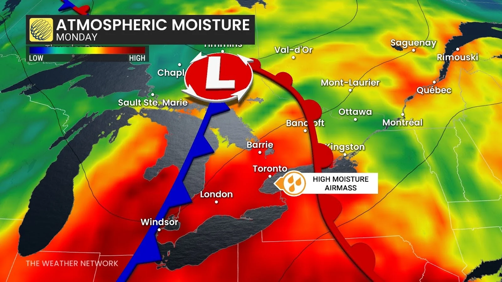
High humidity fuels localized flooding risk
A warm front sliding into Ontario to start the week will drag a very humid airmass north of the border. Atmospheric moisture levels are twice as high as normal for this time of year—providing a deep reservoir for thunderstorms to tap into and produce drenching rains.
Muggy air and daytime heating will build up the energy needed to fuel thunderstorms. Expect thunderstorms to develop along the warm front Monday afternoon from southwestern Ontario to Georgian Bay.
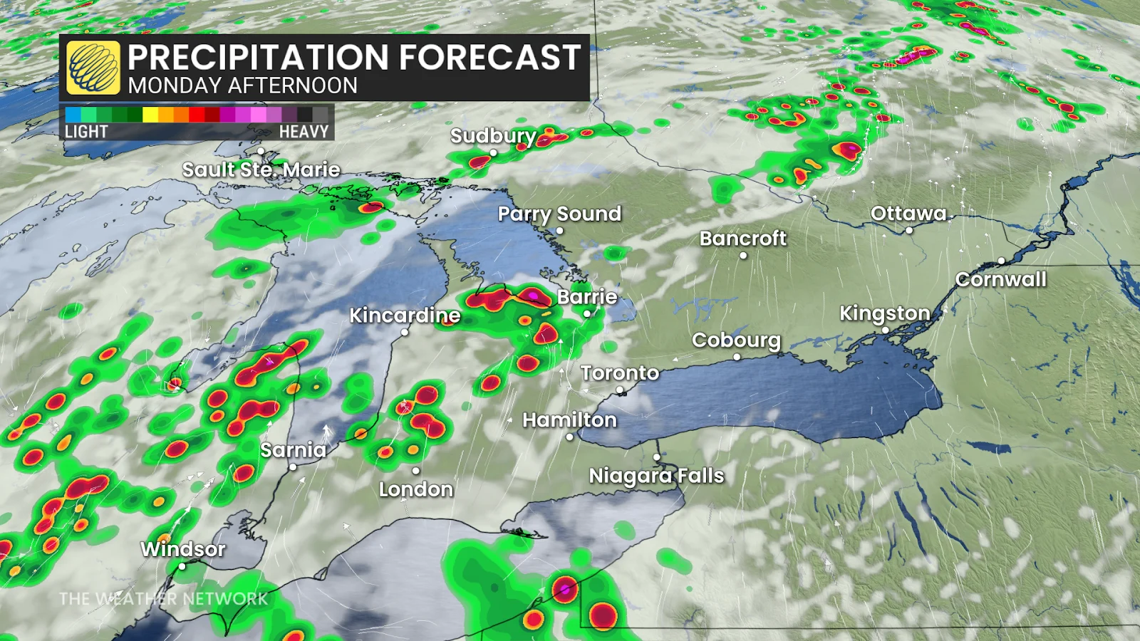
Folks across the Greater Toronto Area (GTA) should escape the storms in the afternoon, but activity will track into the region by Monday evening.
Monday’s storms could easily reach severe limits across much of Ontario.The greatest risk will be torrential downpours leading to the potential for localized flooding. Thunderstorms in such a humid environment are notorious for producing very heavy rain in short order.
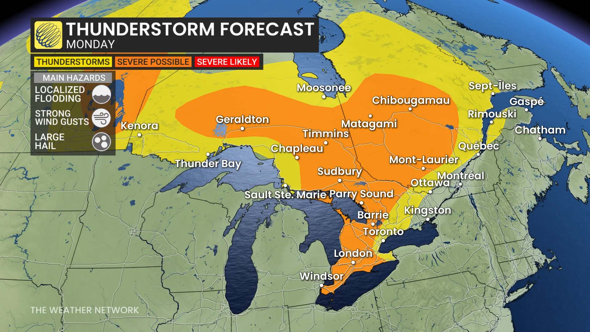
Large hail is possible across cottage country and into northeastern Ontario, with hailstones potentially reaching the size of quarters. Severe thunderstorms will also be capable of producing strong wind gusts.
Tuesday storm risk pushes east
A cold front pushing into this unstable airmass will trigger additional thunderstorms into early Tuesday, bringing rumbles of thunder and heavy rainfall to the GTA, the Niagara peninsula, cottage country, and the National Capital Region through Tuesday morning.
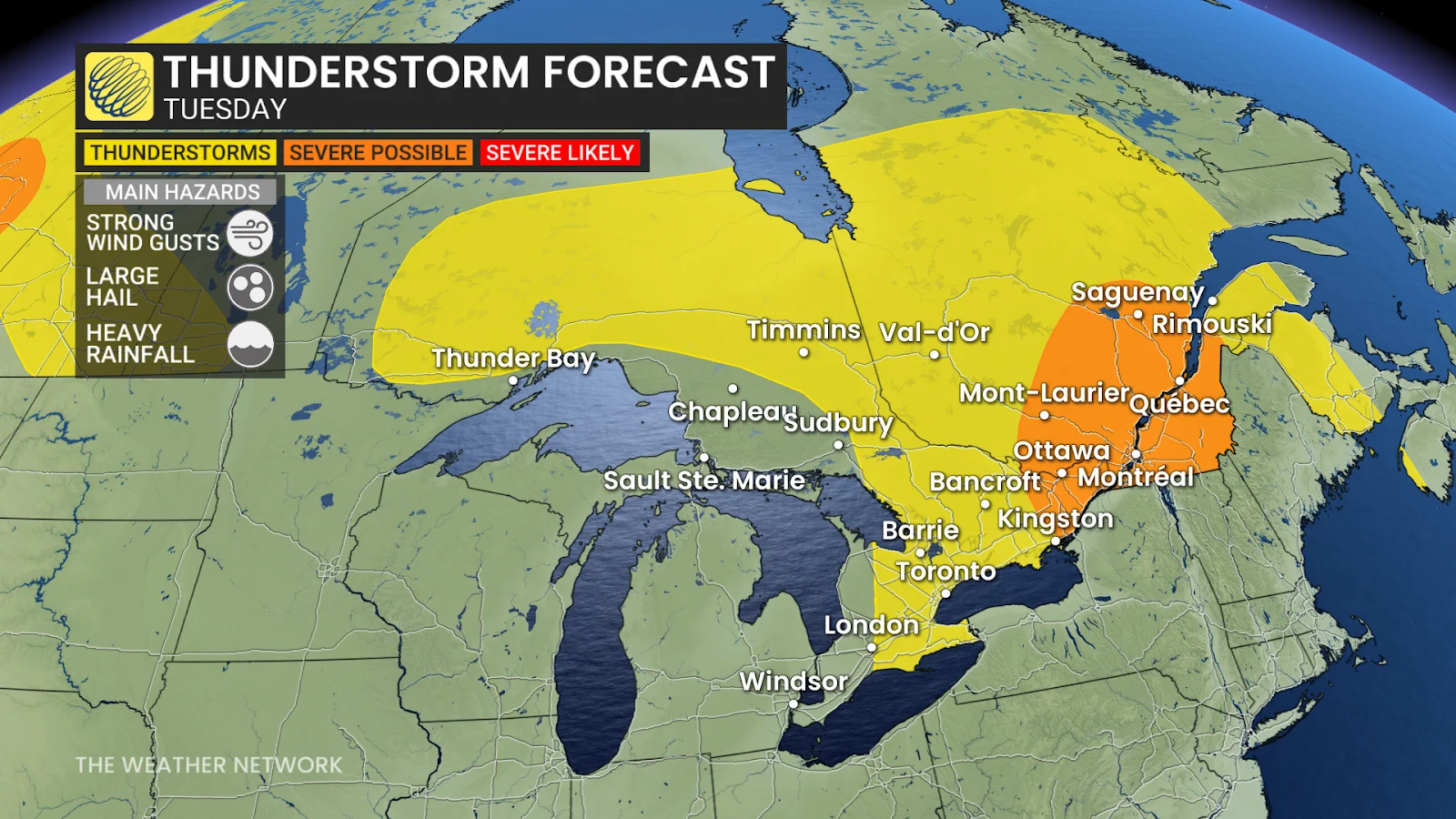
Strong to severe thunderstorms are possible in eastern Ontario, including Ottawa, as well as much of southern Quebec heading into Tuesday afternoon. These storms will be capable of strong wind gusts, large hail, and heavy rainfall.
The storm risk will greatly diminish after 4:00 p.m. in Ottawa, and the fireworks will go off under ideal conditions with temperatures in the low 20s and light winds.
Severe weather safety
Lots of folks have plans to spend time outdoors during the long Canada Day weekend. Severe weather safety is paramount when you’re outdoors enjoying the summer weather.
Remember: if you hear thunder, you’re close enough to be struck by lightning.
Pay close attention to severe weather watches and warnings in your area. Stay close to safe shelter in case a thunderstorm approaches your location. Strong wind gusts can knock down trees and power lines. Large hail can cause serious injury.
Never try to drive across a flooded roadway. It’s impossible to tell how deep the water is until it’s too late. It only takes a small amount of water to cause a vehicle to lose grip with the roadway and become stranded. Just 15-30 cm of moving water can carry a vehicle away.
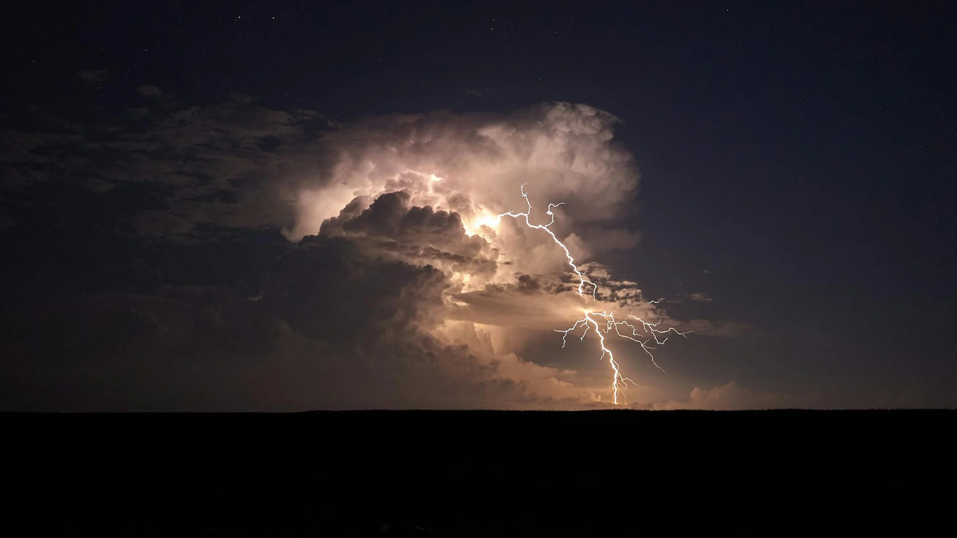
Header image courtesy of Pexels.