Extreme heat sends mercury climbing in Ontario, comes with storm threat
The heat is on in southern Ontario for the first weekend of July as a tumbling ridge ushers in hot, muggy air, accompanied by a risk of scattered thunderstorms
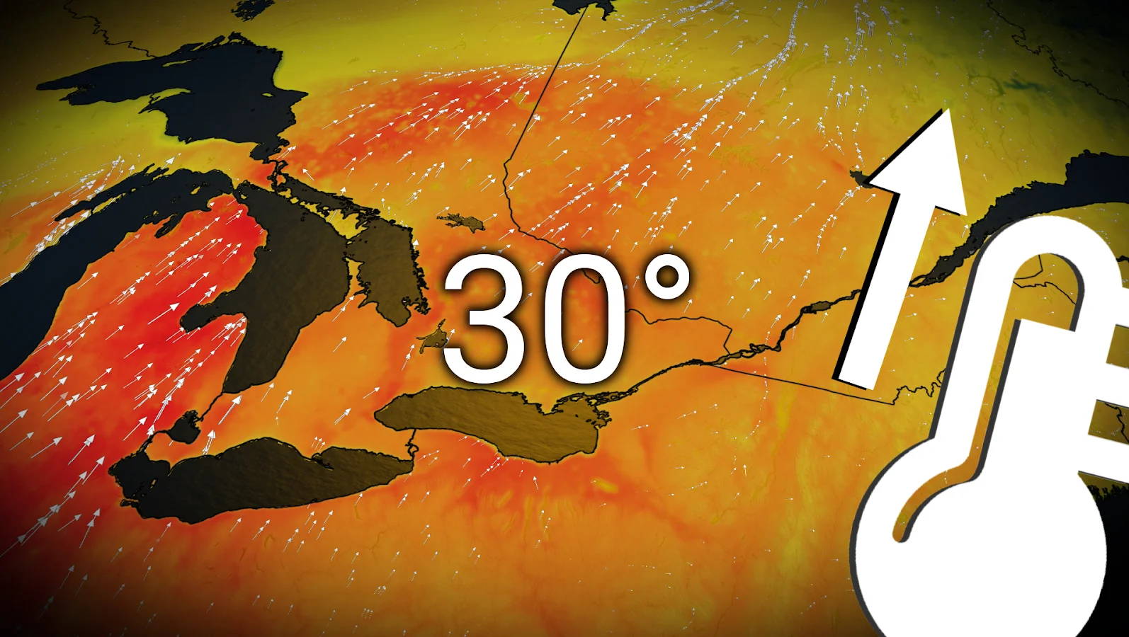
July didn't waste any time in bringing the heat to southern Ontario as warm, southerly winds will drag a humid air mass into the region this weekend.
The heat event will persist Saturday and Sunday, with temperatures expected to climb into the 30s while the humidex approaches, hits or exceeds 40. Overnight lows won't offer much in the way of relief, either. Coming with the heat will be a higher thunderstorm risk on Sunday, so make sure to stay weather-aware if you have any plans.
DON’T MISS: 'Feel' miserable out? How our bodies react when humidex values soar
Take it easy in the hot weather—high heat and humidity can affect even healthy individuals. Keep an eye on the radar as you go about your day and pay attention to watches and warnings in your area.
Heat warnings in effect this weekend
Heat warnings blanket southern Ontario for Saturday and Sunday.
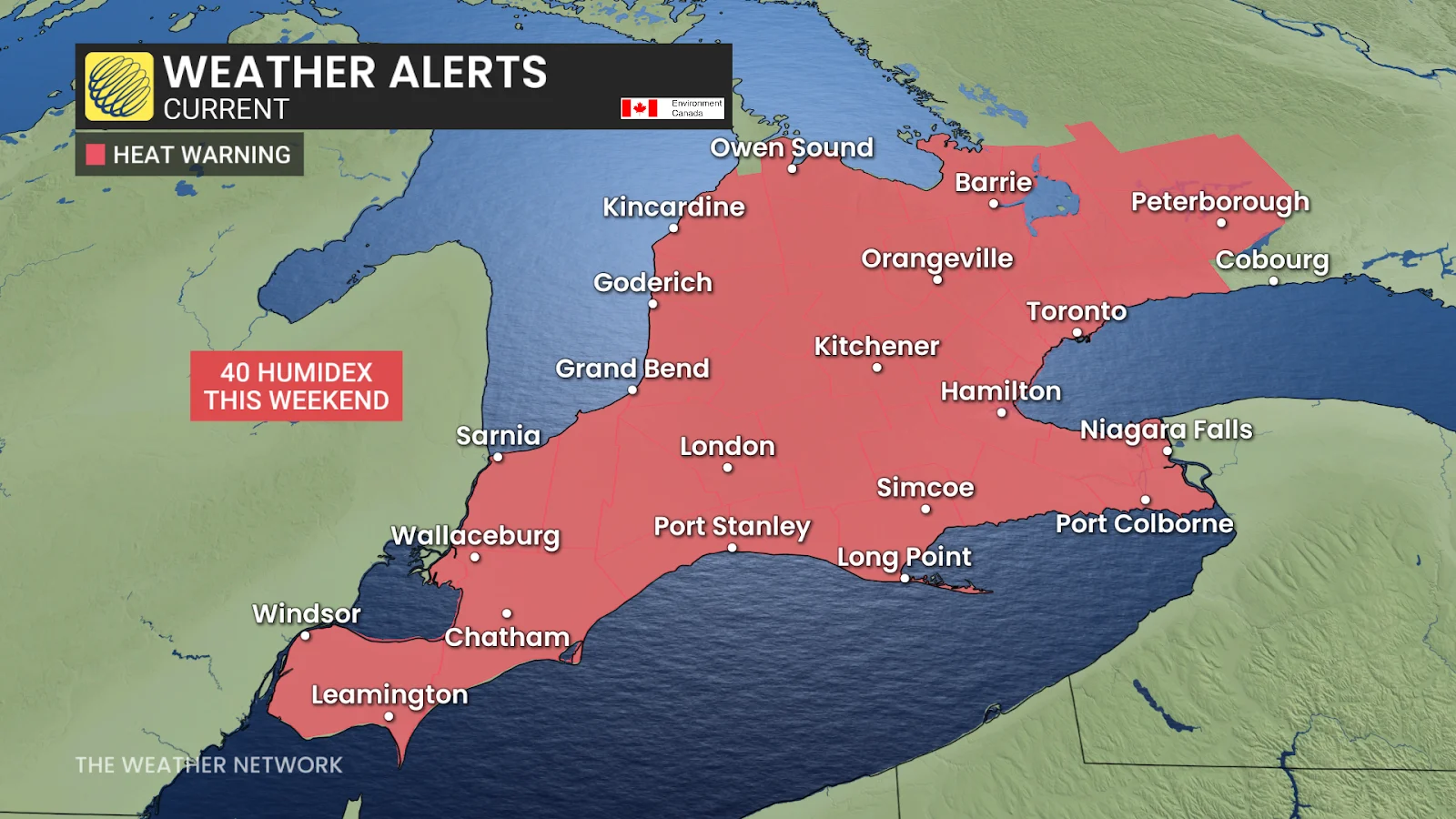
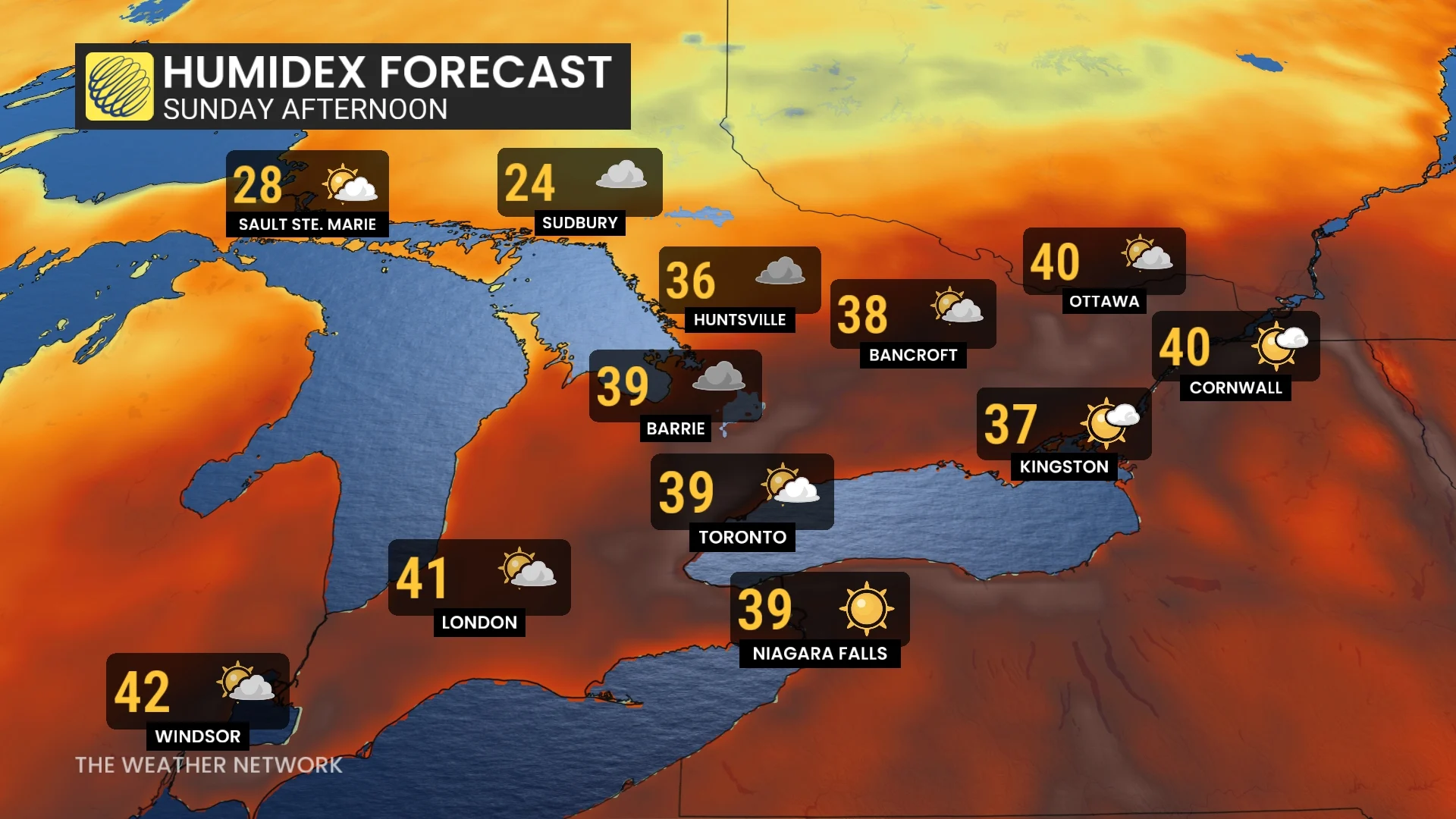
Folks with chronic health conditions and those living without air conditioning may struggle this weekend as feels-like values climb to 40 or higher in many locations. Sunday will feel like 42 in Windsor, 39 in Toronto, and 40 in Ottawa.
In addition to the heat of the day, the mugginess will keep overnight temperatures on the warm side, precluding the ability to find meaningful relief after sundown.
Hot weather safety tips
Drink plenty of water. Avoid caffeine and alcohol, which can be dehydrating.
Avoid direct sunlight, especially during peak hours and when the UV rating is high.
Wear lightweight, loose-fitting clothing.
Use air conditioning when possible. If you do not have access to air conditioning, consider visiting a cooling centre, a shopping centre, or a public library.
Check on elderly relatives and other vulnerable neighbours.
Avoid strenuous activities during the hottest parts of the day.
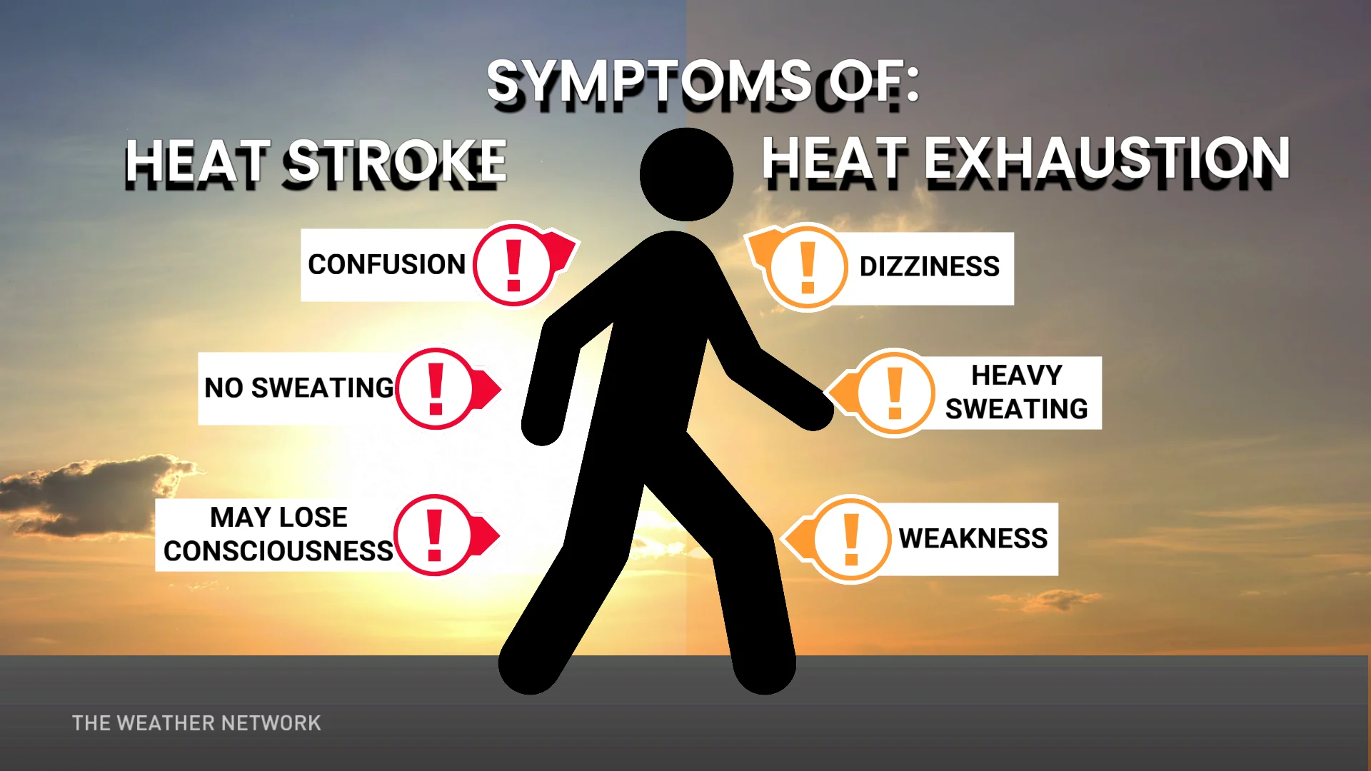
If you experience symptoms of heat-related illnesses like dizziness, nausea, or confusion, seek medical attention.
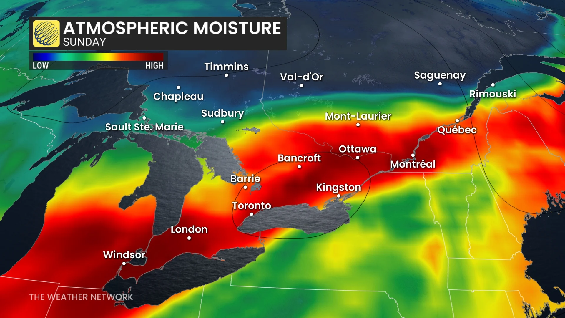
Thunderstorm risk builds with the heat
Daytime heating and high humidity will fuel the instability needed for a risk for thunderstorms on Saturday afternoon.
JULY OUTLOOK: The heat is on! Where will Canada sizzle the most in July?
A cold front pushing into southern Ontario on Sunday could trigger severe thunderstorms across the region.
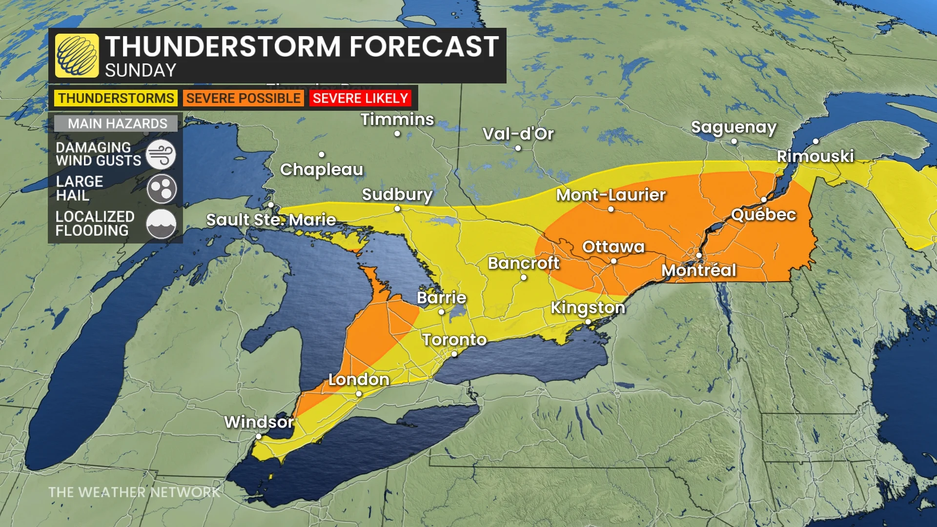
The exact location and strength of these storms is still uncertain—but given the instability and the arrival of the front, the severe potential will exist around the shorelines of Lake Huron and southern Georgian Bay, as well as in eastern Ontario and western Quebec.
Hail, damaging wind gusts and heavy rain will be possible in severe storms.
Non-severe storms will be possible in southern Ontario, away from the Lake Huron shores, extending down to Windsor and across the Greater Toronto Area (GTA).
This boundary and instability will remain in place heading into Monday, as well, bringing a second round of active weather to start the work week.
Be sure to check back this weekend for the latest on the specifics surrounding the storm threat in your area.
Stay with The Weather Network for all the latest on conditions across Ontario.