
Fall chill rushes into Ontario with heavy, cold rain on route
Weather shift brings rain and cooler temperatures to Ontario
Students in Ontario returning to school this week will experience warm weather conditions to start. Wednesday's forecast calls for temperatures in the mid-20s, with some areas in southwestern Ontario expected to reach the upper 20s.
DON'T MISS: September’s back-to-school tug of war: Summer heat meets fall chill
Scattered showers may develop by Wednesday, however, shifting to a more widespread rain on Thursday. There is also potential for embedded thunderstorms and breezy conditions.
As the week progresses, autumn-like weather is expected to settle in. Scattered showers, including lake effect precipitation, are likely from Friday through the weekend. Daytime highs will dip to much cooler levels, as well.
Be sure to stay weather-aware for mid-week rain impacts and prepare for changing conditions later in the week, as well.
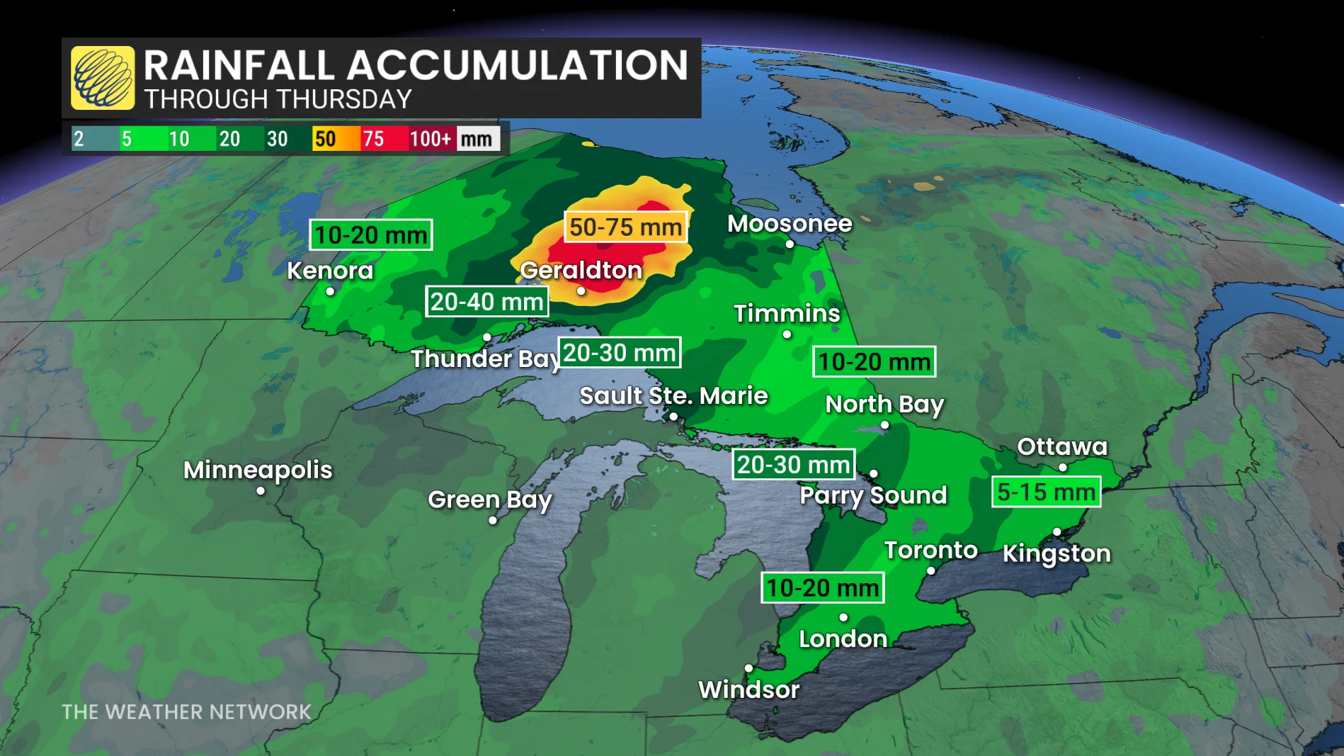
Pattern interruption brings heavy rain through Thursday
A system over northeastern Ontario is pushing a cold front through southern and eastern Ontario this week. Rainfall is expected to spread from Lake Huron into the Greater Toronto Area (GTA) Thursday morning, reaching the Ottawa Valley by evening.
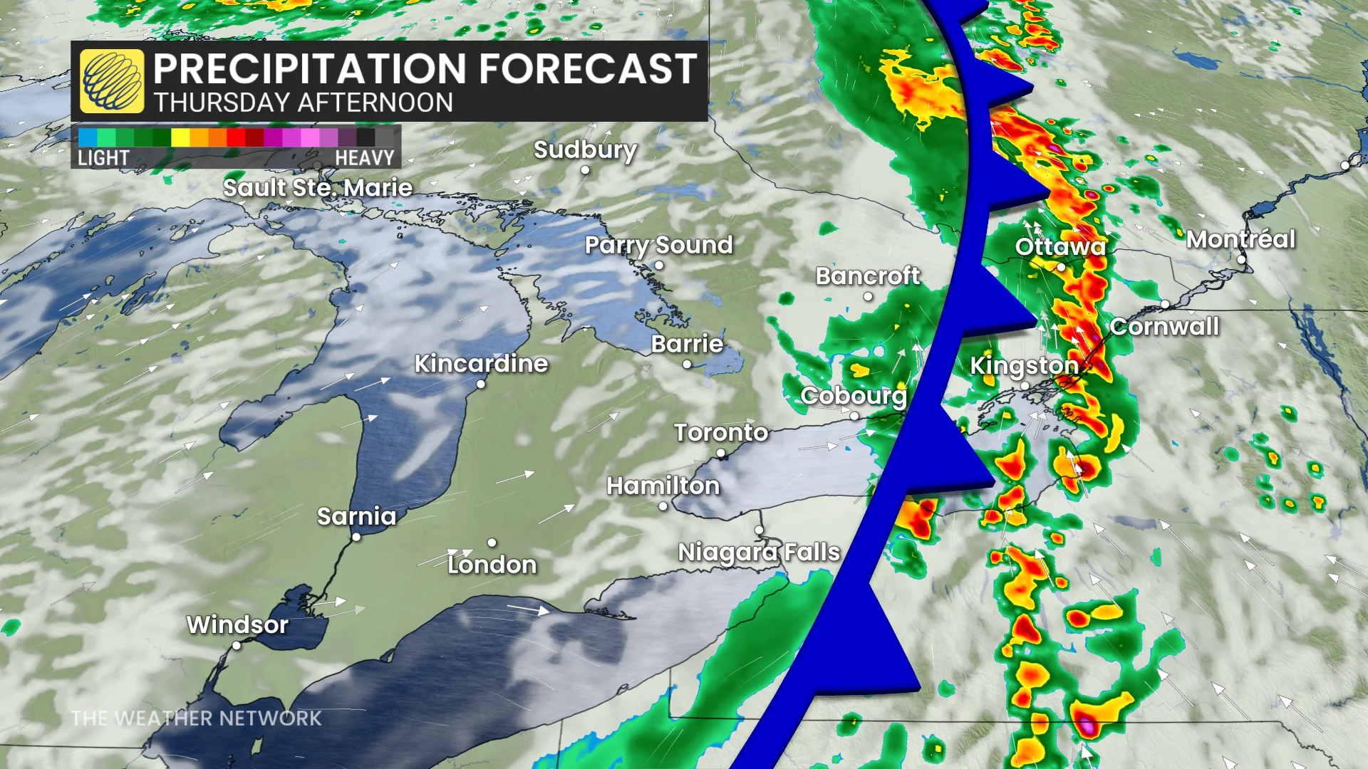
Rain could bring heavy downpours and isolated rumbles of thunder. Northern Ontario may see 50-75 mm of rain, while southern Ontario is forecast to pick up 10-20 mm due to fast-moving showers. Rainfall in any given area in the south is likely to last no longer than 3-4 hours.
Model projections suggest the rain will affect the GTA during Thursday's morning commute and shift into the Ottawa Valley by the afternoon.
Gusty winds pick up on Friday
On Friday, the rain will taper off in southern Ontario, but remain over northeastern Ontario. However, southern Ontario could experience wind gusts of 50-70 km/h heading into the weekend.
DON'T MISS: A typical September sends Canada heat, frost, hurricanes, and snow
Drivers are advised to plan for potential disruptions during the Thursday morning commute in the GTA and monitor for updates on local rainfall amounts and storm activity.
Autumnal chill hits in time for the weekend
A large upper-level low will pull a cold air mass from the north across the province later this week.
By the weekend, daytime highs in the GTA are expected to settle in the mid to high teens, accompanied by chilly morning temperatures. These readings will be a few degrees below the seasonal average for early September.

Looking ahead, temperatures are forecast to gradually climb back to seasonal averages by the second week of September.
WATCH: Canada, what kind of weather is typical in September?
Be sure to check back for the latest weather updates across Ontario.