Fire-stricken East Coast finally gets a rainy helping hand
With Hurricane Erin in the rearview mirror, forecasters are looking at a bout of notable, beneficial rainfall for parts of the dry Atlantic provinces this week
Notable rainfall is expected to spill into parts of Atlantic Canada early this week, but it won't be from any tropical system.
The much-needed precipitation will be beneficial to help ease drought and wildfire concerns. On the heels of an already severe drought, August has brought another stretch of unusually dry weather across Eastern Canada, particularly Atlantic Canada.
RELATED: See the aftermath of Canada’s prolific fires from space
Much-needed rainfall is coming this week
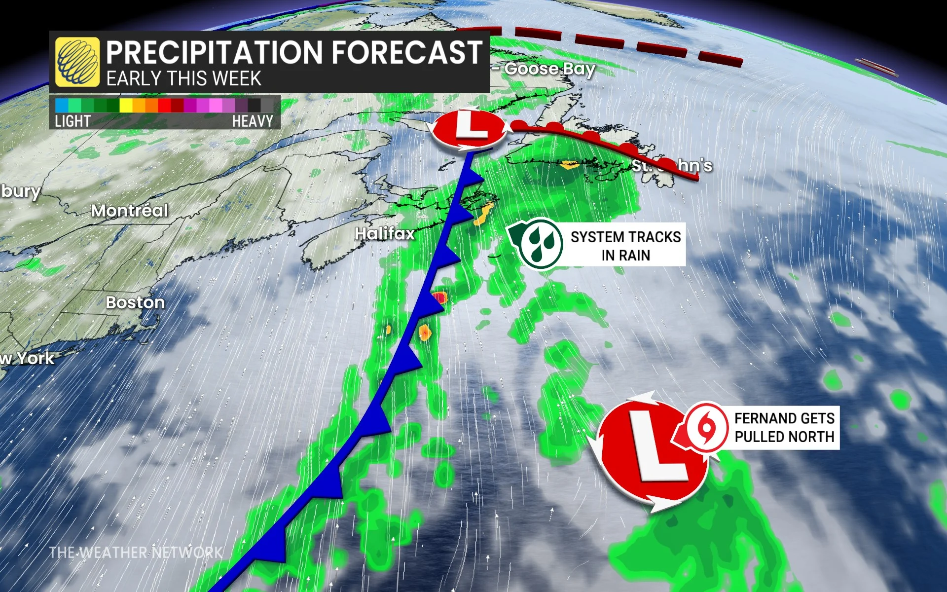
A large, low-pressure system is tracking up the East Coast and into Labrador, bringing widespread and substantial rain to Atlantic Canada.
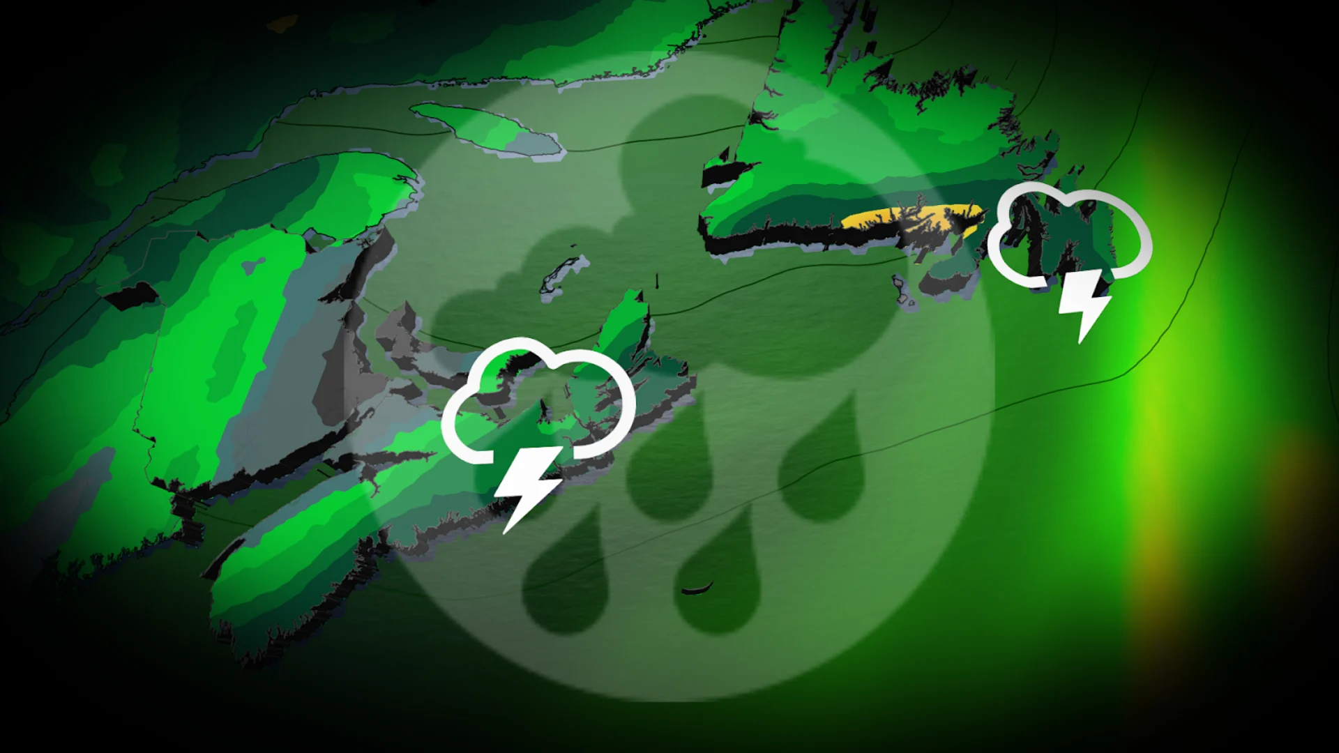
The Maritimes saw the rainy weather begin on Monday. The heaviest of the rain was concentrated over the northeastern portion of the region and had a risk of embedded thunderstorms by the overnight hours. The embedded thunderstorms will also serve to raise local rainfall amounts.
Unfortunately, we won't be seeing any of the heavy rain fall over the Annapolis fire, which is still burning out of control. The area will still get 5-10 mm of rain, however, which will still be helpful in the fight against the fire.
Newfoundland will start to see the rain on Tuesday.
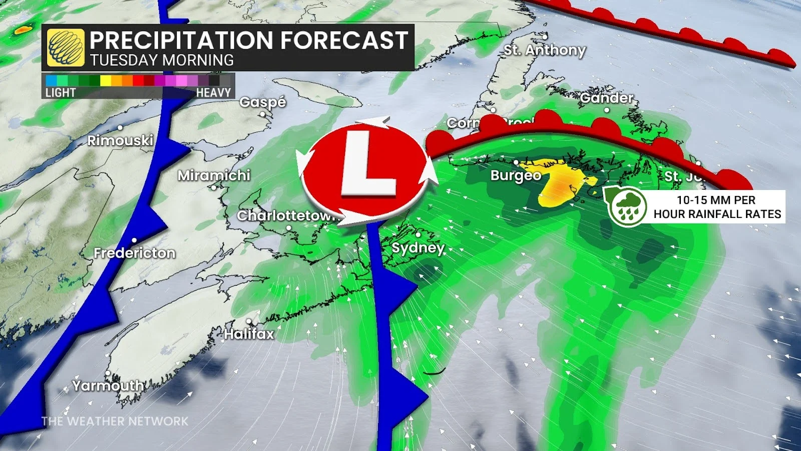
Rainfall rates along Newfoundland's southern coast could reach 10-15 mm per hour, raising the risk of localized flooding.
There will also be a chance for embedded thunderstorms heading into the afternoon hours on Tuesday as the system's cold front sweeps across the Avalon Peninsula.
SEE ALSO: Fernand hitting the open waters of the North Atlantic, may throw waves at N.L.
Even though rainfall totals aren’t expected to be extreme, it won’t be the only shot of rain this week as another system will follow later on.

While Fernand stays well offshore and outside of Canadian waters, its track is helping to push the system heading to Atlantic Canada a little more inland.
This is welcome news for communities facing extreme fire danger and those that have been battling active wildfires, as even modest amounts of rain will help ease the parched conditions.
The rain is desperately needed in these regions where summer rain has significantly lacked, with current status of moderate to severe drought.
The start of the month was the driest in more than a decade for St. John’s, N.L., and the overall dry trend has continued through August.
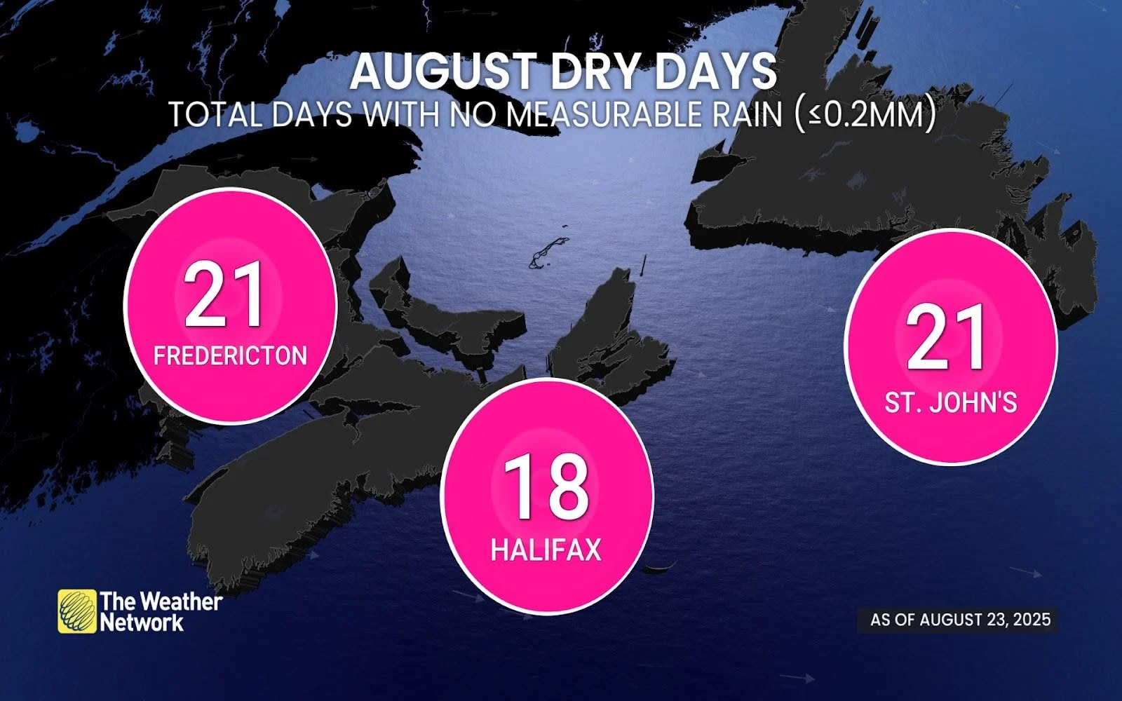
As of Aug. 23, St. John’s has gone 21 days without measurable rain (less than 0.2 mm), matching the total in Fredericton, N.B., while Halifax, N.S., has tallied 18 dry days.
After the front tracks to the east of the region midweek, the rest of the week and weekend should be mostly dry, and temperatures are expected to be within a few degrees of seasonal.
Stay tuned to The Weather Network for the latest forecast updates.