
Freezing rain risk builds in Ontario, Quebec with messy storm
Another messy storm is taking aim at Ontario and southern Quebec this week, bringing rain and a considerable potential for freezing rain to parts of both provinces
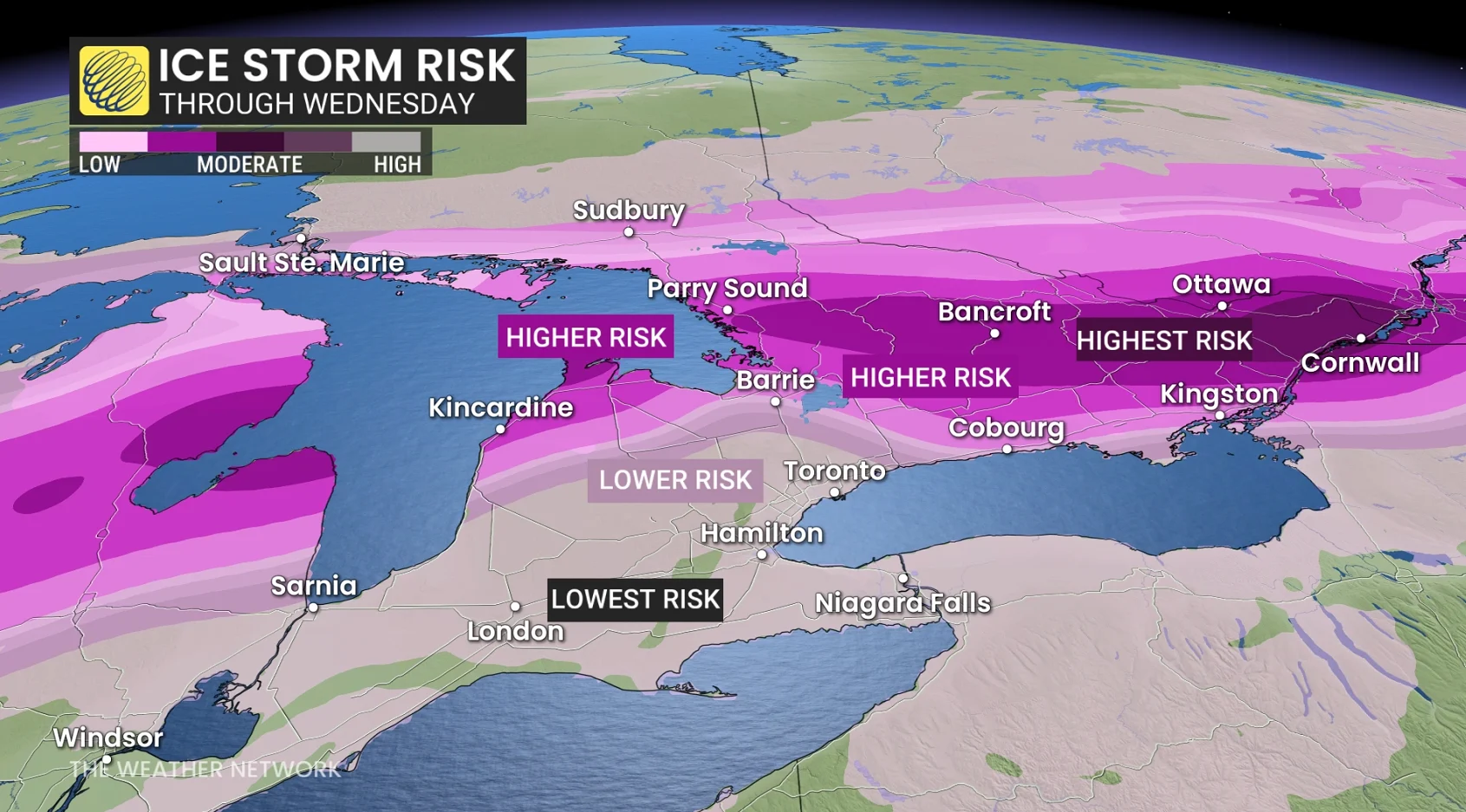
An ice storm is possible this week for parts of Ontario and Quebec as a dynamic storm system pushes into the region.
Some areas may see a significant amount of freezing rain, which could lead to tree damage, power outages, and travel issues.
We’ll also see southern Ontario’s ongoing flood threat extend into the week ahead as temperatures rise once again.
SEE ALSO: Alberta considers scrapping time change, but not Ontario
Storm develops Tuesday night, ice storm potential builds Wednesday
A large centre of low pressure over the Mississippi Valley will slowly slice across southern and eastern Ontario through late Wednesday.
We’ll see precipitation build into Ontario beginning Tuesday night. Showers will spread across most of southern Ontario, with a slight risk for thunderstorms in the extreme southwest.

A wintry mix will develop in central portions of the province, eventually extending east across cottage country and into eastern Ontario. This will create hazardous travel conditions beginning in the overnight hours.
The potential for freezing rain will increase across southern Quebec into Wednesday as warm air aloft crosses paths with a stubborn slab of subfreezing air at the surface.
Ottawa and Montreal should pay particularly close attention to the forecast over the coming days, as a major weather event is possible here.
Periods of heavy rain will soak southern Ontario, including the Greater Toronto Area, through the day.
A sharp temperature gradient will exist across the region.Easterly winds off the lake will keep the GTA in the single digits even when it’s near 20°C in Windsor. A brief, sharp temperature increase is possible late Wednesday ahead of the cold front’s arrival.
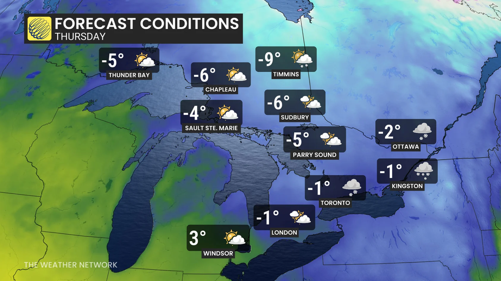
Readings will quickly drop below freezing for all of southern Ontario behind the cold front, creating slick roads and slippery sidewalks. The freezing rain threat will dissipate across eastern Ontario after the front passes through.
Wind gusts behind the cold front will grow to 40-60 km/h through Thursday, making the day’s chilly conditions feel even colder.
Stay with The Weather Network for more information and updates on your weather across Ontario and Quebec.