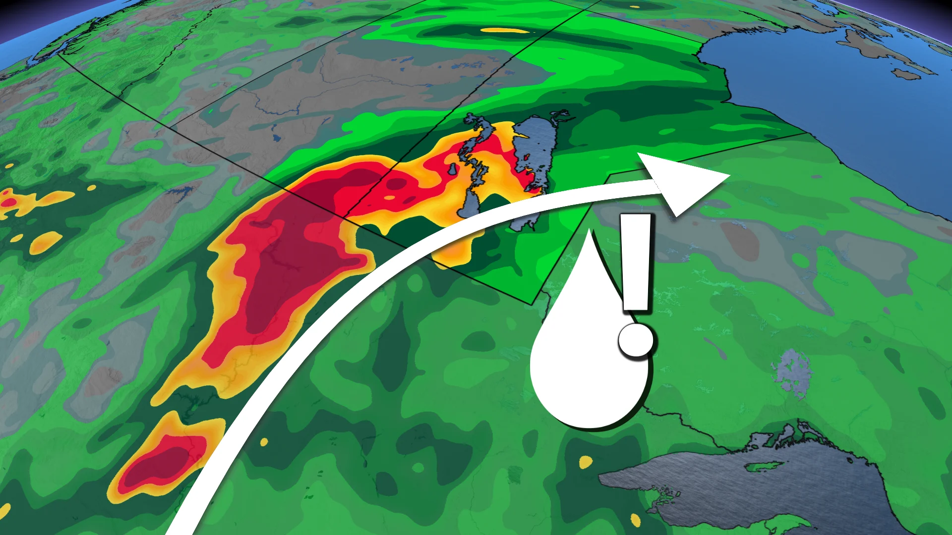
75+ mm: From heat waves to heavy rain, flood risk for parts of Sask., Man.
Over 75 mm of rain across three days runs the risk of floods after heat warnings started off the week in Manitoba
As wildfires continue to appear across the Prairies, residents will finally get some reprieve as a drop in temperatures and heavy rainfall is in sight.
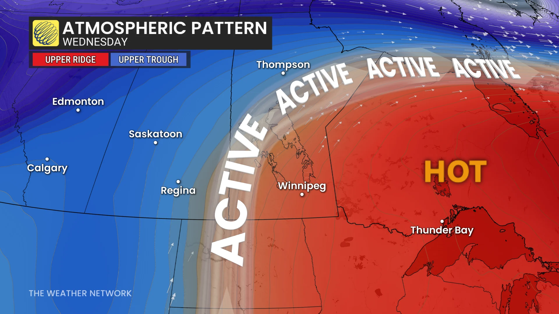
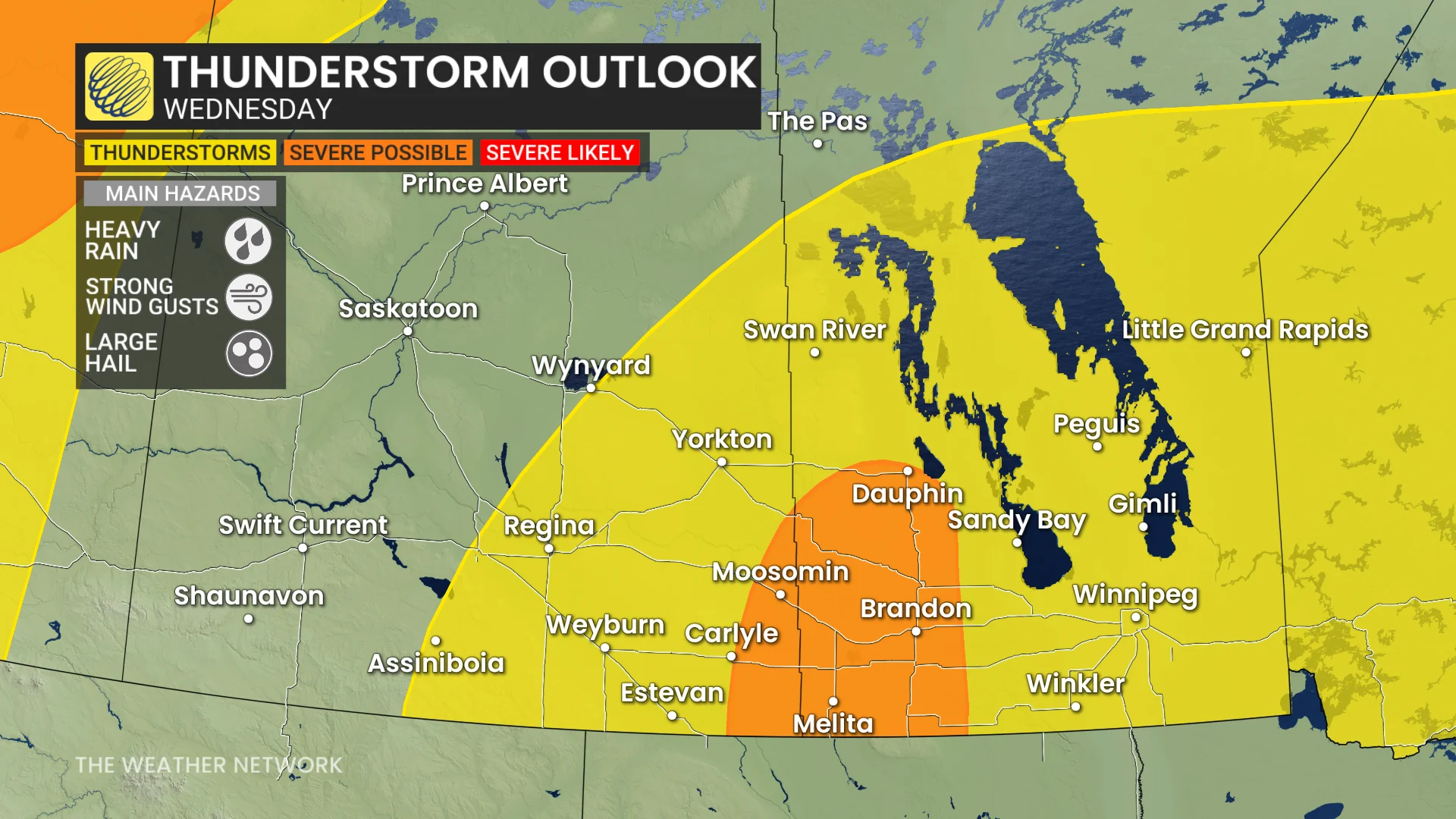
However, Manitoba and parts of southeast Saskatchewan will have to contend with potential flood warnings and thunderstorms, as a significant pattern change pushes the storms eastward through the province later this week.
RELATED: Parts of Narrow Hills Provincial Park burned by wildfire, closed to public
Central Manitoba could see anywhere from 75-100 mm of rain from Wednesday through Friday.
Heat to fall off by Wednesday
With a heat warning having been issued for the province earlier this week, Tuesday is going to be another hot day for Manitoba, with much of the province still experiencing 30°C heat. Thankfully, Wednesday will see a drop into the high 20s, still hot, but a much-needed reprieve from the early season heat wave.
From there, temperatures will freefall, dropping into the single digits by Friday.
READ MORE: Hoodie or shorts? 'Backwards' set up may have you second guessing in Ontario
The significant weather threat rides along the edge of the current heat in place, which will eventually push eastwards, allowing storms to move through Manitoba.
Thunder and flooding
Starting Wednesday, Manitoba and southeast Saskatchewan can expect 48-72 hours of heavy rain, while multiple systems make their way through central Manitoba.
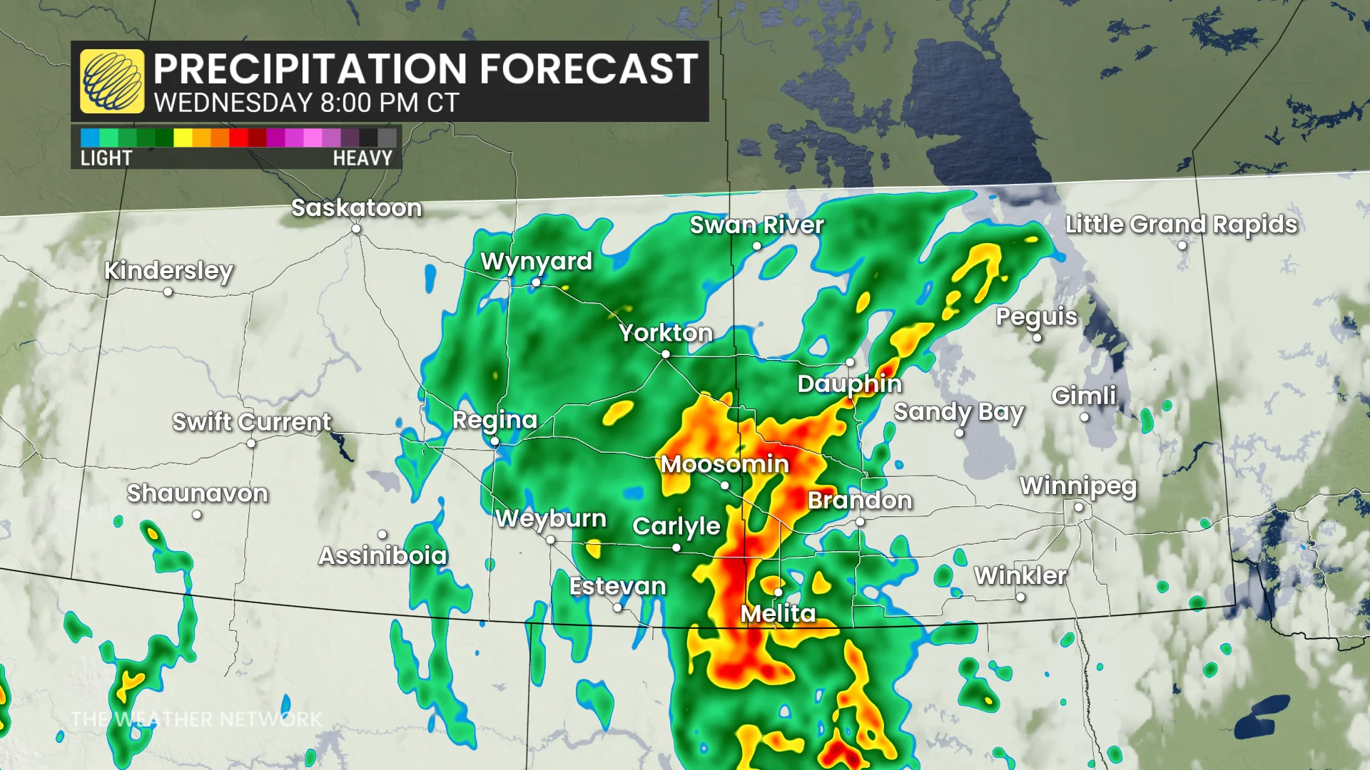
There is currently some uncertainty around the exact location of where most of the rainfall could hit. As models continue to shift leading up to the storms, it’s especially dangerous for Manitoba’s Interlake region across the provincial border.
The lakes are at risk of seeing anywhere from 50 to 100 mm of rain during this three-day event.
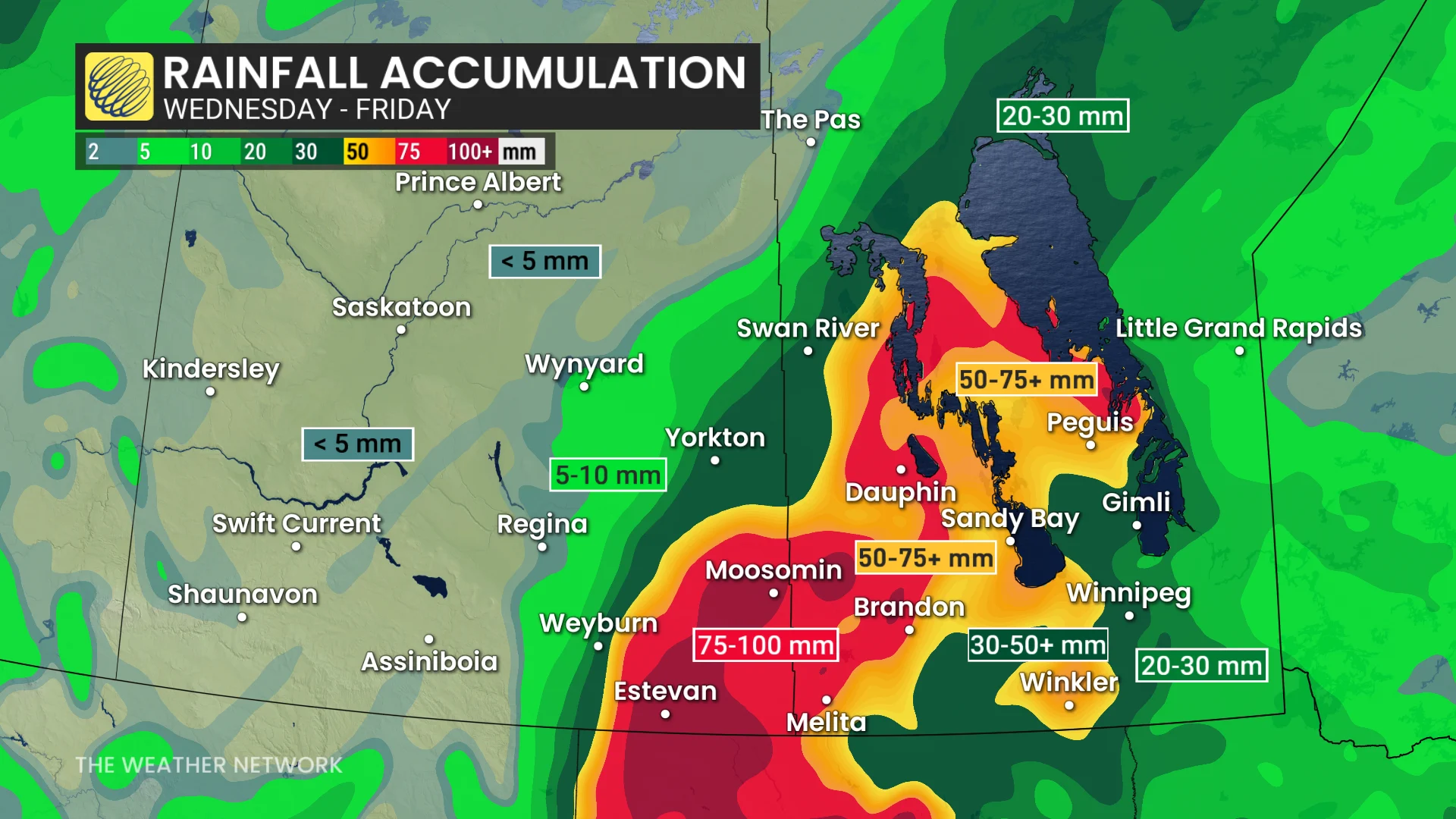
Along with that, the Prairies have experienced an unusually hot beginning to May, leaving most of the soil hot and dry, making it bad at absorbing the coming rain, and raising the flood risk.
The recent heat wave has also set the stage for high thunderstorm energy. Much of the same area can expect to see severe thunderstorms accompanying the rain, especially on Wednesday.
Winnipeg’s major temperature roller-coaster
From the high of 35°C at the beginning of this week, dropping to the 20s by Wednesday, and then a significant temperature tumble, it's a roller-coaster to say the least in terms of temperatures across Winnipeg this week.
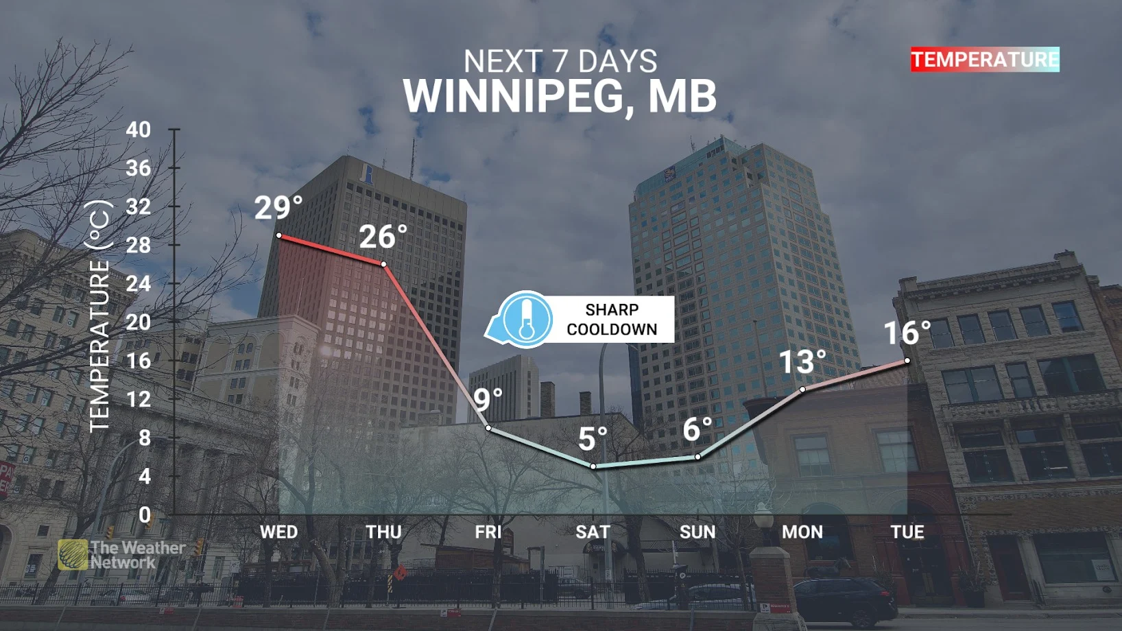
The cool off from the systems will see a sharp drop in the city from Thursday to Friday as it continues to rain.