Hawaii may face tropical threat while Atlantic disturbance brews
Forecasters are watching tropical development in both the Pacific and Atlantic basins this weekend
Interests from Hawaii to the Caribbean should closely monitor tropical forecasts over the next couple of days as numerous systems bubble throughout the Pacific and Atlantic basins.
Hawaii may face a relatively rare tropical threat by early next week as Hurricane Kiko makes its way west across the central Pacific Ocean.
Forecasters are also monitoring a tropical disturbance crossing the Atlantic Ocean for signs of development over the next week.
Anyone near the coast is advised to stay prepared for storms as we’re now in the peak of hurricane season.
DON’T MISS: Hurricane terms everyone should know as the season heats up
Atlantic system still one to watch
The second week of September marks the peak of the Atlantic hurricane season. We’ve seen six named storms—and only one hurricane—so far this year, putting us a little bit behind the pace of an average season.

MUST SEE: The high-stakes factors that decide where a hurricane tracks
A disturbance in the tropical Atlantic may encounter favourable conditions for development over the next couple of days as it continues moving west toward the Caribbean.
Weather models are less impressed with this feature than they were just the other day—the latest trends indicate that development may be suppressed.
Regardless, it’s the peak of the season and folks near the coast should always remain alert for potential storms on the horizon.
Watching Hurricane Kiko in the Pacific
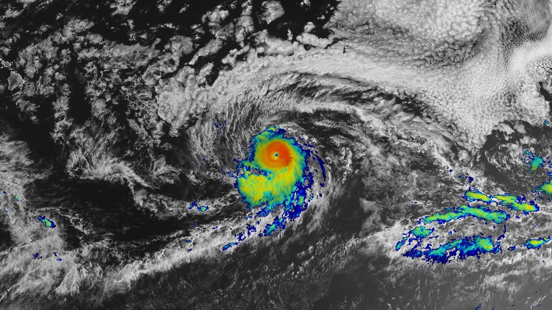
Things are much more active in the Pacific basin, where forecasters are monitoring the progress of Hurricane Kiko.
RELATED: How spaghetti models and cones help refine your forecast
Kiko peaked as a powerful Category 4 storm on Wednesday before weakening slightly, and the system remained a major hurricane on Friday afternoon.
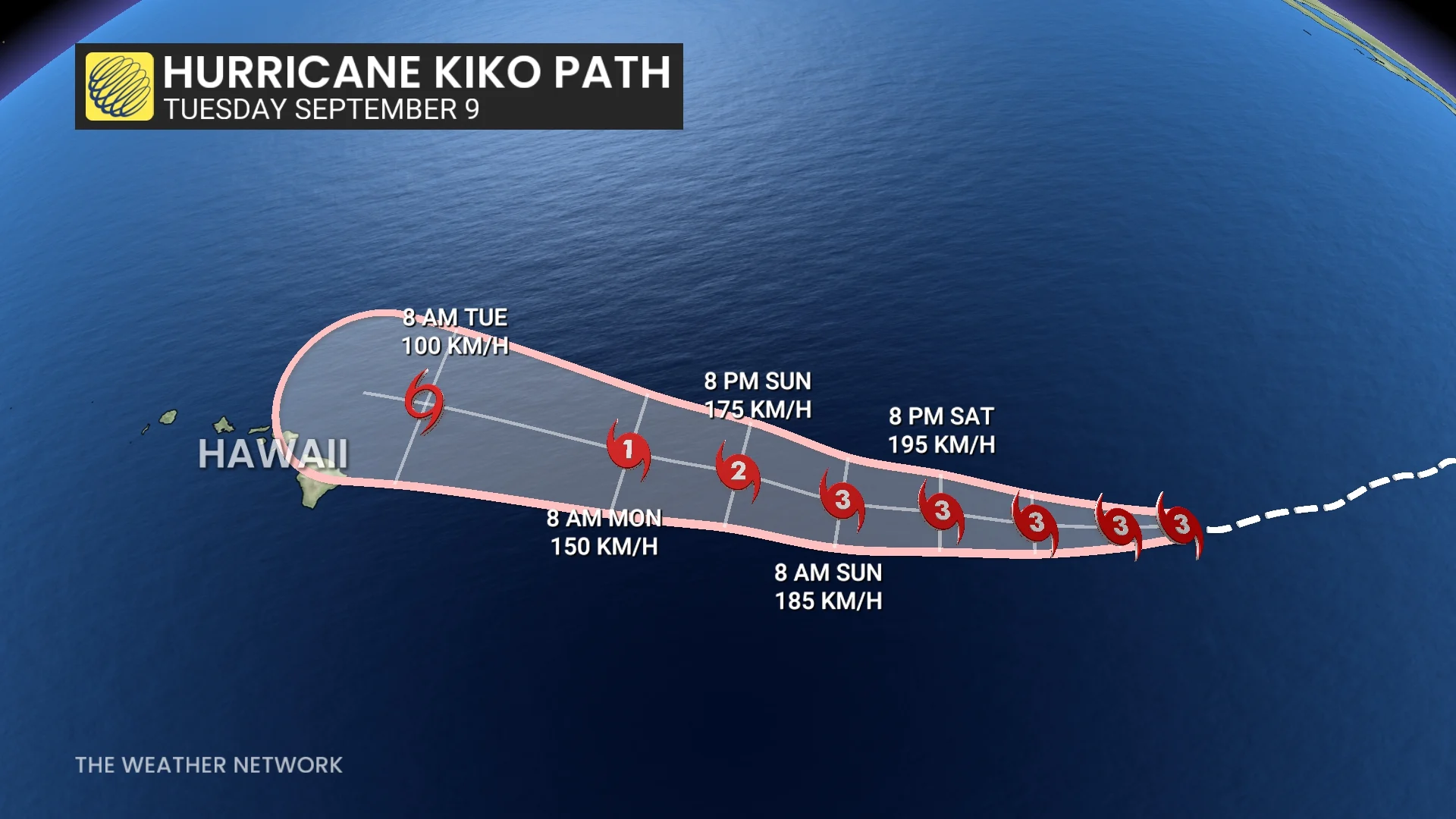
The U.S. National Hurricane Center (NHC) expects Kiko to move west-northwest across the open central Pacific over the next five days, potentially coming close to the state of Hawaii.
The storm’s predicted path is close enough to place Hawaii within the cone of uncertainty, which is the historical margin of error in a track forecast. It’s important to note that wind, rain, and waves can extend far beyond the centre of a storm.
All interests in Hawaii should keep a close eye on this system over the coming days.
Tropical systems can bring major flooding to Hawaii
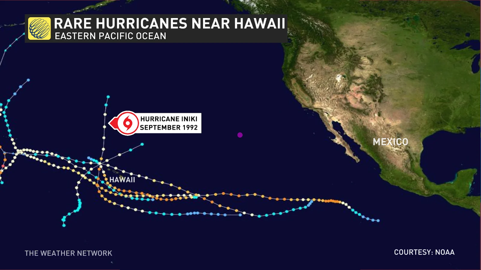
Despite its vulnerable location, tropical systems aren’t a routine occurrence in Hawaii.
Several dozen tropical storms and hurricanes have come within 100 km of Hawaii’s eight major islands since reliable records began in 1950. Most of these storms were relatively weak, falling apart as they approached the state from the east due to cooler waters and unfavourable conditions.
RELATED: Eight of the strangest hurricanes we’ve ever seen
The most recent—and most powerful—hurricane to make a direct landfall on one of the eight major islands was Hurricane Iniki in 1992. The Category 4 storm struck the island of Kauai, killing seven people and causing billions of dollars in damages.
Moisture-laden tropical systems running against the mountainous terrain of this volcanic island chain is a recipe for prolific rains.
Even though the centre of Hurricane Lane remained far to the south of Hawaii in August 2018, the storm fed downpours that produced nearly 1,500 mm of rain near Hilo on the Big Island.
Last year, Hurricane Hone passed just south of the islands—but close enough to drop more than 730 mm of rain across eastern sections of the Big Island.
Header image courtesy of NOAA.