Severe storms fire up in Quebec, prompting a tornado warning
A severe thunderstorm that is possibly producing tornado has been detected in Quebec. Residents in the affected region should be in their shelters.
A tornado warning has been issued in Quebec as meteorologists with Environment and Climate Change Canada (ECCC) are tracking a thunderstorm that is possibly producing a tornado.
In addition to potentially producing a tornado and intense winds, large hail and locally intense rainfall are possible. See below for the details.
Current tornado warnings
l'Étape area
7:26 PM EDT: Environment Canada meteorologists are tracking a severe thunderstorm that is possibly producing a tornado. Damaging winds, large hail and locally intense rainfall are also possible.
A rotation has been detected on the radar heading toward Highway 175, between Camp Mercier and Étape.
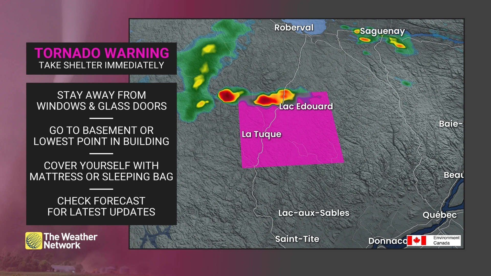
This is a dangerous and potentially life-threatening situation.
Take cover immediately, if threatening weather approaches. If you hear a roaring sound or see a funnel cloud, swirling debris near the ground, flying debris, or any threatening weather approaching, take shelter immediately.
Go indoors to a room on the lowest floor, away from outside walls and windows, such as a basement, bathroom, stairwell or interior closet. Leave mobile homes, vehicles, tents, trailers and other temporary or free-standing shelter, and move to a strong building if you can. As a last resort, lie in a low spot and protect your head from flying debris.
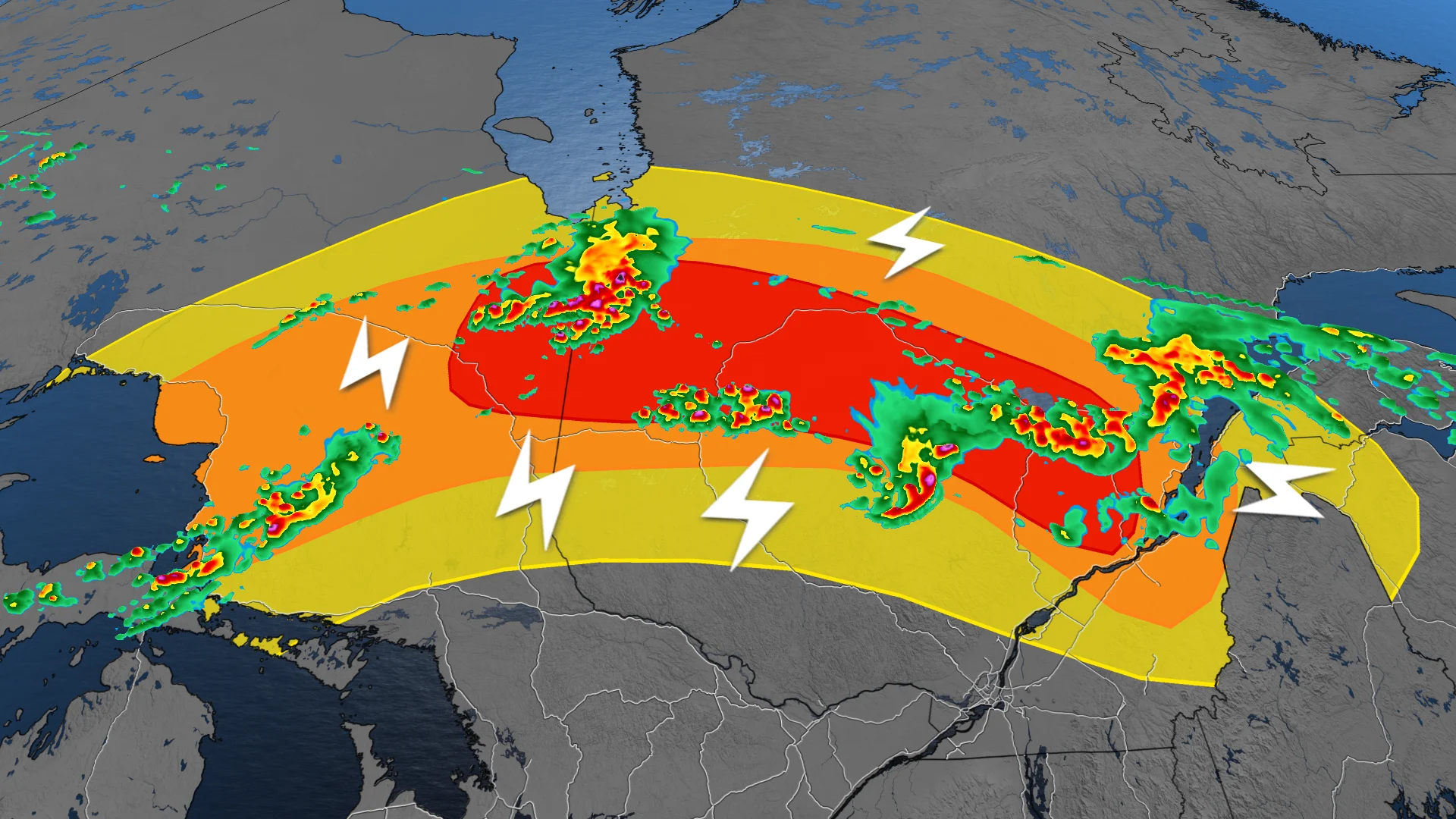
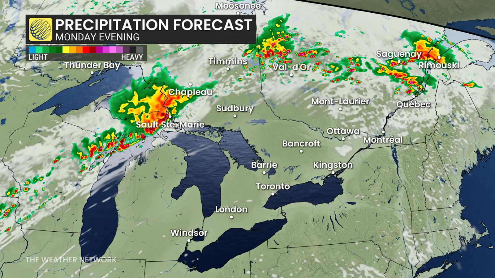
Tornado risk appears Monday
Monday's storm activity will extend east of Lake Superior, through northeastern Ontario and central Quebec, and into Maine.
Folks should remember to stay weather-aware on Monday—especially those in Quebec spending time outdoors for Saint-Jean-Baptiste Day.

RELATED: Storm downs trees, knocks out power in Mattawa, Ont., area
To the south, the warm air aloft and high pressure over southern Ontario have served to stabilize the atmosphere, inhibiting any storm development on Monday.
DON'T MISS: Don't overlook your eyes when protecting yourself from the sun
That will change on Tuesday, however, as the stormy system begins to sink south into southern Ontario and Quebec.
Once again we will see a risk of severe thunderstorms on Tuesday around southwestern Ontario and the Lake Erie shores, with the main threats being heavy rain and strong wind gusts.
The extreme heat in the atmosphere will provide enough energy that we could even see some funnel clouds develop, and maybe even a landspout tornado. Landspouts are tornadoes that form from non-supercell thunderstorms.
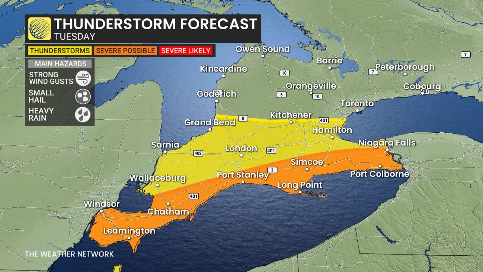
In Quebec, we'll see the risk for some strong storms across the Eastern Townships, but this risk is quite isolated and is not backed up with much confidence.
Stay with The Weather Network for more information and updates on your weather across Ontario and Quebec.