Heat and humidity fuel hazardous weekend storm risk on the Prairies
Strong thunderstorms threaten the southern Prairies on Saturday, with the risk for localized flooding and damaging winds with some storms
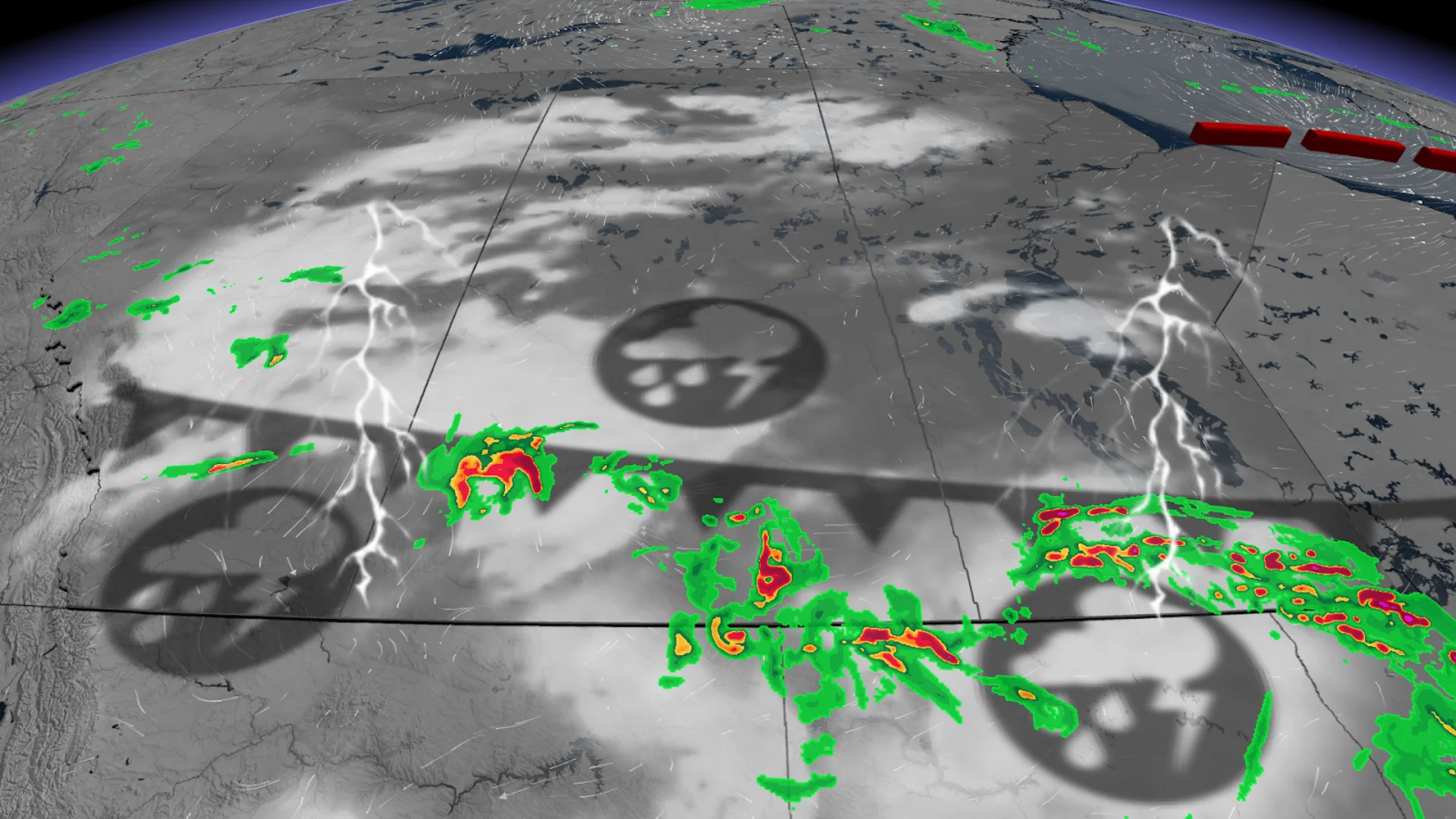
A renewed thunderstorm threat brought large hail and frequent lightning to parts of Alberta Thursday, and tornado warnings to southern Saskatchewan late Friday.
The storm risk will persist through Saturday across the Prairies as a cold front continues to push south across the hot and humid region.
SEE ALSO: Jasper rising from the ashes: A journey of recovery one year later
You'll want to stay updated on the weather alerts in your area as conditions can change quickly when severe weather hits.
Risk of strong, rotating storms sweeps over Alberta and Saskatchewan Saturday night
Scattered storms are likely to form along Alberta's foothills as well as in central and northern British Columbia, driven by a surge of cold air pushing southward.

The stormy weather is expected to fire up in isolated cells by the late-evening hours.
Damaging winds and 2-3+ cm hail, as well as the risk for rotating storms to develop, are the main hazards forecasters are looking out for on Saturday.
A low-pressure system is also expected to develop over Montana and track across the southern Prairies Saturday night, further fuelling the storms.
DON'T MISS: Why nocturnal thunderstorms can be particularly dangerous

By the time the storm cells reach Saskatchewan during the overnight, they're expected to organize into a mesoscale convective system--a strong, long-lived cluster of storms that can travel great distances.
There is a chance for some capping in the atmosphere (where a stable airmass sits over the unstable air) that may prevent storm development, but we could see hazardous weather if the storms are able to break the cap.
Warmer weather returns, little help for Manitoba wildfires
Following this week's frost and even snow threat for parts of the Prairies, warmer weather is set to return next week, though no extreme heat is expected.
SEE ALSO: Wildfire smoke, other extreme weather affecting Ontarians' vision: Poll
Warm weather next week will bring the typical summer risk of thunderstorms, with periods of strong to severe storms expected, particularly in Alberta.
Meanwhile, central and northern Manitoba, where wildfires remain a concern, are expected to see below-normal rainfall throughout the week, offering little relief to affected areas.
Stay tuned to The Weather Network for the latest forecast updates for the Prairies.