Heavy rains, significant July cooldown on tap for Alberta
Widespread heavy rain to start the workweek will coincide with an unseasonable chill across southern Alberta
A brief but significant change will sweep into southern Alberta to start the workweek.
Temperatures will plummet more than 10 degrees below seasonal while heavy rains fall on the region. Some areas could even see snow—welcome to July in Alberta!
DON’T MISS: Canada's fire bans and danger ratings explained
Surge of moisture arrives starting Monday
Thunderstorms that bubbled up across southern Alberta on Sunday will continue through the pre-dawn hours Monday.
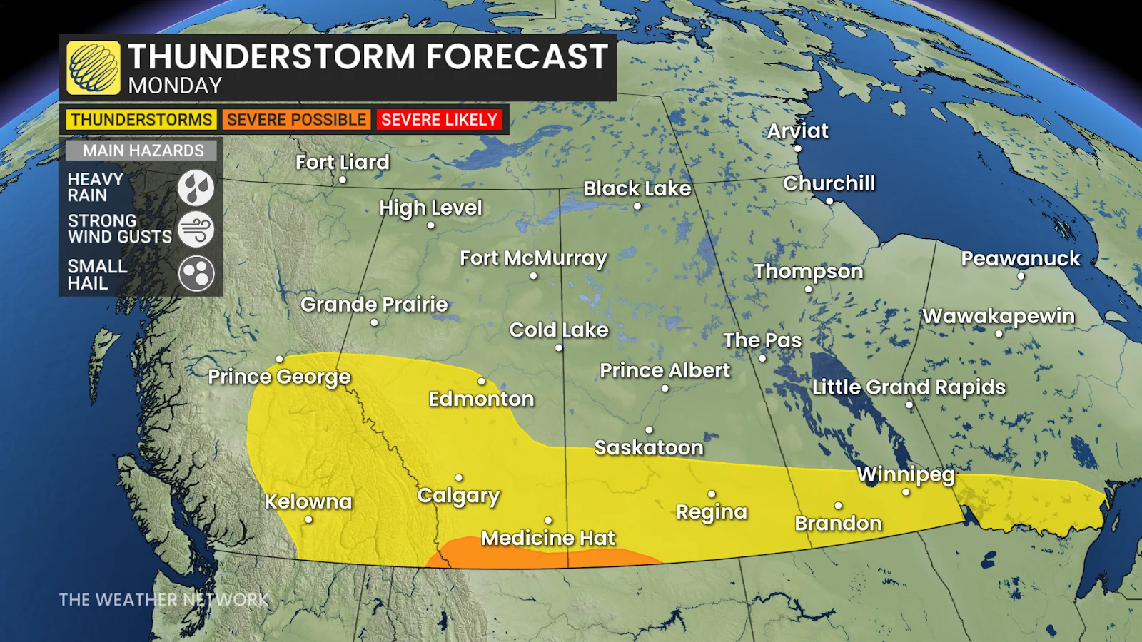
Meanwhile, a surge of Pacific moisture will combine with an approaching cold front to produce widespread rain across the region into Wednesday.
Embedded thunderstorms are likely within the rain bands. A few stronger storms are possible near the international border late in the day Monday. If any storms reach severe limits, they’ll be capable of producing heavy rain, strong wind gusts, and small hail.
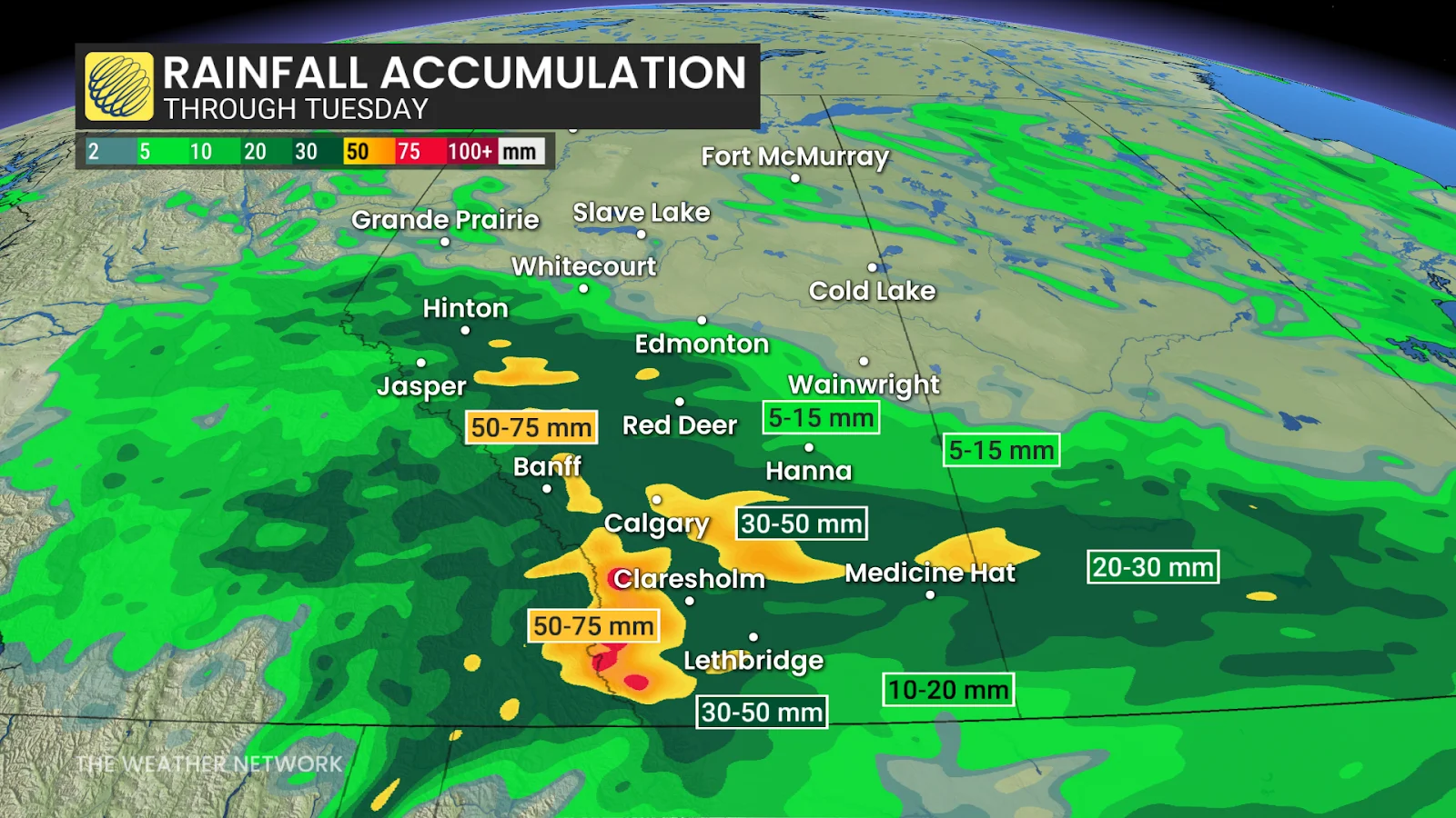
Widespread heavy rainfall totals are expected throughout southern Alberta by Tuesday.
MUST SEE: La Niña could return in a quick burst this fall and winter
Folks across Calgary, Banff, and Canmore, as well as Jasper east to Highway 40, are all in line for 30-50+ mm of rainfall by Tuesday. Communities from Medicine Hat to Lethbridge are in line for 20-40 mm of rainfall from this event.
Expect a break in the rain to arrive on Tuesday before the precipitation returns again Wednesday.
Visitors to places like Jasper National Park could see a touch of rare July snow as freezing levels drop to around 2300 metres behind the cold front.
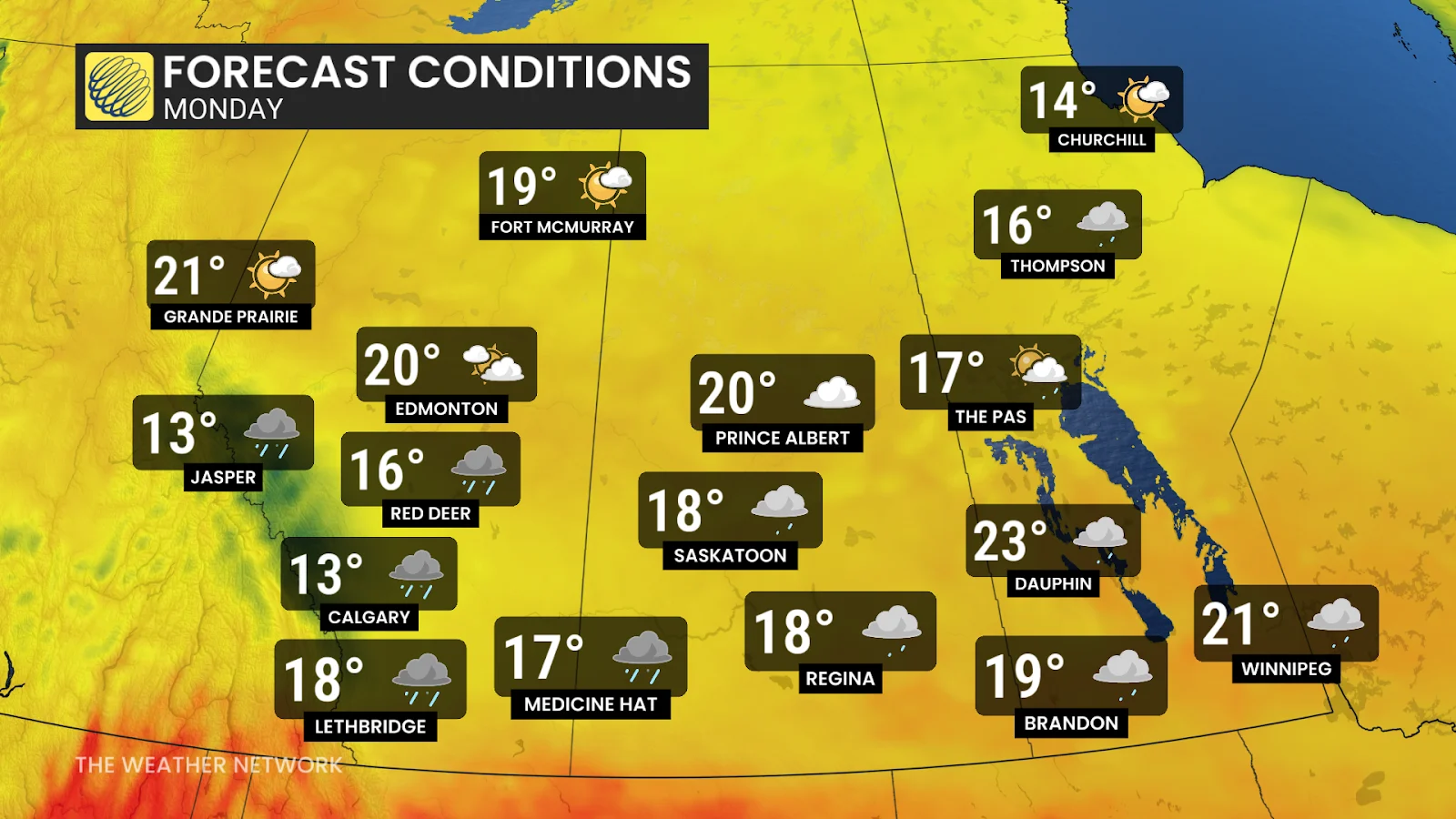
Temperatures are certainly going to feel raw for this time of year when combined with the persistent rain. Calgary is only expecting a high of 13°C on Monday, while readings around the mid-teens are expected throughout the rest of southern Alberta.
Southerly flow scooting around a centre of high pressure in British Columbia will keep northern Alberta much warmer than their southern counterparts, with daytime highs in the lower 20s on tap for places like Edmonton and Grande Prairie.
Header image courtesy of Unsplash.
Stay with The Weather Network for all the latest on conditions across Alberta.