Heavy snow hits Alberta, Sask. on Monday ahead of an Arctic cooldown
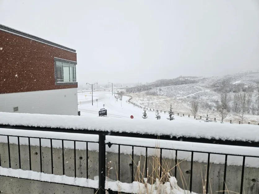
A period of heavy snow and strong winds kick-started the new work week across Alberta and Saskatchewan
The snowfall in parts of Alberta and Saskatchewan arrived on Monday, just ahead of an Arctic air mass forecast to surge across the region, bringing a sharp drop in temperatures. This weather pattern could mark the arrival of Canada's first widespread Arctic air outbreak to close out November.
DON’T MISS: Canada’s first countrywide Arctic air outbreak arrives to end November
Be sure to allow extra time for travel, slow down and maintain a safe following distance as conditions deteriorate.

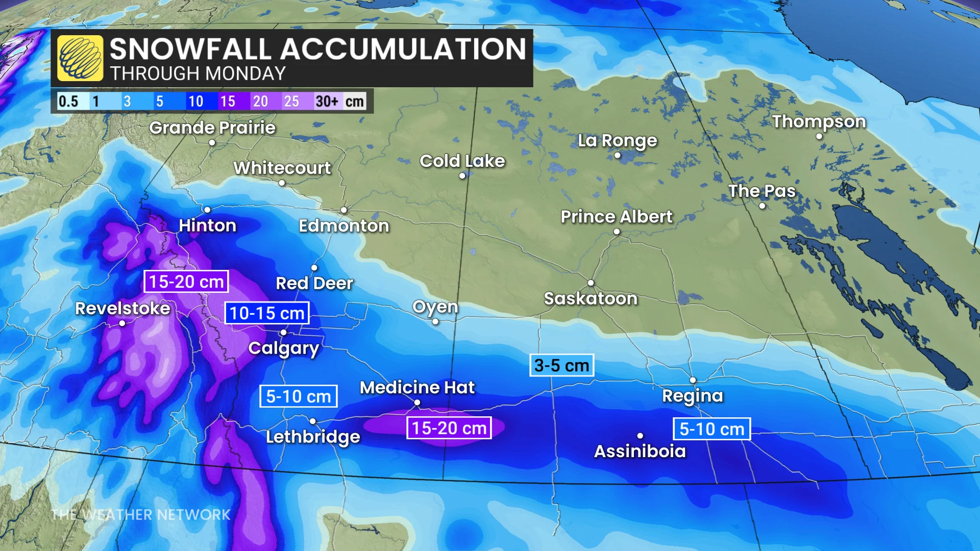
Snowfall warnings in effect with 10-20 cm possible Monday
Snowfall impacted Monday's commute times across southern Alberta, with Calgary experiencing peak snowfall rates at around 1 cm per hour through the morning. Heavier snowfall, reaching 2-4 cm per hour, is expected closer to the Canada-U.S. border.
It's a particularly challenging forecast for Calgary, with current projections indicating totals exceeding 10 cm, though the city is expected to see accumulations within a few centimetres of this benchmark.
RELATED: Snow paradox: Why 2 cm of snow can actually be worse than 25 cm
A typical November usually generates 20 cm of snow for Calgary, but so far, it has only seen 3.2 cm to date. Since September, only 9.6 mm of precipitation has been recorded, just 14 per cent of the average.
Gusty winds up to 40 km/h could lead to reduced visibility and blowing snow in some areas. Snow tapered off late Monday afternoon.
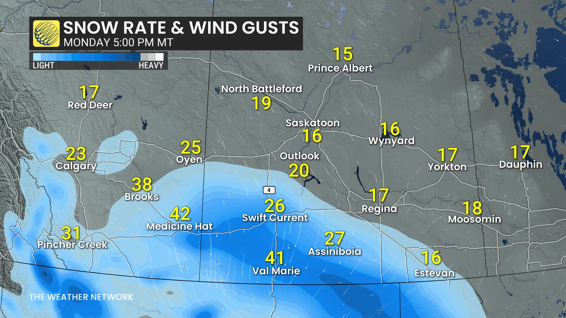
In southwestern Saskatchewan, light snow began early Monday morning in areas such as Swift Current, Cypress Hills, and Moose Jaw. Snowfall will persist throughout the day, with accumulations focused along and south of the Trans-Canada Highway, easing early Tuesday morning.
Snowfall projections
Banff/Canmore: 10-20 cm
Calgary: About 10 cm
Jasper: 5 cm
Lethbridge: About 10 cm
Medicine Hat: About 10 cm
Red Deer: Less than 5 cm
Edmonton: Trace
Eastend: 15-20 cm
Estevan: 5-10 cm
Assiniboia: 10-15 cm
Swift Current: 5-10 cm
Moose Jaw: 3-5 cm
Regina: 3-5 cm
An extended period of Arctic air will follow this system.
Into early December, temperatures will plunge well below freezing across the Prairies, ushering in a frigid stretch. Those in affected regions should prepare accordingly, as the cold pattern is expected to persist.
Stay with The Weather Network for all the latest on conditions across the region.